My Store
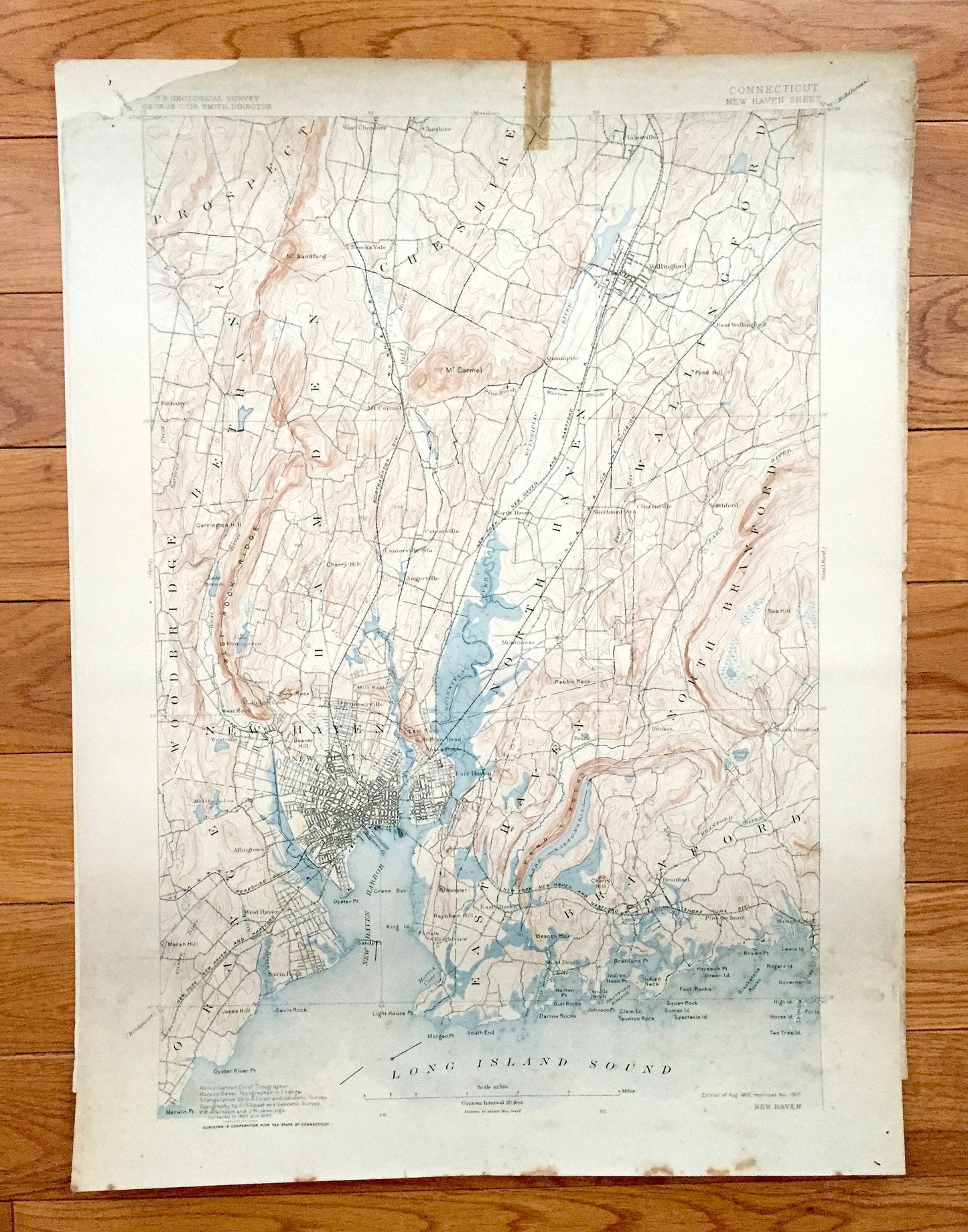
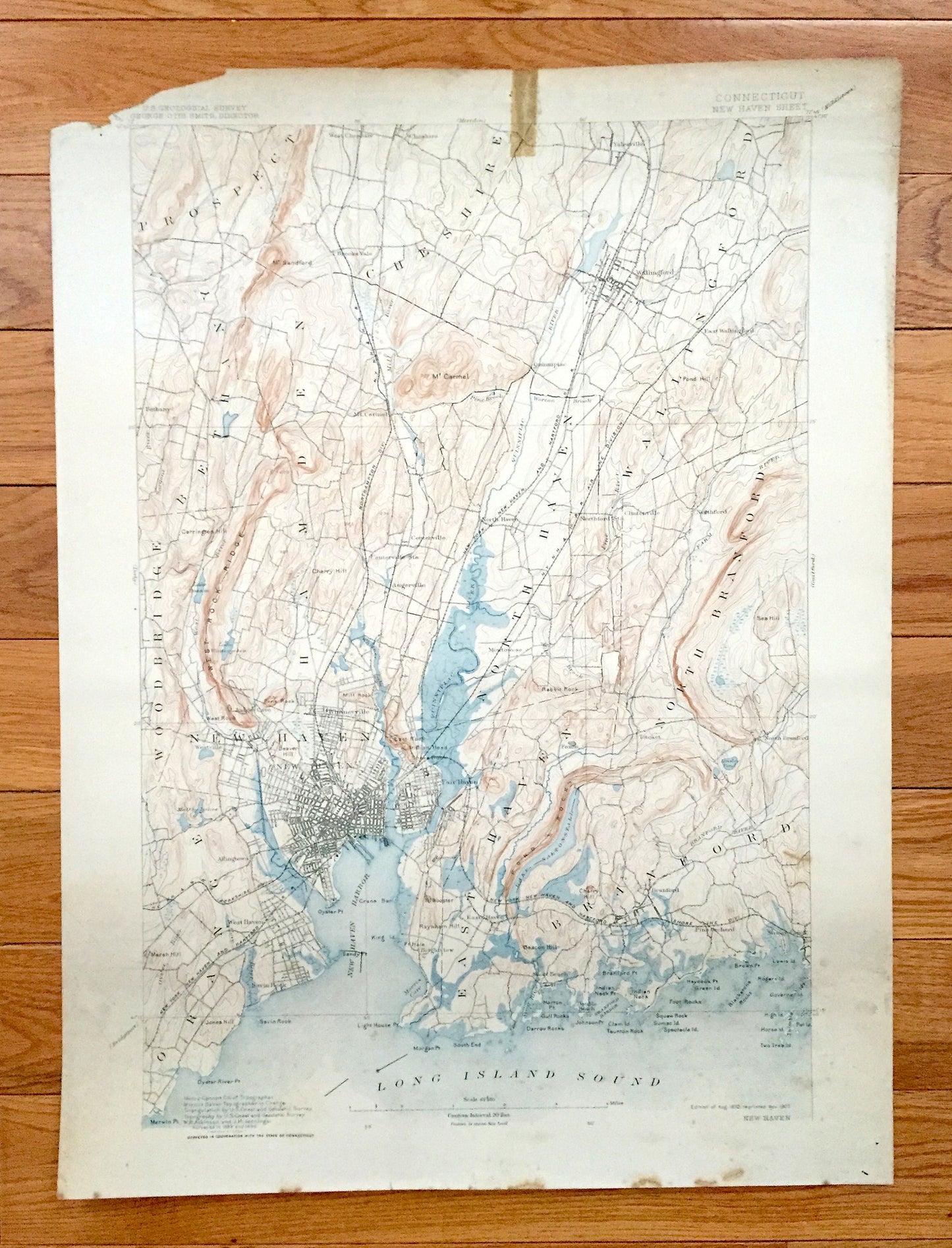
Antique New Haven, Connecticut 1892 US Geological Survey Topographic Map – East, North, Branford, Orange, Bethany, Cheshire, Wallingford, CT
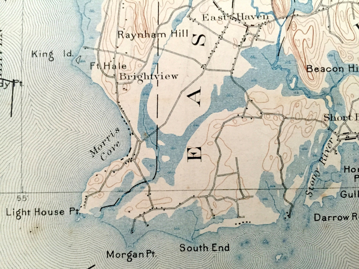
Antique New Haven, Connecticut 1892 US Geological Survey Topographic Map – East, North, Branford, Orange, Bethany, Cheshire, Wallingford, CT
Beautiful, antique map of New Haven and surrounding New Haven County area on the Connecticut Coast. This is an authentic 1892 edition, 1907 print from the U.S. Geological Survey and NOT a computer reproduction.
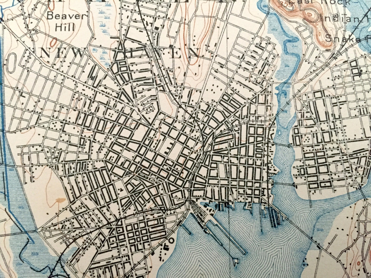
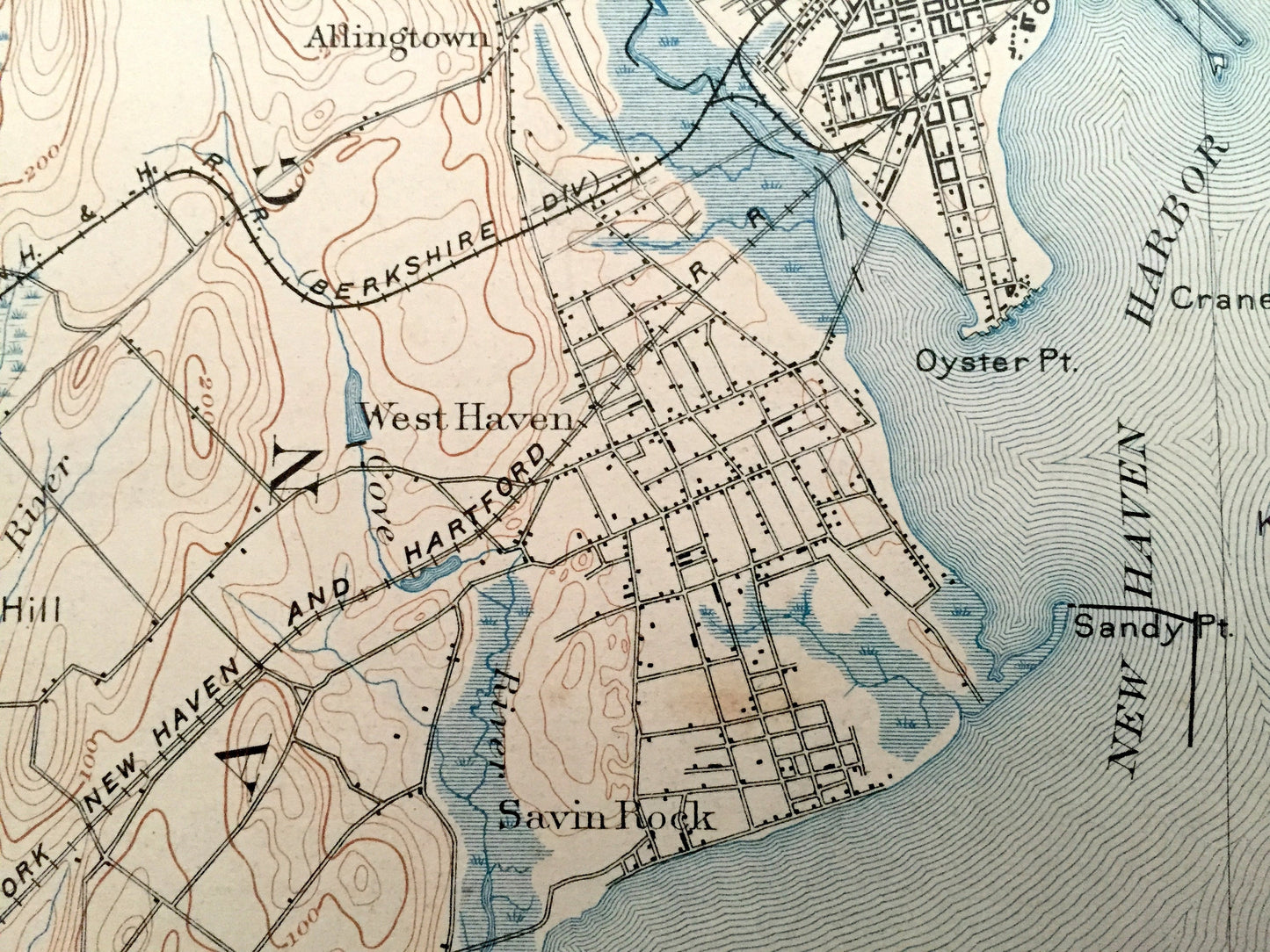
See what Connecticut looked like over 125 years ago. Lots of intricate details and geological contours. Map even has little squares for every house that existed at the time. The USGS cartographers were very thorough back then! On the back is a description of topographic symbols and map guide.
Perfect for the historian, map-lover, the curious or just as a conversation starter. Wonderful and rare. Vintage maps such as these make great gifts.
Edition of 1892, printed 1907
Dimensions: 16 1/2" width x 22" height
----
Features
Cities & Towns: Prospect, Woodbridge, Bethany, Hamden, Cheshire, North Haven, Wallingford, North Brandford, Orange, New Haven, East Haven, Branford, Brooks Vale, Mt. Carmel, Quinnipiac, Yalesville, East Wallingford, Whitneyville, Centerville, Augerville, Montowese, Clintonville, Northford, Westville, Allingtown, Fair Haven, Foxon, Short Beach, Totoket, North Branford, Pine Orchard, Stony Creek, Judges Cave, Savin Rock.
Points of Interest: New Haven County, New Haven Harbor, Long Island Sound, Quinnipiac River, Lake Saltonstall, Whitney lake, West Rock Ridge Mountains, Pond Rock, Good Ol' Yale University, Rabbit Rock, Mt. Sandford, Mount Carmel, Sea Hill, Linsley Pond, Branford River, New York New Haven and Hartford Shore Line Division Rail Road, Oyster Point, Marsh Hill, Lake Wintergreen, Lake Dason, Carrington Hill, Beaver Hill, Beacon Hill, Blackston Rocksand more roads, railroads, houses, ponds, hills, creeks, bays, islands and coves.
Condition: Good or "Very Vintage" condition, commensurate with age. This map is in great shape for being over 110 years old. Has some obvious wear, stains, archival tape repair and pinholes, but this will add to the vintage character when framed.
----
We will happily adjust shipping price for multiple purchases. Maps are rolled up and shipped in sturdy mailing tubes, never folded.
Couldn't load pickup availability
Share