My Store
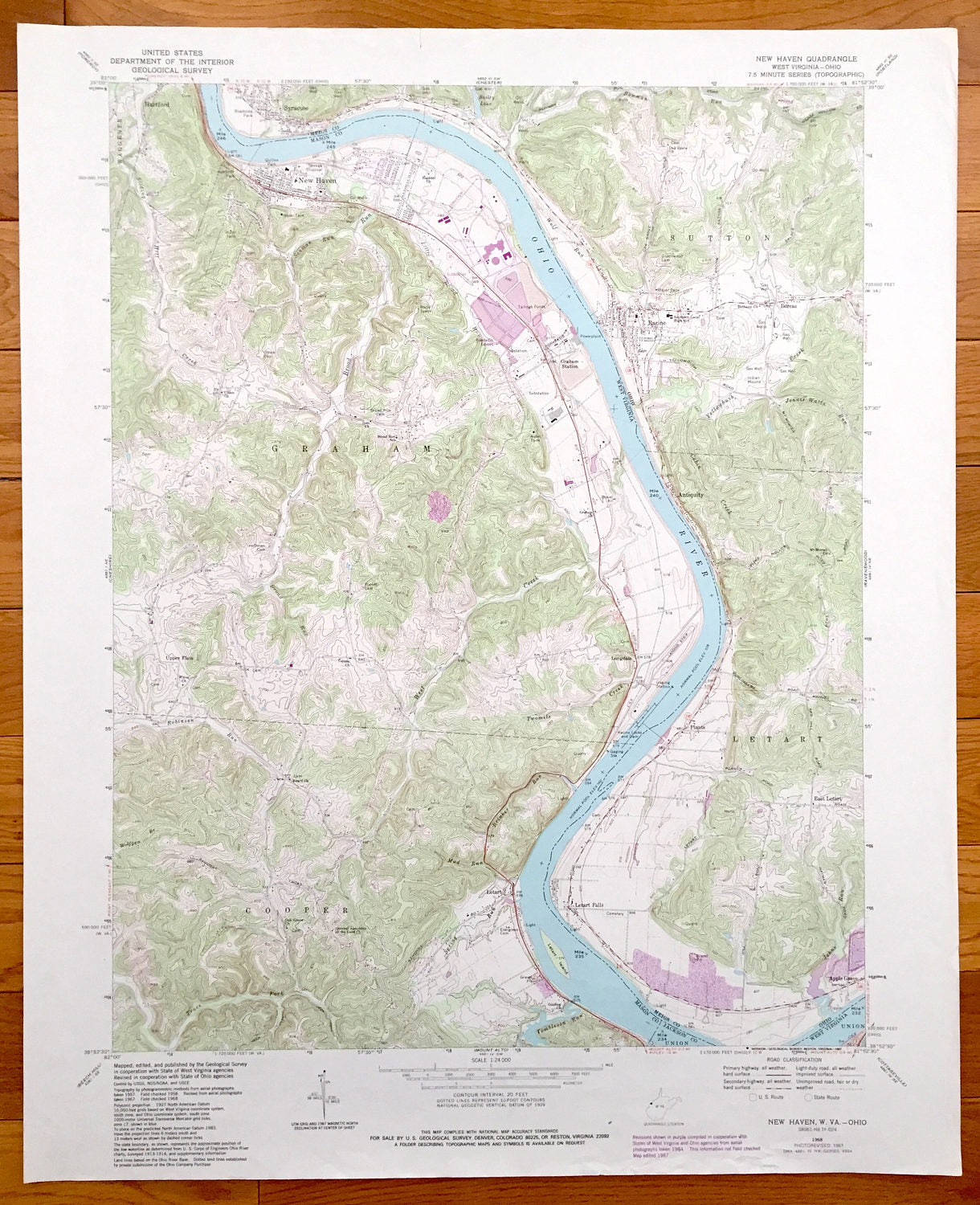
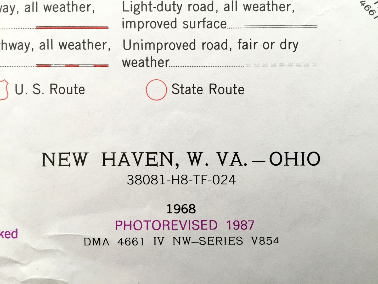
Antique New Haven, West Virginia & Sutton, Ohio 1968 US Geological Survey Topographic Map – Racine, Letart, Cooper, Graham, Longdale, Letart
Antique New Haven, West Virginia & Sutton, Ohio 1968 US Geological Survey Topographic Map – Racine, Letart, Cooper, Graham, Longdale, Letart
Beautiful, antique map of New Haven, Graham, Letart, Cooper and Longdale, West Virginia including nearby Letart, Sutton and Racine, Ohio. This is an authentic 1987 print of 1968 survey data from the U.S. Geological Survey and NOT a computer reproduction.
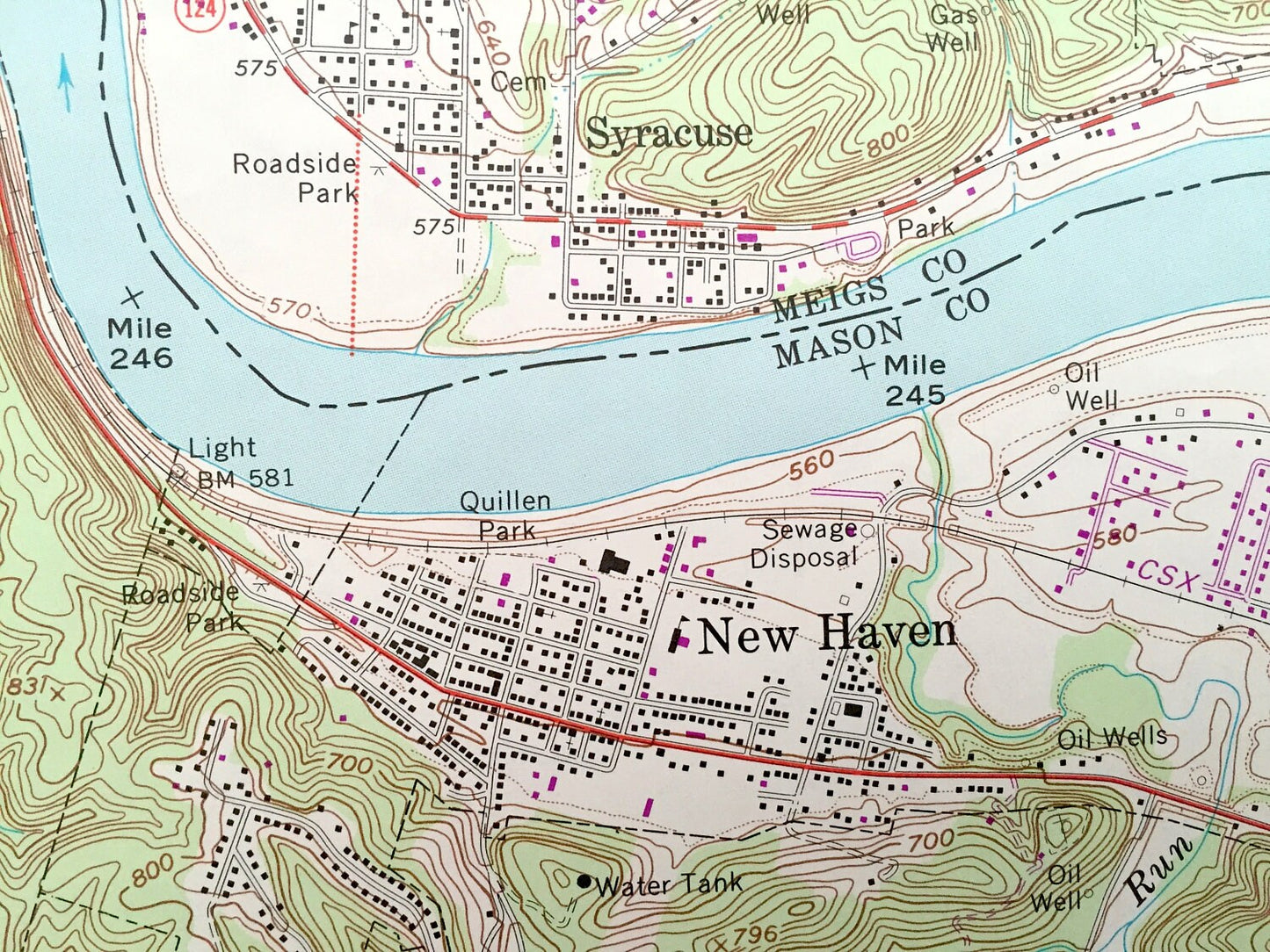
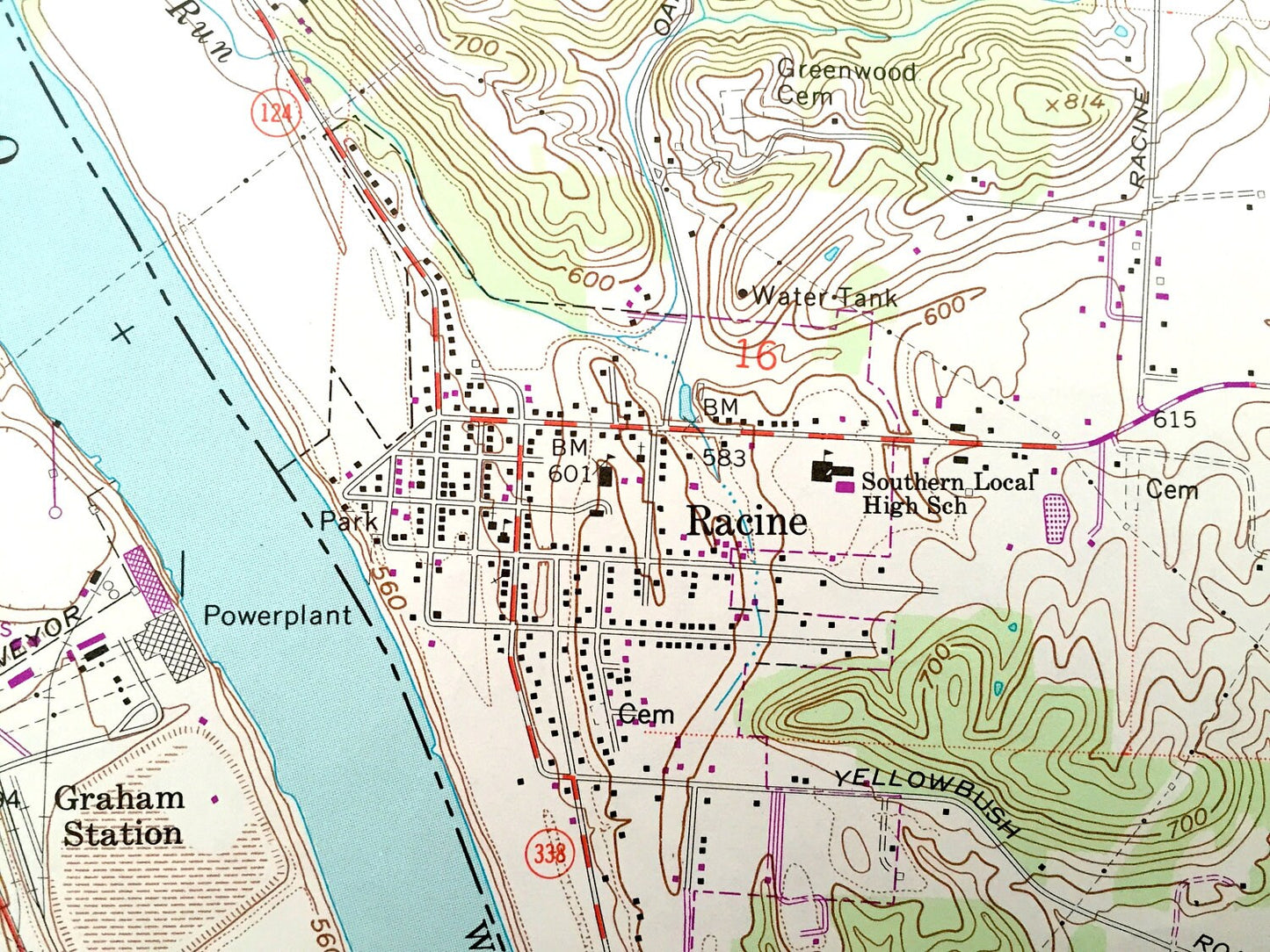
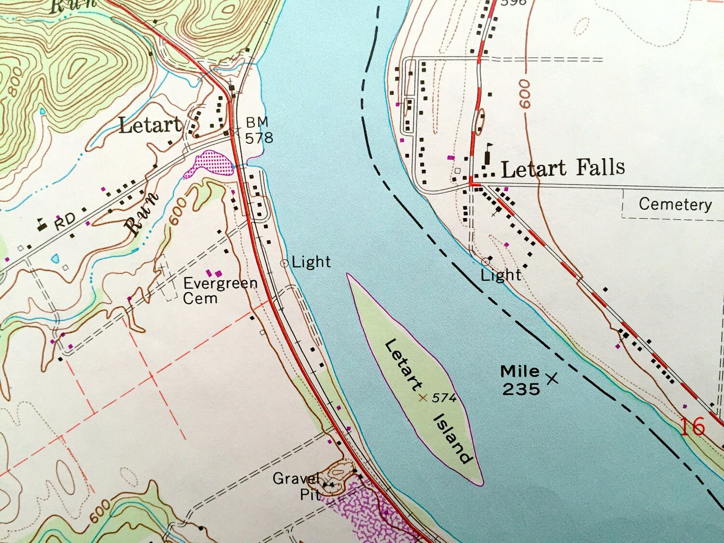
See what Mason County of West Virginia and Megis County of Ohio looked like over 50 years years ago. Lots of intricate details and geological contours. Map even has little squares for every house that existed at the time. The USGS cartographers were very thorough back then!
Perfect for the historian, map-lover, the curious or just as a conversation starter. Wonderful and rare. Vintage maps such as these make great gifts.
Edition of 1968, printed 1987
Dimensions: 22" width x 27" height
----
Features
Cities & Towns: West Virginia: New Haven, Graham, Hartford, Longdale, Letart, Cooper. Ohio: Syracuse, Racine, Sutton, Letart Falls, Plants, Antiquity, Dorcas, East Letart, Apple Grove.
Points of Interest: Ohio River, Graham Station, Racine Locks and Dam, Oak Grove Church, Broad Run School, Southern Local High School, Indian Mound, Gaging Station, Twomile Creek, Quillen Park and lots more streams, ponds, houses, churches, schools and roads.
Condition: Very Good condition, commensurate with age. This map is in incredible shape for being 30 years old. Has some edge-wear, which will read as character when framed.
----
We will happily adjust shipping price for multiple purchases. Maps are rolled up and shipped in sturdy mailing tubes, never folded.
Couldn't load pickup availability
Share