My Store
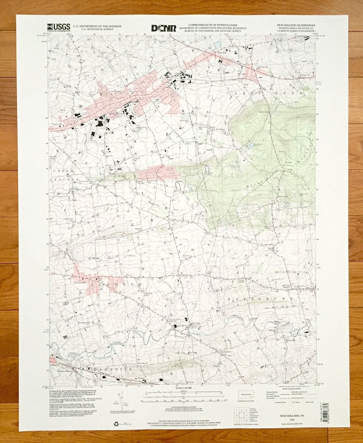
Antique New Holland, Pennsylvania 1999 US Geological Survey Topographic Map – Lancaster County, Salisbury, Leacock, East Earl, Paradise
Antique New Holland, Pennsylvania 1999 US Geological Survey Topographic Map – Lancaster County, Salisbury, Leacock, East Earl, Paradise
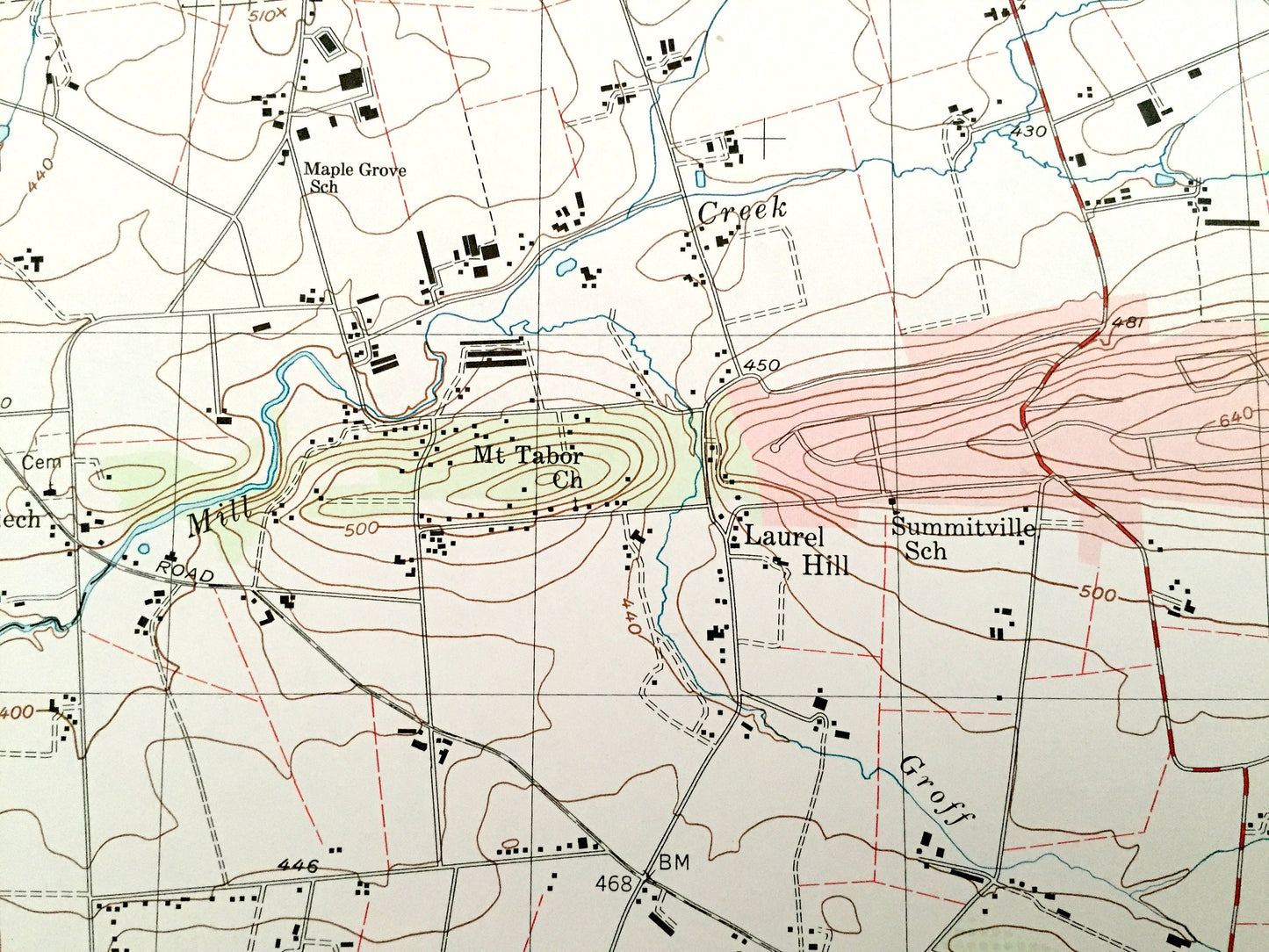
Beautiful, antique map of New Holland, Pennsylvania and surrounding Lancaster County areas. This is an authentic 1999 edition, 1999 print from the U.S. Geological Survey and NOT a computer reproduction.
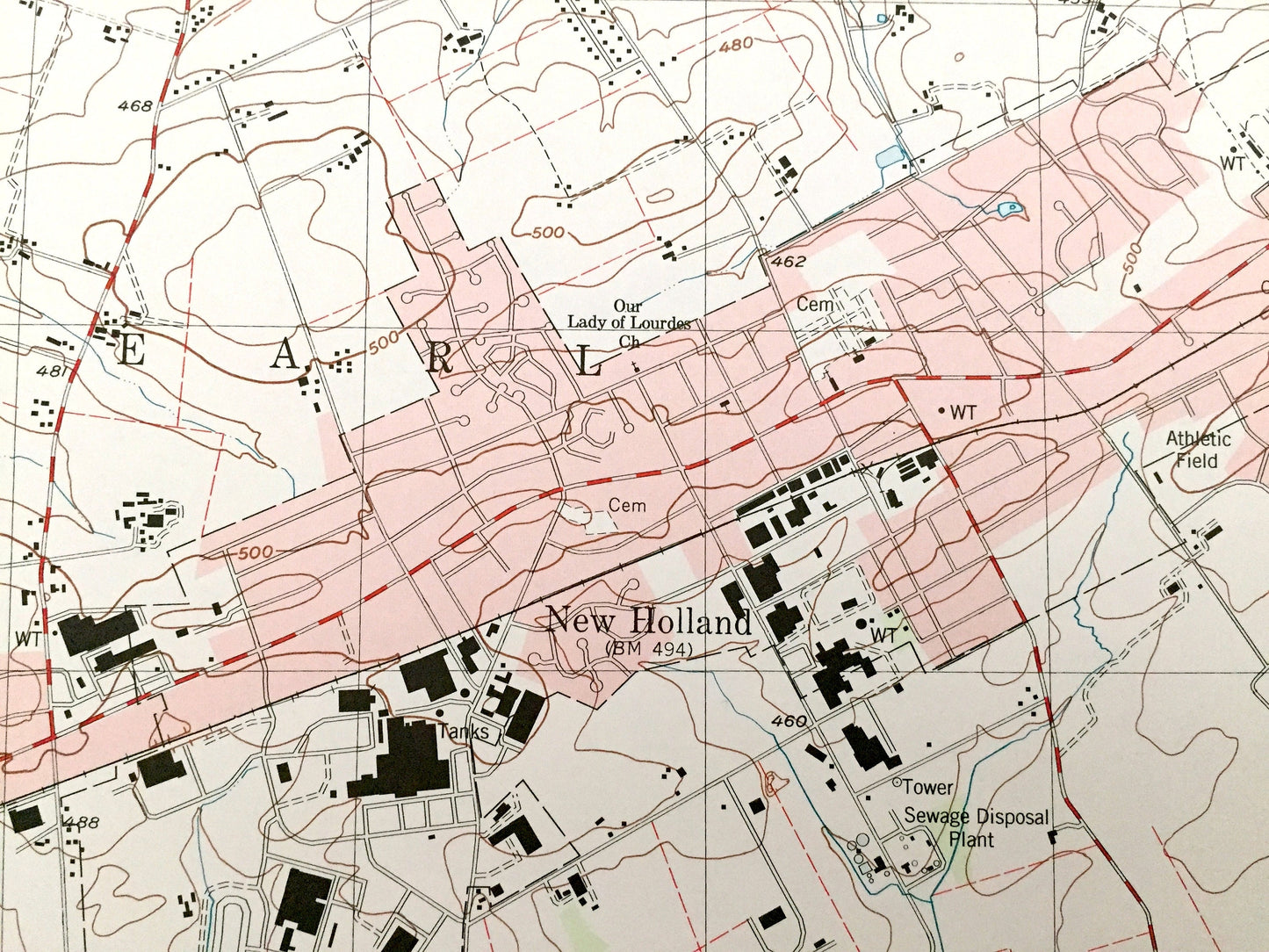
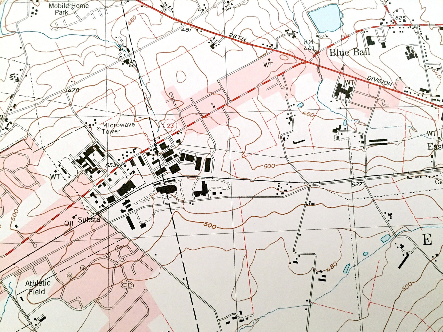
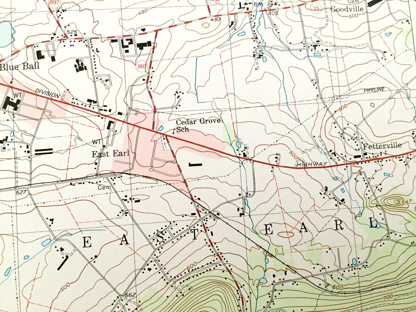
See what Pennsylvania looked like over 20 years ago. Lots of intricate details and geological contours. Map even has little squares for every house that existed at the time. The USGS cartographers were very thorough back then!
Perfect for the historian, map-lover, the curious or just as a conversation starter. Wonderful and rare. Vintage maps such as these make great gifts.
Edition of 1999, printed 1999
Dimensions: 22" width x 27" height
----
Features
Cities & Towns: New Holland, Earl, Upper Leacock, Salisbury Heights, Spring Gardern, Intercourse, Leahman Place, Harristown, Vintage, Kinzers, Buyerstown, Springville, Laurel Hill, Mount Airy, Cedar Lane, Blue Ball, New Milltown, Fetterville, Goodville.
Points of Interest: Lancaster County, Welsh Mountain, Dry Hill, Pequea Creek, Mill Creek, New Holland Reservoir and lots more hills, streams, ponds, schools, churches, houses, and roads.
Condition: Very Good condition, commensurate with age. This map is in incredible shape for being over 20 years old. Has light edge-wear, all of which will read as vintage character when framed.
----
We will happily adjust shipping price for multiple purchases. Maps are rolled up and shipped in sturdy mailing tubes, never folded.
Couldn't load pickup availability
Share