My Store
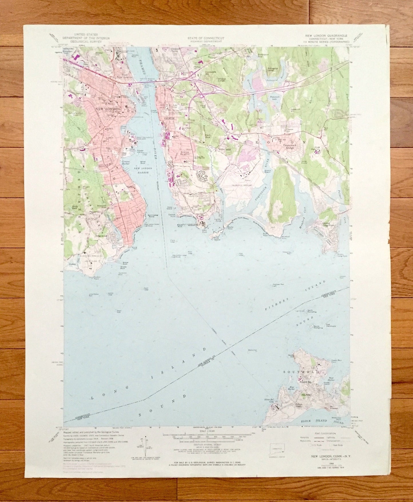
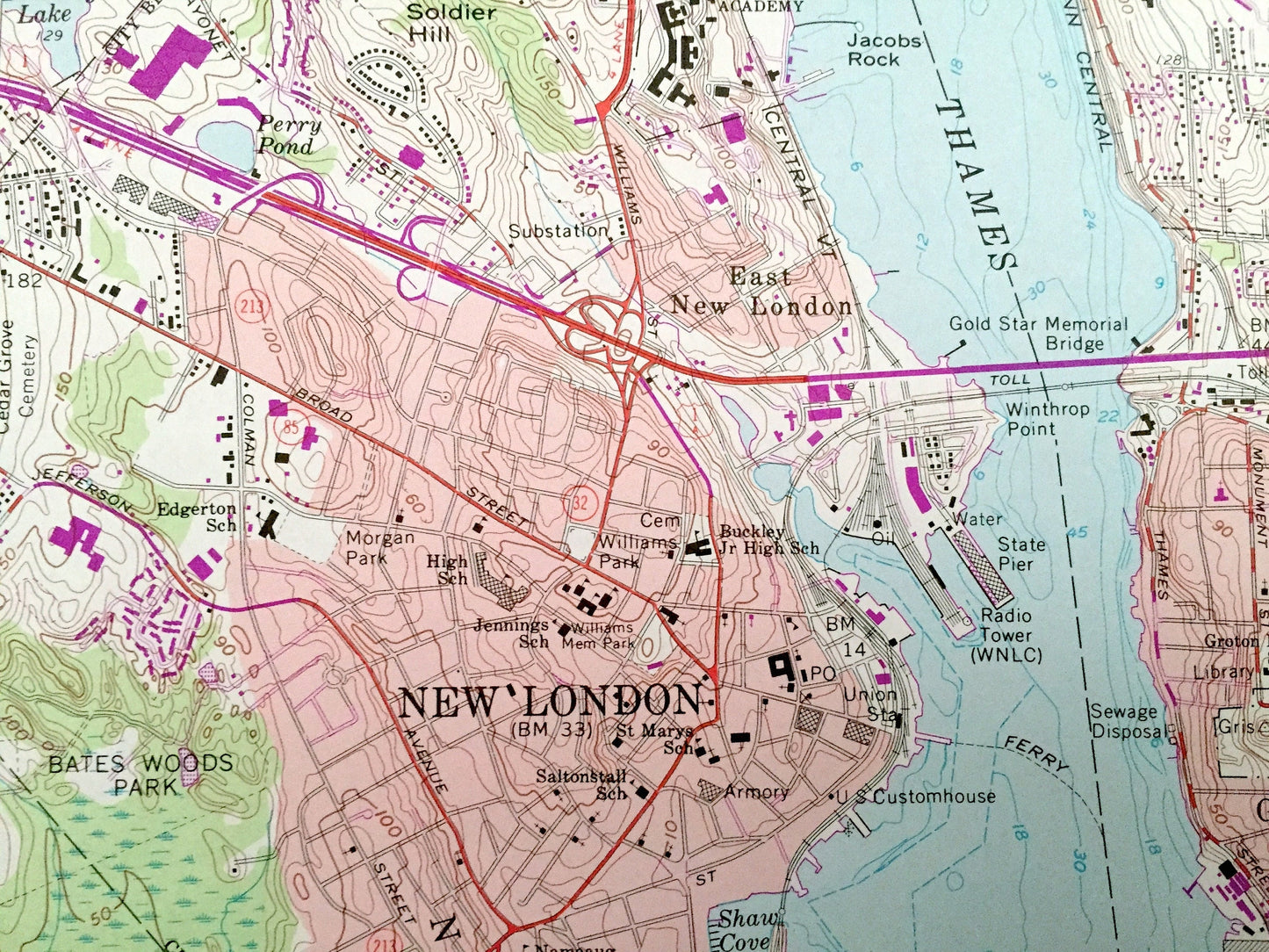
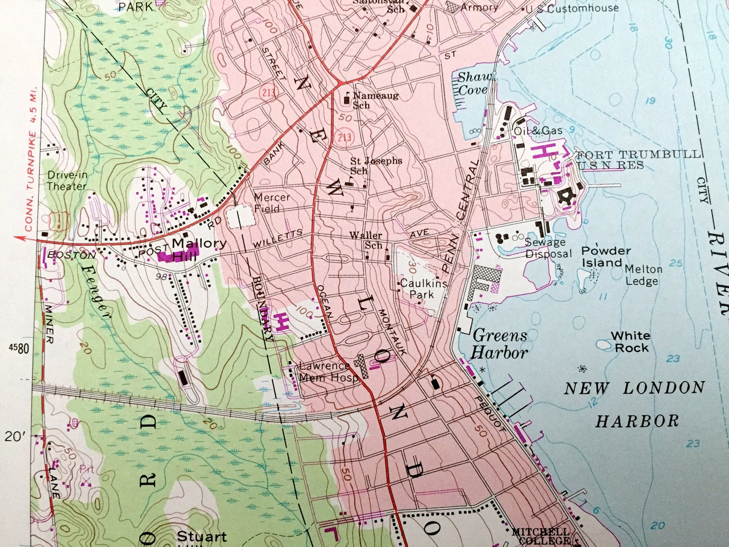
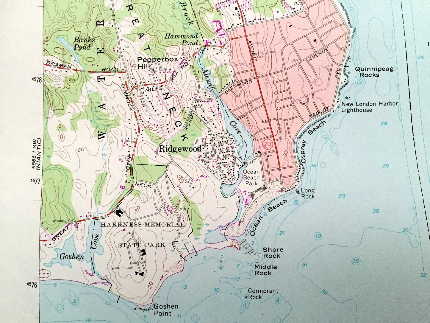
Antique New London, Connecticut 1958 US Geological Survey Topographic Map – New London County, Waterford, Groton, CT, Suffolk County, NY
Antique New London, Connecticut 1958 US Geological Survey Topographic Map – New London County, Waterford, Groton, CT, Suffolk County, NY
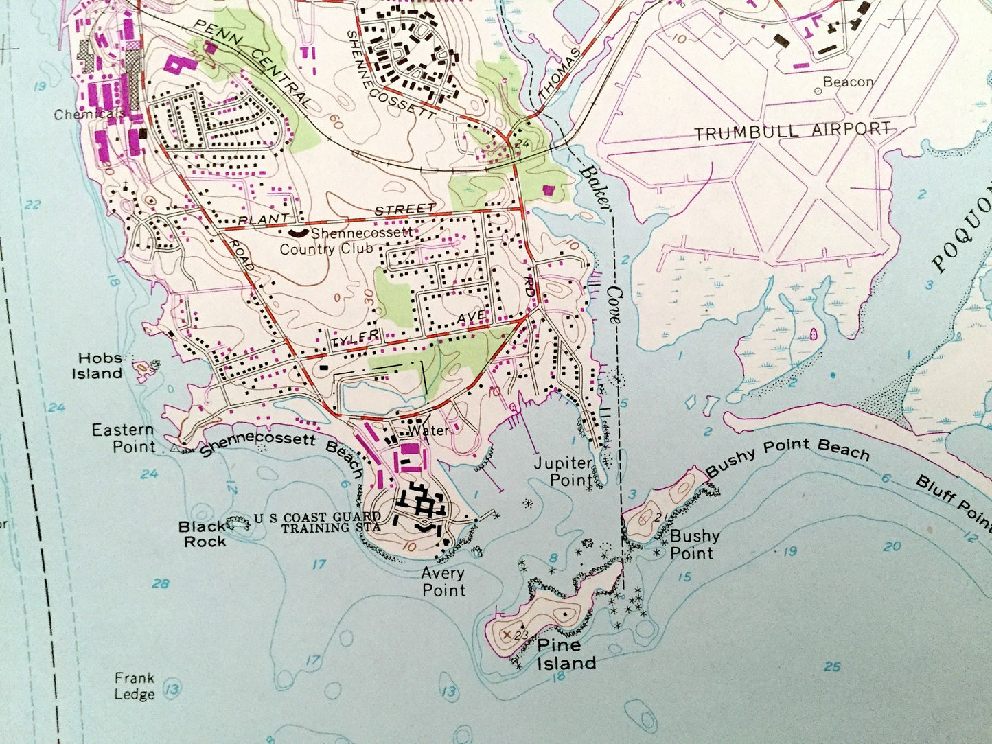
Beautiful, antique map of New London, Connecticut and surrounding New London County areas, including New York’s Suffolk County. This is an authentic 1958 edition, 1971 print from the U.S. Geological Survey and NOT a computer reproduction.
See what Connecticut and New York looked like over 60 years ago. Lots of intricate details and geological contours. Map even has little squares for every house that existed at the time. The USGS cartographers were very thorough back then!
Perfect for the historian, map-lover, the curious or just as a conversation starter. Wonderful and rare. Vintage maps such as these make great gifts.
Edition of 1958, printed 1971
Dimensions: 22" width x 27" height
----
Features
Cities & Towns: CONNECTICUT: Waterford, New London, Groton, Osprey Beach, Ocean Beach, Ridgewood, Groton Heights, Midway, Poquonock Bridge, Shenecossett Beach, Bluff Point Beach, Groton Long Point.
NEW YORK: Southold, Fisher Island.
Points of Interest: Connecticut Shoreline, Thames River, Long Island Sound, Fishers Island Sound, Block Island Sound, Poquonock River, Mumford Cove, Baker Cove, Palmer Cove, Greens Harbor, For Trumbull Coast Guard Base, US Coast Guard Academy, Bates Woods Park, Mitchell Park, Great Neck, Stuart Hill, Soldier Hill, Powder Island, Poquonock Plains, Trumbull Airport, Washington Park, Walker Hill, Wildcat Ledge, Odd Fellows Home, Shenecossett Country Club, Avery Point, Jupiter Point, Bushy Point, Pine Island, Bushy Point Beah, Bluff Point, Mumford Point, New York New Haven and Hartford Railroad, Groton Reservoir, Smith Lake, North Dumpling Island, Fishers Island, Silver Eel Pond, Fort HG Wright Military Reservation, Mt. Prospect, West Harbor, Goose Island, North Hill, Hawks Nest Point, New London Ledge Lighthouse, Goshen Point, Goshen Cove, and many more hills, streams, ponds, houses, schools, railroads, churches and roads.
Condition: Good Vintage condition, commensurate with age. This map is in great shape for being over 50 years old. Has some edge-wear that includes small tears and fold creases, all of which will read as character when framed.
----
We will happily adjust shipping price for multiple purchases. Maps are rolled up and shipped in sturdy mailing tubes, never folded.
Couldn't load pickup availability
Share