My Store
Antique New London County, Connecticut WALL SIZE 1979 US Geological Survey Topographic Map – Old, East Lyme, Waterford, Groton, Norwich, ct
Antique New London County, Connecticut WALL SIZE 1979 US Geological Survey Topographic Map – Old, East Lyme, Waterford, Groton, Norwich, ct
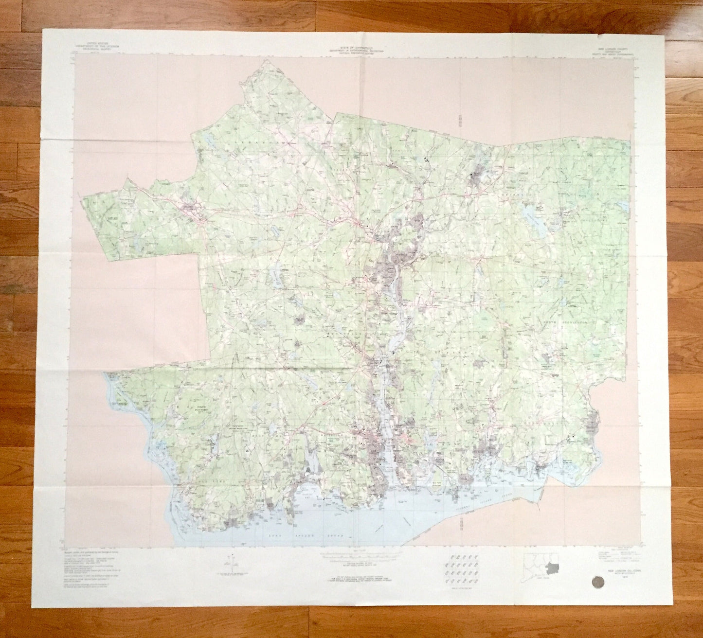
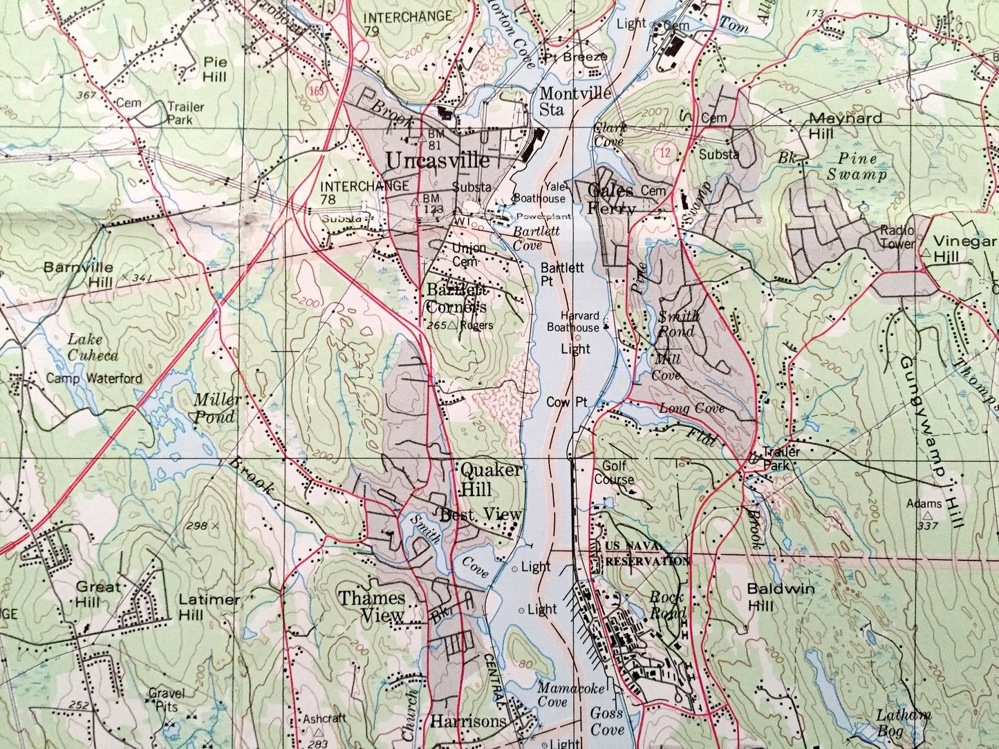
Beautiful, antique and *very large* map of New London County, Connecticut. This is an authentic 1979 edition, 1980 print from the U.S. Geological Survey and NOT a computer reproduction.
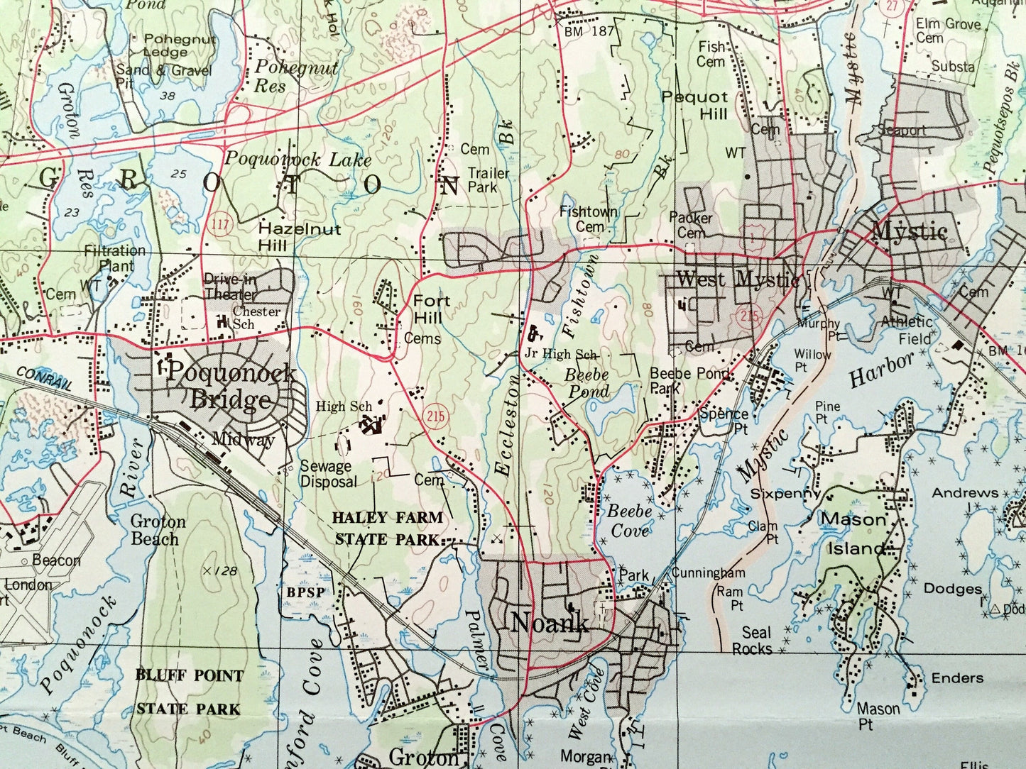
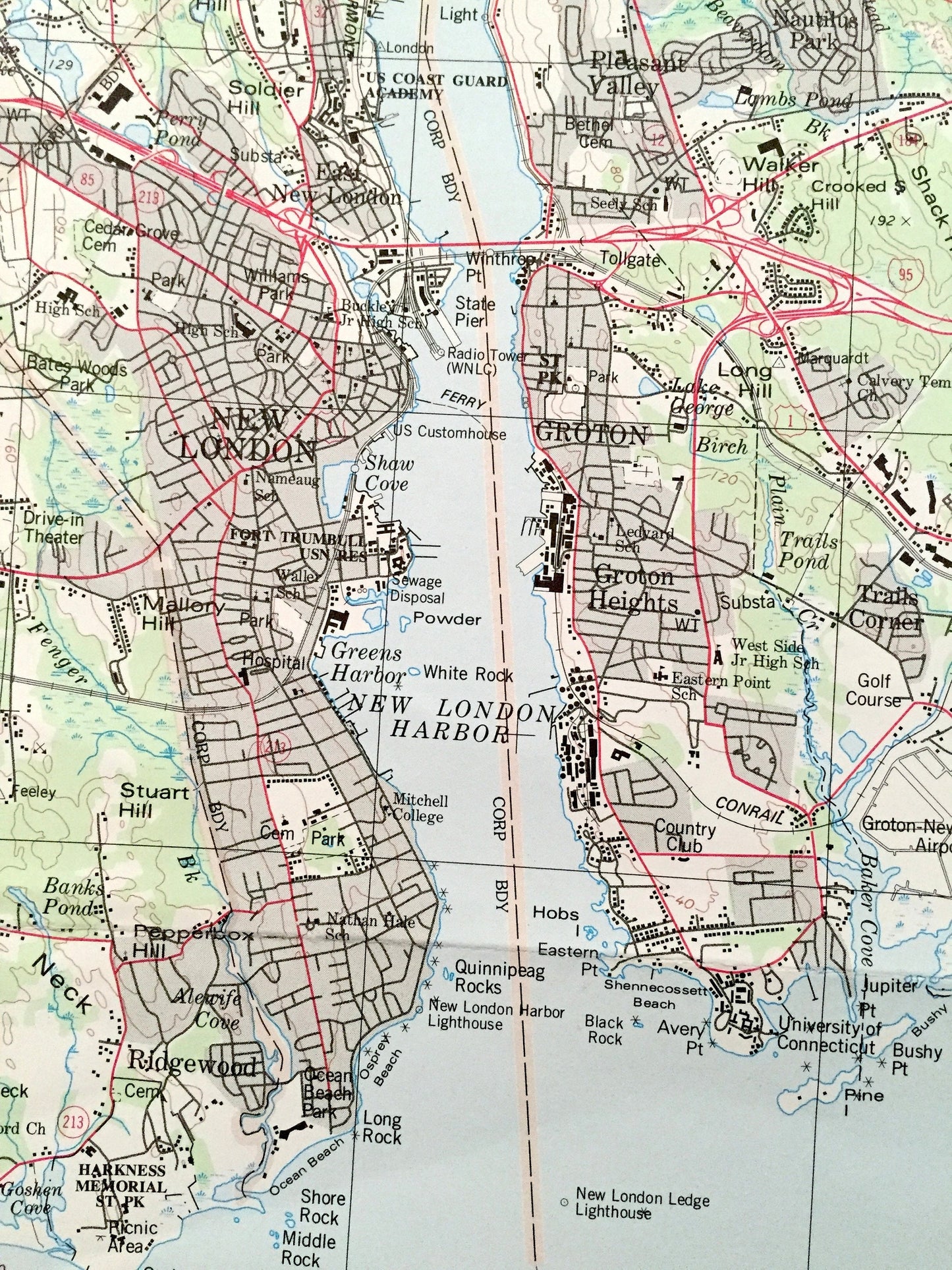
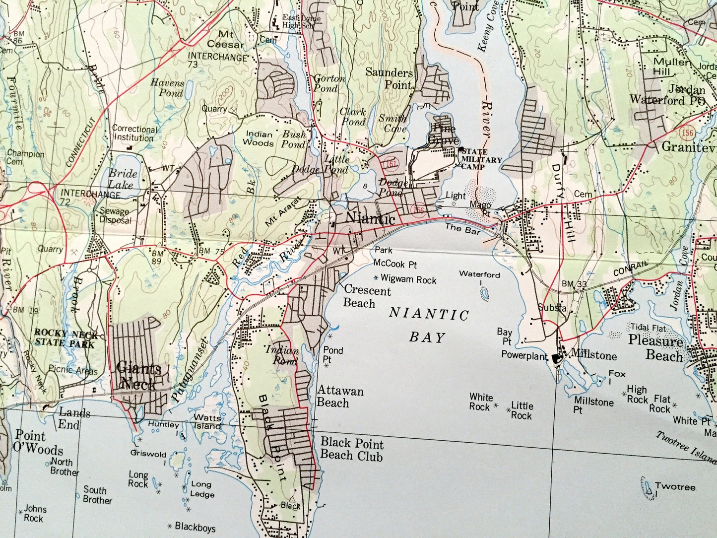
See what Connecticut looked like over 40 years ago. Lots of intricate details and geological contours. Map even has little squares for every house and building that existed at the time (no small feat for how large the map is). The USGS cartographers were very thorough back then!
This map is very large, about 4 feet by 4 feet, and the print is as detailed as the smaller USGS maps. The breadth of detail is incredible and would be the focal point of wherever it is hung. (See coin in the bottom right corner of the map in first photo for scale.) Verso is blank.
Perfect for the historian, map-lover, the curious or just as a conversation starter. Wonderful and rare. Vintage maps such as these make great gifts or office decoration.
Edition of 1979, printed 1980
Dimensions: 50 1/2" width x 46" height
----
Features
Towns & Cities: Bozrah, Colchester, Westchester, East Lyme, Flanders, Niantic, Franklin, Griswold, Borough of Jewett City, Hopeville, Glasgo, Pachaug, Groton, Groton, Long Point, Long Hill, Mystic, Noank, Poquonock Bridge, Lebanon, Ledyard, Gales Ferry, Ledyard Center, Lisbon, Lyme, Montville, Chesterfield, Mohegan, Oakdale, Oxoboxo River, Uncasville, North Stonington, Old Lyme, Preston, Poquetanuck, Preston City, Salem, Sprague, Baltic, Hanover, Stonington, Pawcatuck, Mystic, Old Mystic, Voluntown, Waterford, Quaker Hill.
Points of Interest: Thames River, Shetucket River, Quinebaug River, Pawcatuck River, Niantic River, Connecticut River, Fishers Island Sound, Long Island Sound, Little Narraggansett Bay, Bluff Point State Park, Stone Ranch Military Reservation, Nehantic State Forest, Pachaug Pond, Rocky Neck State park, Lake of Isles, Amos Lake, Avery Pond, Gardner Lake, Rogers Lake, Barn Island Hunting Area, Lake Konomoc, Red Cedar Lake and many more mountains, peaks, hills, canyons, creeks, rivers, valleys, beaches, train tracks, schools, churches neighborhoods and streets.
Condition: Good Vintage condition, commensurate with age. This map is in great shape for being 40 years old. Has some wear and folds as-issued, but these will flatten easily, and all will read as vintage character when framed.
----
We will happily adjust shipping price for multiple purchases. Map will be shipped folded and fully-insured.
Couldn't load pickup availability
Share