My Store
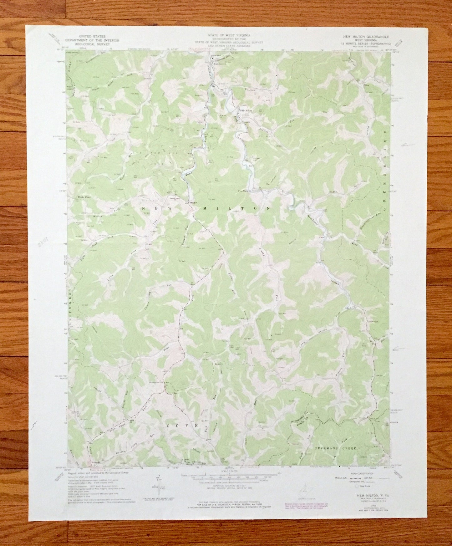
Antique New Milton, West Virginia 1965 US Geological Survey Topographic Map – Lewis, Doddridge County, Cove, Freemans Creek, Leopold, WV
Antique New Milton, West Virginia 1965 US Geological Survey Topographic Map – Lewis, Doddridge County, Cove, Freemans Creek, Leopold, WV
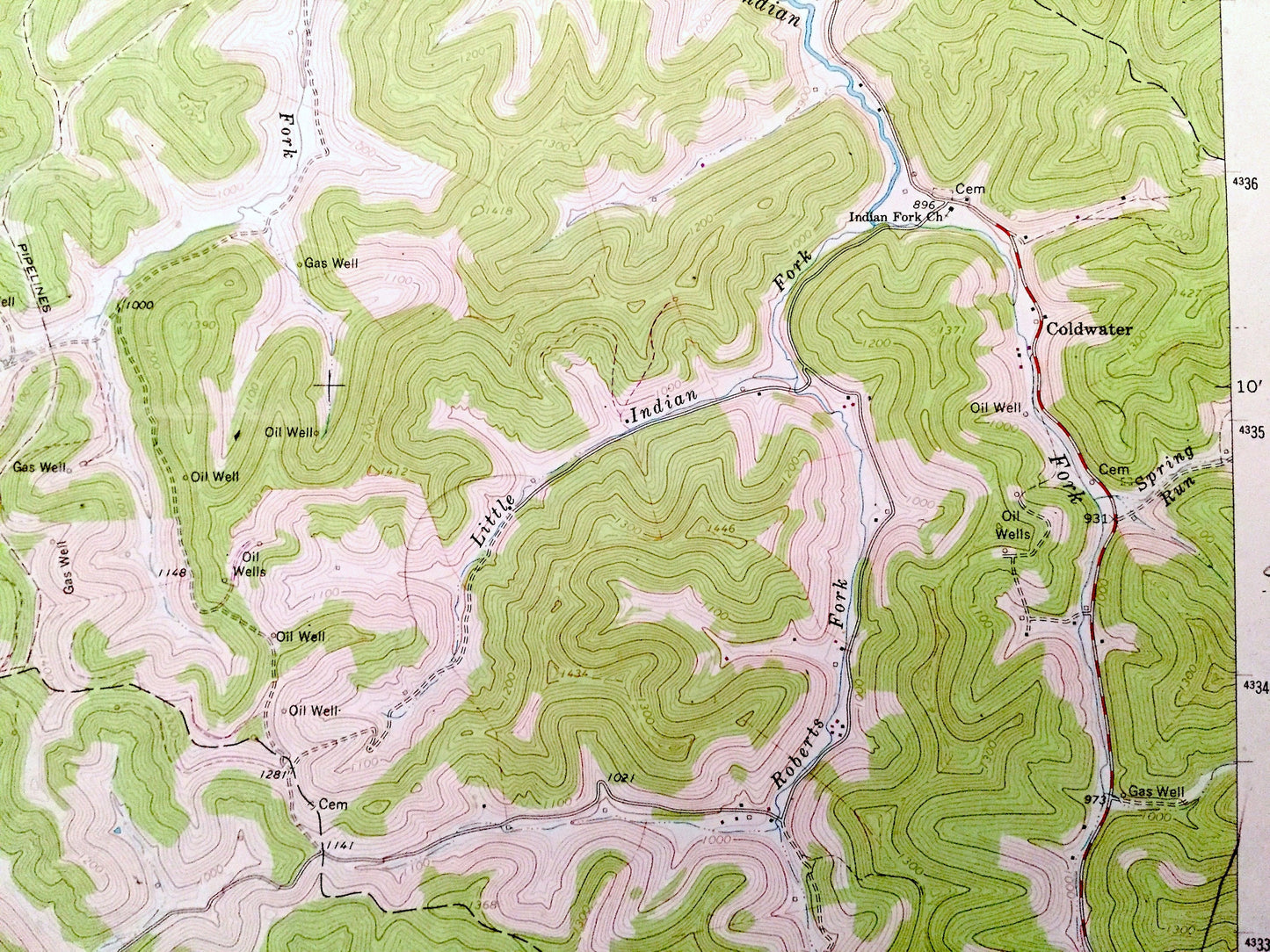
Beautiful, antique map of New Milton, West Virginia and surrounding Lewis and Doddridge County areas. This is an authentic 1965 edition, 1977 print from the U.S. Geological Survey and NOT a computer reproduction.
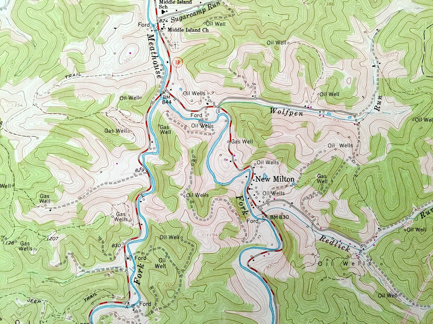
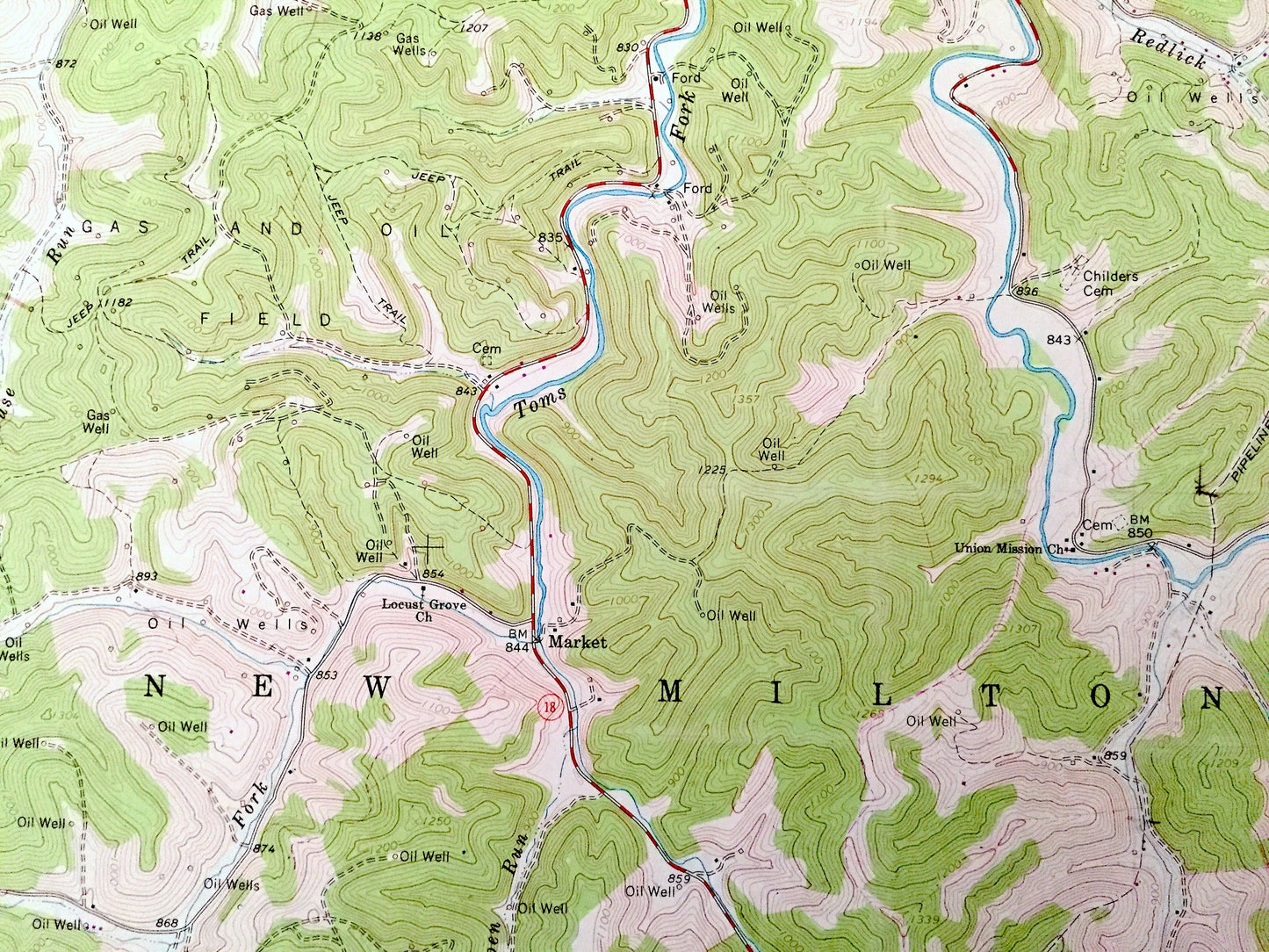
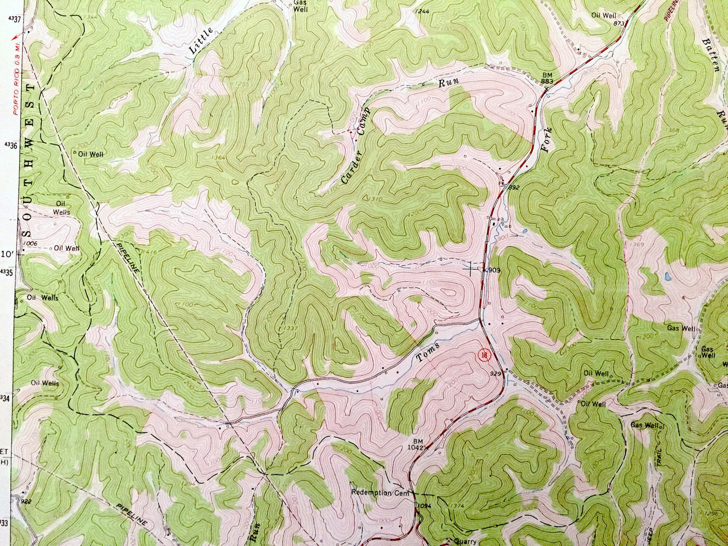
See what West Virginia looked like over 50 years ago. Lots of intricate details and geological contours. Map even has little squares for every house that existed at the time. The USGS cartographers were very thorough back then!
Perfect for the historian, map-lover, the curious or just as a conversation starter. Wonderful and rare. Vintage maps such as these make great gifts.
Edition of 1965, printed 1977
Dimensions: 22" width x 27" height
----
Features
Cities & Towns: Cove, Freemans Creek, Leopold, Southwest, Coldwater, Greenbrier, Nina, New Milton, Market, Middle Point.
Points of Interest: Doddridge County, Lewis County, Sand Fork, Buck Run, Carter Camp Run, Cover Creek, Redlick Run, Burton Run, Batten Run, Brushy Fork, Meathouse Fork, Standingstone Run, Buckeye Creek, Toms Frk, Wolfpen Run, Maxwell Ridge, Grouse Run, and lots more hills, mountains, creeks, towns, roads and train tracks.
Condition: Very Good Vintage condition, commensurate with age. This map is in incredible condition for being over 40 years old. Has some light edge-wear, pencil marks, and a repaired tear along the bottom edge but this will read as vintage character when framed.
----
We will happily adjust shipping price for multiple purchases. Maps are rolled up and shipped in sturdy mailing tubes, never folded.
Couldn't load pickup availability
Share