My Store
Antique New Orleans, Louisiana 1950 US Geological Survey Topographic Map – Jefferson Parish, Metairie, French Quarter, Treme Ward Audubon LA
Antique New Orleans, Louisiana 1950 US Geological Survey Topographic Map – Jefferson Parish, Metairie, French Quarter, Treme Ward Audubon LA
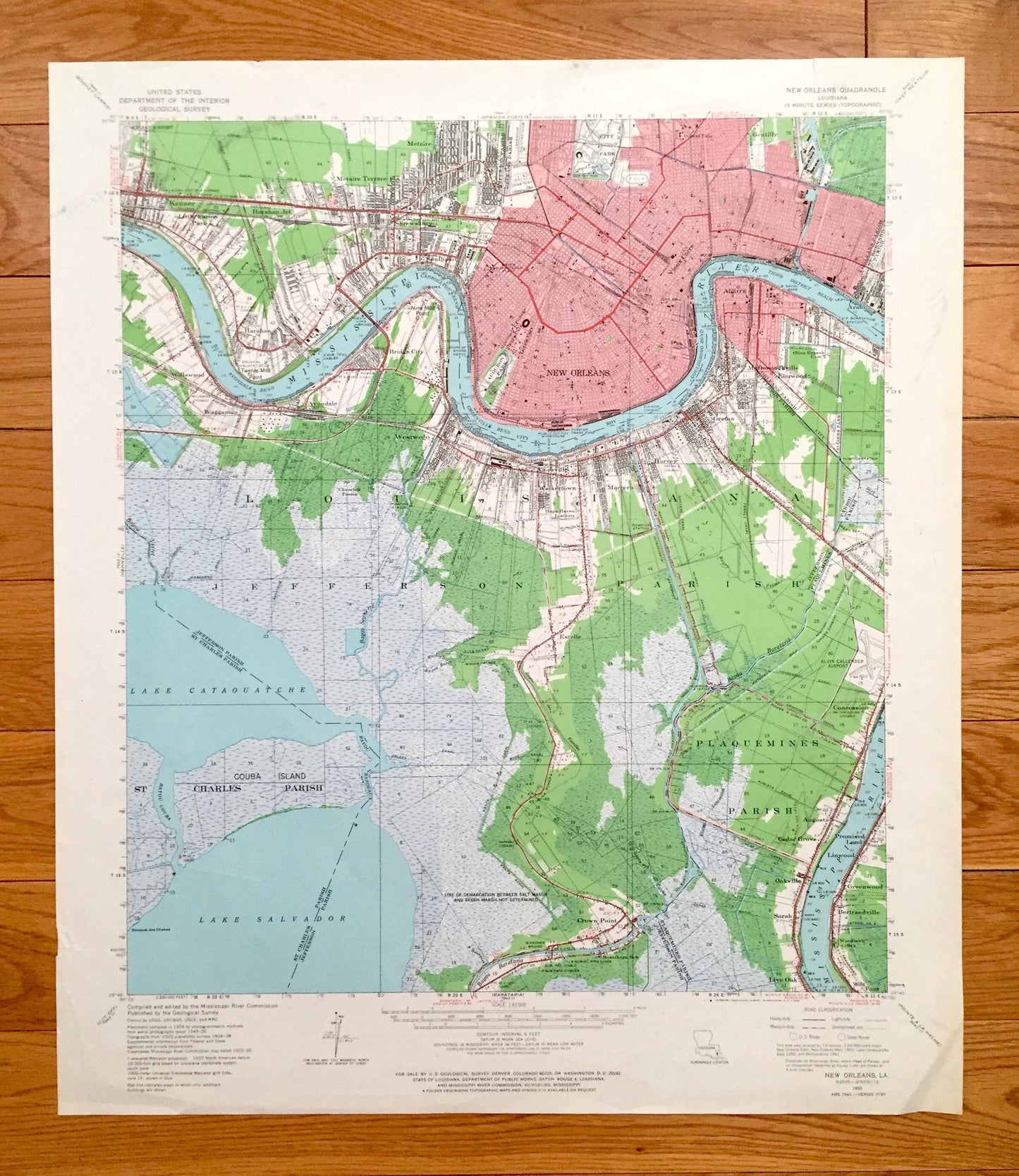
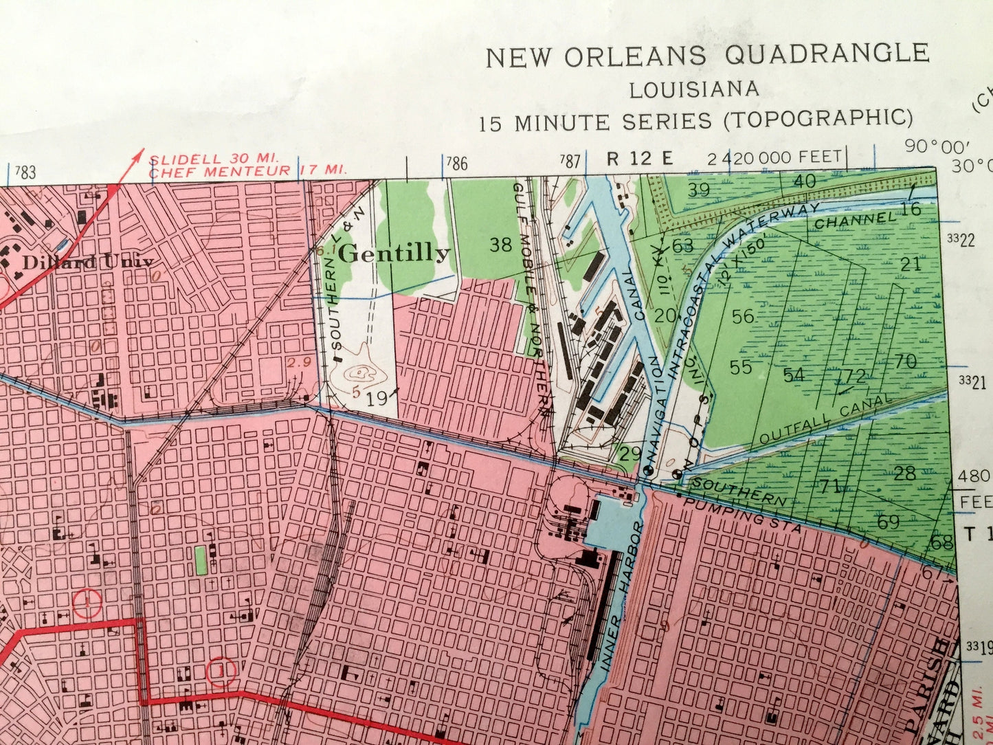
Beautiful, antique map of New Orleans, Louisiana and surrounding Orleans, St Charles, Plaquemines & Jefferson Parishes on the Mississippi River down to Lake Salvador. This is an authentic 1950 edition, 1966 print from the U.S. Geological Survey and NOT a computer reproduction.
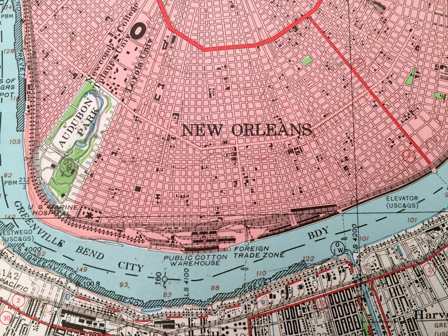
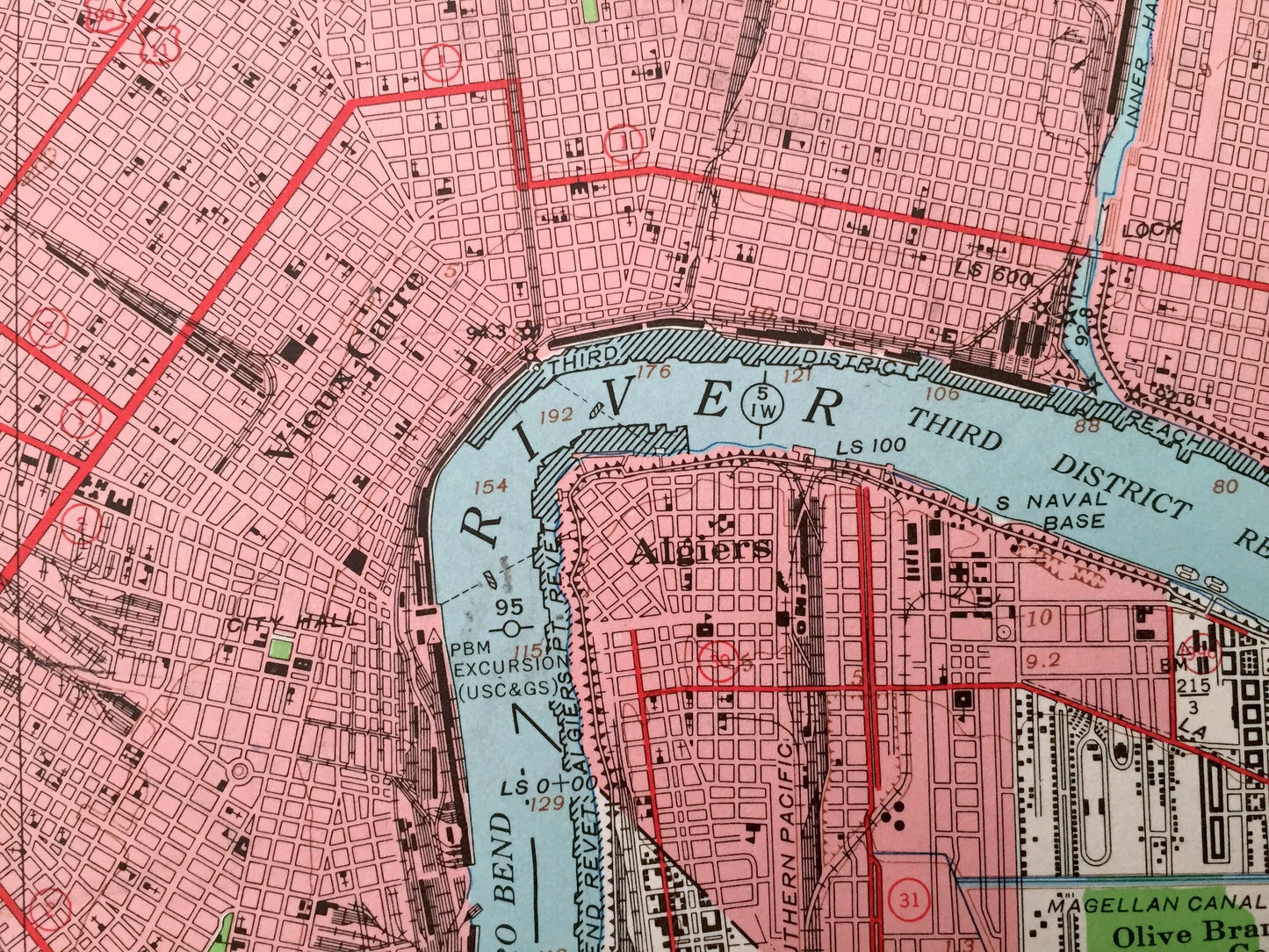
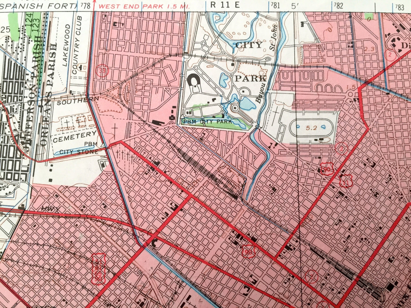
See what New Orleans looked like over 70 years ago. Lots of intricate details and geological contours. Map even has little squares for every house that existed at the time. The USGS cartographers were very thorough back then!
Perfect for the historian, map-lover, the curious or just as a conversation starter. Wonderful and rare. Vintage maps such as this make great gifts.
Edition of 1950, printed 1966
Dimensions: 18" width x 21" height
----
Features
Cities & Towns: New Orleans, French Quarter, Metairie, Mid City, Holly Grove, Audubon, Touro, Marigny, Tremé, Lafitte, Freret, Central City, Irish Channel, Seventh Ward, Fairgrounds, Bayou St John, Lower Garden District, Bywater, Marrero, Harvey, Gretna, Walkertown, Amesville, McDonoghville, Algiers, Westwego, Bridge City, Kenner, Harahan Jet, Avondale, Waggaman, Willswood, Elmwood, Estelle, Concession, Crown Point, Augusta, Cedar Grove, Oakville, Sarah, Live Oak, Promised Land, Linwood, Greenwood, Bertrandville.
Points of Interest: Orleans Parish, Jefferson Parish, Plaquemine Parish, St Charles Parish, St Bernard Parish, Mississippi River, Lake Cataouatche, Lake Salvador, Couba Island, Bayou Couba, Bayou Segnette, Bayou Barataria, Tulane University, Inner Harbor Canal, Bourbon Street, French Quarter, City Park, Lakewood Country Club and many more towns, train tracks, bayous, canals and rivers.
Condition: Very Good condition, commensurate with age. This map is in great shape for being over 50 years old. Some light edge-wear, smudging in margins and a small 1/2" tear in lower left margin, but this will add to vintage character when framed.
----
We will happily adjust shipping price for multiple purchases. Maps are rolled up and shipped in sturdy mailing tubes, never folded.
Couldn't load pickup availability
Share