My Store
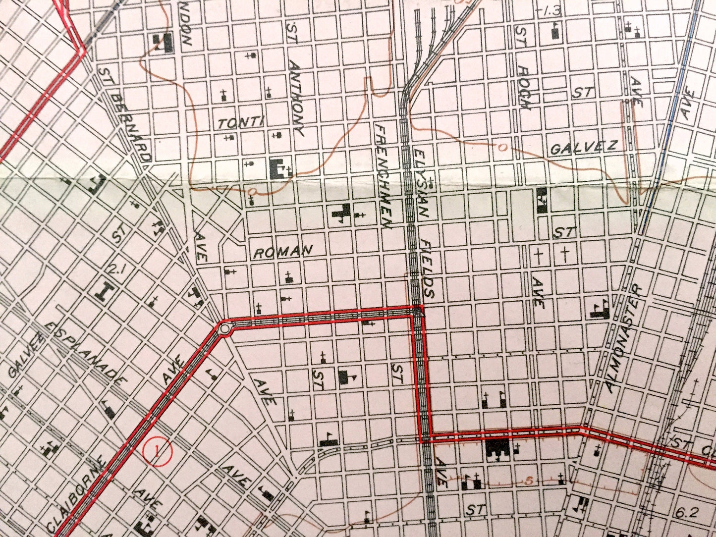
Antique New Orleans, Louisiana 1951 WALL SIZE US Geological Survey Topographic Map – Big Easy, Bourbon Street, French Quarter, Saints, la
Antique New Orleans, Louisiana 1951 WALL SIZE US Geological Survey Topographic Map – Big Easy, Bourbon Street, French Quarter, Saints, la
Beautiful, antique *Wall Size* map of New Orleans, Louisiana and surrounding area. This is an authentic and very rare 1951 edition, 1956 print from the U.S. Geological Survey and NOT a computer reproduction.
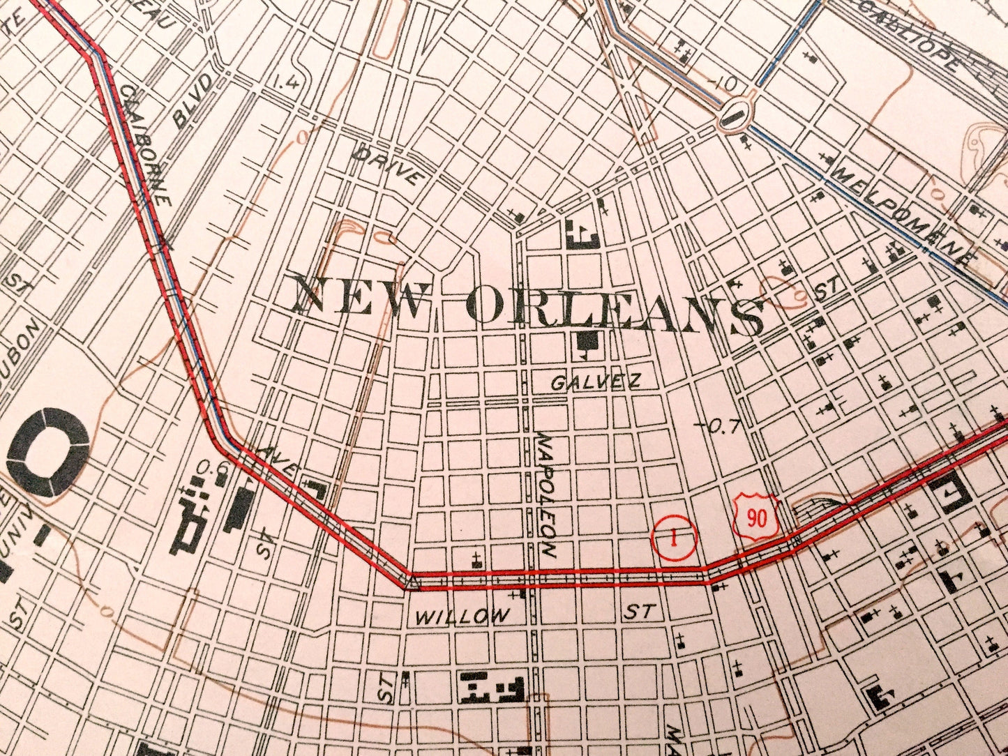
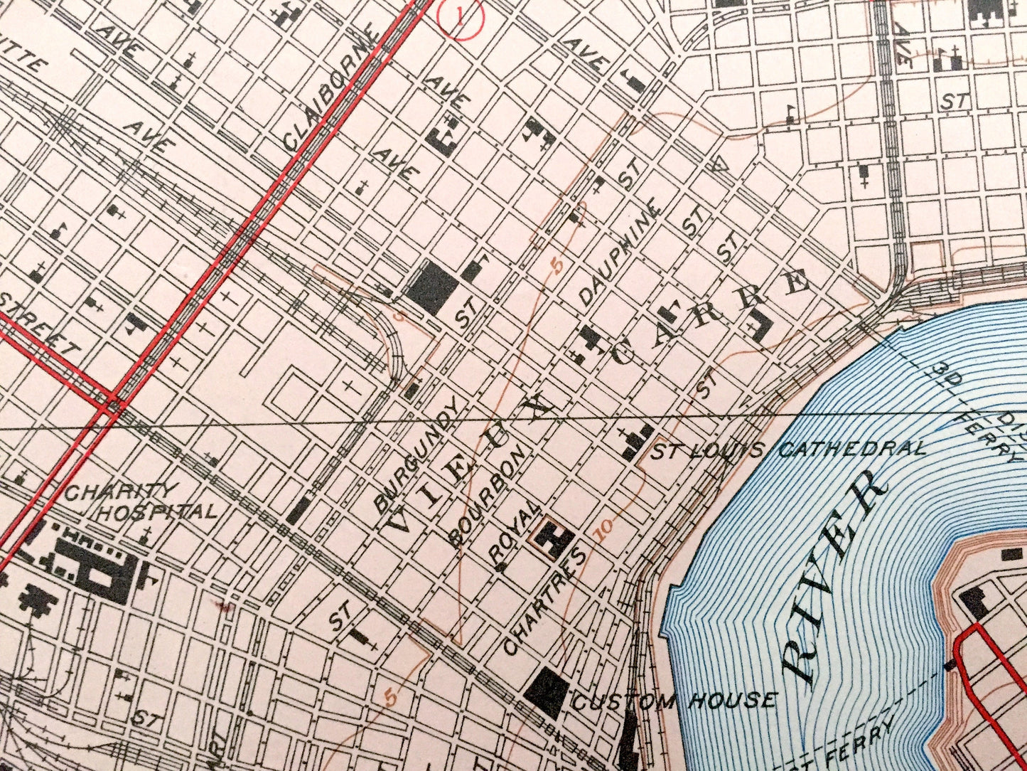
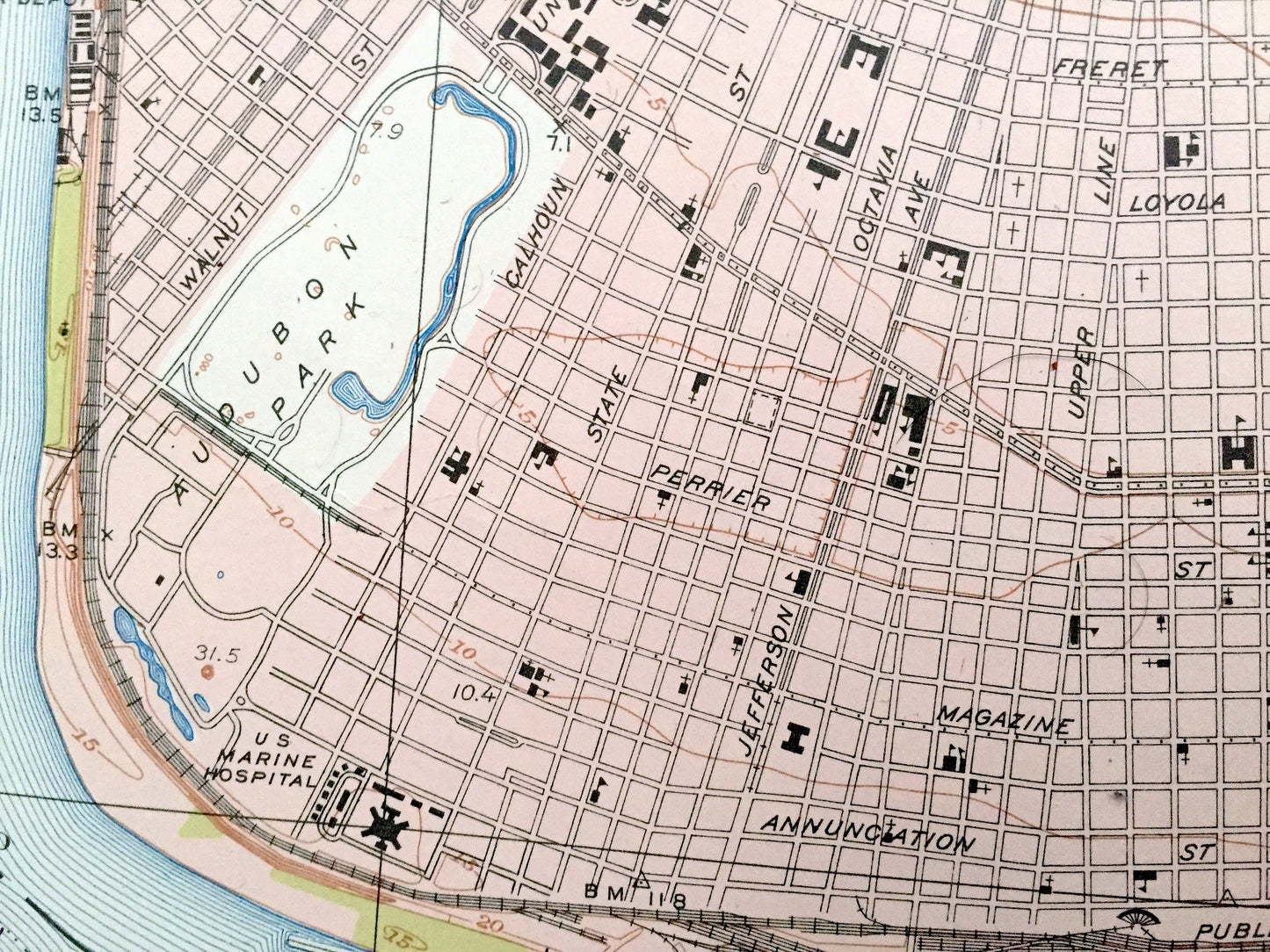
See what New Orleans looked like over 70 years ago. Lots of intricate details and geological contours. Lots of intricate details and geological contours, even many individual houses. The USGS cartographers were very thorough back then!
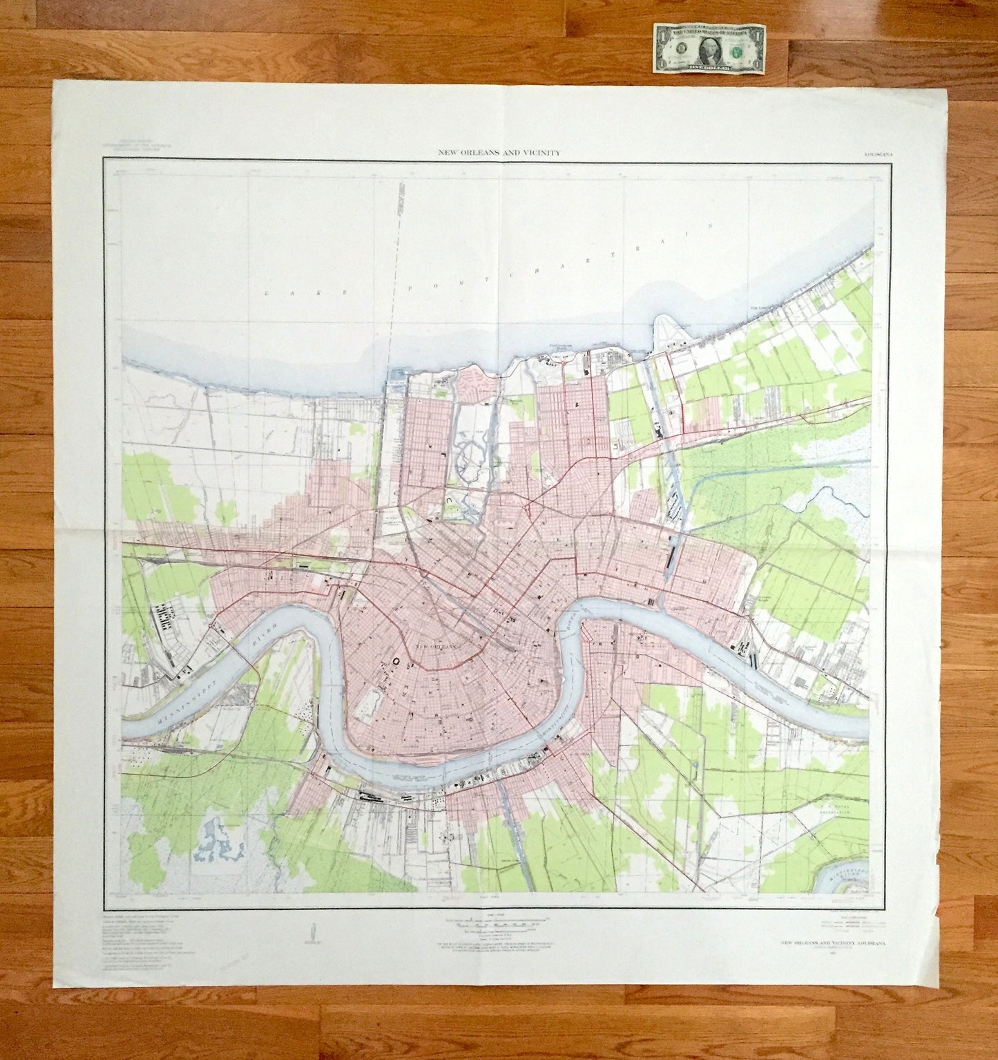
This map is extremely large, 4 feet wide by 4 feet tall, and the print is as detailed as the smaller USGS maps. Would be perfect for a corporate office, loft or any room with a lot of wall space. The breadth of detail is incredible and would be the focal point of wherever it is hung. (See dollar bill at the top of the map in first photo for scale.) Verso is blank. Feel free to email with any questions.
Perfect for the historian, map-lover, the curious or just as a conversation starter. Wonderful and rare. Vintage maps such as these make great gifts.
Edition of 1951, printed 1956
Dimensions: 47" width x 47 1/2" height
----
Cities & Towns: New Orleans, French Quarter, Metairie, Mid City, Holly Grove, Audubon, Touro, Marigny, Tremé, Lafitte, Freret, Central City, Irish Channel, Seventh Ward, Fairgrounds, Bayou St John, Lower Garden District, Bywater, Marrero, Harvey, Gretna, Walkertown, Amesville, McDonoghville, Algiers, Kenner, Riverside Park, Roseland Park, Little Farms Park, Jefferson Heights, Metarie, Metarie Terrace, Willswood, Waggaman, Belt City, Westwego, Avondale, Churchill Farms, Shrewsbury.
Points of Interest: Orleans Parish, Jefferson Parish, Lake Pontchartrain, St Bernard Parish, Mississippi River, Tulane University, Inner Harbor Canal, Bayou Segnete, and many more towns, train tracks, bayous, canals and rivers.
Condition: Very Good Vintage condition, commensurate with age. This map is in great shape for being over 65 years old. Has light edge-wear but this will read as vintage character when framed and add to its authenticity.
----
We will happily adjust shipping price for multiple purchases. Maps are rolled up and shipped fully-insured in sturdy mailing tubes, never folded.
Couldn't load pickup availability
Share