My Store
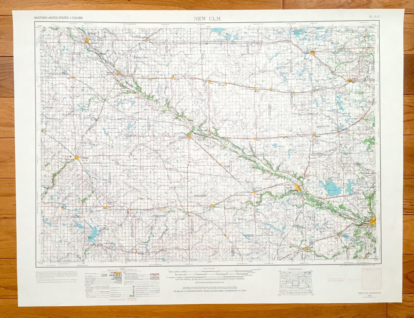
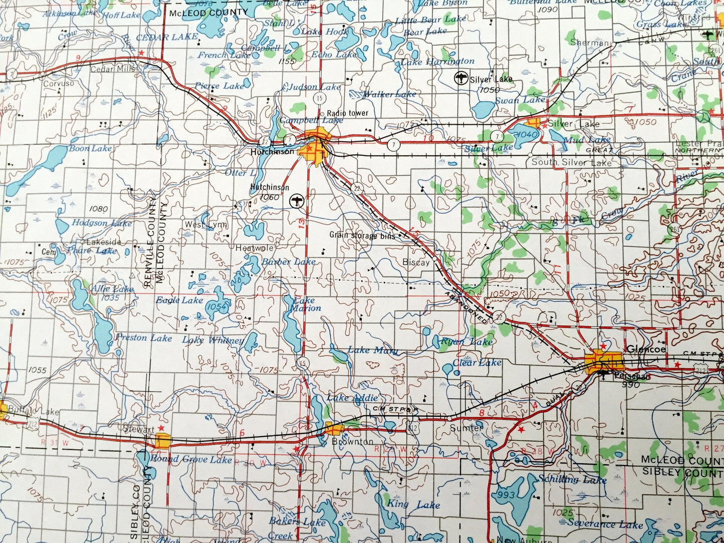
Antique New Ulm, Minnesota 1953 US Geological Survey Topographic Map – Sleepy Eye, Mankato, Marshall, Montevideo Hutchinson Glencoe Tracy MN
Antique New Ulm, Minnesota 1953 US Geological Survey Topographic Map – Sleepy Eye, Mankato, Marshall, Montevideo Hutchinson Glencoe Tracy MN
Beautiful, antique map of New Ulm, Minnesota and surrounding areas. This is an authentic 1953 edition, 1968 print from the U.S. Geological Survey and NOT a computer reproduction.
See what Minnesota looked like over 65 years ago. Lots of intricate details and geological contours. Map is incredibly large and in the grand 1:250,000 scale. The USGS cartographers were very thorough back then!
Perfect for the historian, map-lover, the curious or just as a conversation starter. Wonderful and rare. Vintage maps such as these make great gifts.
Edition of 1953, printed 1968
Dimensions: 32" width x 22 1/2" height
----
Features
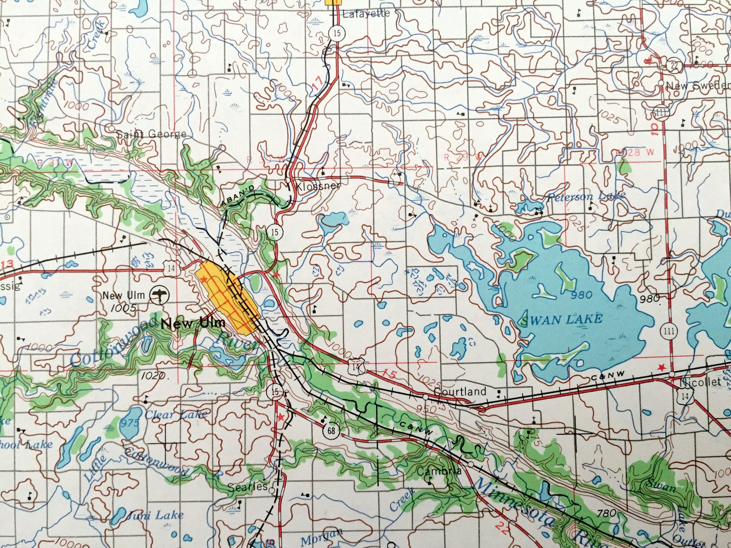
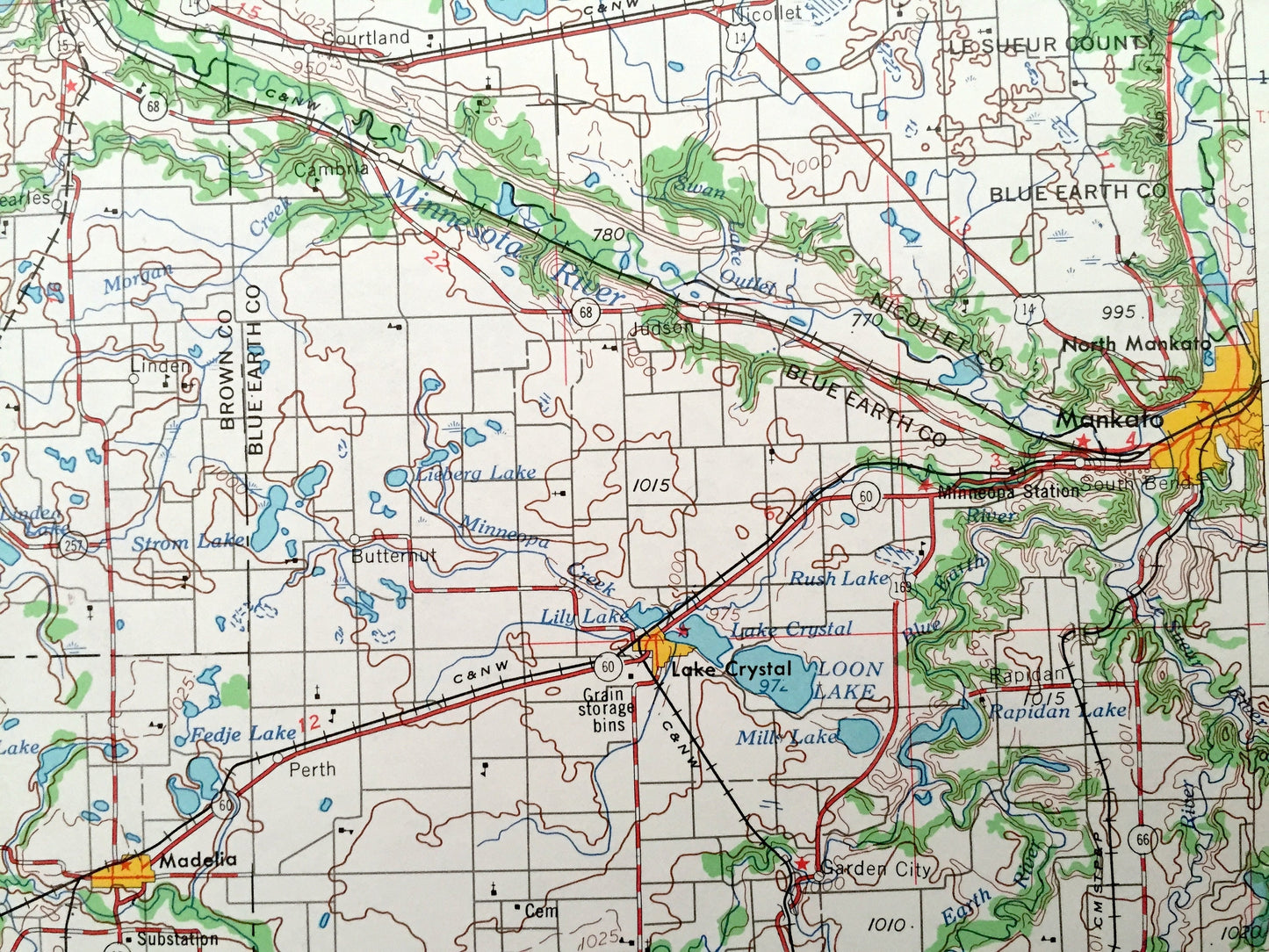
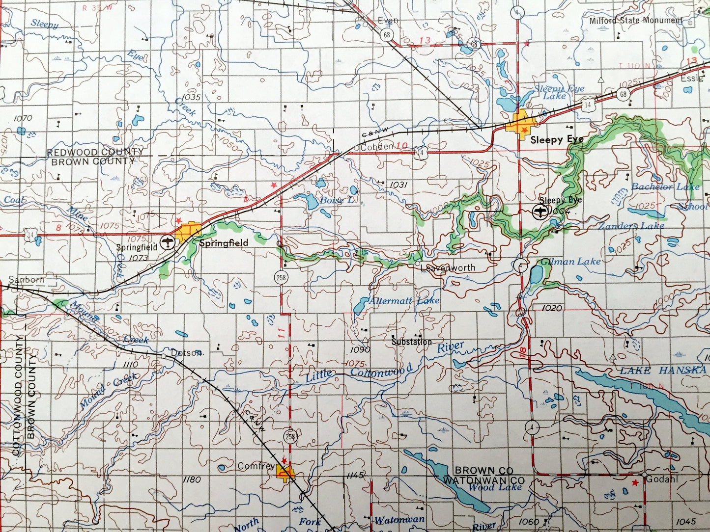
Cities & Towns: New Ulm, Springfield, Lake Crystal, Gaylord, Good Thunder, Arlington, Fairfax, Redwood Falls, Morton, Granite Falls, Clarkfield, Minneota, Balaton, Walnut Grove, Lamberton, Sanborn, Comfrey, Bird Island, Olivia, Renville, Clara City, Stewart, Sleepy Eye, Mankato, Marshall, Montevideo, Hutchinson, Glencoe, Tracy.
Points of Interest: Minnesota River, Swan Lake, Lake Lillian, Lake Shelter, Cedar Lake, Loon Lake, and lots more hills, mountains, lakes, rivers, creeks, roads, highways and railroads.
Condition: Very Good Vintage condition, commensurate with age. This map is in great shape for being over 50 years old. Has light edge-wear, all of which will read as vintage character when framed.
----
We will happily adjust shipping price for multiple purchases. Maps are rolled up and shipped in sturdy mailing tubes, never folded.
Couldn't load pickup availability
Share