My Store
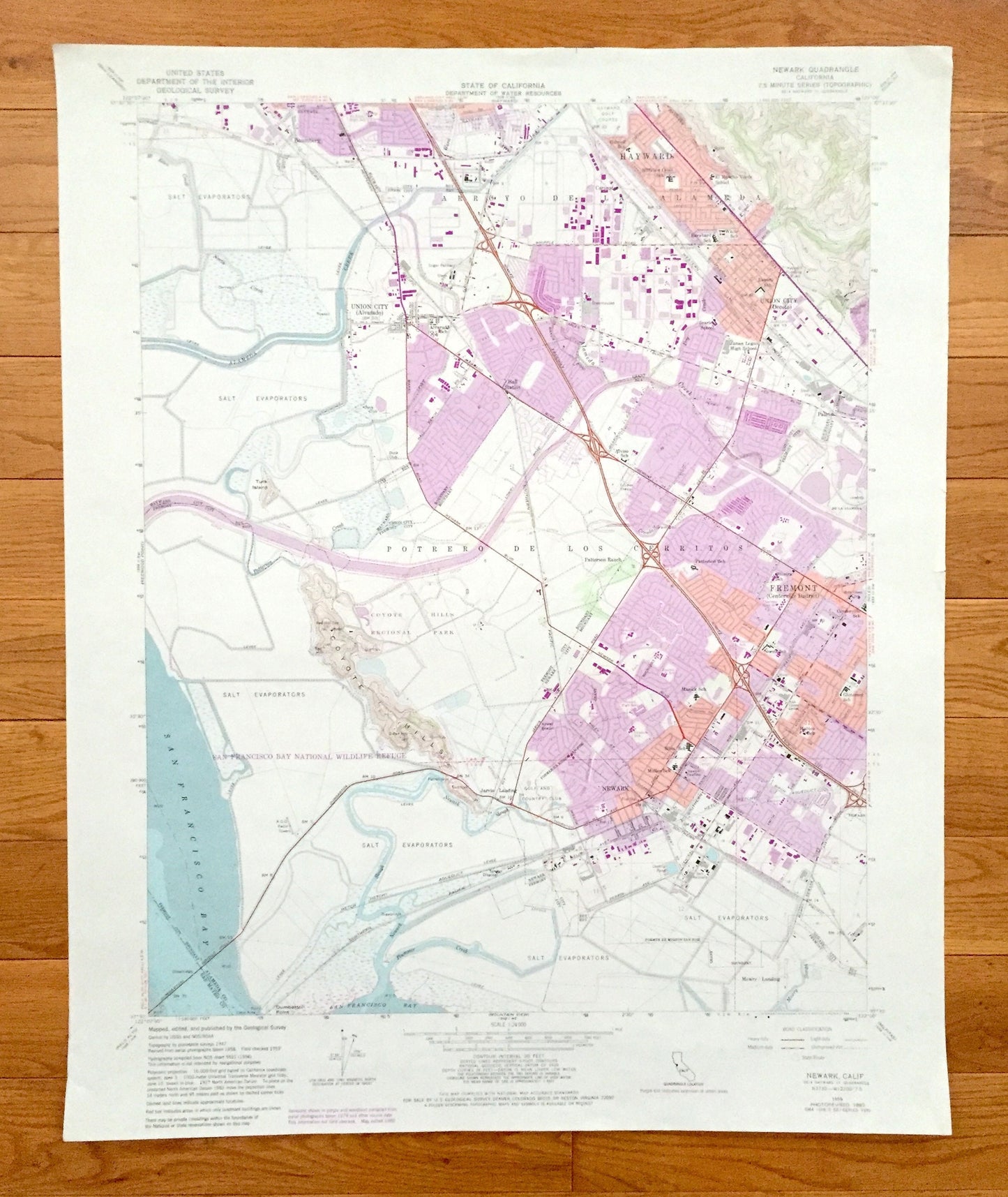
Antique Newark, California 1959 US Geological Survey Topographic Map – Alameda, San Mateo County, Hayward, Fremont, San Francisco Bay
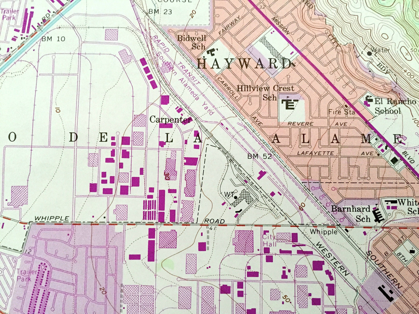
Antique Newark, California 1959 US Geological Survey Topographic Map – Alameda, San Mateo County, Hayward, Fremont, San Francisco Bay
Beautiful, antique map of Newark, California and surrounding Alameda & San Mateo County areas. This is an authentic 1959 edition, 1984 print from the U.S. Geological Survey and NOT a computer reproduction.
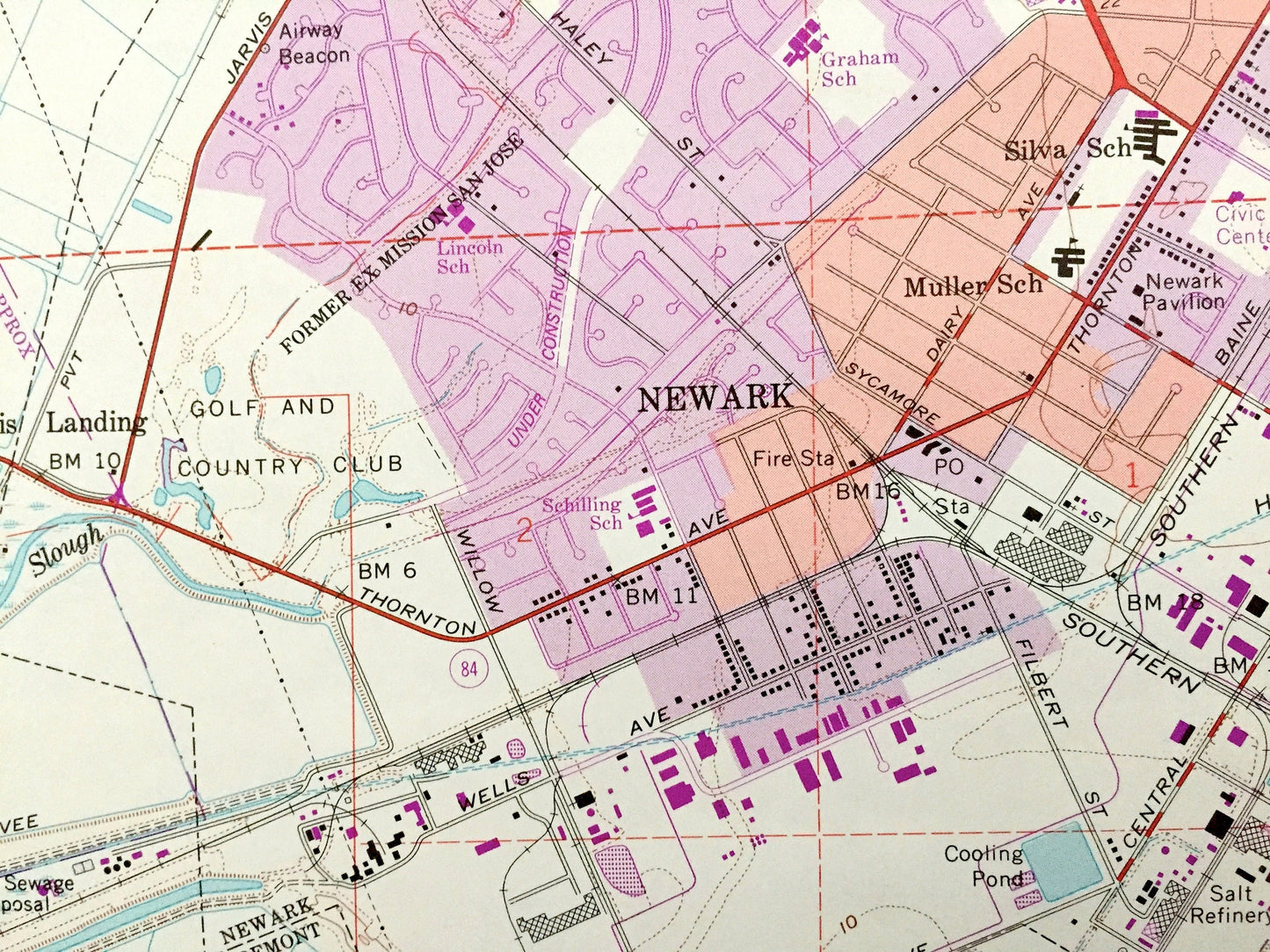
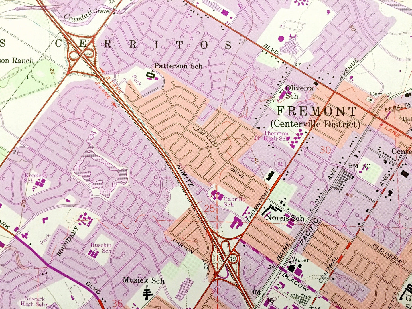
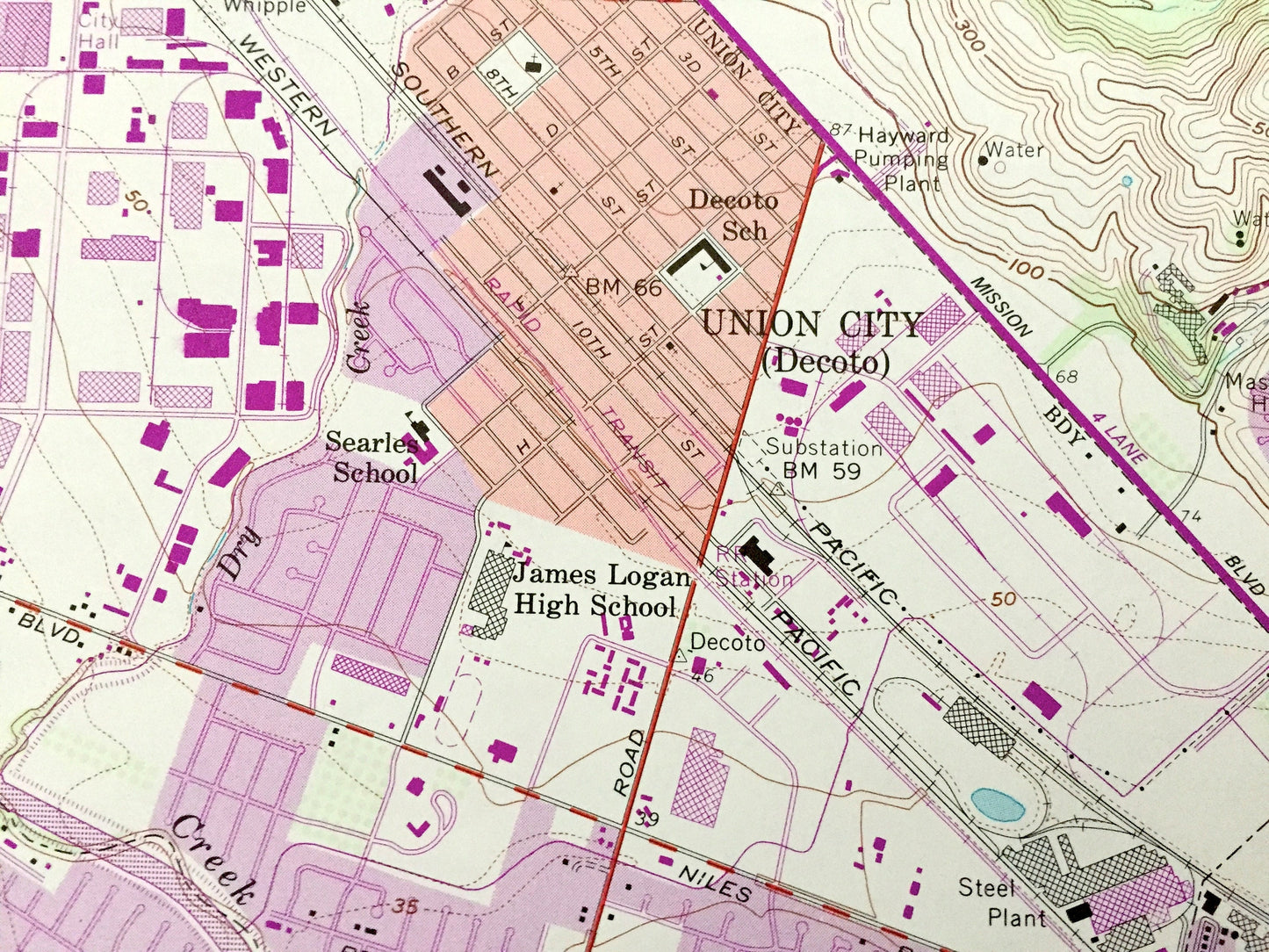
See what California looked like over 60 years ago. Lots of intricate details and geological contours. Map even has little squares for every house that existed at the time. The USGS cartographers were very thorough back then!
Perfect for the historian, map-lover, the curious or just as a conversation starter. Wonderful and rare. Vintage maps such as these make great gifts.
Edition of 1959, printed 1984
Dimensions: 22" width x 27" height
----
Features
Cities & Towns: Newark, Hayward, Fremont, Baumberg, Union City Alvaredo, Union City Decoto, Hall Station, Jarvis Landing.
Points of Interest: Alameda County, San Mateo County, San Francisco Bay, San Francisco Bay Wildlife Refuge, Newark Slough, Alameda Creek, Dumbarton Bridge, Hayward Golf Course, Coyote Hills Regional Park, Turk Island, Hetch Hetchy Aqueduct, and lots more hills, mountains, ravines, creeks, houses, canals, roads and camps.
Condition: Good Vintage condition, commensurate with age. This map is in great shape for being almost 40 years old. Has some edge-wear but this will add to vintage character when framed.
----
We will happily adjust shipping price for multiple purchases. Maps are rolled up and shipped in sturdy mailing tubes, never folded.
Couldn't load pickup availability
Share