My Store
Antique Newfield, New Jersey 1953 US Geological Survey Topographic Map – Franklin, Vineland, Pittsgrove, Brotmanville, Alliance, Malaga NJ
Antique Newfield, New Jersey 1953 US Geological Survey Topographic Map – Franklin, Vineland, Pittsgrove, Brotmanville, Alliance, Malaga NJ
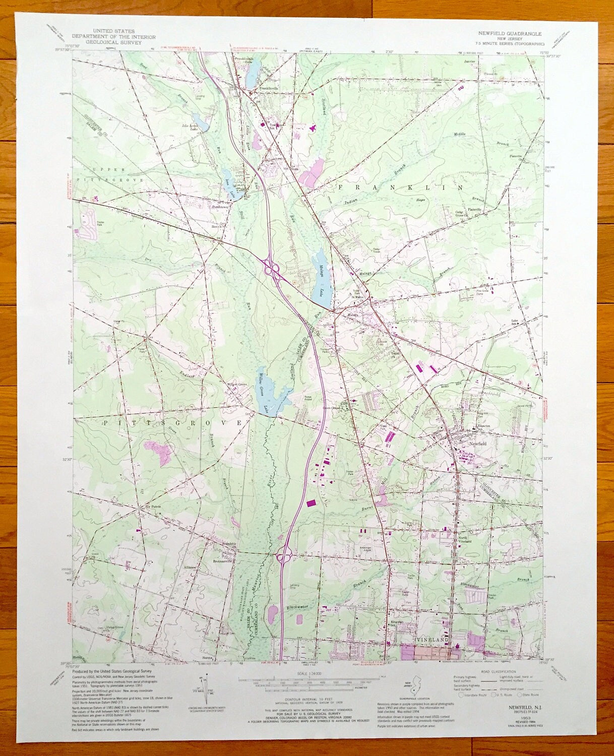
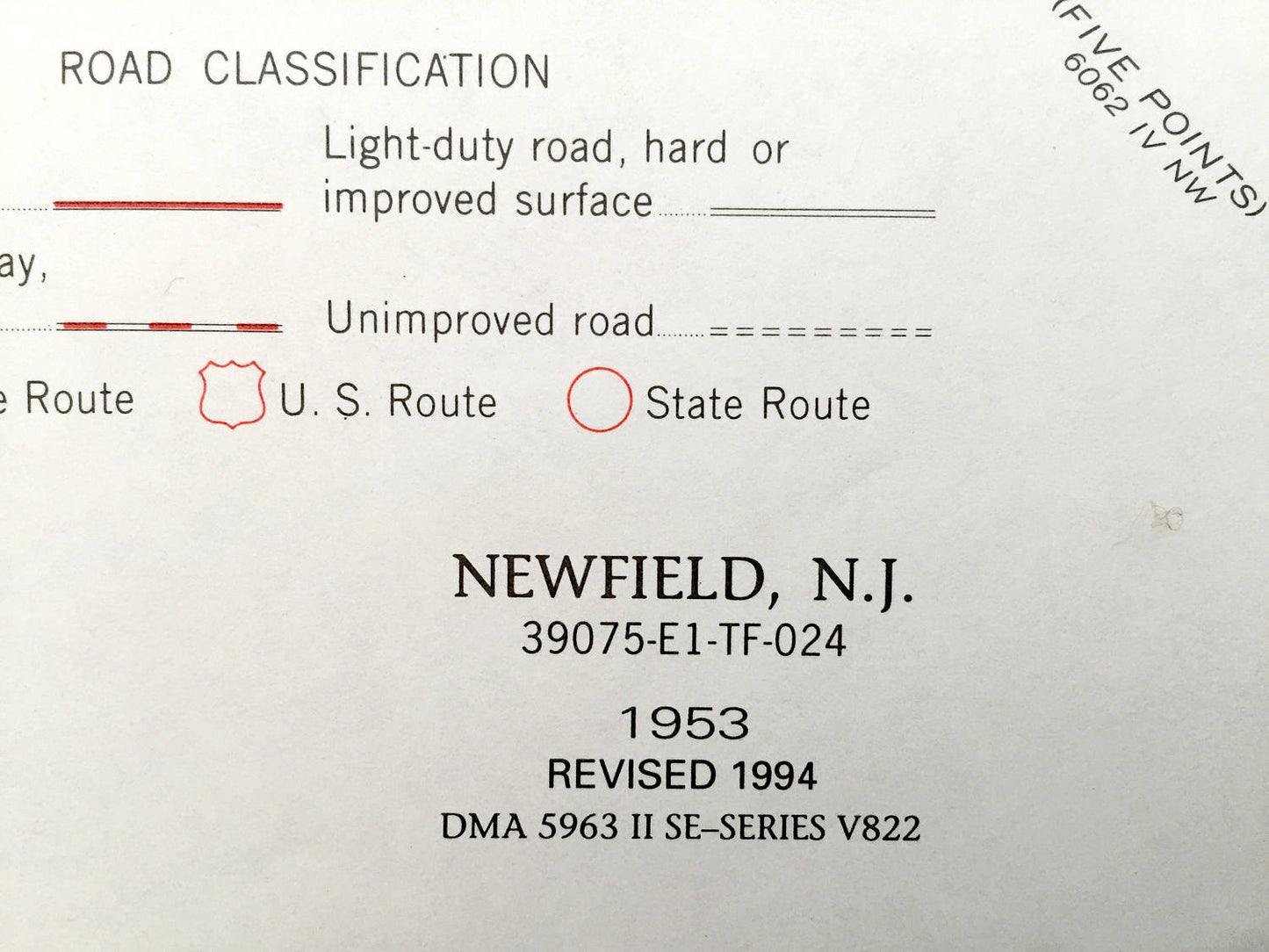
Beautiful, antique map of Newfield, Vineland, Brotmanville, Pittsgrove, Franlin, Plainville and Malaga, New Jersey. This is an authentic 1953 edition, 1994 print from the U.S. Geological Survey and NOT a computer reproduction.
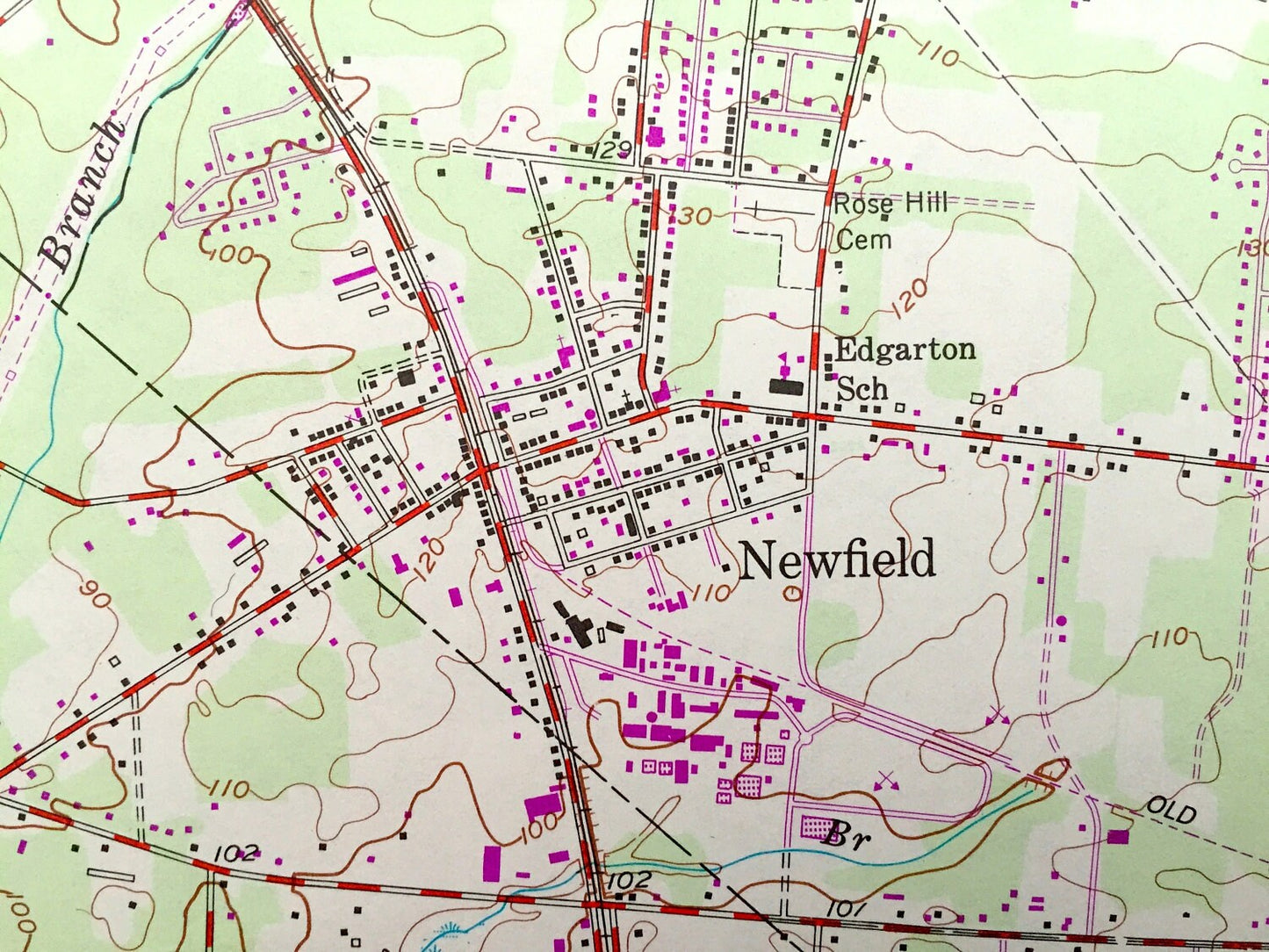
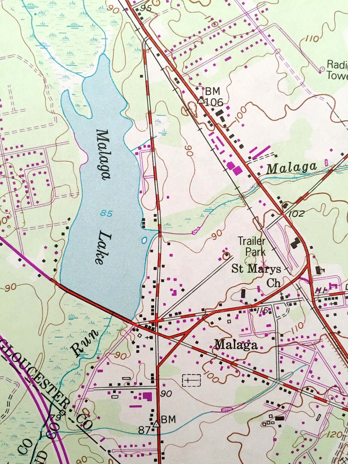
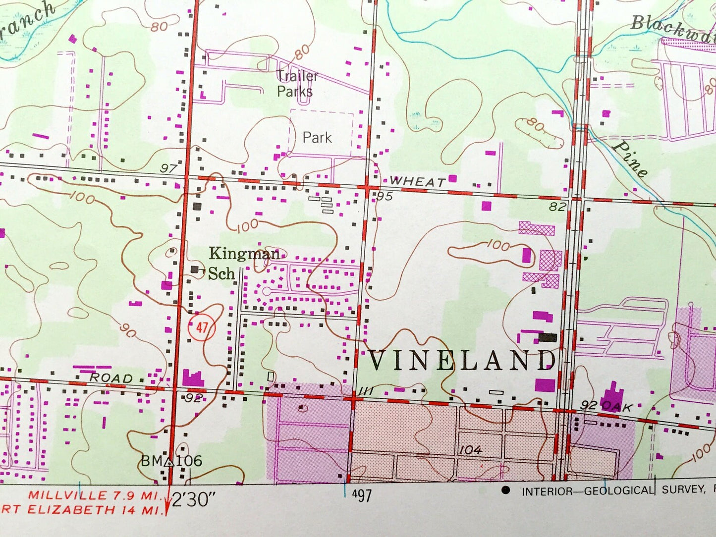
See what Gloucester & Salem Counties of New Jersey looked like almost 65 years years ago. Lots of intricate details and geological contours. Map even has little squares for every house that existed at the time. The USGS cartographers were very thorough back then!
Perfect for the historian, map-lover, the curious or just as a conversation starter. Wonderful and rare. Vintage maps such as these make great gifts.
Edition of 1953, printed 1994
Dimensions: 21 3/4" width x 27" height
----
Features
Cities & Towns: Franklinville, Iona, Upper Pittsgrove, Porchtown, Alliance, Brotmanville, Vineland, Grove Chapel, Malaga, Newfield, Plainville, Janvier.
Points of Interest: Iona Lake, Idle Acres Lake, Franklinville Lake, Plainville Church, Pine Grove Camp, Lake School, St Marys Church, Kingman School, Union Lake State Wilkdlife Management Area, Willow Grove Lake, Rudys Airport, Malaga Camp, and lots more hills, streams, ponds, churches, houses, schools and roads.
Condition: Very Good condition, commensurate with age. This map is in incredible shape for being over 25 years old.
----
We will happily adjust shipping price for multiple purchases. Maps are rolled up and shipped in sturdy mailing tubes, never folded.
Couldn't load pickup availability
Share