My Store
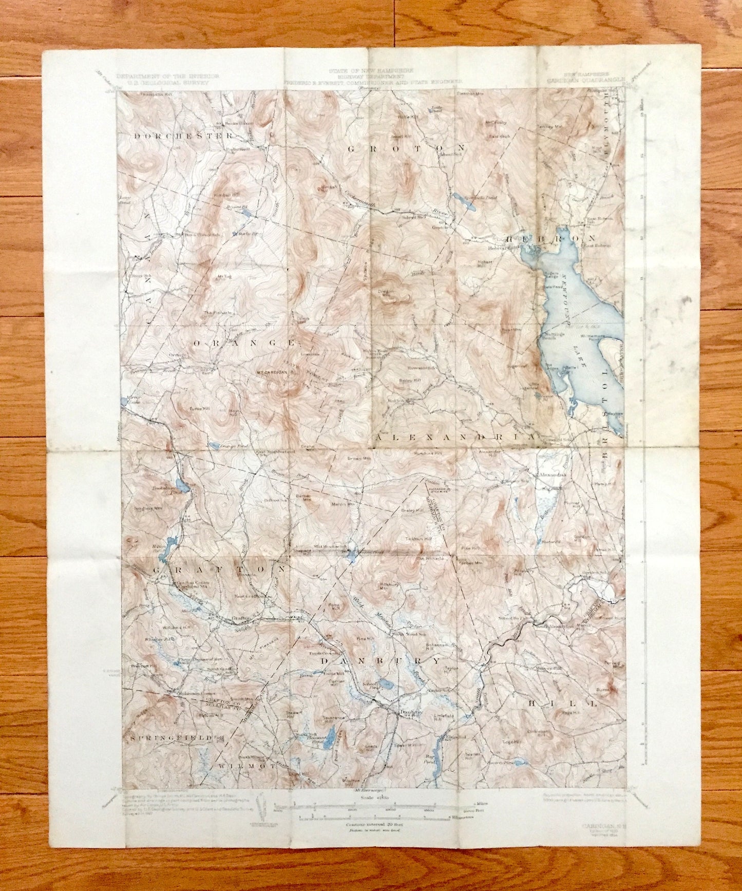
Antique Newfound Lake, New Hampshire 1930 US Geological Survey Topographic Map – Hebron, Bristol, Alexandria, Orange, Danbury Mt Cardigan NH
Antique Newfound Lake, New Hampshire 1930 US Geological Survey Topographic Map – Hebron, Bristol, Alexandria, Orange, Danbury Mt Cardigan NH
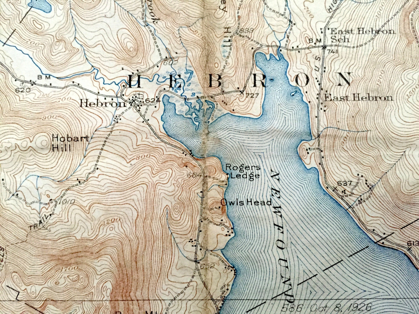
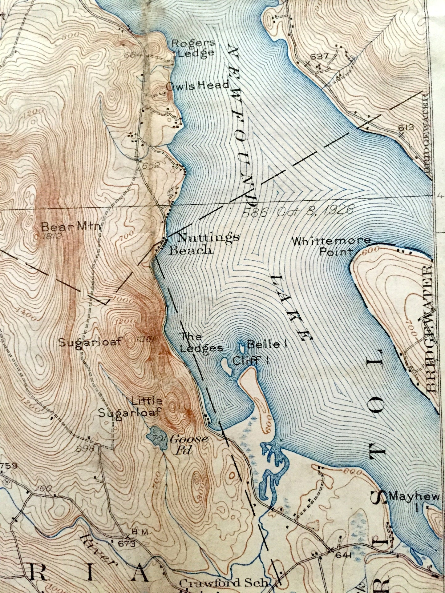
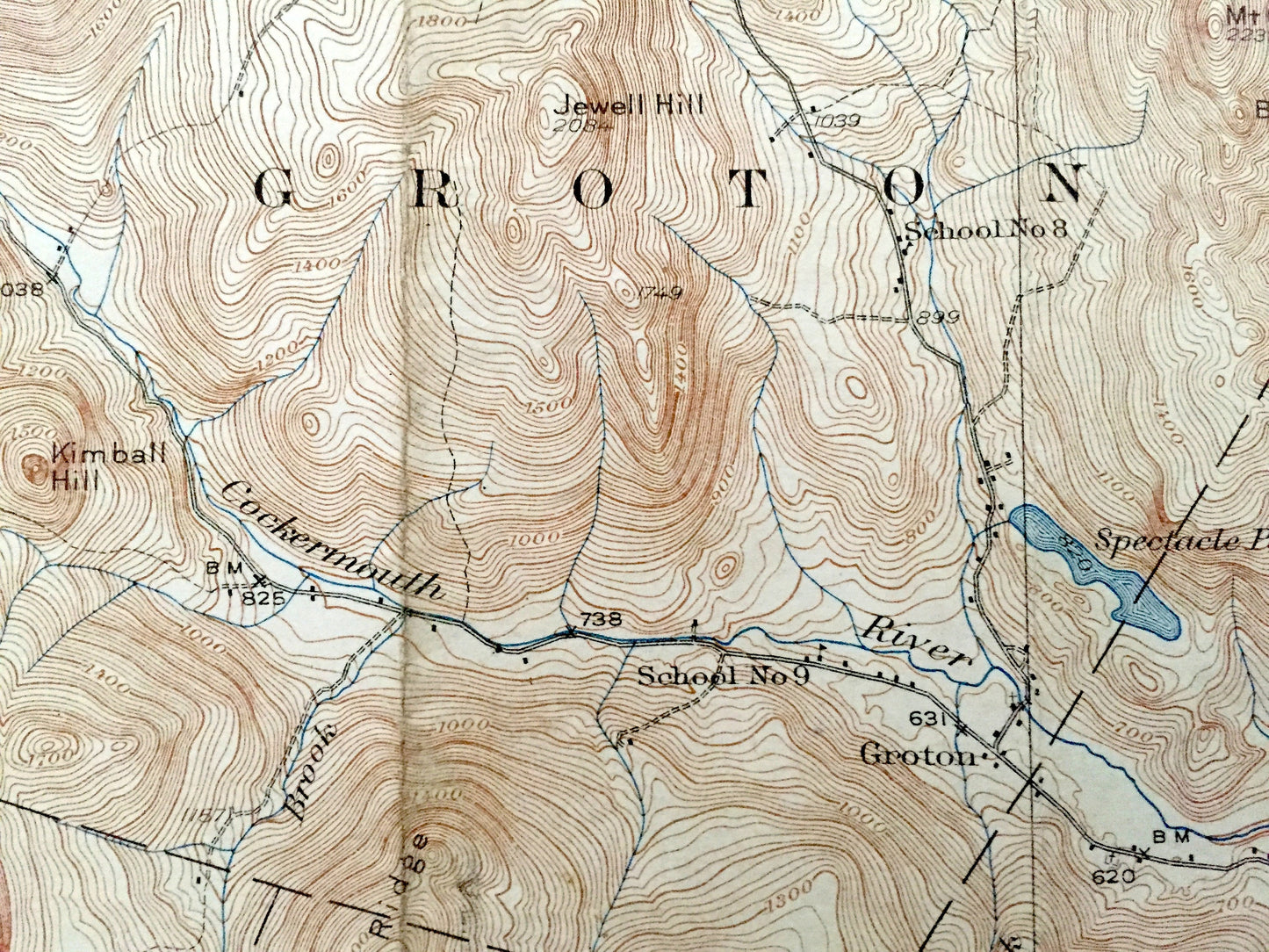
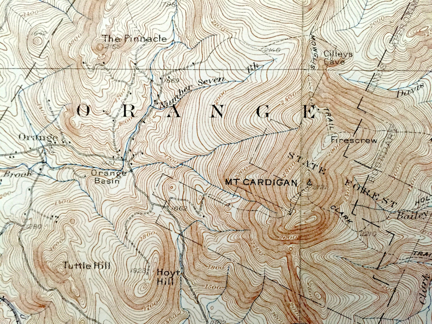
Beautiful, antique map of Mount Cardigan and Hebron, New Hampshire, including Newfound Lake. This is an authentic 1930 edition, 1934 print from the U.S. Geological Survey and NOT a computer reproduction.
See what Grafton County, Sullivan County & Merrimack County looked like over 90 years ago. Lots of intricate details and geological contours. Map even has little squares for every house that existed at the time. The USGS cartographers were very thorough back then! On the back is a description of topographic symbols and map guide.
Perfect for the historian, map-lover, the curious or just as a conversation starter. Wonderful and rare. Vintage maps such as these make great gifts.
Edition of 1930, printed 1934
Dimensions: 16 1/2" width x 20" height
----
Features
Cities & Towns: Dorchester, Groton, Plymouth, Canaan, Orange, Alexandria, Hebron, Bristol, Bridgewater, Grafton, Danbury, Hill, Sprinfield, Wilmot, Bucks Corner, East Hebron, Nuttings Beach, East Grafton, Grafton Center, Robinson Corner, Fords Crossing, South Alexandria, Murray Hill.
Points of Interest: Newfound Lake, Spectacle Pond, Tewksbury Pond, Kilton Pond, Grants Pond, Pleasant Pond, Fowler River, Smith River, Cockermouth River, Orange Brook, Mirror Lake, Kimball Hill, Indian River, The Pinnacle, Mount Tug, Oregon Mountain, Rolfe Hill, Mt. Crosby, Bald Knob, Tenney Mountain, Hoyt Hill, Hobart Hill, Rodgers Ledge, Owls Head, Tuttle Hill, Isinglass Mountain, Mount Cardigan, Cilleys Cave, Welton Falls, Bailey Hill, Brown Mountain, Barber Mountain, Braley Hill, Alexandria Mica Mine, Bear Mountain, Sugarloaf, Simmons Ledges, Alexander Hill, Hemp Hill, The Ledges, Whittemore Point, Mayhew Island, Plummer Hill, Pillsbury Ridge, Smith Mountain, Roby Hill, Pillsbury Mountain, Bohannan Hill, Taylor Hill, Currier Hill, Severance Hill, Pond Ledges, Leeds Hill, Spear Hill, Moulton Hill, Forbes Mountain, Rowell Hill, Periwig Hill, Burnt Hill and lots more hills, mountains, streams, ponds, marshes, camps, roads.
Condition: Good or "Very Vintage" condition, commensurate with age. This map is in great shape for being over 85 years old. Has edge-wear, foxing, toning, smudges in margins and folds as-issued, but these will flatten easily and all will add to vintage character when framed.
----
We will happily adjust shipping price for multiple purchases. Maps are rolled up and shipped in sturdy mailing tubes, never folded.
Couldn't load pickup availability
Share