My Store
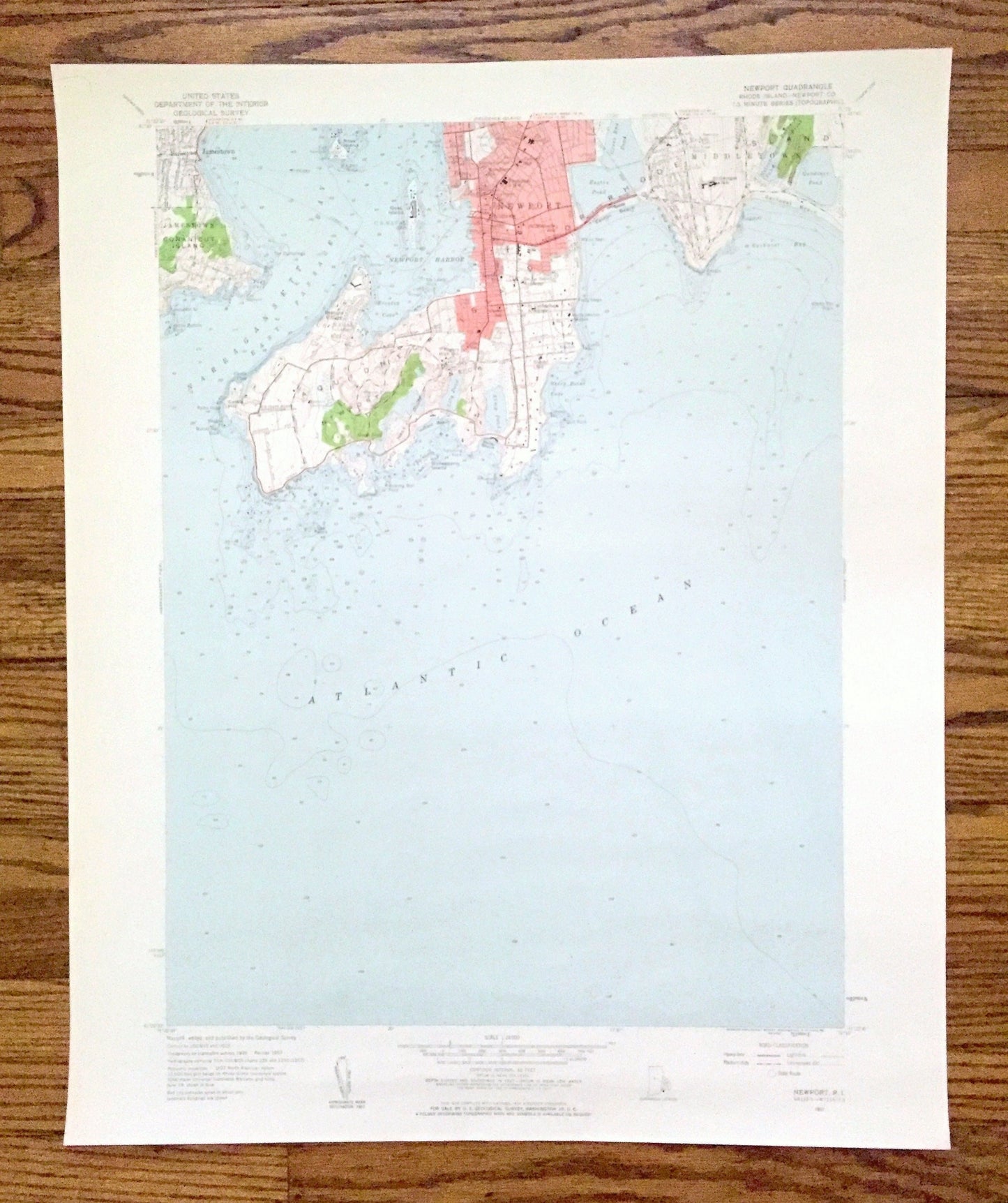
Antique Newport, Rhode Island 1957 US Geological Survey Topographic Map – Narraganset Bay, Jamestown, Middletown, Conanicut Island County RI
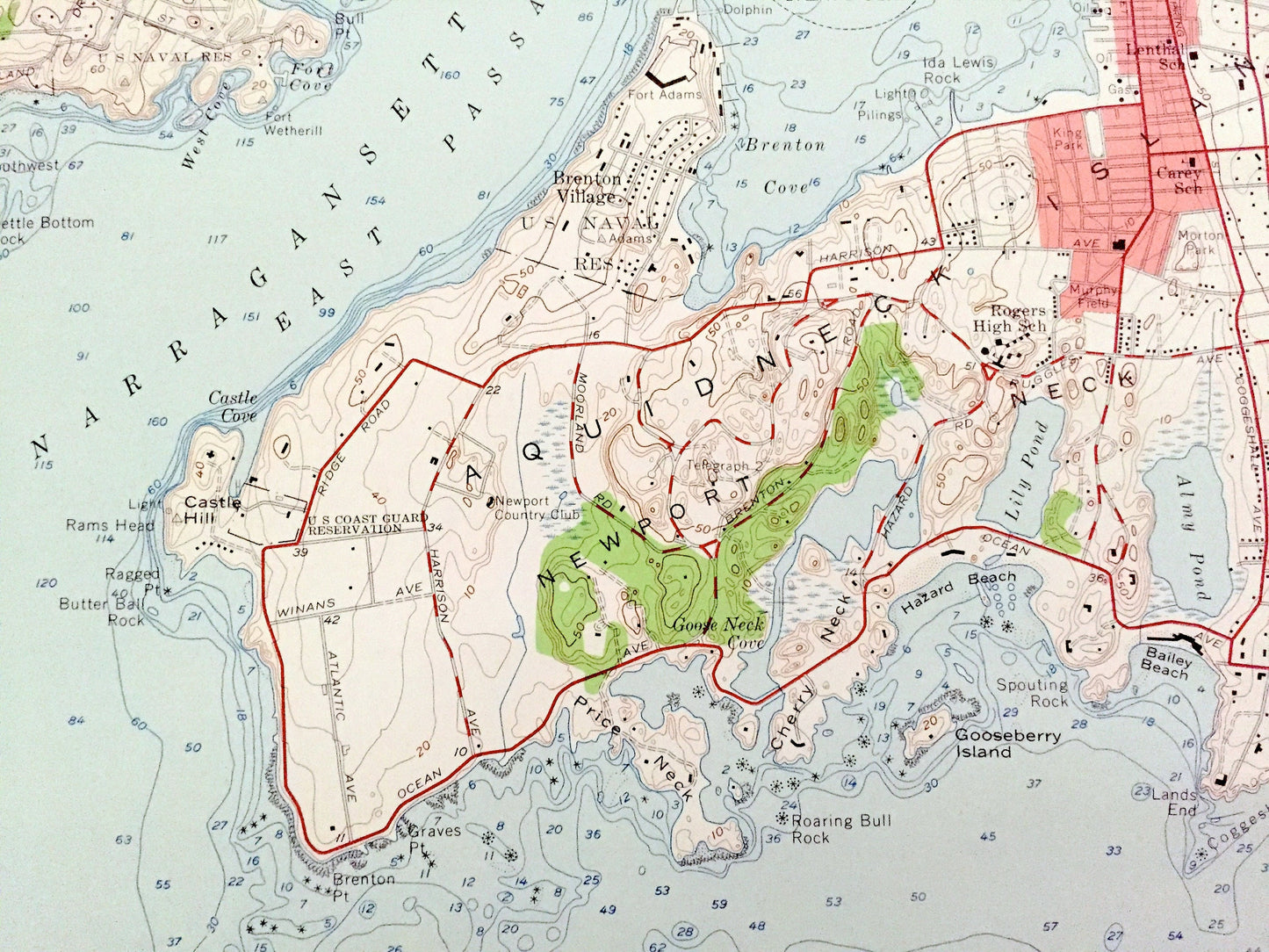
Antique Newport, Rhode Island 1957 US Geological Survey Topographic Map – Narraganset Bay, Jamestown, Middletown, Conanicut Island County RI
Beautiful, antique map of Newport, Rhode Island and surrounding Newport County area on Narragansett Bay. This is an authentic 1957 edition, 1959 print from the U.S. Geological Survey and NOT a computer reproduction.
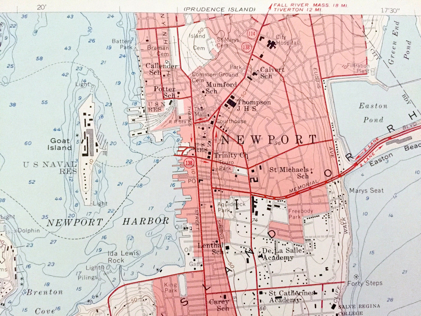
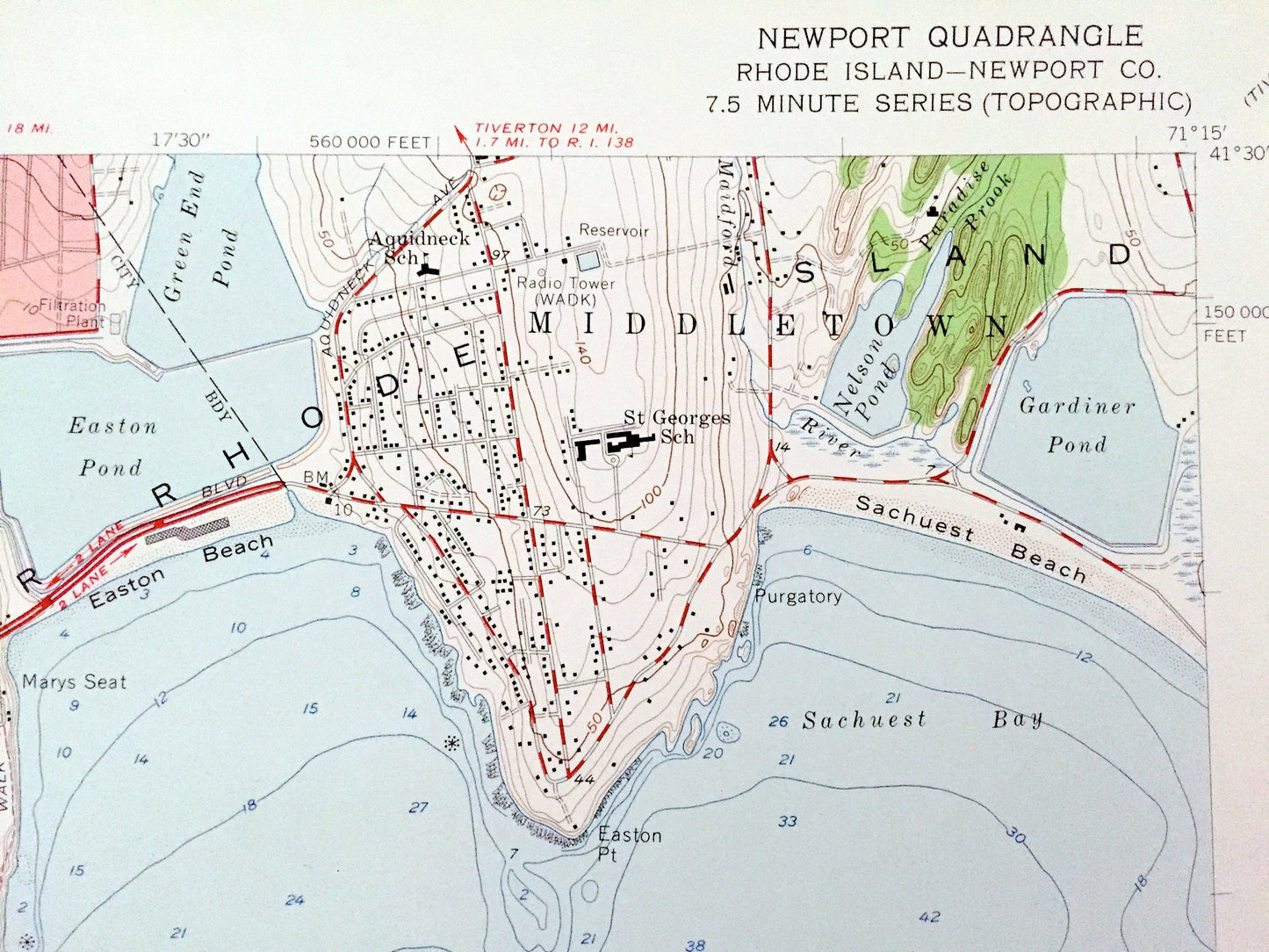
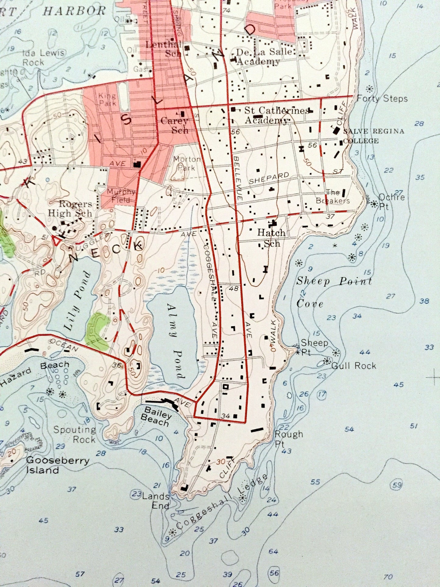
See what Rhode Island looked like over 60 years ago. Lots of intricate details and geological contours. Map even has little squares for every house that existed at the time. The USGS cartographers were very thorough back then!
Perfect for the historian, map-lover, the curious or just as a conversation starter. Wonderful and rare. Vintage maps such as these make great gifts.
Edition of 1957, printed 1959
Dimensions: 22" width x 27" height
----
Features
Cities & Towns: Newport, Jamestown, Middletown, Brenton Village.
Points of Interest: Narragansett Bay, Atlantic Ocean, Newport County, East Passage, Newport Harbor, Rose Island, Conanicut Island, Brenton Cove, Castle Hill, Point of Trees, Price Neck, Gooseberry Island, Lily Pond, Ocean State Drive Park, Almy Pond, Baily Beach, Sheep Point Cove, De La Salle Academy, Salve Regina College, Ochre Point, Goat Island, Easton Pont, Easton Bay, Gardiner Pond, and many more hills, streams, ponds, coves, islands, beaches, houses, schools, churches and roads.
Condition: Good Vintage condition, commensurate with age. This map is in great shape for being over 60 years old. Some edge-wear, but this will add to vintage character when framed.
----
We will happily adjust shipping price for multiple purchases. Maps are rolled up and shipped in sturdy mailing tubes, never folded.
Couldn't load pickup availability
Share