My Store
Antique Niles, Indiana 1981 US Geological Survey Topographic Map – Cass, Berrien County, Howard, Milton, Barron Lake, & Clay, Harris, IN
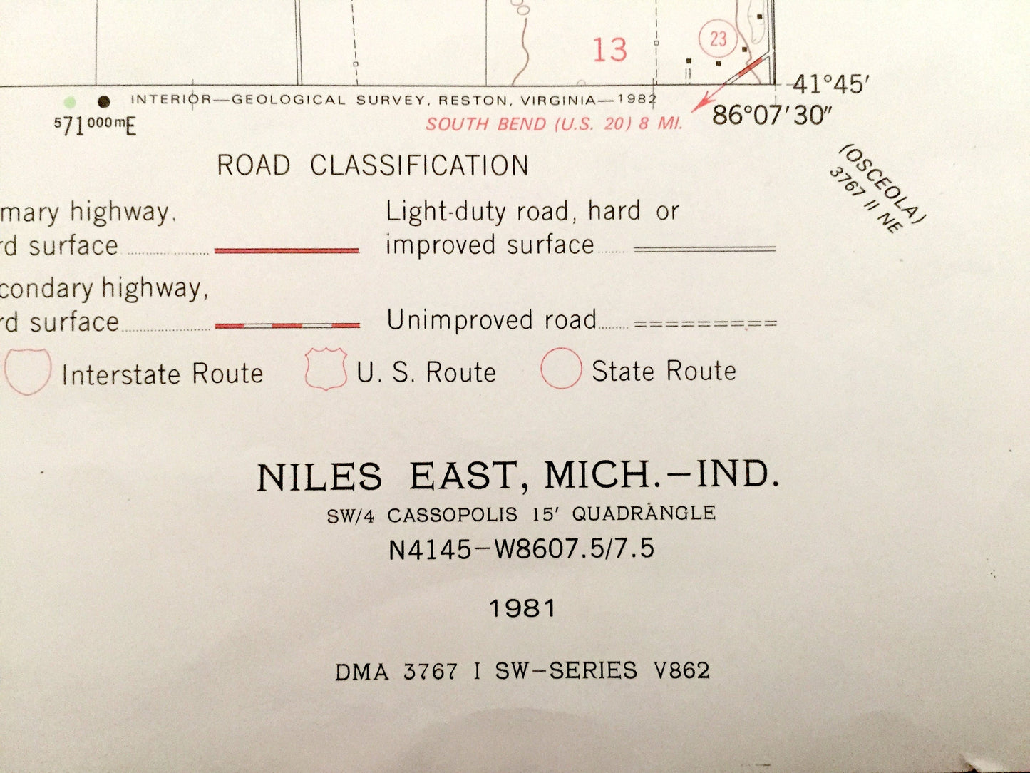
Antique Niles, Indiana 1981 US Geological Survey Topographic Map – Cass, Berrien County, Howard, Milton, Barron Lake, & Clay, Harris, IN
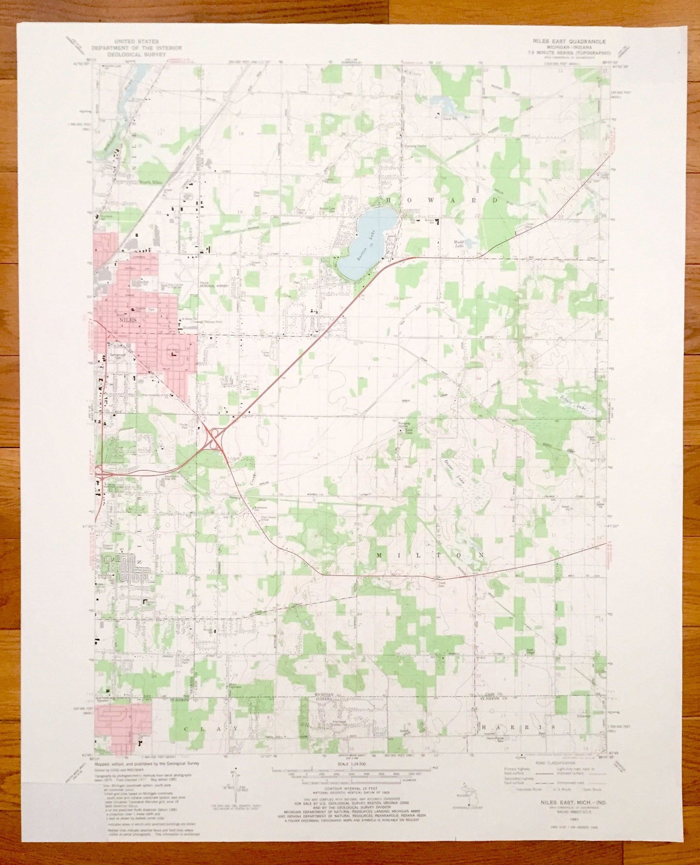
Beautiful, antique map of Niles, Michigan and surrounding Cass and Berrien County area, including north St. Joseph County, Indiana. This is an authentic 1981 print from the U.S. Geological Survey and NOT a computer reproduction.
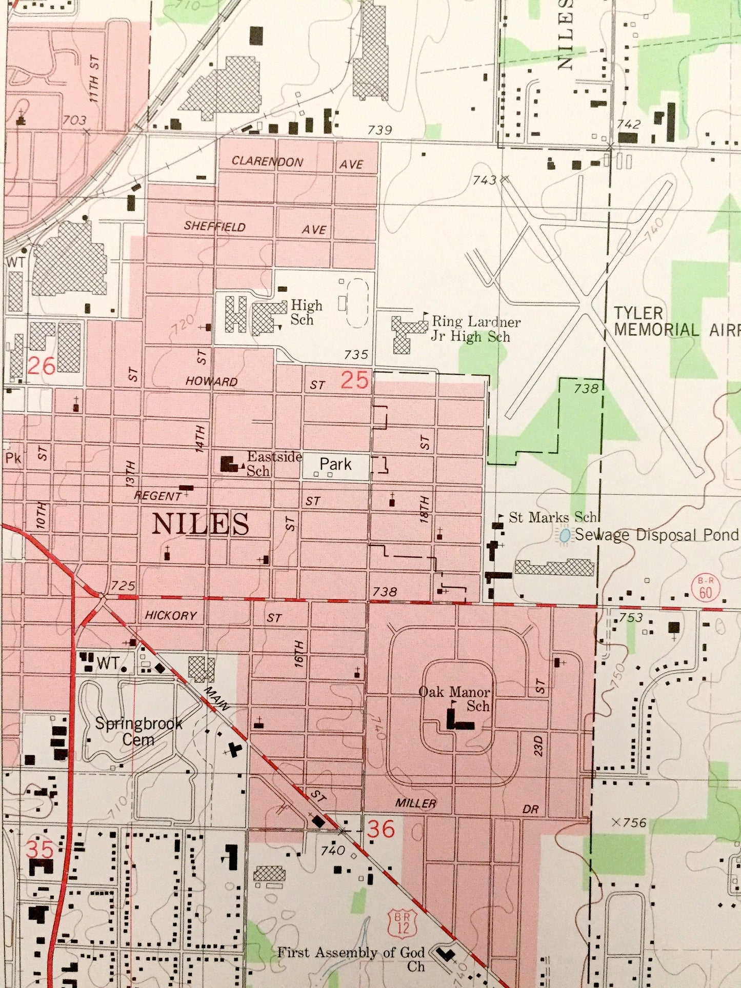
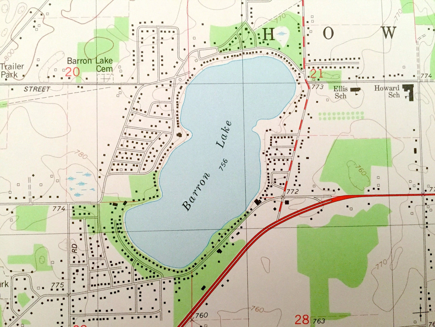
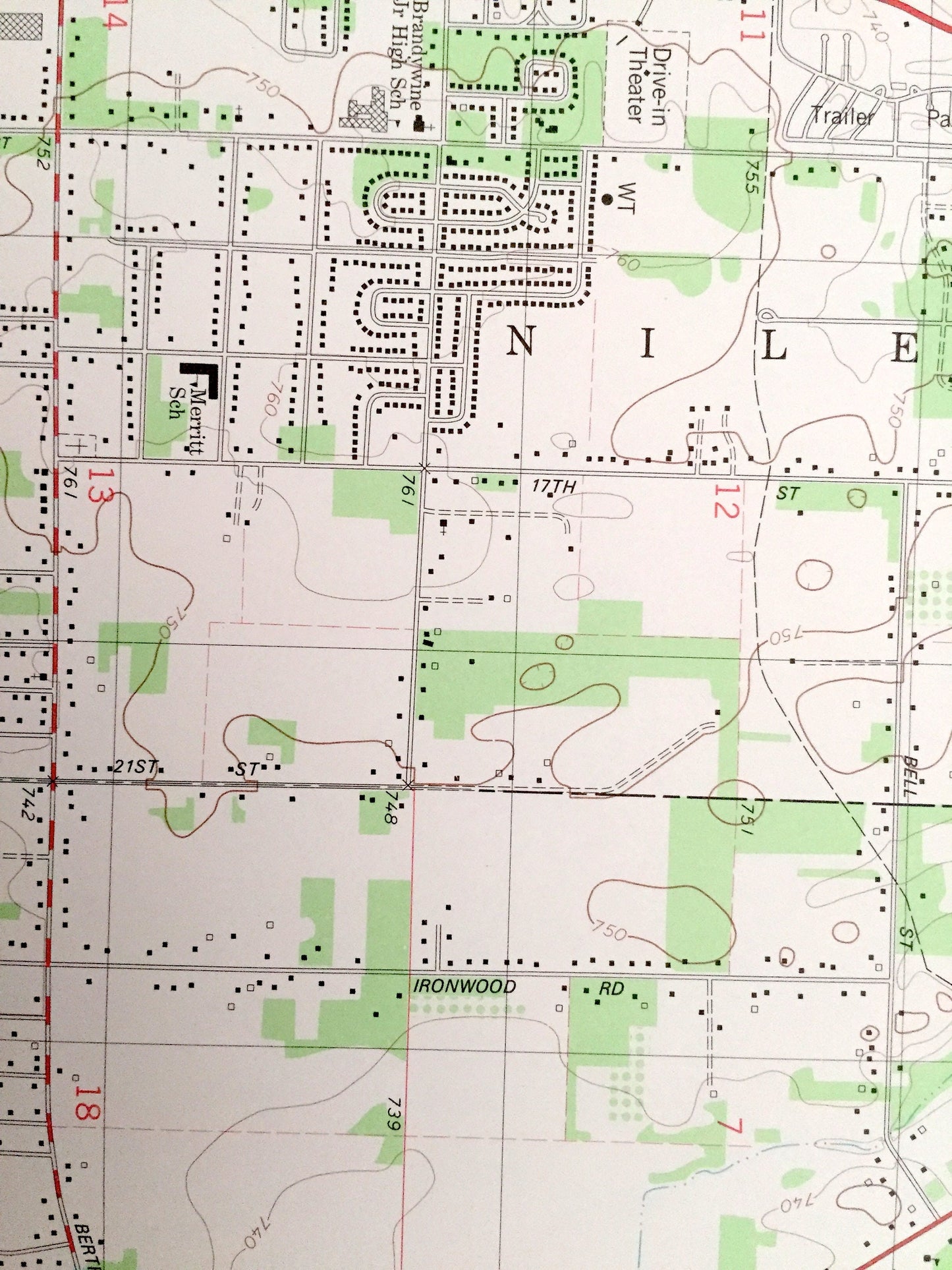
See what Michigan looked like almost 40 years ago. Lots of intricate details and geological contours. Map even has little squares for every house that existed at the time. The USGS cartographers were very thorough back then!
Perfect for the historian, map-lover, the curious or just as a conversation starter. Wonderful and rare. Vintage maps such as these make great gifts.
Edition of 1981, printed 1981
Dimensions: 22" width x 27" height
----
Features
Cities & Towns: MICHIGAN: Niles, Howard, Milton, North Niles.
INDIANA: Clay, Harris.
Points of Interest: Berrien County, Cass County, St. Joseph County, Barron Lake, Dibble Lake, Mudd Lake, Dowagiac River, Goose Lake, Brandywine Creek, Tyler Memorial Airport, Knollwood Country Club, Amtrak Railroad and lots more creeks, hills, houses, schools, churches, train tracks and roads.
Condition: Very Good condition, commensurate with age. This map is in incredible shape for being almost 40 years old. Bottom left corner has been cut, but this is easily concealed by placing same-colored paper behind map when framing—as seen in photo.
----
We will happily adjust shipping price for multiple purchases. Maps are rolled up and shipped in sturdy mailing tubes, never folded.
Couldn't load pickup availability
Share