My Store
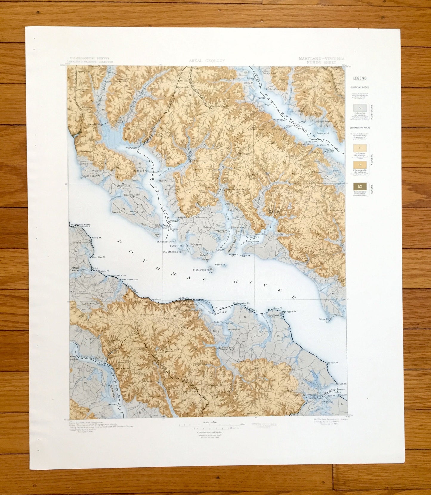
Antique Nomini, Virginia 1895 US Geological Survey Topographic Map – Piney Point, Potomac River, Leonardtown Maryland Westmoreland County VA
Antique Nomini, Virginia 1895 US Geological Survey Topographic Map – Piney Point, Potomac River, Leonardtown Maryland Westmoreland County VA
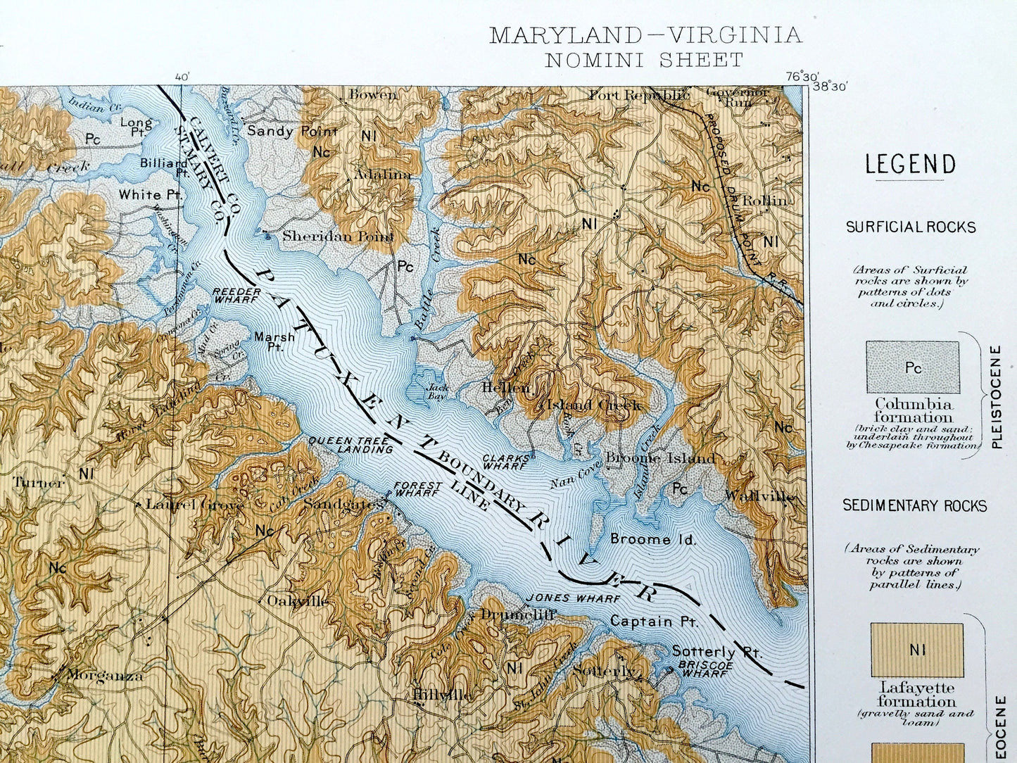
Beautiful, antique Areal Geology map of Nomini, Virginia and Maryland on the Potomac River. This is an authentic 1895 print from the U.S. Geological Survey and NOT a computer reproduction.
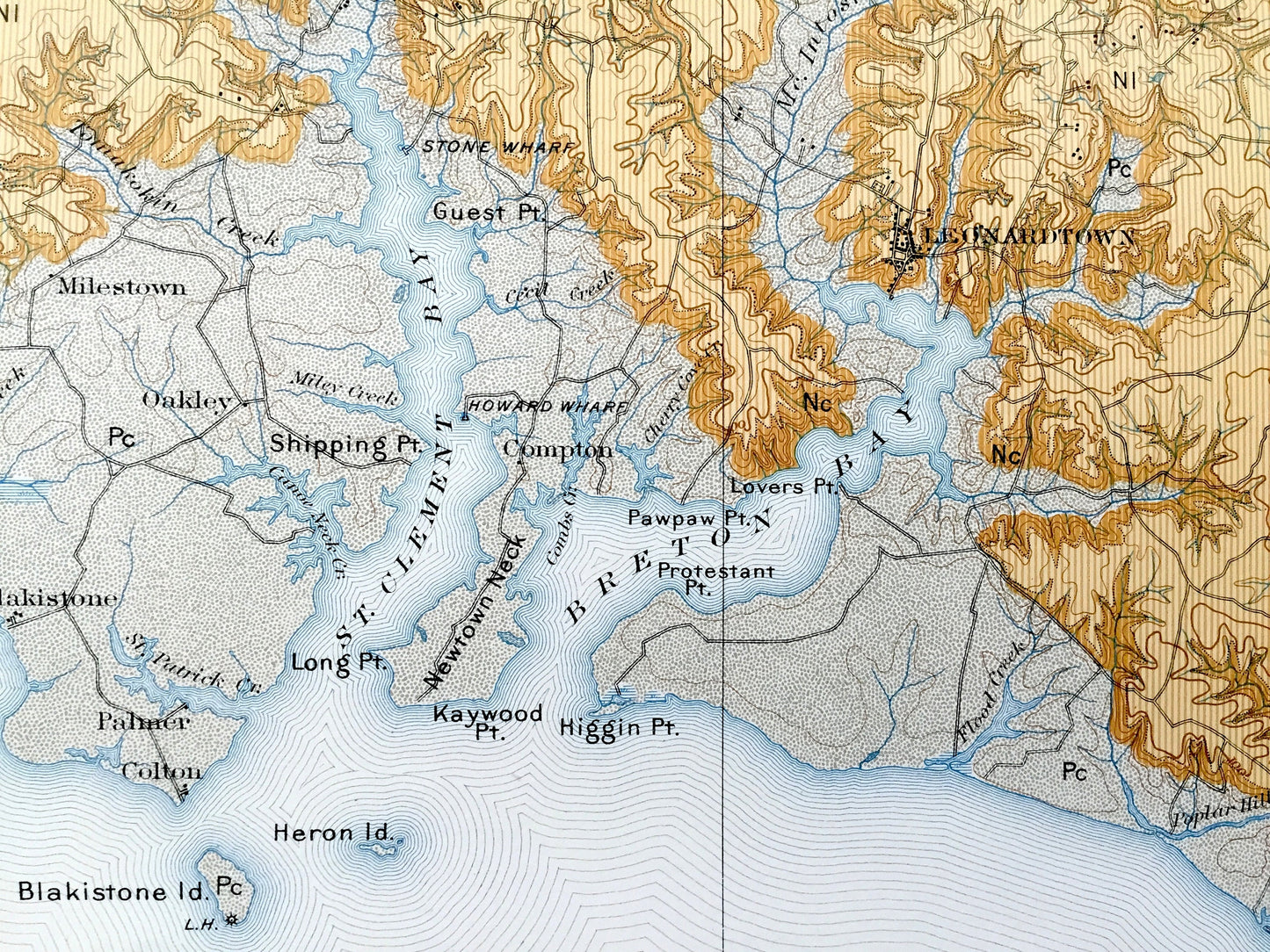
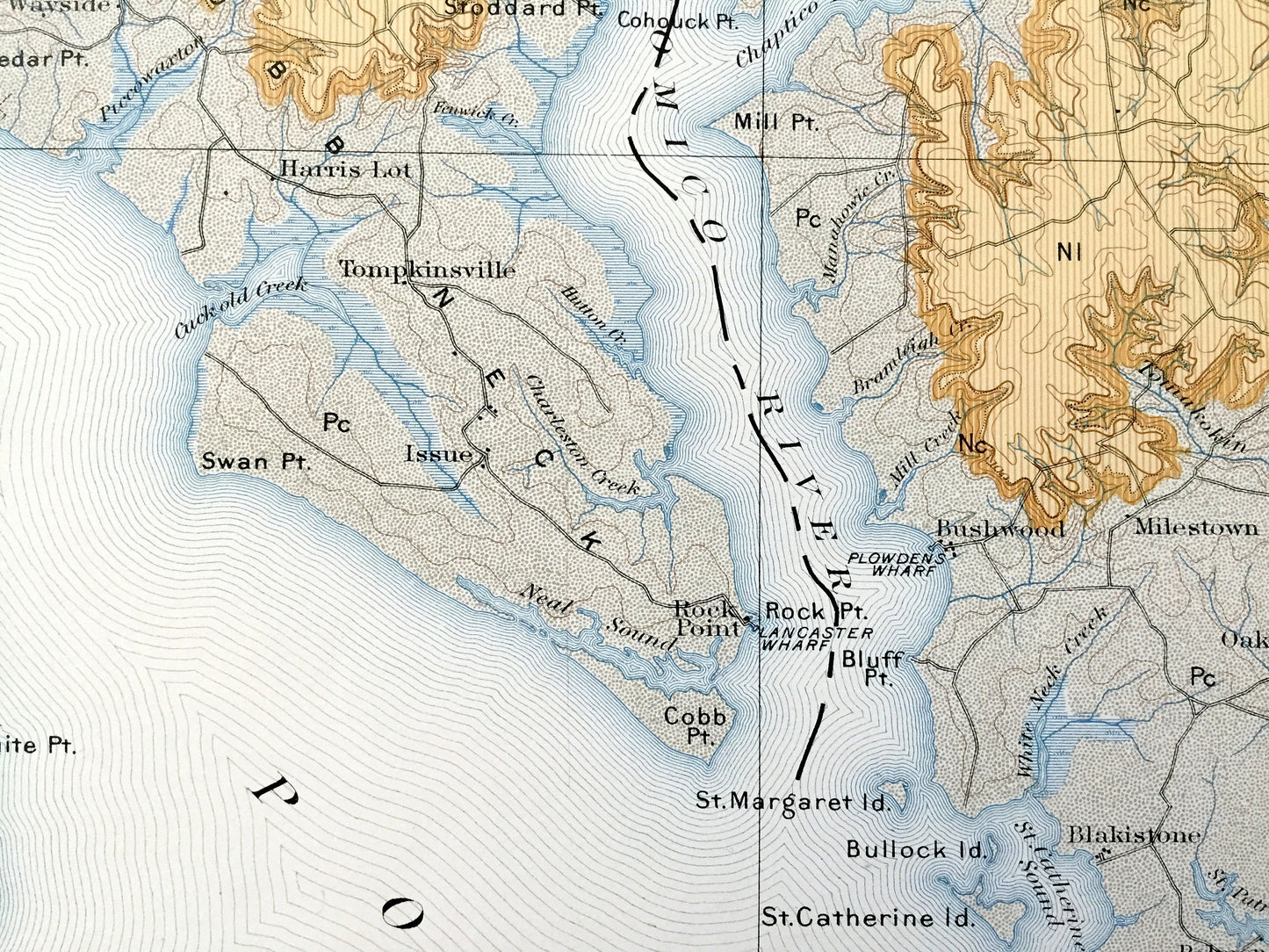
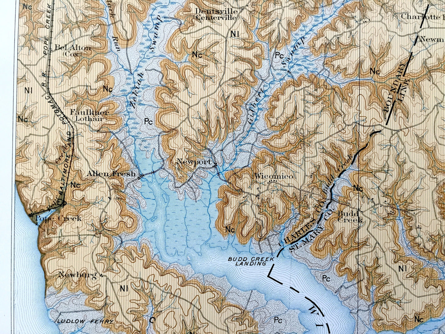
See what the Maryland and Virginia looked like over 125 years ago. Lots of intricate details and geological contours. Map even has little squares for every house that existed at the time. The USGS cartographers were very thorough back then! This is one of the rare maps with the map legend on the front.
Perfect for the historian, map-lover, the curious or just as a conversation starter. Wonderful and rare. Vintage maps such as these make great gifts.
Edition of 1895, printed 1895
Dimensions: 18 1/2" width x 21 3/4" height
----
Features
Cities & Towns: MARYLAND: Pope Creek, Wicomico, Allen Fresh, Newburg, Wayside, Harris Lot, Tompkinsville, Rock Point, Newport, Dentsville, Spring Hill, Faulkner, Chaptico, Charlotte Hall, Newmarket, Mechanicsville, Turner, Morganza, Loveville, Budd Creek, SHeridan Point, Hellen, Island Creek, Broome Island, Wallville, Oakville, Hillville, Drumcliff, Hollywood, Sotterly, Issue, Bushwood, Milestown, Oakley, Palmer, Colton, Blakistone, Compton, Saint Clement Bay, Leonardtown, California, Valley Lee.
VIRGINIA: Colonial Beach, Oak Grove, Potomac Mills, Horner, Foneswood, Stony Hill, Oak Row, Newland, Ramy Fork, Baynesville, Stratford, Chilton, Montross, Templeman, Farmer Fork, Warrensville, Nomini Grove, Mount Holly, Cole Point, Kinsale.
Points of Interest: St Mary County, Charles County, Calvert County, Westmoreland County, Essex County, Northumberland County, Potomac River, Rappahannock River, Patuxent River, Wicomico River, Cobbs Neck, St Clement Bay, Breton Bay, Nomini Bay, Yeocomico River, Ragged Point, Cole Point, Blakistone Island, Newtown Neck, Piney Point, and lots more hills, creeks, towns, schools, churches, roads, islands, points, coves and marshes.
Condition: Very Good Vintage condition, commensurate with age. This map is in incredible shape for being over 125 years old. Has very light edge-wear and staple holes along the left margin, but these are easily-hidden with framing as the right margin is wider than the left. All will add to vintage character when framed.
----
We will happily adjust shipping price for multiple purchases. Maps are rolled up and shipped in sturdy mailing tubes, never folded.
Couldn't load pickup availability
Share