My Store
Antique Norcross, Maine 1951 US Geological Survey Topographic Map – Pemadumcook, Millinocket, Mary-Jo, Ambajejus Lake, Penobscot Piscataquis
Antique Norcross, Maine 1951 US Geological Survey Topographic Map – Pemadumcook, Millinocket, Mary-Jo, Ambajejus Lake, Penobscot Piscataquis
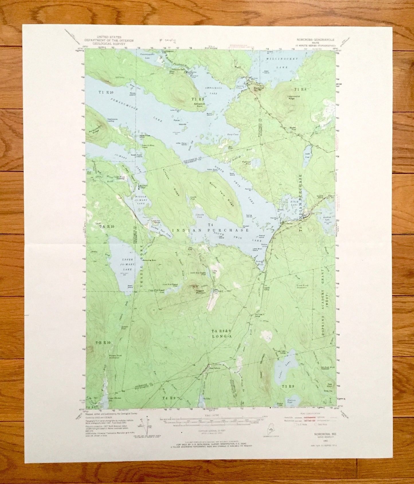
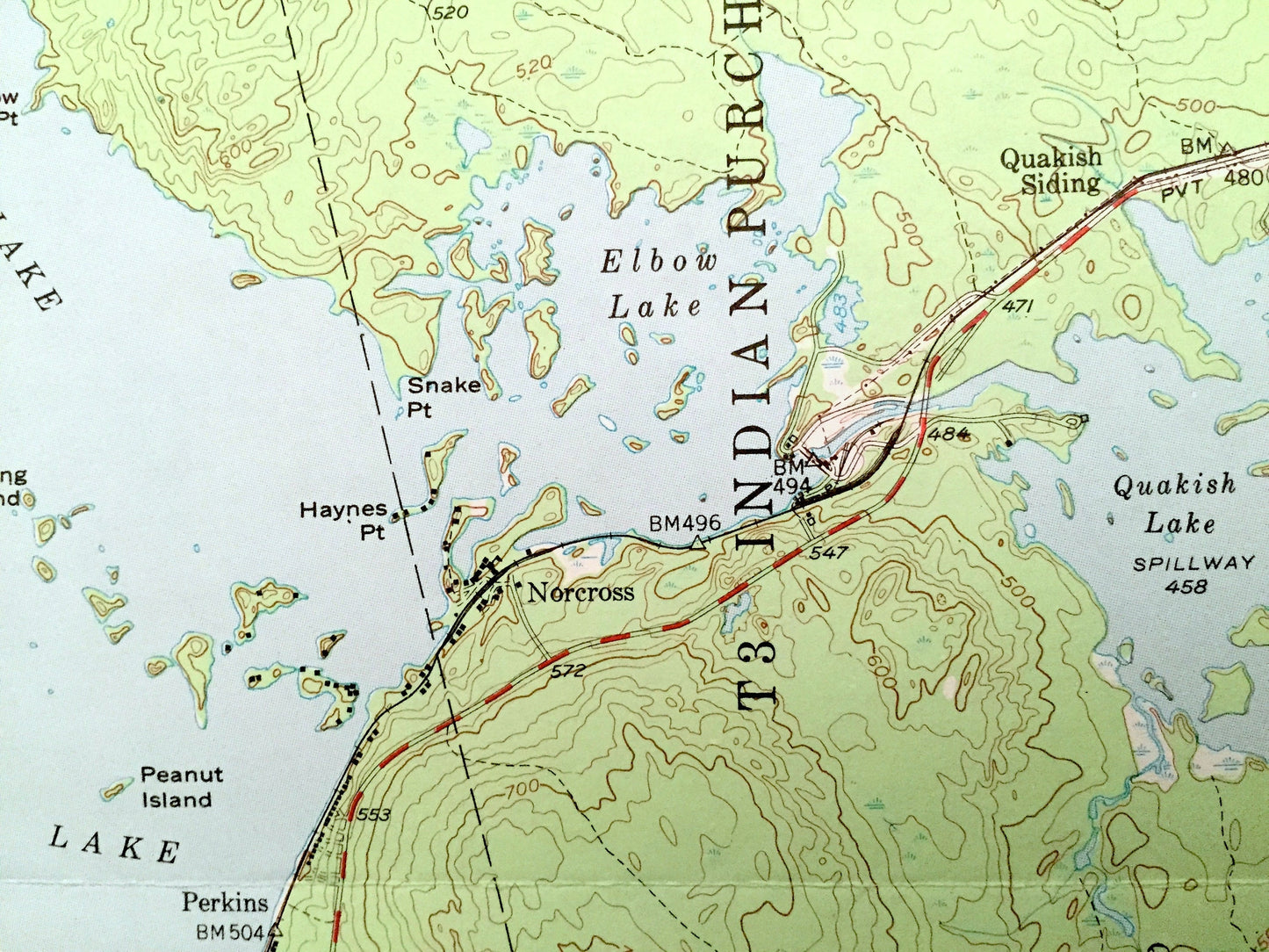
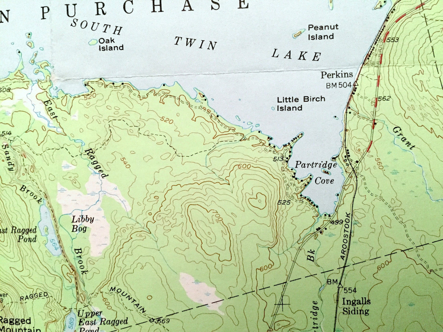
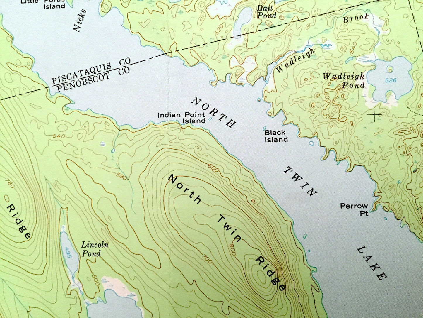
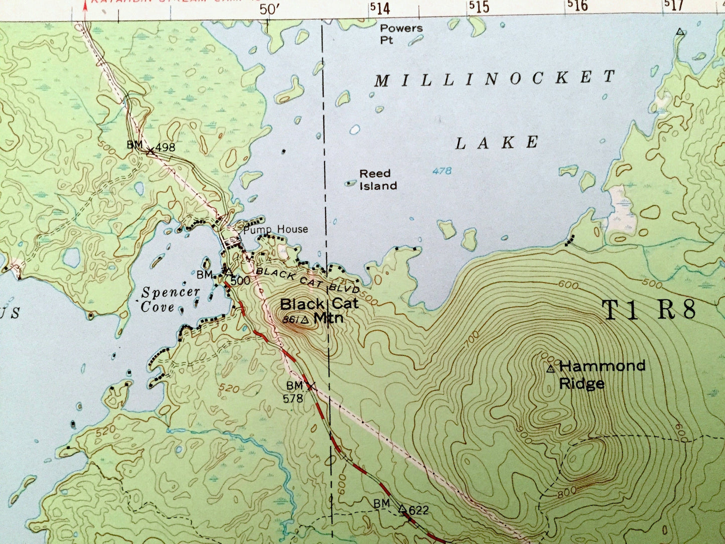
Beautiful, antique map of Norcross, Maine, Pemadumcook Lake and surrounding Piscataquis & Penobscot Counties just south of Mt. Katahdin. This is an authentic 1951 edition, 1967 print from the U.S. Geological Survey and NOT a computer reproduction.
See what Maine looked like over 70 years ago. Lots of intricate details and geological contours. Map even has little squares for every house that existed at the time. The USGS cartographers were very thorough back then!
Perfect for the historian, map-lover, the curious or just as a conversation starter. Wonderful and rare. Vintage maps such as these make great gifts.
Edition of 1951, printed 1967
Dimensions: 18" width x 21" height
----
Features
Cities & Towns: Norcross, West Sebois, Perkins.
Points of Interest: Piscataquis County, Penbobscot County, Pemadumcook Lake, North Twin Lake, Ambajejus Lake, Millinocket Lake, South Twin Lake, Upper Mary-Jo Lake, Turkey Tail Lake, Quakish Lake, Cedar Lake, Black Cat Mountain, Hammond Ridge, Ragged Mountain, Poraywadjo Ridge, Hopkins Academy Grant, Ambajejus Point, Porus Islands, Elbow Lake, Smith Pond, North Twin Ridge, Buckhorn Camps, and lots more hills, streams, ponds, marshes, houses, islands, coves and roads.
Condition: Very Good Vintage condition, commensurate with age. This map is in great shape for being over 55 years old. Has light wear and folds as-issued, but these will flatten easily and all will add to vintage character when framed.
----
We will happily adjust shipping price for multiple purchases. Maps are rolled up and shipped in sturdy mailing tubes, never folded.
Couldn't load pickup availability
Share