My Store
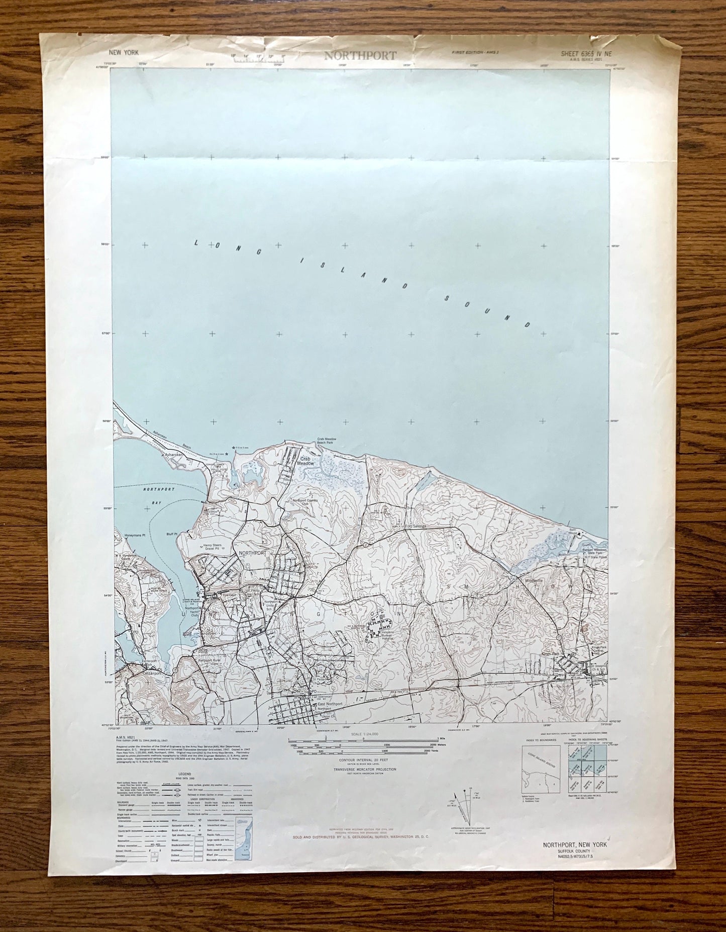
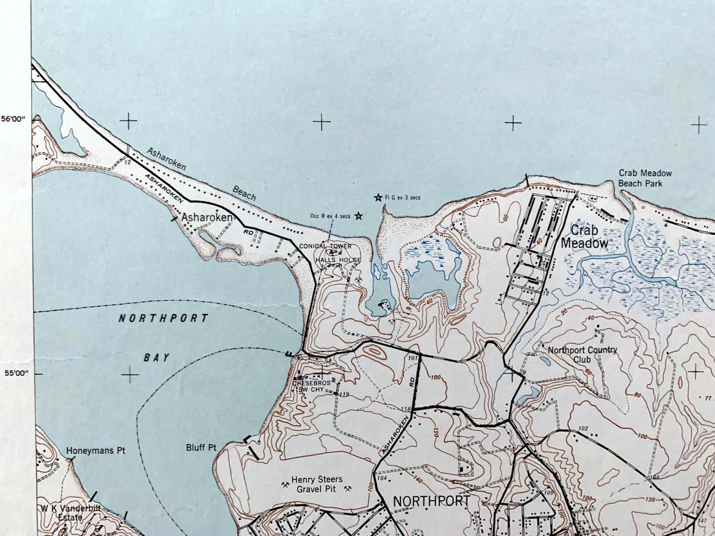
Antique Northport, New York 1947 US Geological Survey Topographic Map – Suffolk County, Long Island, Asharoken Beach, Centerport, Bay NY
Antique Northport, New York 1947 US Geological Survey Topographic Map – Suffolk County, Long Island, Asharoken Beach, Centerport, Bay NY
Beautiful, antique map of Northport, New York and surrounding Suffolk County on Long Island. This is an authentic 1947 print from the Army Map Service Corps of Engineers & US War Department and is NOT a computer reproduction.
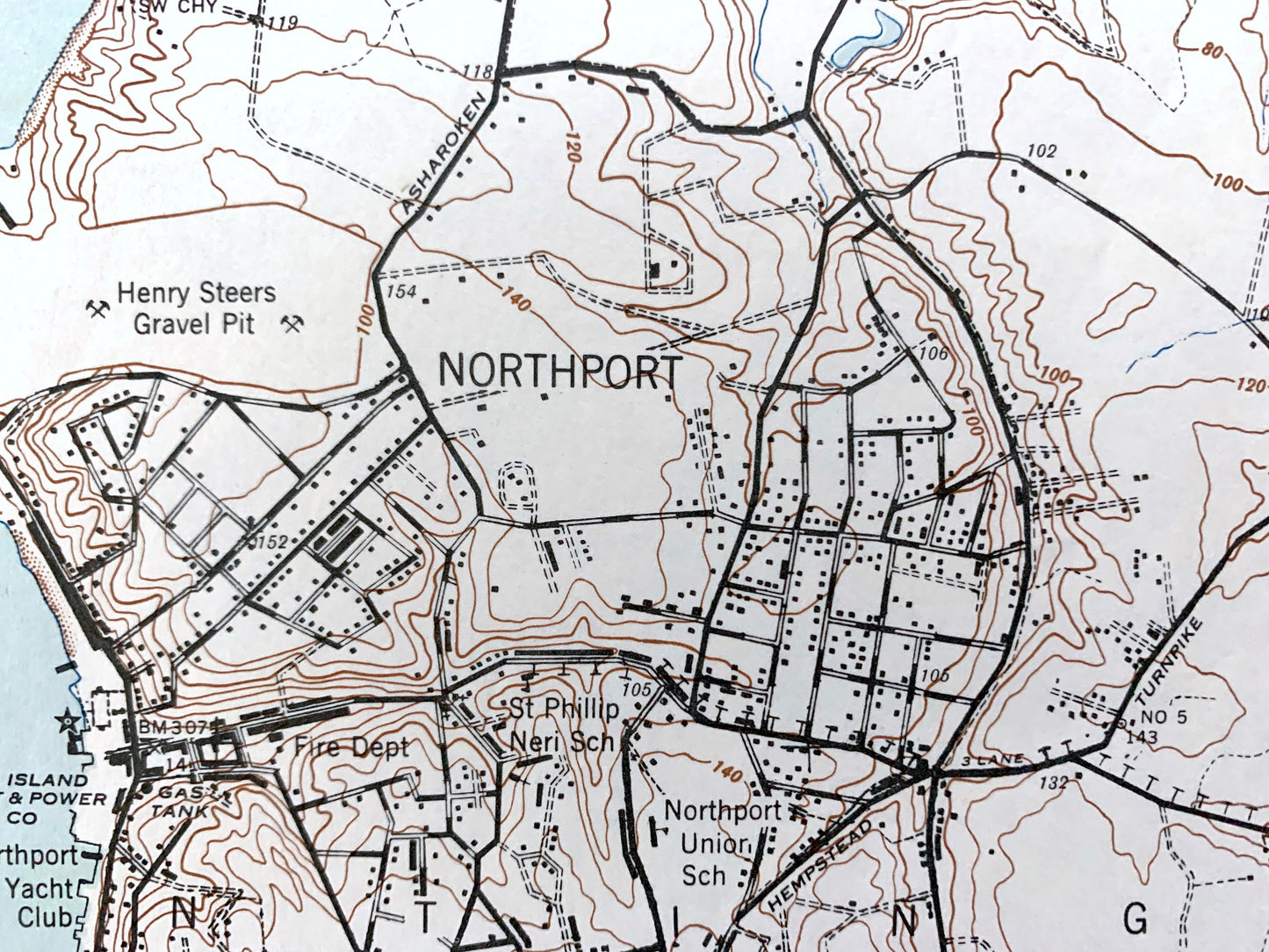
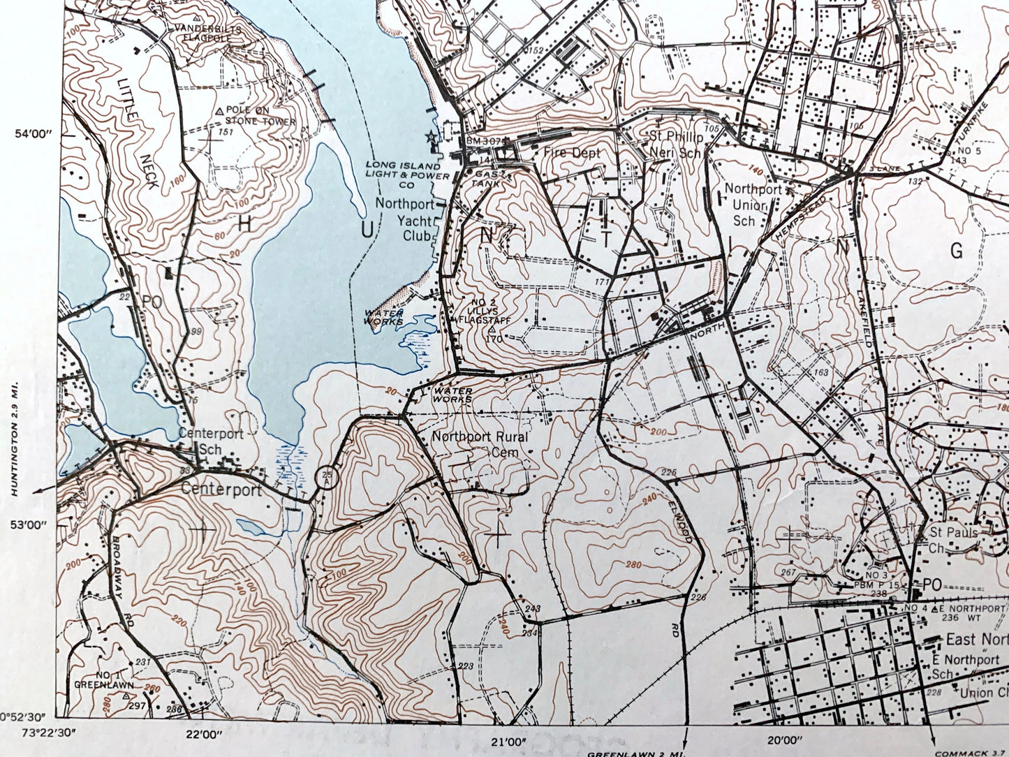
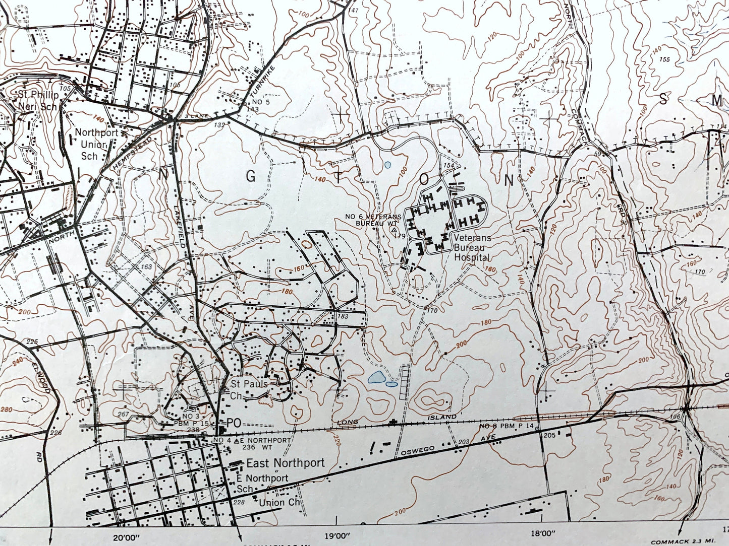
See what Long Island looked like over 75 years ago. Lots of intricate details and geological contours. Map even has little squares for every house that existed at the time. The US Army cartographers were very thorough back then!
Perfect for the historian, map-lover, the curious or just as a conversation starter. Wonderful and rare. Vintage maps such as this make great gifts.
Edition of 1947, printed 1947
Dimensions: 22" width x 29" height
----
Features
Cities & Towns: Northport, Centerport, East Northport, Fort Salonga, Middleville, Kings Park, Crab Meadow, Vernon Valley.
Points of Interest: Long Island, Suffolk County, Long Island Sound, Northport Bay, Northport Harbor, Asharoken Beach, Northport Veterans Hospital, Makamah Beach, Sunken Meadow State Park, Mill Pond, Fresh Pond, Bluff Point, Little Neck, Crab Meadow Beach Park, and many more, brooks, ponds, islands, coves, hills, houses, train tracks and roads.
Condition: Good Vintage condition, commensurate with age. This map is in great shape for being over 75 years old. Has some edge-wear, toning, and fold line, but this will flatten easily and all will add to vintage character when framed.
----
We will happily adjust shipping price for multiple purchases. Maps are rolled up and shipped in sturdy mailing tubes, never folded.
Couldn't load pickup availability
Share