My Store
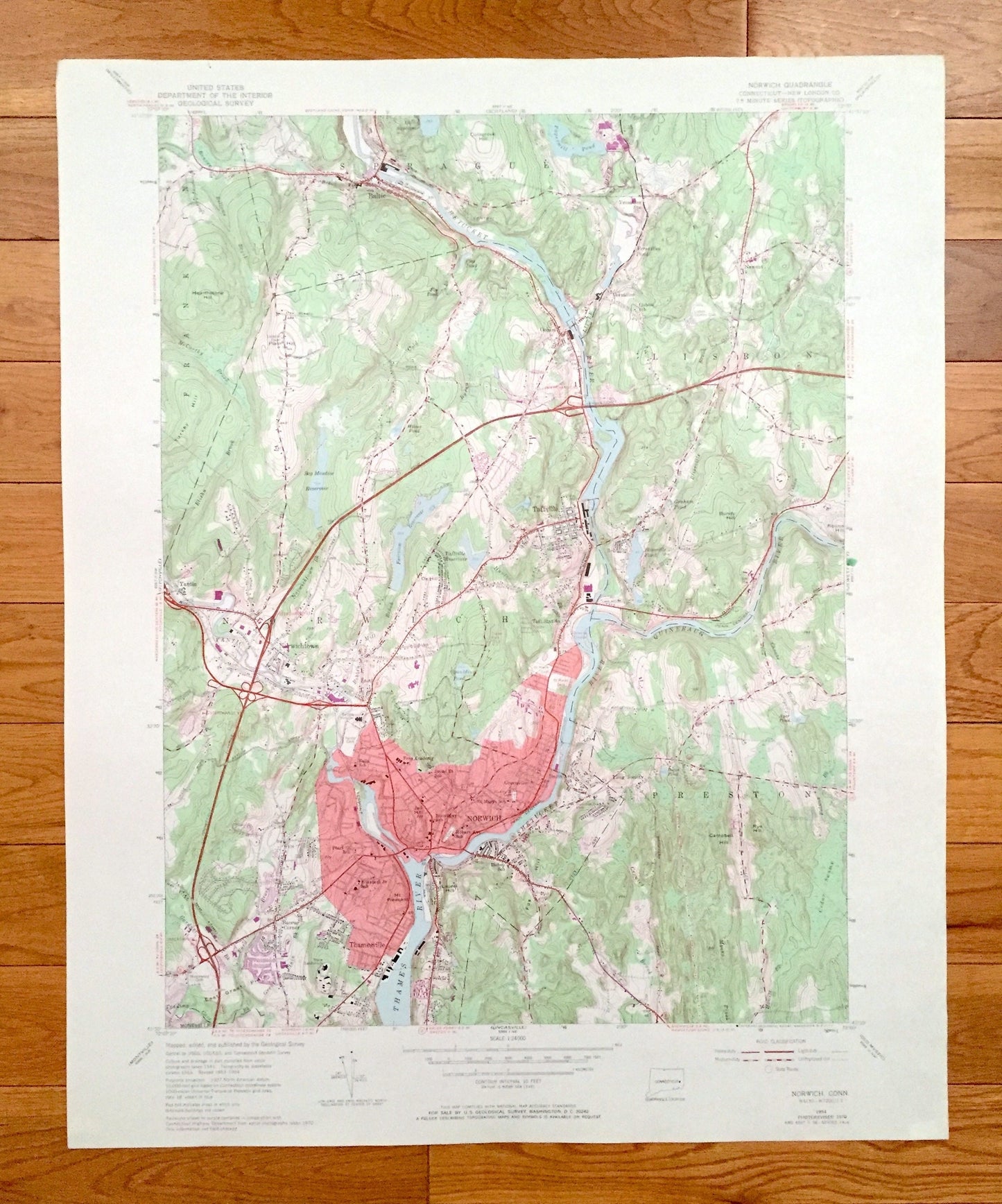
Antique Norwich, Connecticut 1954 US Geological Survey Topographic Map – New London County, Sprague, Lisbon, Franklin, Preston, Baltic, CT
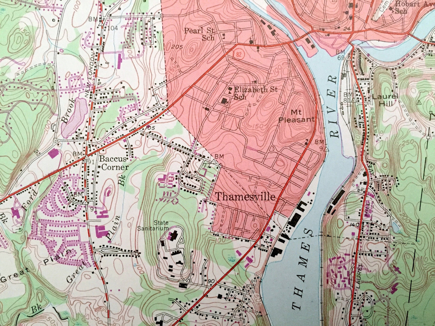
Antique Norwich, Connecticut 1954 US Geological Survey Topographic Map – New London County, Sprague, Lisbon, Franklin, Preston, Baltic, CT
Beautiful, antique map of Norwich, Connecticut and surrounding New London County area. This is an authentic 1954 edition, 1971 print from the U.S. Geological Survey and NOT a computer reproduction.
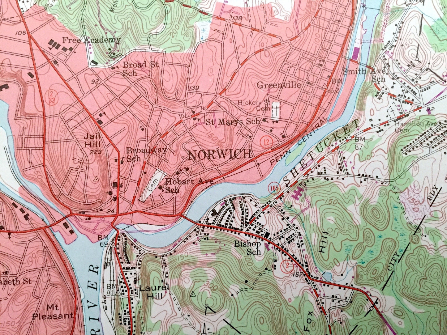
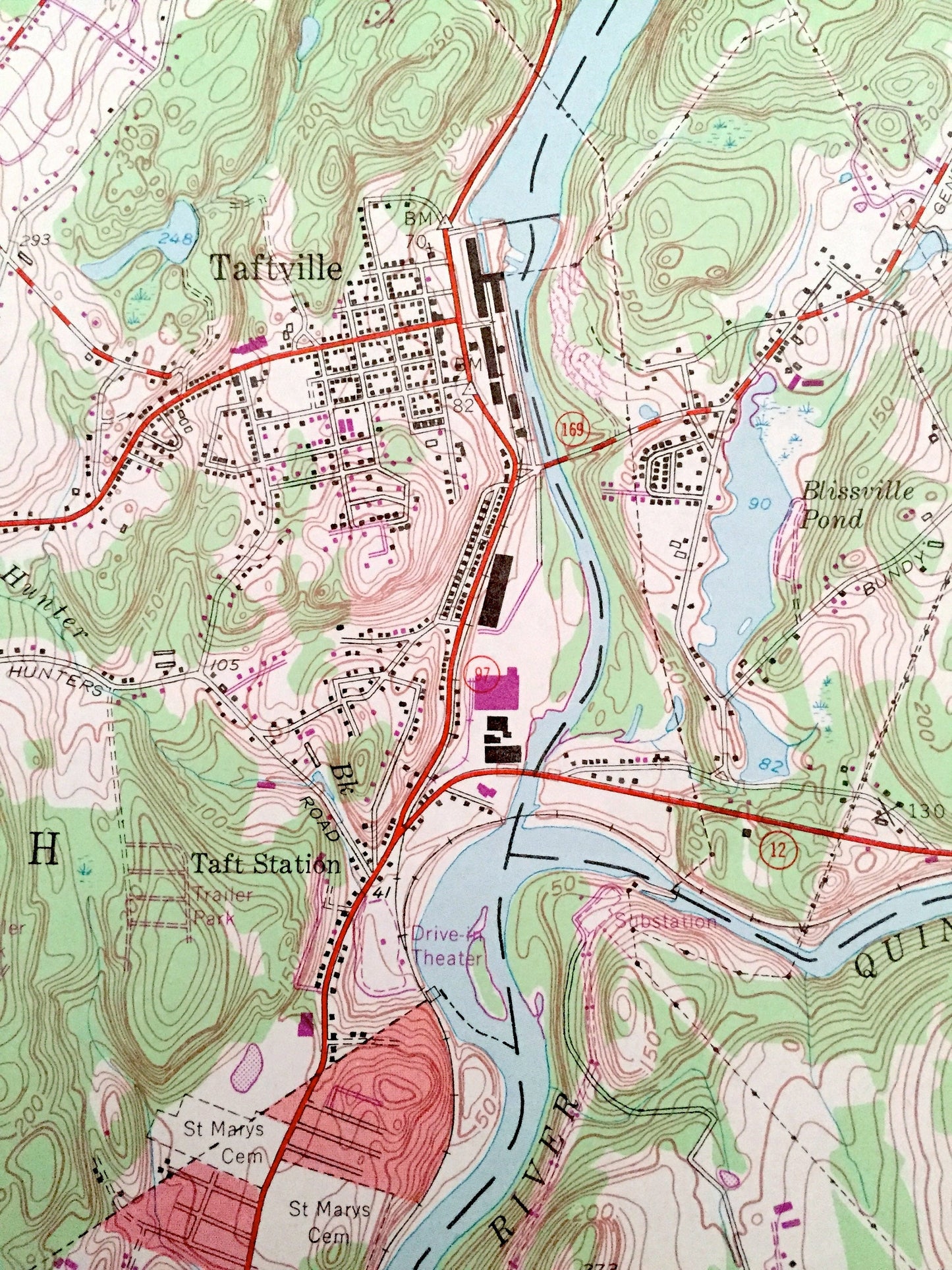
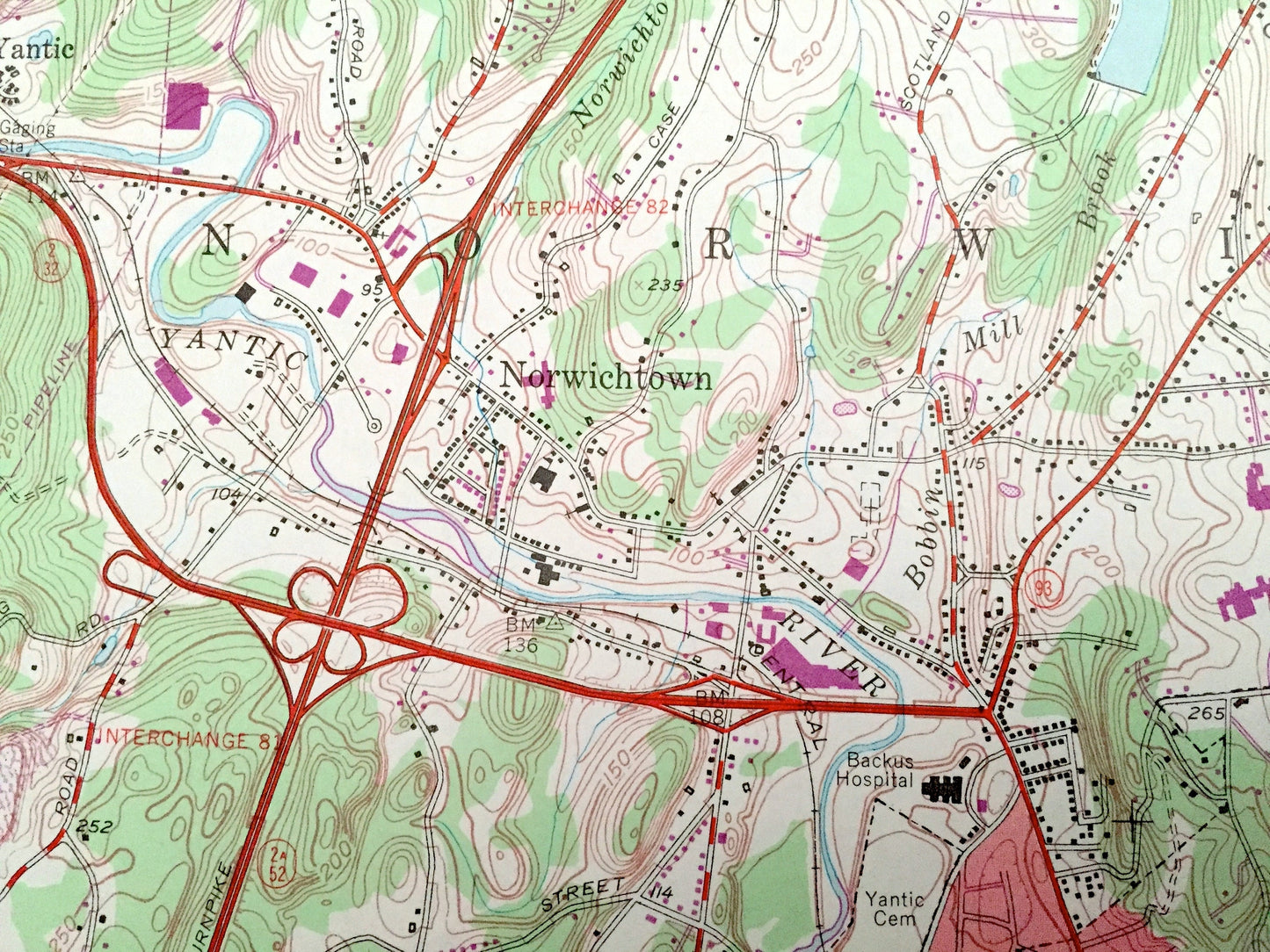
See what Connecticut looked like over 65 years ago. Lots of intricate details and geological contours. Map even has little squares for every house that existed at the time. The USGS cartographers were very thorough back then!
Perfect for the historian, map-lover, the curious or just as a conversation starter. Wonderful and rare. Vintage maps such as these make great gifts.
Edition of 1954, printed 1971
Dimensions: 22" width x 27" height
----
Features
Cities & Towns: Versailles, Newent, Occum, Yantic, Norwichtown, Taftville, Greenville, Long Society, Thamesville, Baccus Corner, Montville.
Points of Interest: Backus Hospital, Colegrove Hill, Hearthstone Hill, Bundy Hill, Campbell Hill, Fox Hill, Papermill Pond, Bog Meadow Reservoir, Taftville Reservoir, Blissville Pond, Shetucket River, Quinebaug River, Thames River, Cedar Swamp, East Great Plain, and many more hills, streams, ponds, houses, schools, railroads, churches and roads.
Condition: Very Good Vintage condition, commensurate with age. This map is in great shape for being over 50 years old. Has subtle edge-wear but will read as character when framed.
----
We will happily adjust shipping price for multiple purchases. Maps are rolled up and shipped in sturdy mailing tubes, never folded.
Couldn't load pickup availability
Share