My Store
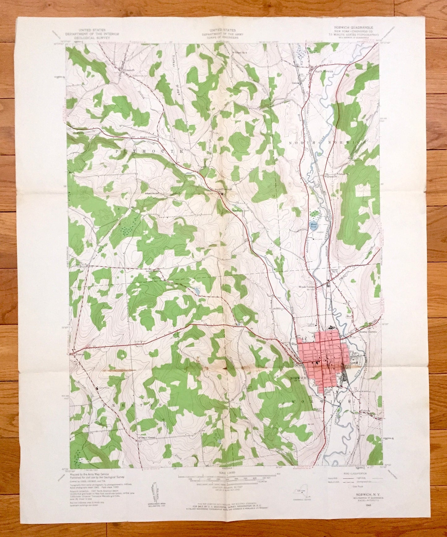
Antique Norwich, New York 1943 US Geological Survey Topographic Map – Chenango Co, Preston, Plymouth, North Norwich, Galena, Plasterville
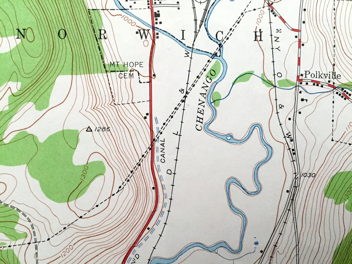
Antique Norwich, New York 1943 US Geological Survey Topographic Map – Chenango Co, Preston, Plymouth, North Norwich, Galena, Plasterville
Beautiful, antique map of Norwich, New York and surrounding Chenango County area. This is an authentic 1943 print from the U.S. Geological Survey and NOT a computer reproduction.
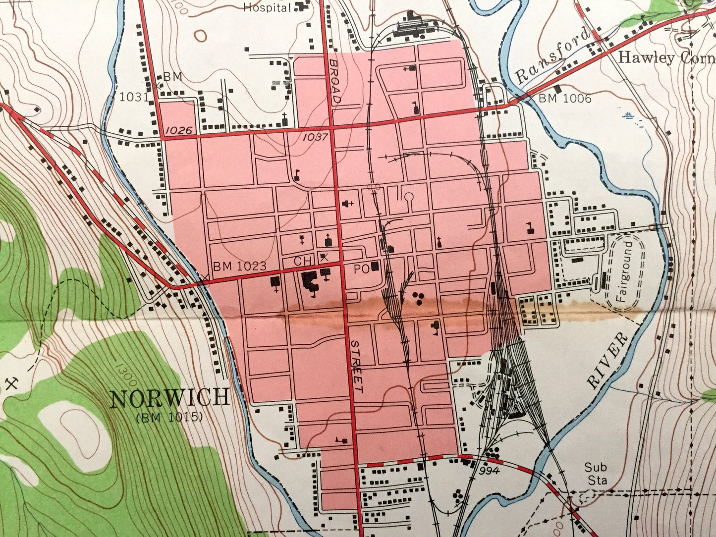
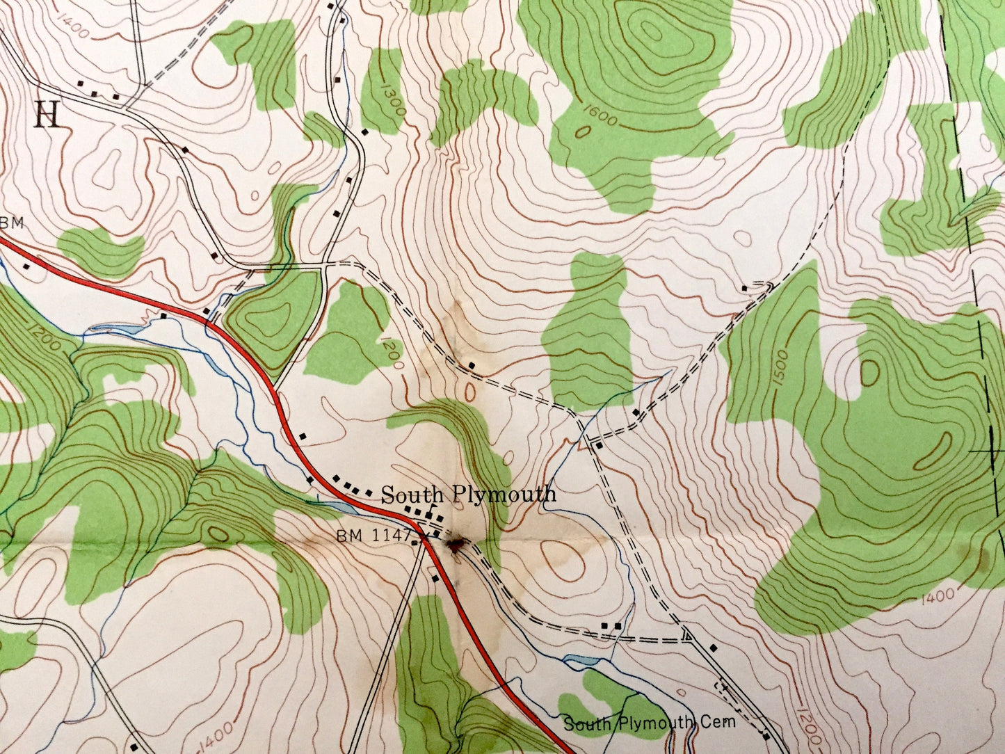
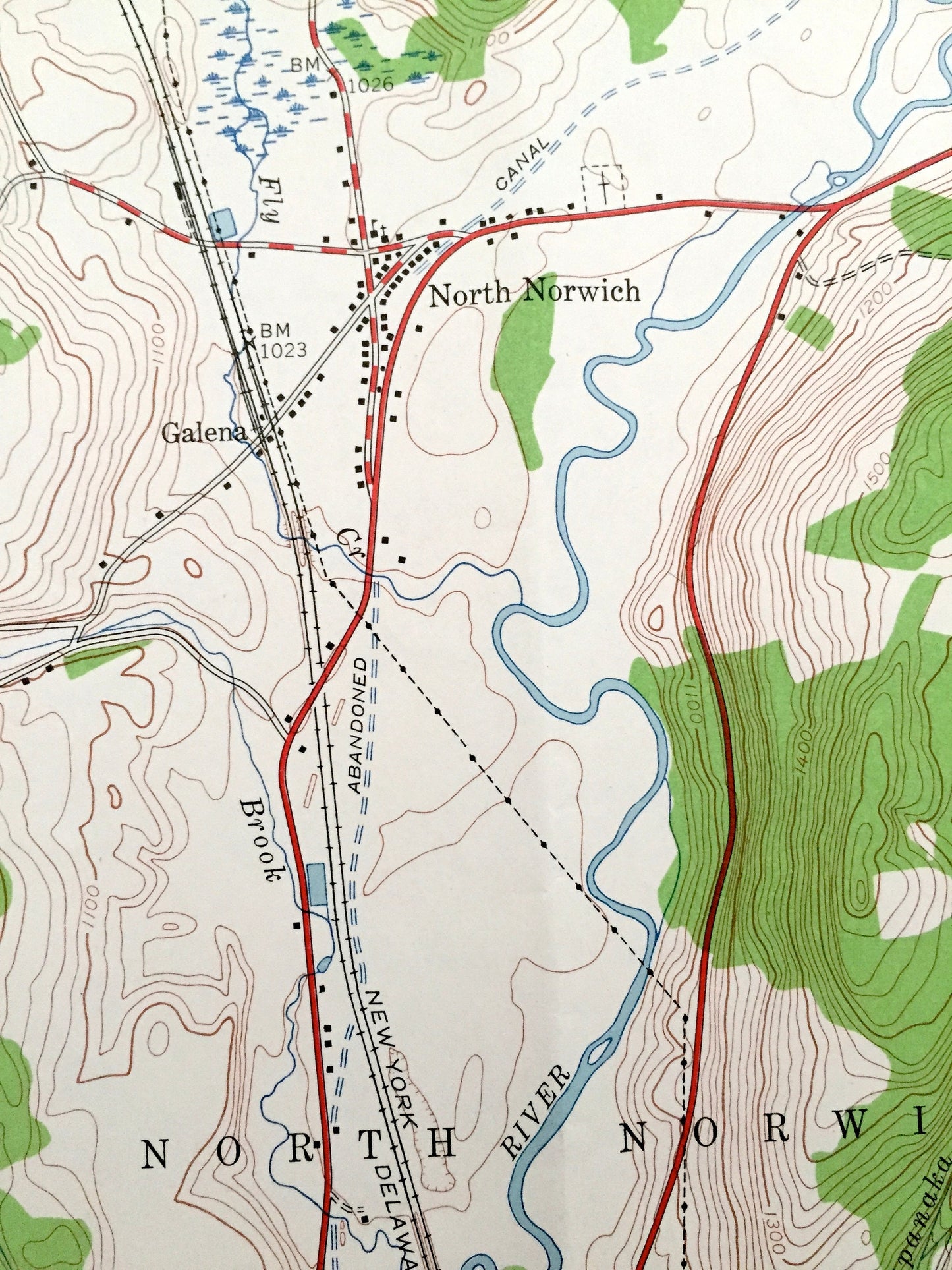
See what New York looked like 75 years ago. Lots of intricate details and geological contours. Map even has little squares for every house that existed at the time. The USGS cartographers were very thorough back then!
Perfect for the historian, map-lover, the curious or just as a conversation starter. Wonderful and rare. Vintage maps such as these make great gifts.
Edition of 1943, printed 1943
Dimensions: 22" width x 27" height
----
Features
Cities & Towns: Norwich, Polkville, Preston, Preston Center, Hawley Corners, Woods Corners, South Plymouth, Plasterville, North Norwich, Galena, Plymouth, Stuart Corners.
Points of Interest: Turner Creek, Chenango River, Canasawacta Creek, Abandoned Canal, Delaware Lackawanna and Western Railroad, New York Ontario and Western Railway, Mead Pond, Airport, German Hollow, Tinker Ridge, and many more hills, streams, ponds, houses, schools, churches and roads.
Condition: Very Good condition, commensurate with age. This map is in incredible shape for being 75 years old. Has fold marks and some light wear and discoloration, but this will read as vintage character when framed.
----
We will happily adjust shipping price for multiple purchases. Maps are rolled up and shipped in sturdy mailing tubes, never folded.
Couldn't load pickup availability
Share