My Store
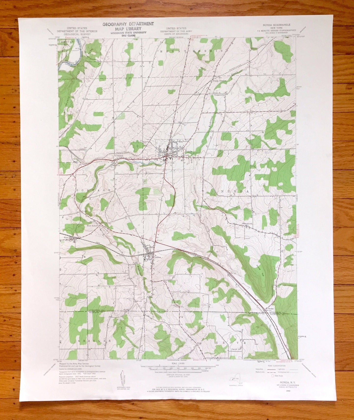
Antique Nunda, New York 1943 US Geological Survey Topographic Map – Livingston, Allegany County, Dalton, Mt Morris, Letchworth State Park NY
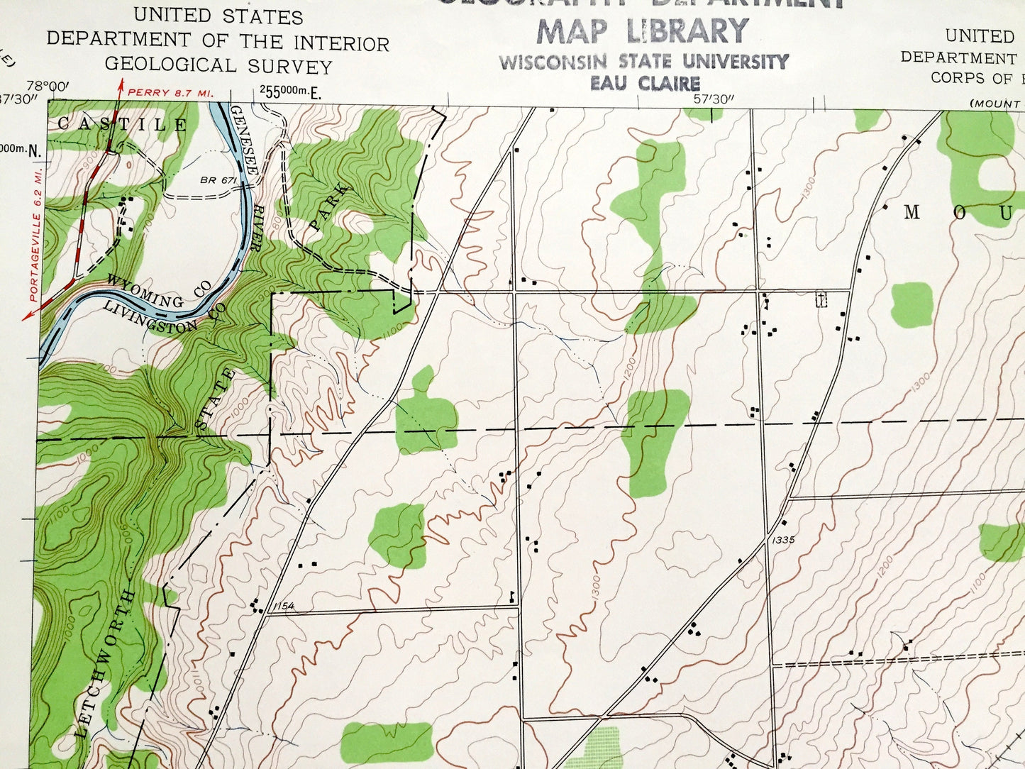
Antique Nunda, New York 1943 US Geological Survey Topographic Map – Livingston, Allegany County, Dalton, Mt Morris, Letchworth State Park NY
Beautiful, antique map of Nunda, New York and surrounding Livingston County & Allegany County areas. This is an authentic 1943 edition, 1960 print from the U.S. Geological Survey and NOT a computer reproduction.
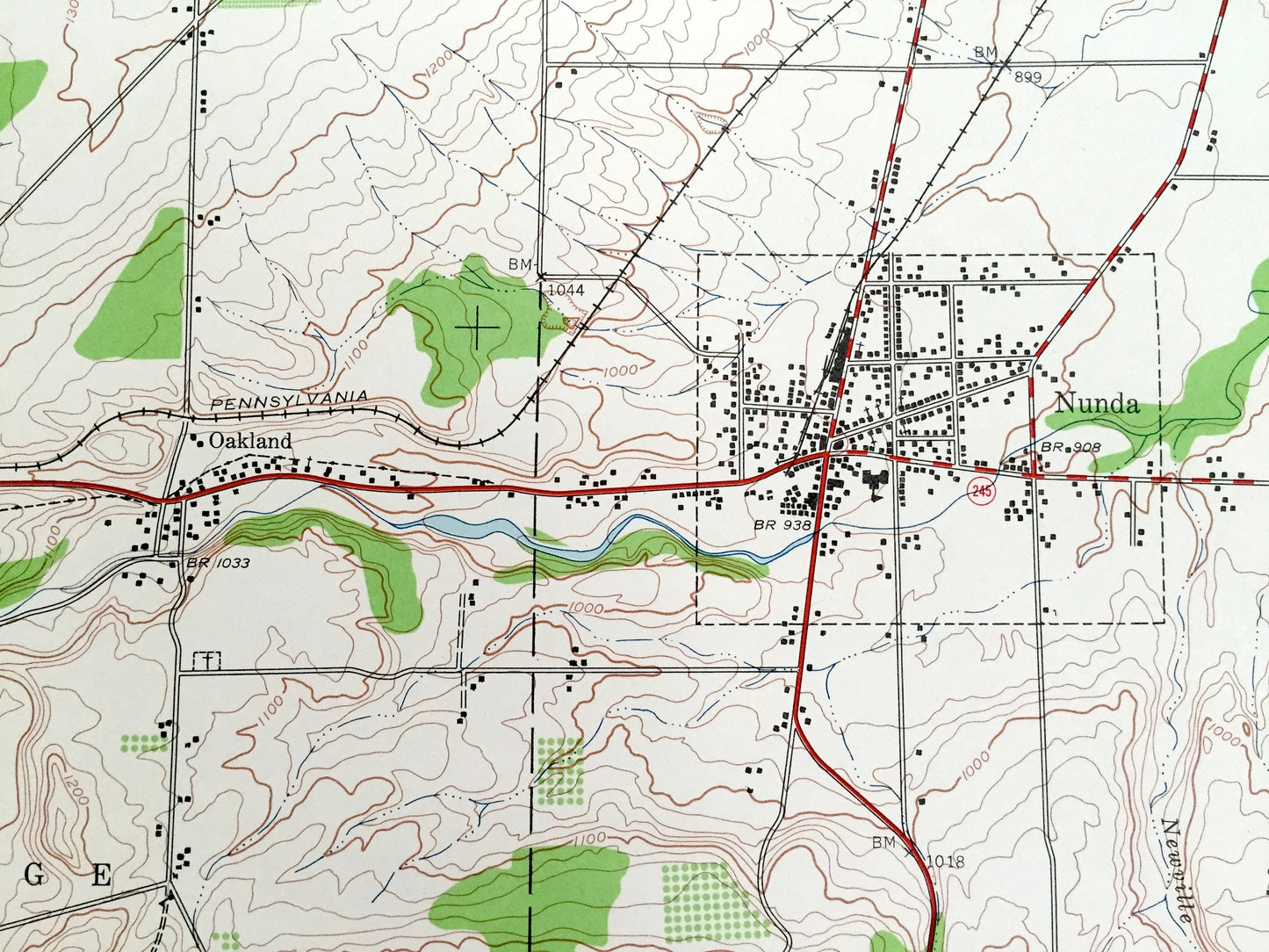
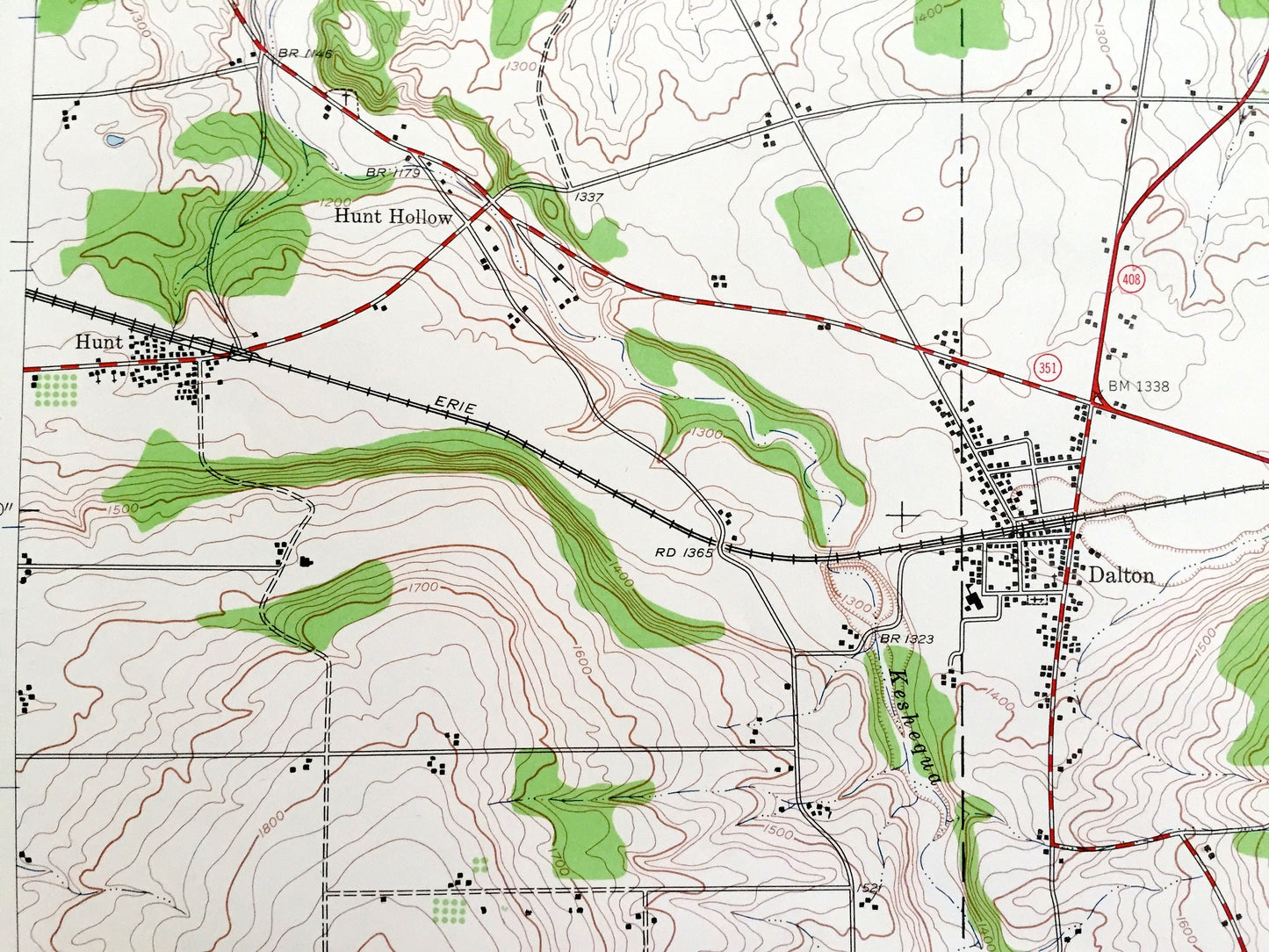
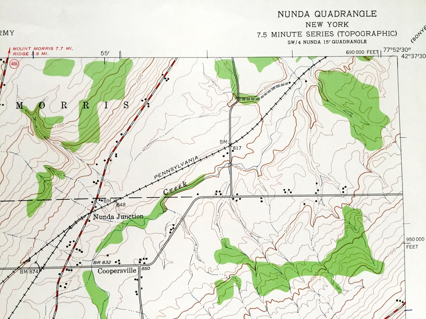
See what New York looked like 80 years ago. Lots of intricate details and geological contours. Map even has little squares for every house that existed at the time. The USGS cartographers were very thorough back then!
Perfect for the historian, map-lover, the curious or just as a conversation starter. Wonderful and rare. Vintage maps such as these make great gifts.
Edition of 1943, printed 1960
Dimensions: 22" width x 27" height
----
Features
Cities & Towns: Nunda, Mount Morris, Castile, Portage, Granger, Grove, Coopersville, Nunda Junction, Oakland, Lewis, Hunt, Hunt Hollow, Dalton, Barkertown, Rosses.
Points of Interest: Livingston County, Allegany County, Letchworth State Park, Genesee River, Round Top, Keshequa Creek, French Hill and more roads, railroads, houses, ponds, hills, creeks, and lakes.
Condition: Good Vintage condition, commensurate with age. This map is in great shape for being over 60 years old. Has light edge-wear, toning and ex-libris stamp in margin, but this will add to vintage character when framed.
----
We will happily adjust shipping price for multiple purchases. Maps are rolled up and shipped in sturdy mailing tubes, never folded.
Couldn't load pickup availability
Share