My Store
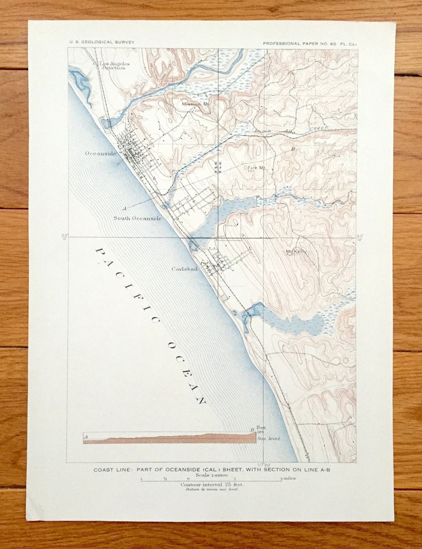
Antique Oceanside, California 1901 US Geological Survey Topographic Map – San Luis Rey, Encinitas, Escondido, Carlsbad, Los Angeles Junction
Antique Oceanside, California 1901 US Geological Survey Topographic Map – San Luis Rey, Encinitas, Escondido, Carlsbad, Los Angeles Junction
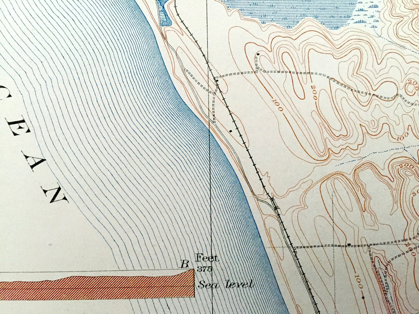
Beautiful, antique map of Oceanside, California area, north of San Diego and South of Los Angeles. This is an authentic 1901 print from the U.S. Geological Survey and NOT a computer reproduction.
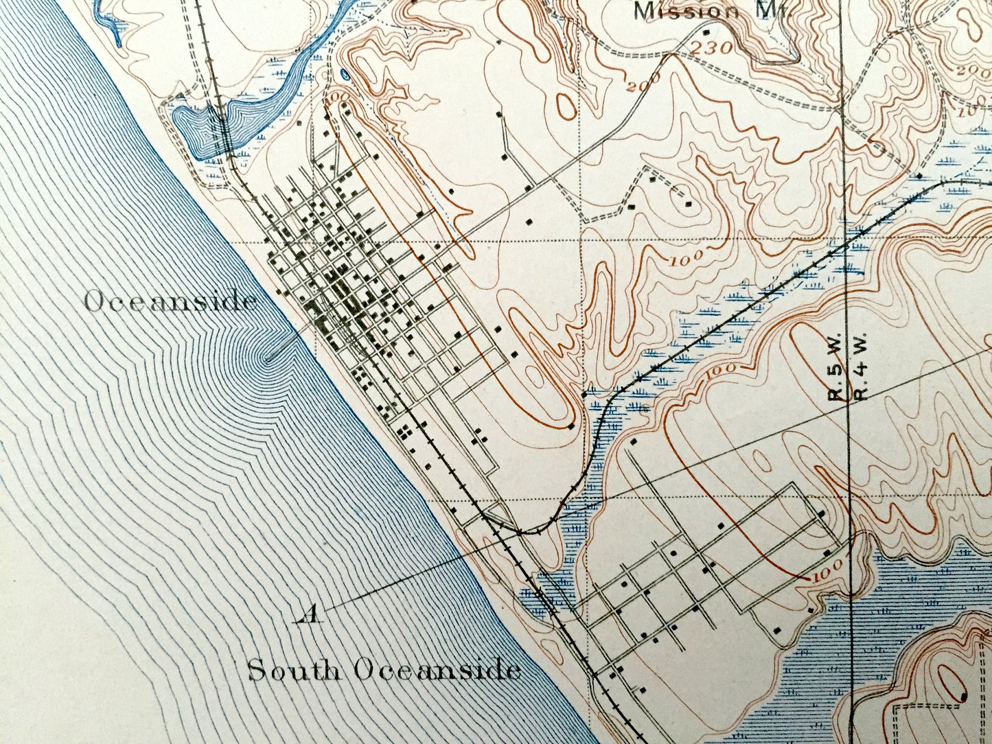
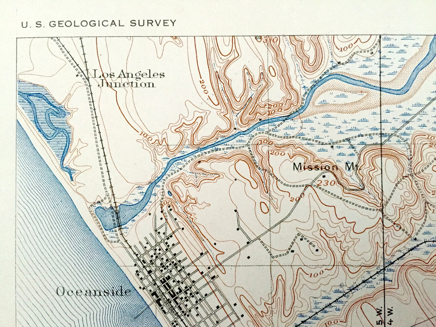
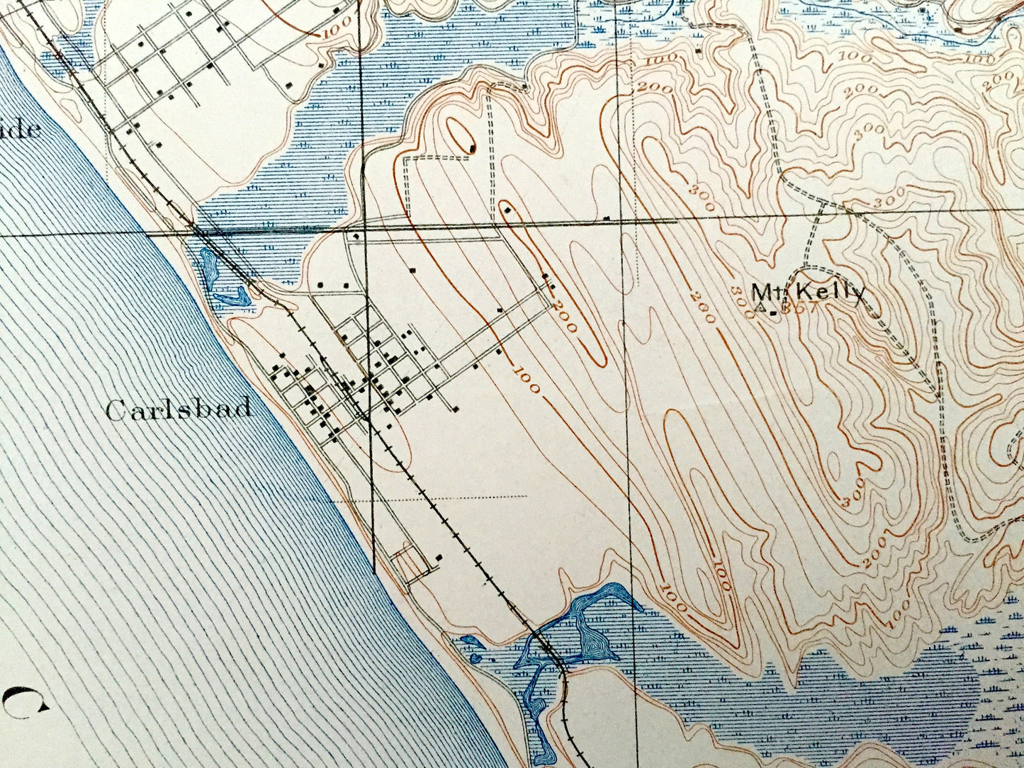
See what the California coast looked like more than 110 years ago. Lots of intricate details and geological contours. Map even has little squares for every house that existed at the time. The USGS cartographers were very thorough back then!
Perfect for the historian, map-lover, the curious or just as a conversation starter. Wonderful and rare. Vintage maps such as these make great gifts.
Edition of 1901, printed 1901
Dimensions: 8" width x 10 3/4" height
----
Features
Cities & Towns: Santa Rosa, Temecula, Pauba, Monserate, Guajome, Oceanside, South Oceanside, Carlsbad, Merle, Encinitas, Buena Vista, Rincon Del Diablo, Escondido, San Bernardo, Sen Deigito, Olivenhain, Temecula Indian Reservation, San Marcos, Richland, Lilac, Bonsal, Pauma, Temecula Valley, Deluz, Fallbrook, Ysidora, Home Ranch.
Points of Interest: Pacific Ocean, California Coast, Mount Ararat, Santa Margarita River, Trabuco Canyon Forest Reserve, San Marcos Mountains, Bernardo River, San Elijo Lagoon, Mt. Whitney, Las Pulgas Canyon, Red Mountain, Pala Montain, Agua Tibia Mountain, Penjango Creek, Gopher Canyon, San Luis Rey River, Los Vallecitos de San Marcos, and lots more hills, mountains, brooks, villages, schools, churches, canyons, mines, roads and train tracks.
Condition: Very Good Vintage condition, commensurate with age. This map is in great shape for being more than 110 years old.
----
We will happily adjust shipping price for multiple purchases. Maps are rolled up and shipped in sturdy mailing tubes, never folded.
Couldn't load pickup availability
Share