My Store
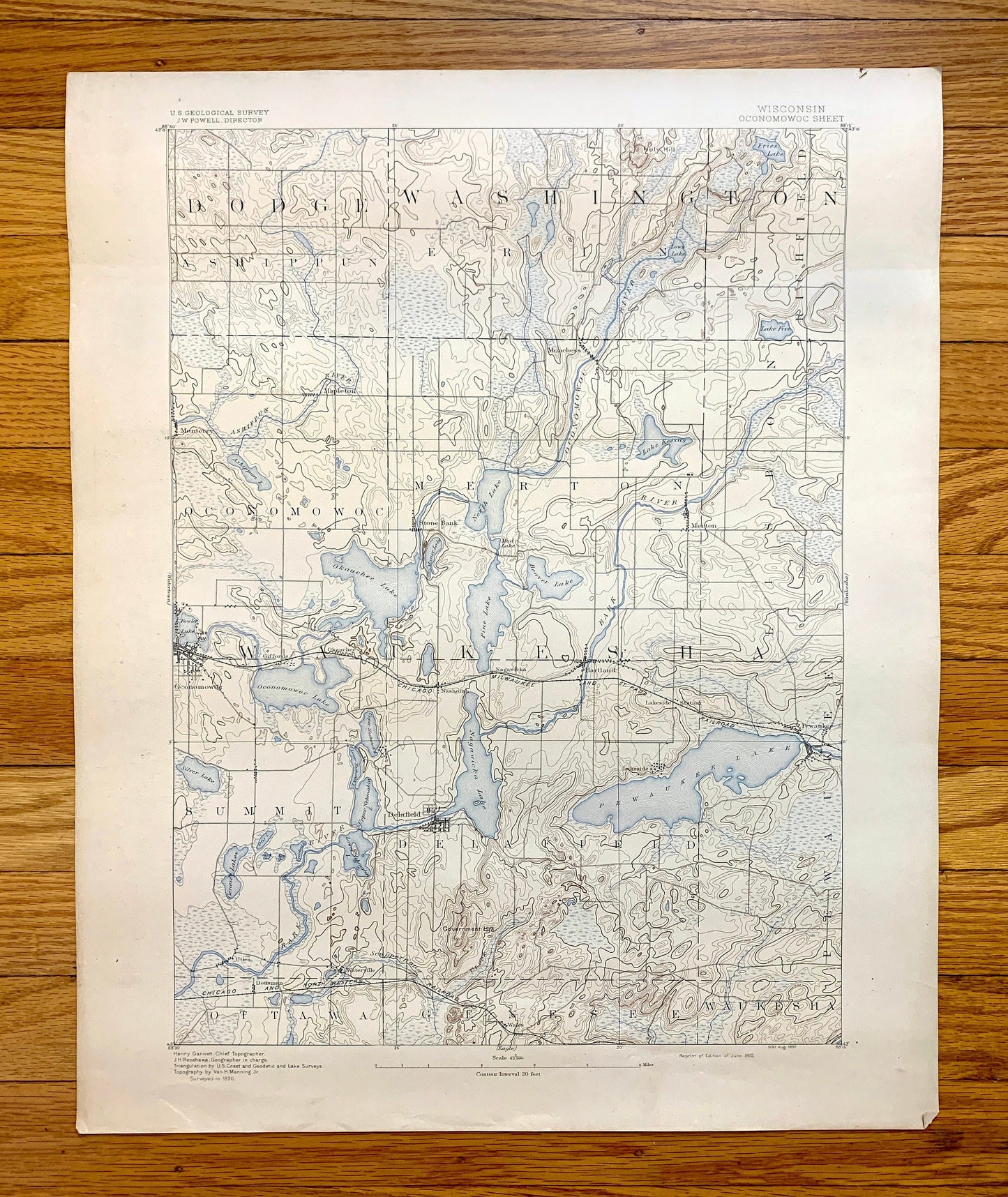
Antique Oconomowoc, Wisconsin 1892 US Geological Survey Topographic Map – Merton, Delafield, Ottawa, Genesee, Waukesha, Pewaukee, Summit, WI
Antique Oconomowoc, Wisconsin 1892 US Geological Survey Topographic Map – Merton, Delafield, Ottawa, Genesee, Waukesha, Pewaukee, Summit, WI
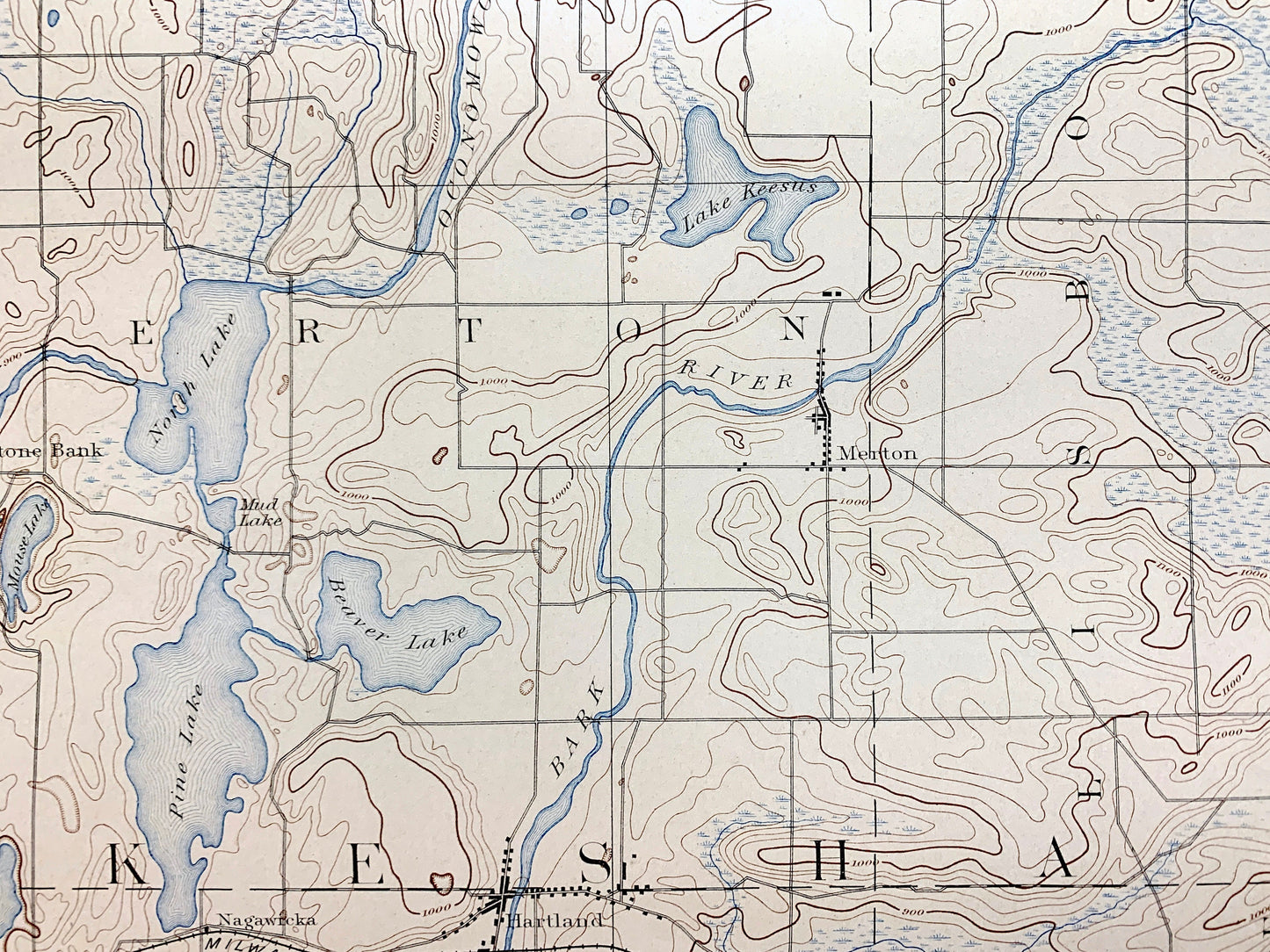
Beautiful, antique map of Oconomowoc, Wisconsin and surrounding Waukesha, Washington and Dodge County areas. This is an authentic 1892 print from the U.S. Geological Survey and NOT a computer reproduction.
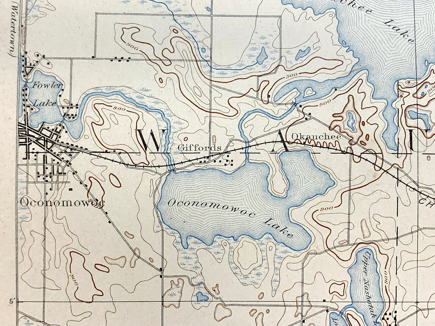
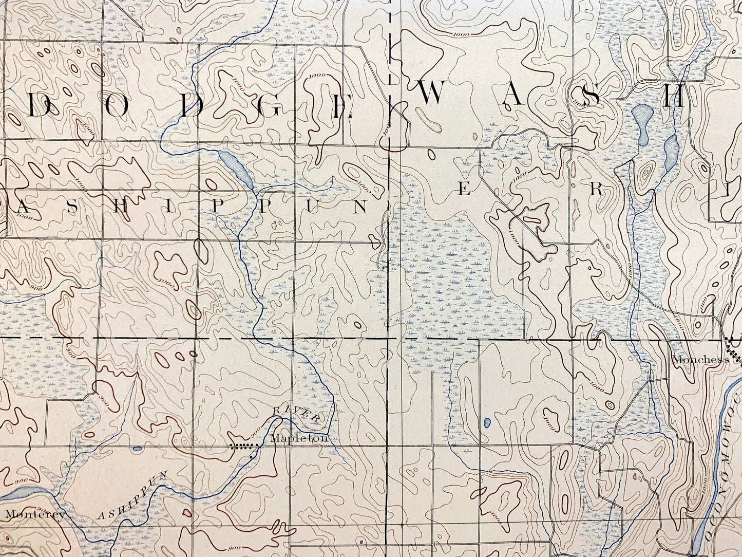
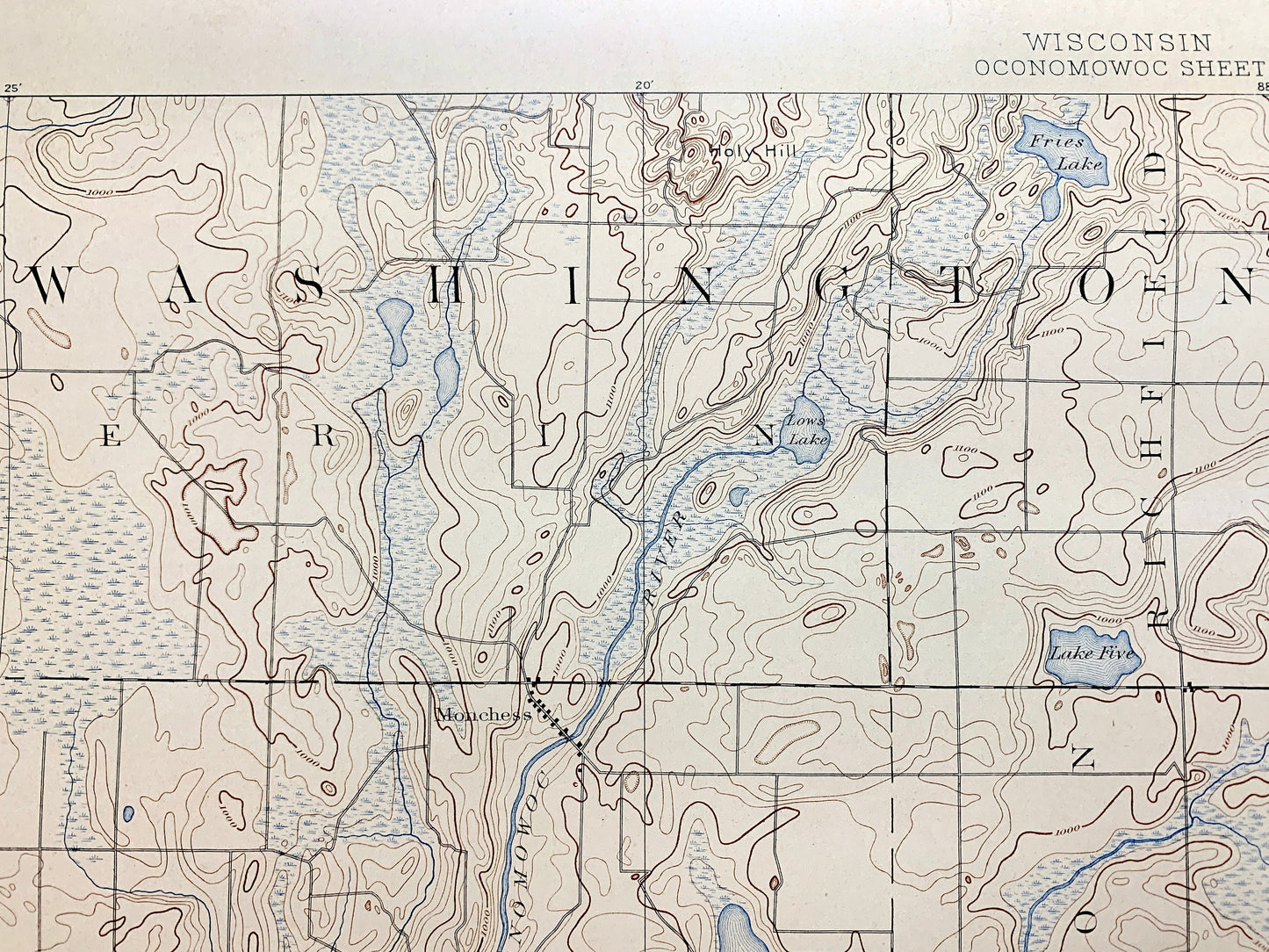
See what Wisconsin looked like more than 130 years ago. Lots of intricate details and geological contours. Map even has little squares for every house that existed at the time. The USGS cartographers were very thorough back then!
Perfect for the historian, map-lover, the curious or just as a conversation starter. Wonderful and rare. Maps such as these make great gifts.
Edition of 1892, printed 1892
Dimensions: 16 1/2" width x 20 1/4" height
----
Features
Cities & Towns: Oconomowoc, Lisbon, Ashippun, Richfield, Hartland, Dousman, Wales, Plat, Mapleton, Stonebank, Monterey, Alderlay, Monches, Merton, Delafield, Ottawa, Genesee, Waukesha, Pewaukee, Summit.
Points of Interest: Waukesha County, Washington County, Dodge County, Pewaukee Lake, Nagawicka Lake, Pine Lake, Bark River, Oconomowoc River, Ashippun River, Lapham Hill, Mason Creek, and lots more hills, creeks, lakes, towns, schools, churches, roads and train tracks.
Condition: Good Vintage condition, commensurate with age. This map is in great shape for being over 130 years old. Has some wear and toning, but this will add to vintage character when framed.
----
We will happily adjust shipping price for multiple purchases. Map will be shipped folded to preserve integrity.
Couldn't load pickup availability
Share