My Store
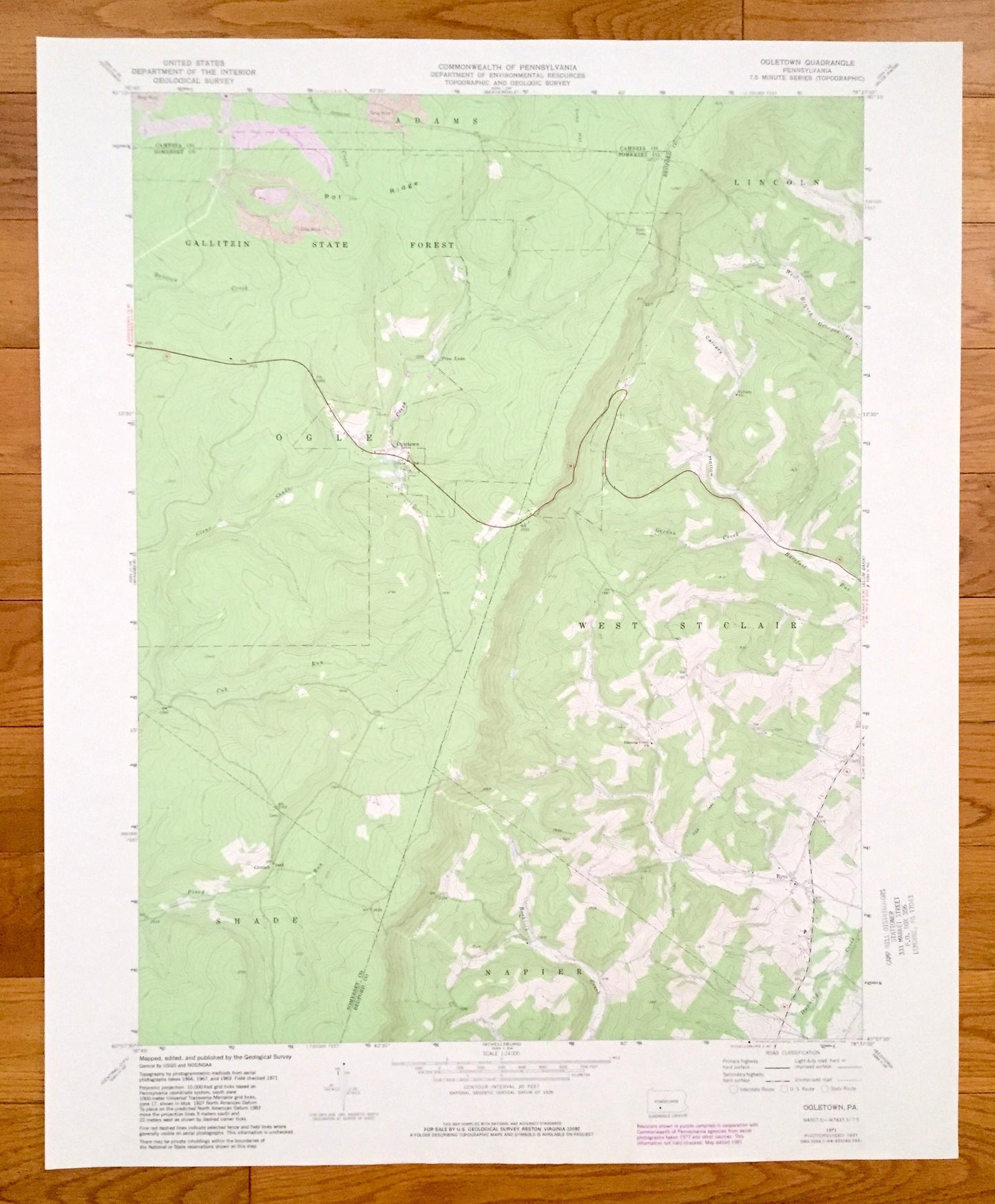
Antique Ogletown, Pennsylvania 1971 US Geological Survey Topographic Map – Somerset County, Bedford County, Cambria County, West St. Clair
Antique Ogletown, Pennsylvania 1971 US Geological Survey Topographic Map – Somerset County, Bedford County, Cambria County, West St. Clair
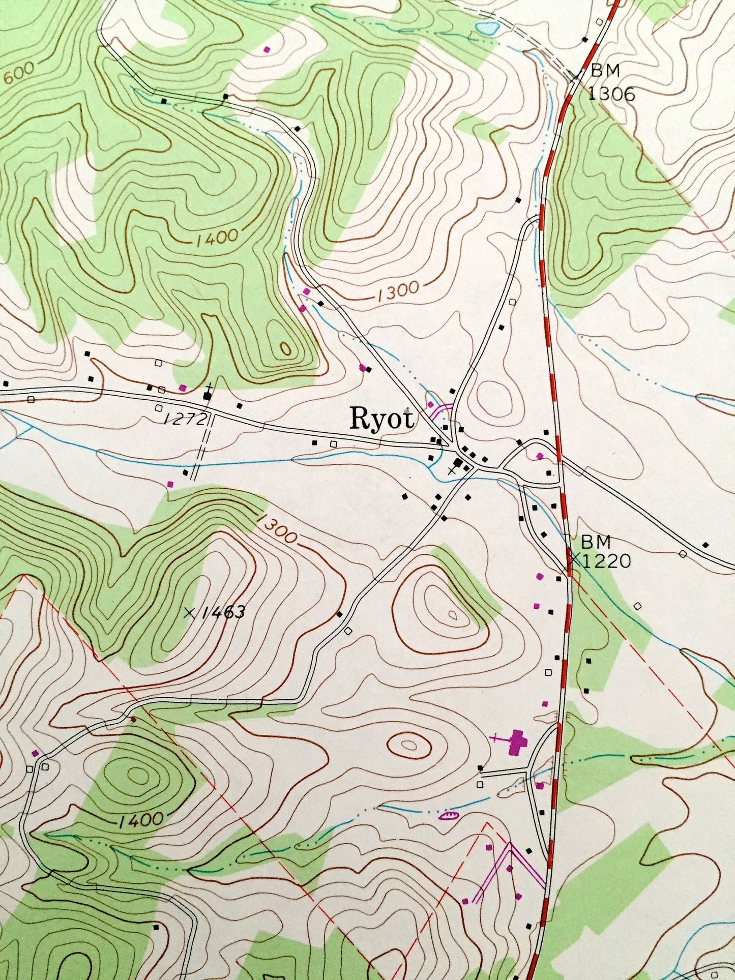
Beautiful, antique map of Oletown, Pennsylvania and surrounding Somerset County, Bedford County, and Cambria County areas. This is an authentic 1971 edition, 1981 print from the U.S. Geological Survey and NOT a computer reproduction.
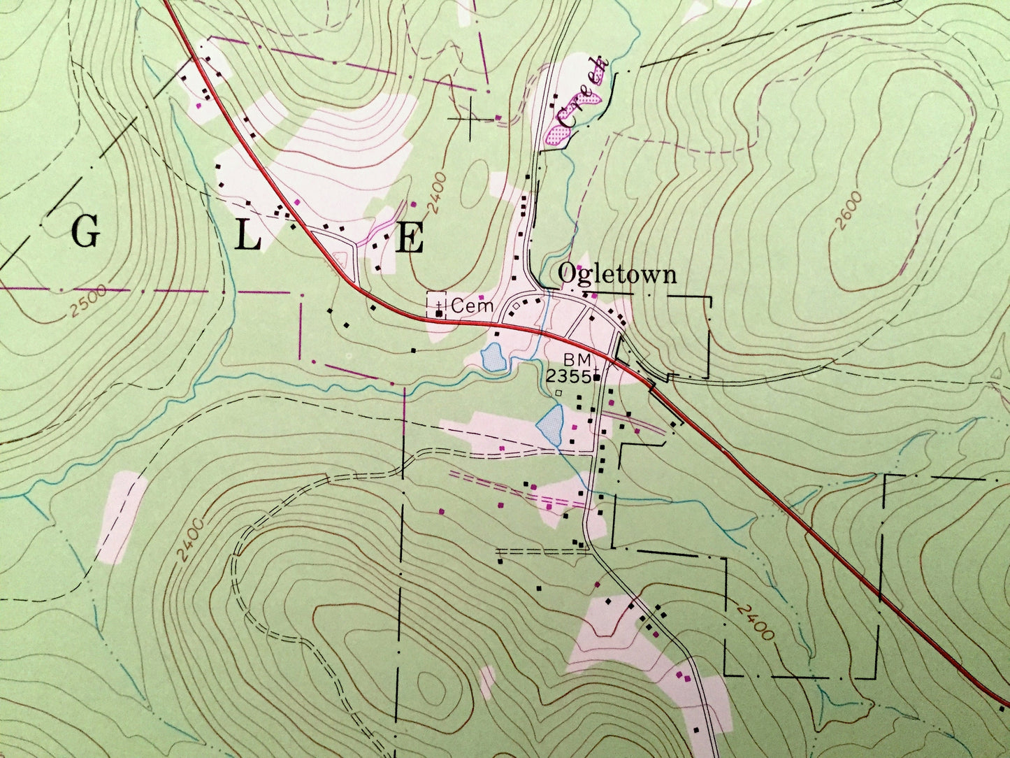
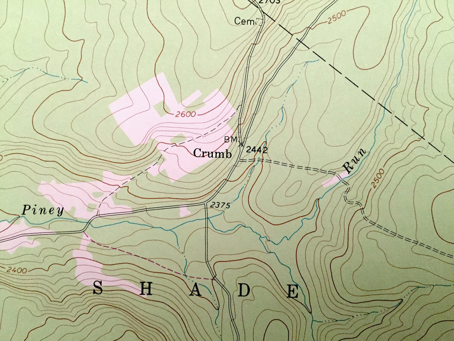
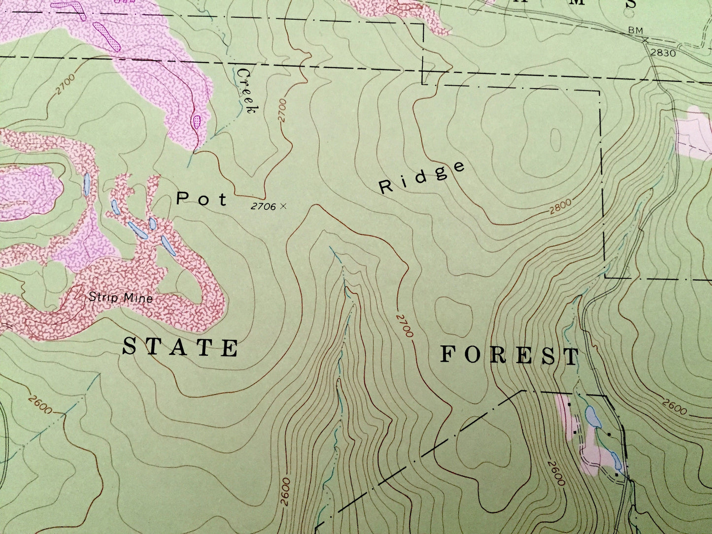
See what Pennsylvania looked like over 45 years ago. Lots of intricate details and geological contours. Map even has little squares for every house that existed at the time. The USGS cartographers were very thorough back then!
Perfect for the historian, map-lover, the curious or just as a conversation starter. Wonderful and rare. Vintage maps such as these make great gifts.
Edition of 1971, printed 1981
Dimensions: 22" width x 27" height
----
Features
Cities & Towns: Ogletown, Napier, Shade, Crumb, Ryot, Ogle, Adams, Lincoln, West St. Clair.
Points of Interest: Somerset County, Bedford County, Cambria County, Gallitzin State Forest, Pot Ridge, Calvary Hollow, Barefoot Run, Piney Run, Pine Lake, Rocklick Creek, Gordon Creek and many more hills, streams, ponds, houses, schools, churches and roads.
Condition: Very Good condition, commensurate with age. This map is in incredible shape for being over 35 years old. Has light edge-wear and a stamp, all of which will read as vintage character when framed.
----
We will happily adjust shipping price for multiple purchases. Maps are rolled up and shipped in sturdy mailing tubes, never folded.
Couldn't load pickup availability
Share