My Store
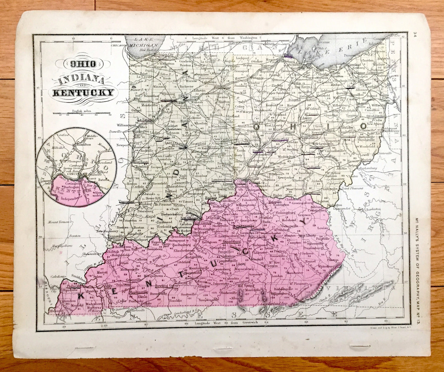
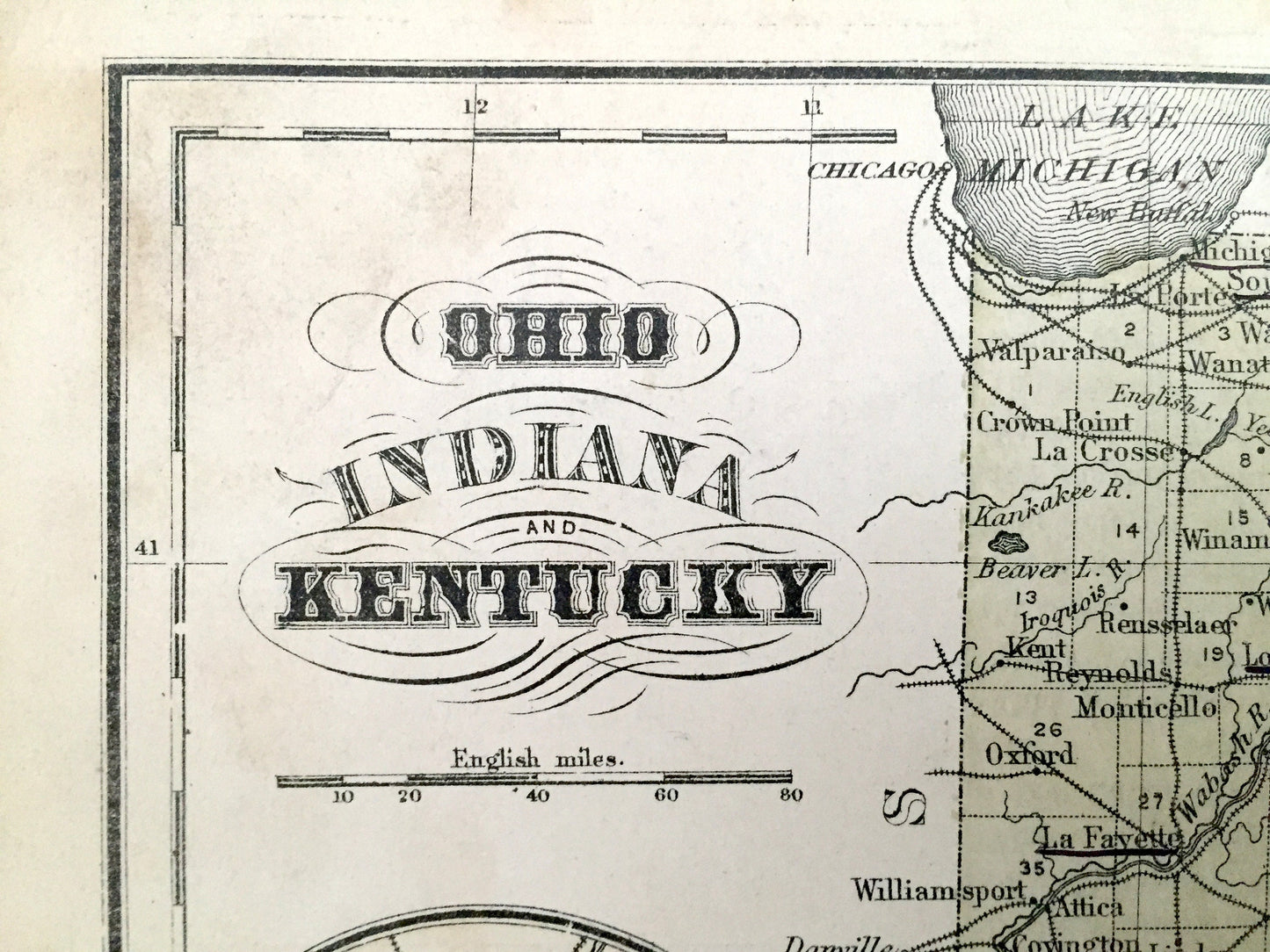
Antique Ohio, Indiana & Kentucky 1866 Rand McNally Map – Terre Haute, Indianapolis, Cleveland, Cincinnati, Louisville, Lexington, Akron
Antique Ohio, Indiana & Kentucky 1866 Rand McNally Map – Terre Haute, Indianapolis, Cleveland, Cincinnati, Louisville, Lexington, Akron
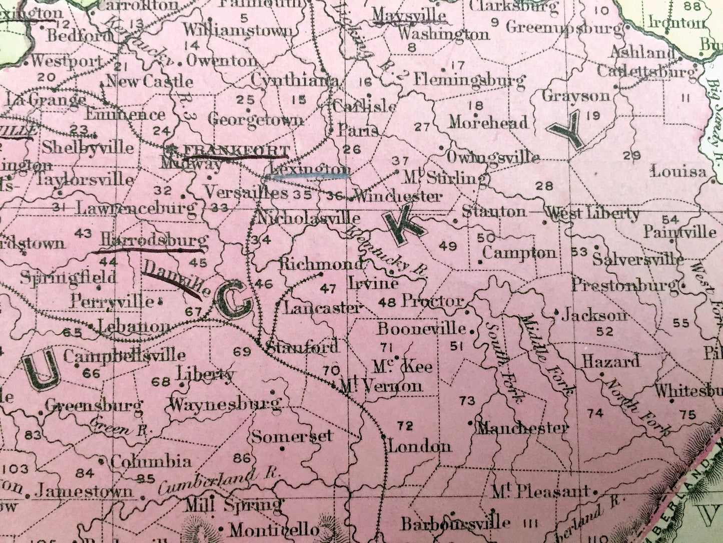
Beautiful, antique map of Ohio, Indiana & Kentucky, with an inset of the Cincinnati area. This is an authentic map taken from Rand McNally's "An Improved System of Geography" atlas, published in 1866 and NOT a computer reproduction.
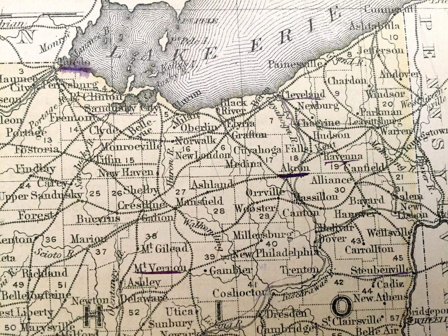
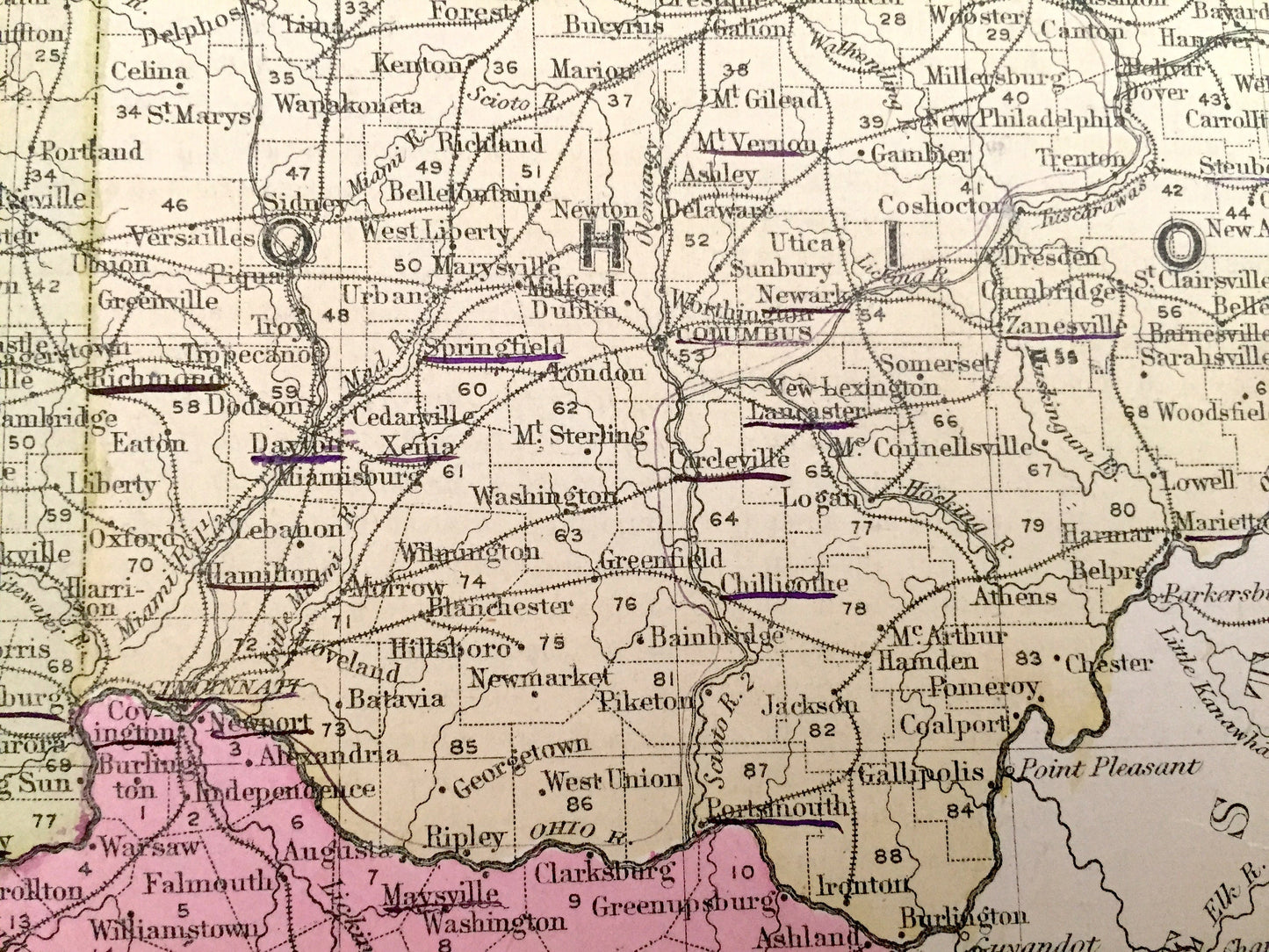
See what Ohio, Indiana & Kentucky looked like more than 150 years ago. Lots of charming, intricate details and contours, including major cities and towns, rivers, lakes, railroads and other points of interest. On the back is a description of Mississippi, Louisiana & Arkansas.
Perfect for the historian, map-lover, the curious or just as a conversation starter. Wonderful and rare. Vintage maps such as these make great gifts.
Edition of 1866, printed 1866
Dimensions: 12" width x 10" height
----
Features
Points of Interest: Ohio, Indiana & Kentucky, Lake Michigan, Lake Erie, Indianapolis, Fort Wayne, Terre Haute, Toledo, Akron, Cleveland, Cincinnati, Richmond, Springfield, Columbus, Lexington, Louisville, Frankfort, Bowling Green, Cumberland Mountains, Olentangy River, Wabash River, Ohio River, and much more.
----
Condition: Good condition, commensurate with age. This map is in incredible shape for being more than 150 years old. Light toning and wear, which will read as vintage character when framed.
----
We will happily adjust shipping price for multiple purchases. Maps are rolled up and shipped in sturdy mailing tubes, never folded.
Couldn't load pickup availability
Share