My Store
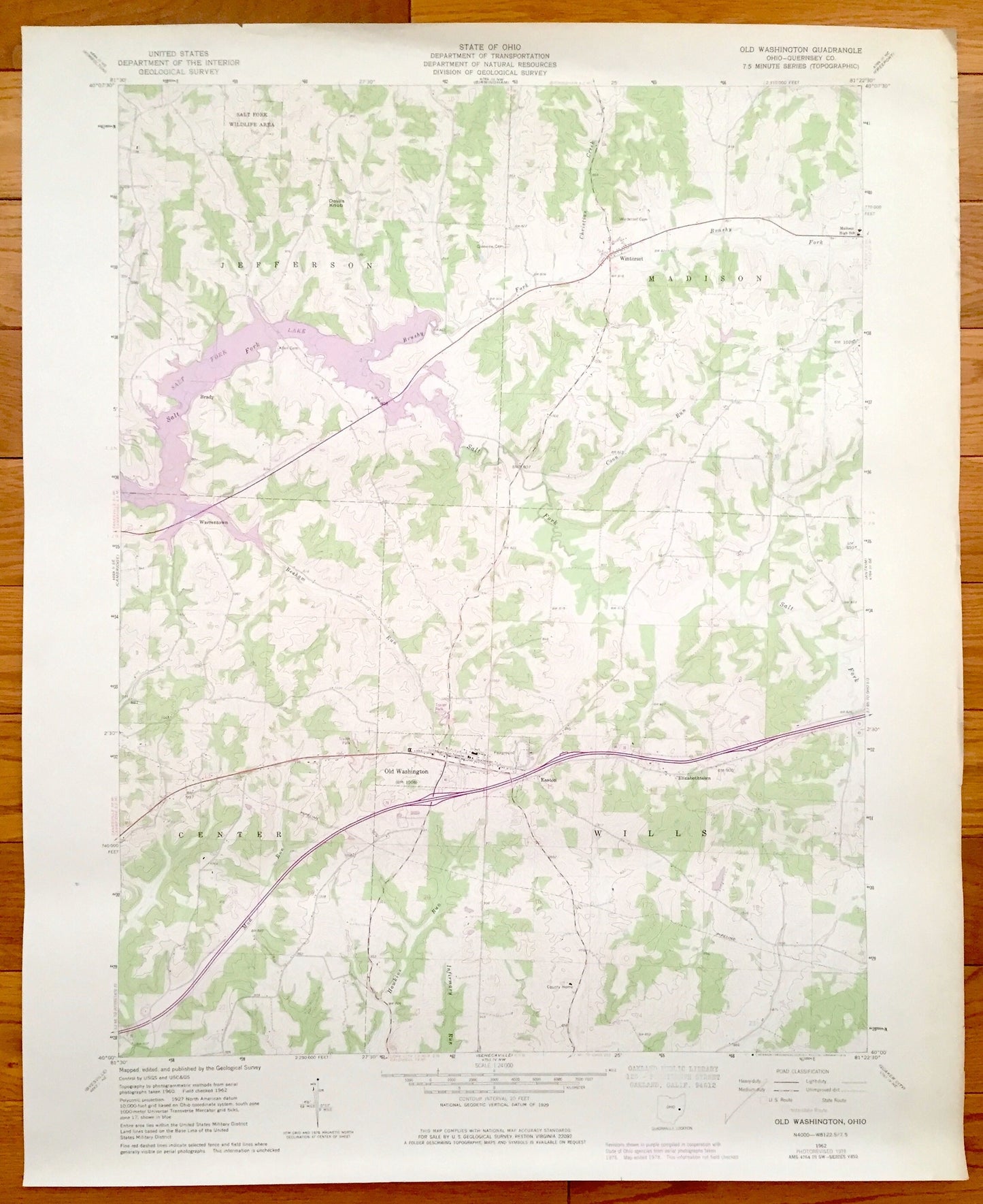
Antique Old Washington, Ohio 1962 US Geological Survey Topographic Map – Jefferson, Madison, Wills, Center, Elizabethtown, Easton, Winterset
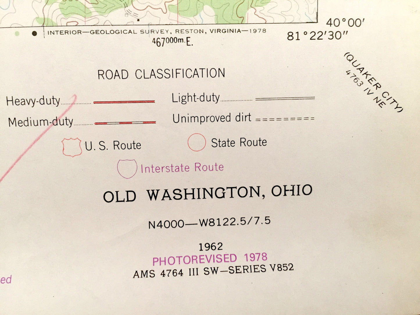
Antique Old Washington, Ohio 1962 US Geological Survey Topographic Map – Jefferson, Madison, Wills, Center, Elizabethtown, Easton, Winterset
Beautiful, antique map of Old Washington, Jefferson, Madison, Wills, Center, Elizabethtown, Easton, and Winterset, Ohio. This is an authentic 1978 print of 1962 survey data from the U.S. Geological Survey and NOT a computer reproduction.
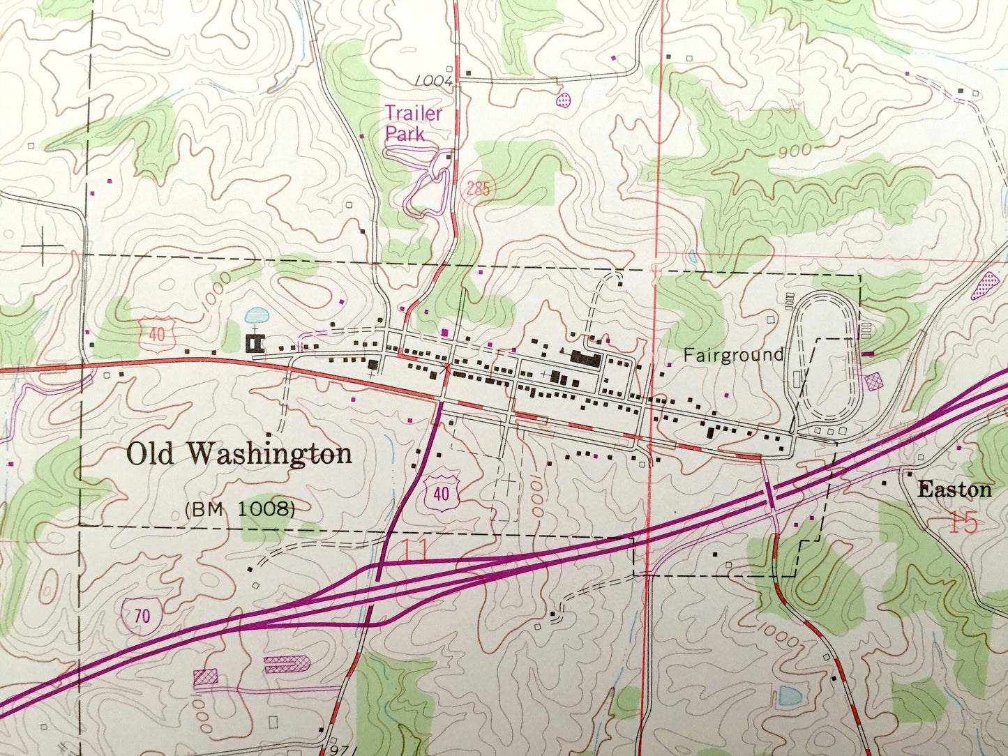
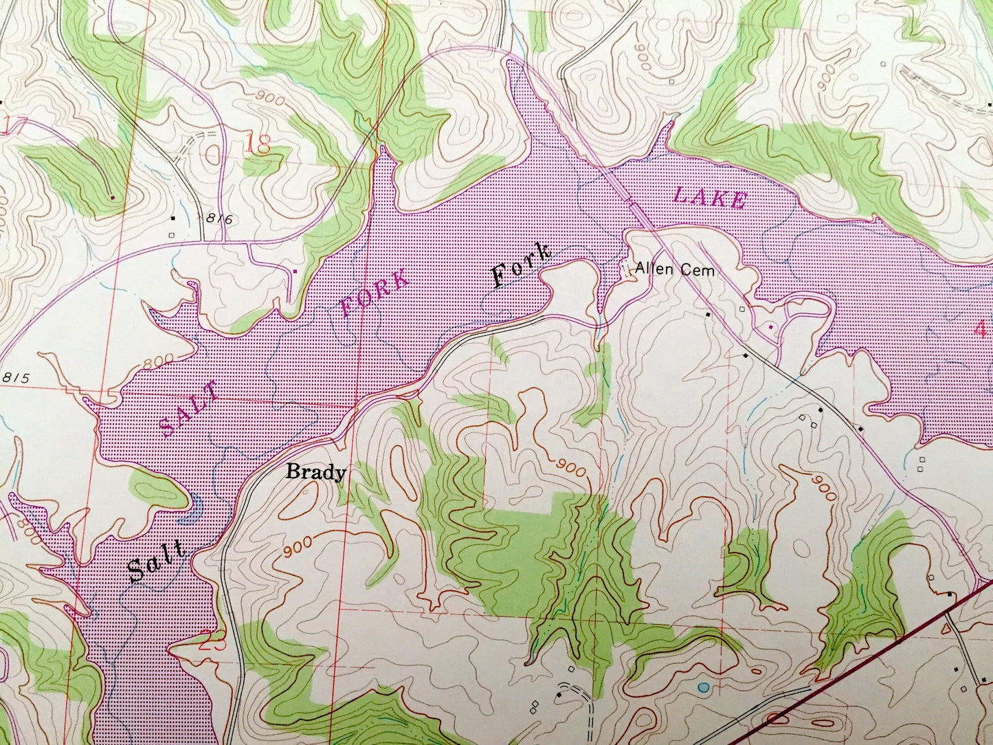
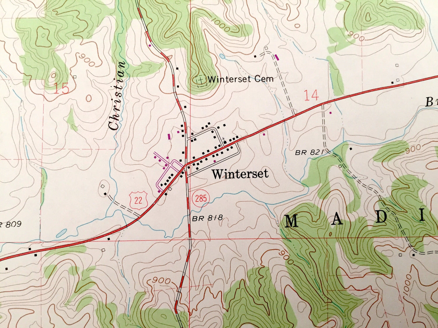
See what Guernsey County of Ohio looked like over 55 years ago. Lots of intricate details and geological contours. Map even has little squares for every house that existed at the time. The USGS cartographers were very thorough back then!
Perfect for the historian, map-lover, the curious or just as a conversation starter. Wonderful and rare. Vintage maps such as this make great gifts.
Edition of 1962, printed 1978
Dimensions: 22" width x 27" height
----
Features
Cities & Towns: Old Washington, Warrentown, Jefferson, Madison, Wills, Center, Elizabethtown, Easton, Winterset.
Points of Interest: Old Washington Fairgrounds, Salt Fork Lake, Salt Fork Wildlife Area, Devils Knob, Madison High School, and many more roads, streams, houses, and rivers.
Condition: Very Good condition, commensurate with age. This map is in incredible shape for being almost 40 years old.
----
We will happily adjust shipping price for multiple purchases. Maps are rolled up and shipped in sturdy mailing tubes, never folded.
Couldn't load pickup availability
Share