My Store
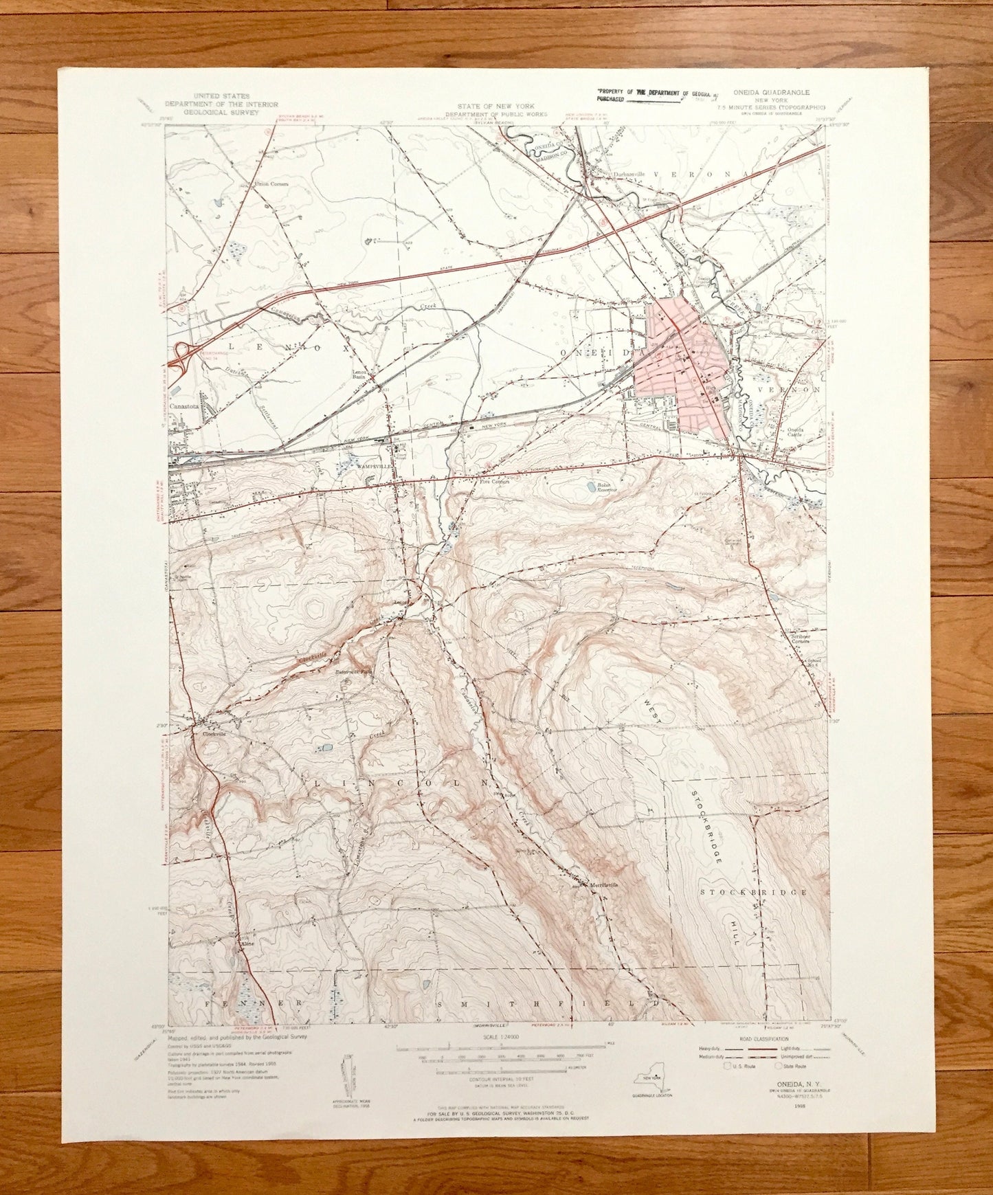
Antique Oneida, New York 1955 US Geological Survey Topographic Map – Oneida, Madison County, Lenox, Verona, Lincoln, Fenner, Smithfield, NY
Antique Oneida, New York 1955 US Geological Survey Topographic Map – Oneida, Madison County, Lenox, Verona, Lincoln, Fenner, Smithfield, NY
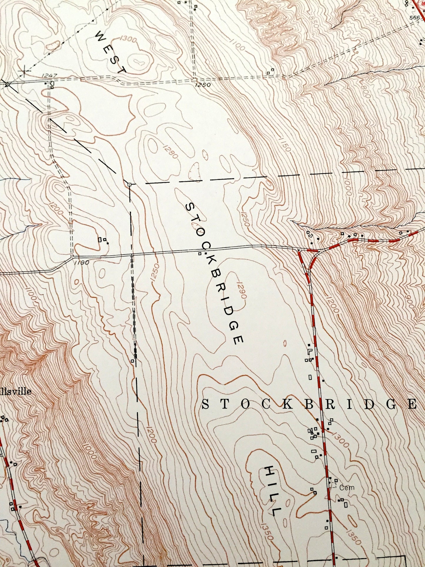
Beautiful, antique map of the Oneida, New York and surrounding Madison & Oneida County areas. This is an authentic 1955 edition, 1957 print from the U.S. Geological Survey and NOT a computer reproduction.
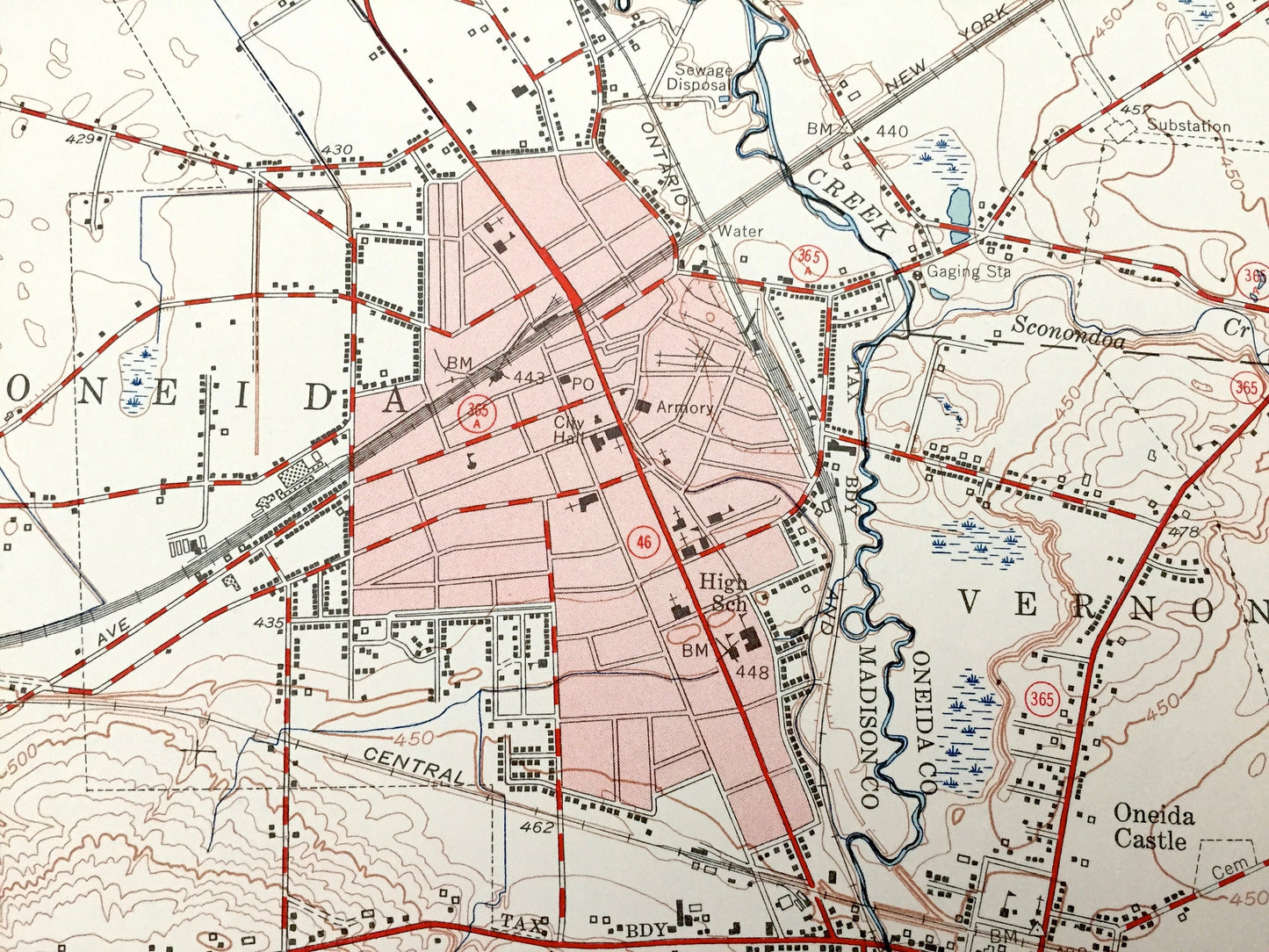
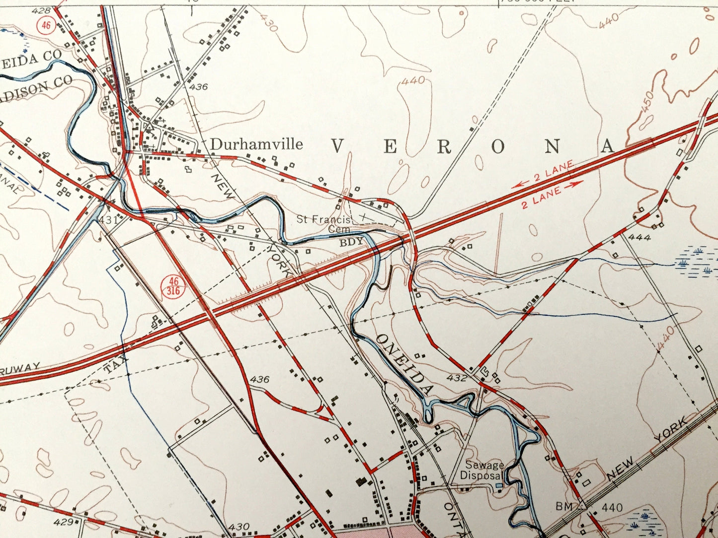
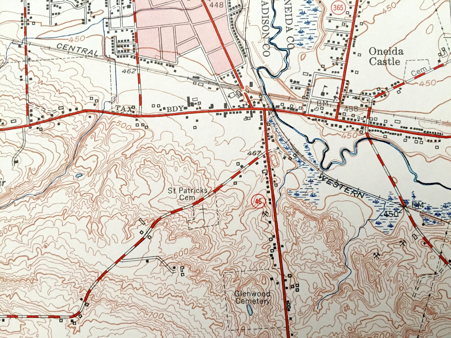
See what New York looked like over 65 years ago. Lots of intricate details and geological contours. Map even has little squares for every house that existed at the time. The USGS cartographers were very thorough back then!
Perfect for the historian, map-lover, the curious or just as a conversation starter. Wonderful and rare. Vintage maps such as this make great gifts.
Edition of 1955, printed 1957
Dimensions: 22" width x 27" height
----
Features
Cities & Towns: Union Corners, Canastota, Lenox Basin, Wampsville, Clockville, Alene, Merrillsville, Five Corners, Stockbridge, Scribner Corners, Oneida Castle, Durhamville.
Points of Interest: New York State Thruway, West Stockbridge Hill, Oneida Creek, Cowaselon Creek, Dutch Settlement Creek, Clockville Creek, Limestone Creek, Buttermilk Falls, and many more hills, streams, ponds, houses, schools, railroads, churches and roads.
Condition: Very Good Vintage condition, commensurate with age. This map is in great shape for being over 60 years old. Light wear and stamp in upper margin, but this will add to vintage character when framed.
----
We will happily adjust shipping price for multiple purchases. Maps are shipped in sturdy mailing tubes, never folded.
Couldn't load pickup availability
Share