My Store
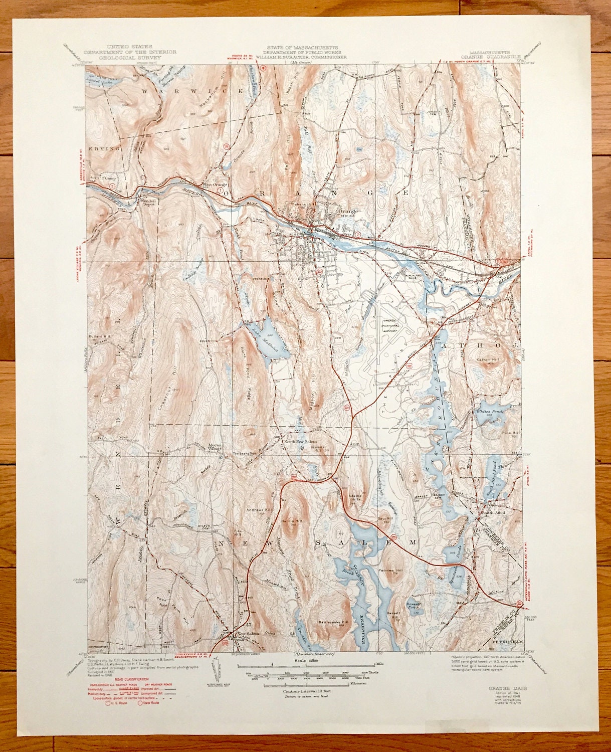
Antique Orange, Massachusetts 1941 US Geological Survey Topographic Map – New Salem, Athol, Erving, Warwick, Wendell, Petersham
Antique Orange, Massachusetts 1941 US Geological Survey Topographic Map – New Salem, Athol, Erving, Warwick, Wendell, Petersham
Beautiful, antique map of Orange, Massachusetts and surrounding Franklin County area. This is an authentic 1949 print with 1941 data from the U.S. Geological Survey and NOT a computer reproduction.
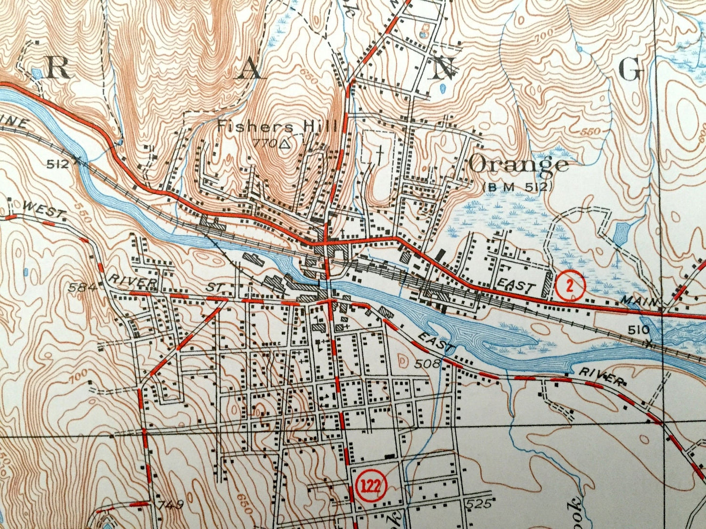
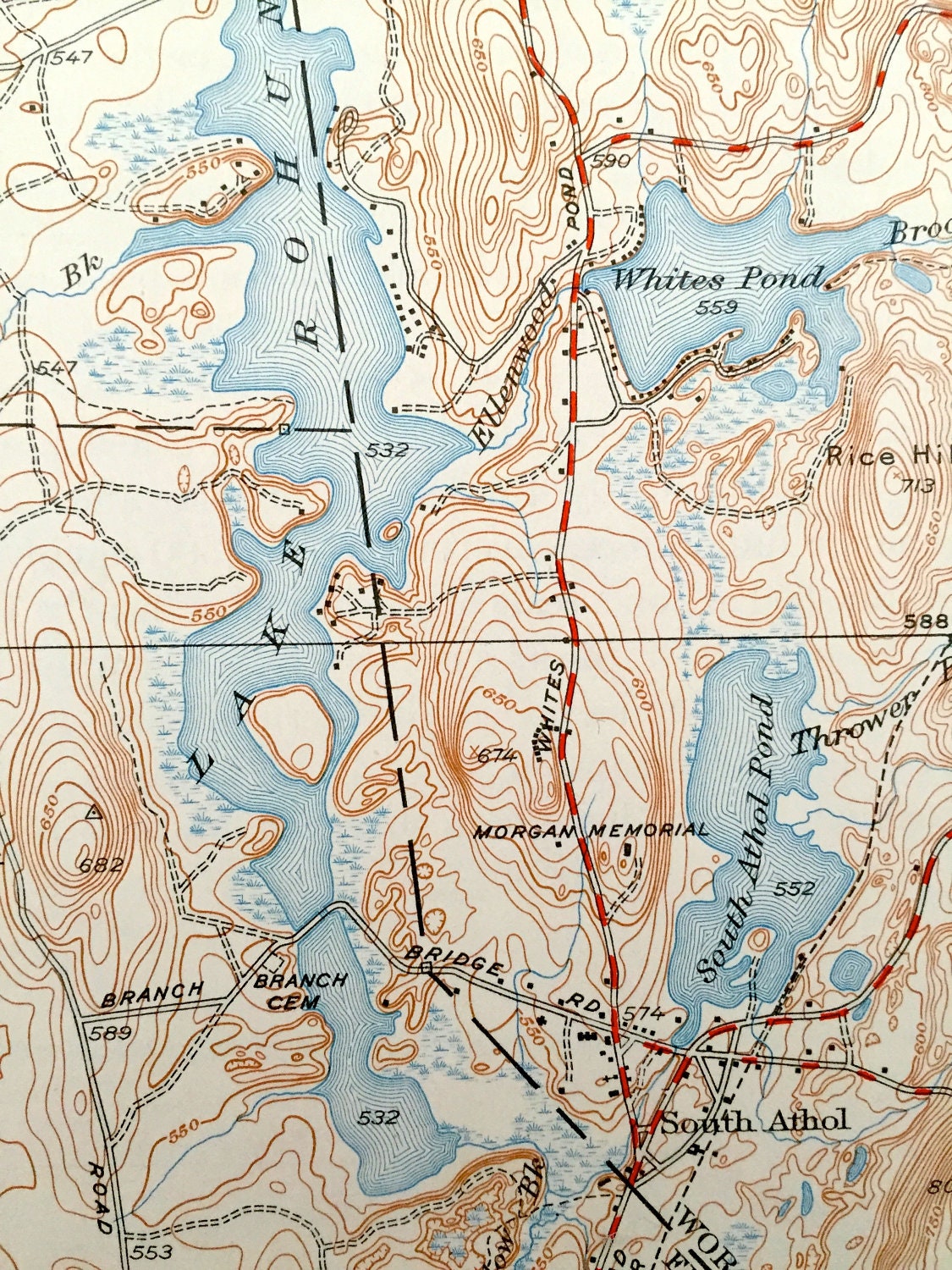
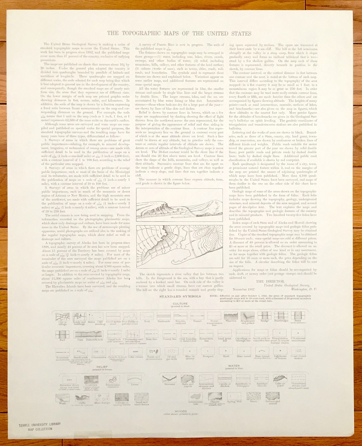
See what Orange looked like more than 75 years ago. Lots of intricate details and geological contours. Map even has little squares for every house that existed at the time. The USGS cartographers were very thorough back then! On the back is a description of topographic symbols and map guide.
Perfect for the historian, map-lover, the curious or just as a conversation starter. Wonderful and rare. Vintage maps such as these make great gifts.
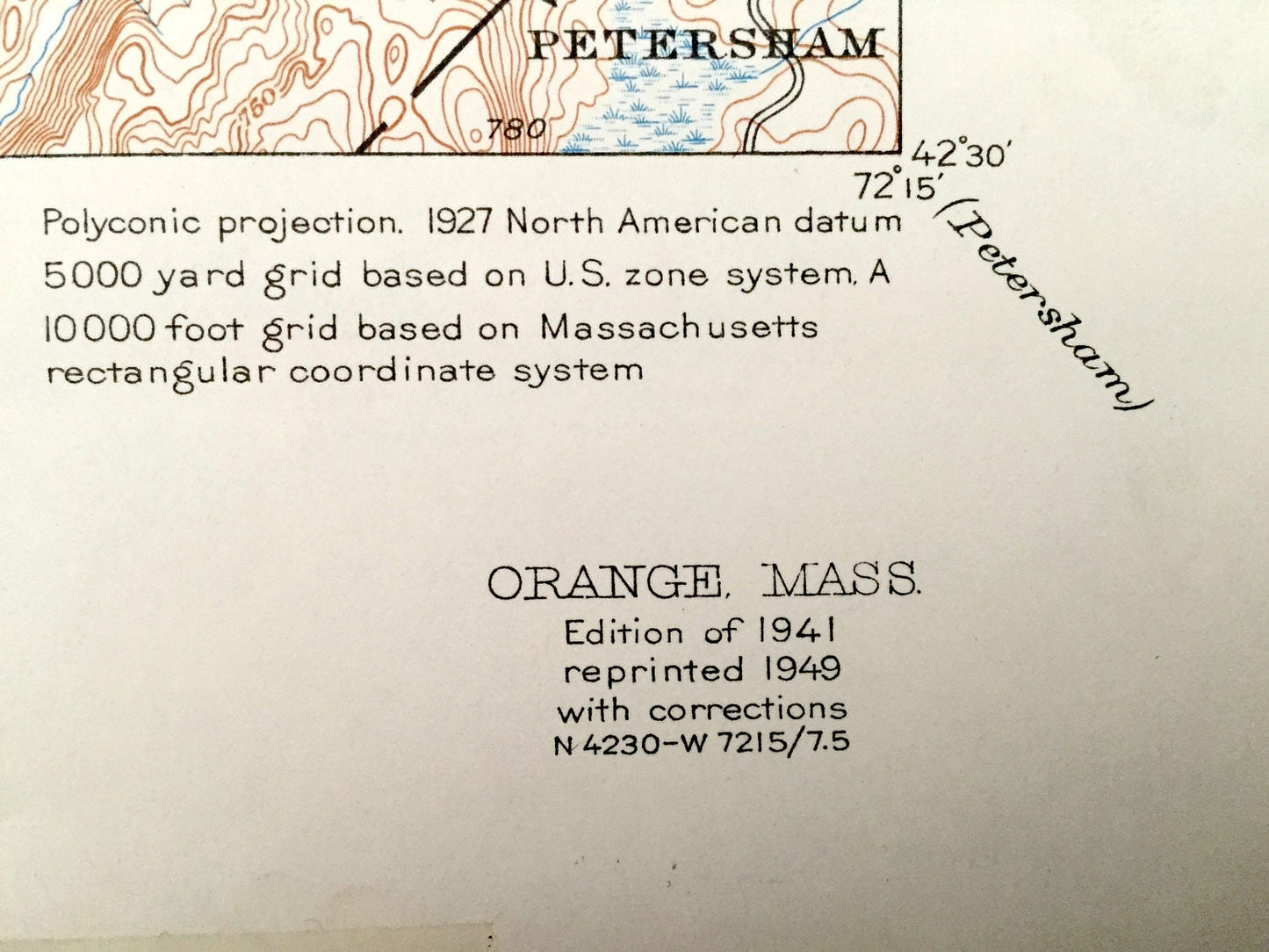
Edition of 1937, printed 1949
Dimensions: 17" width x 21" height
----
Features
Cities & Towns: Erving, Warwick, Orange, Athol, Wendell, New Salem, Petersham, Wendell Depot, North New Salem, South Athol.
Points of Interest: Millers River, Laurel Lake, Wheelers Pond, Lake Mattawa, Lake Rohunta, Whites Pond, South Athol Pond, Quabbin Reservoir, Spectacle Ponds, Bassett Pond, Hockanum Hill, Beech Hill, Fall Hill, Kelton Hill, North Pond Hill, Magoon Hill, Browns Hill, Rattlesnake Hill, Farm Hill, CCC Camp, Harris Swamp, Fishers Hill, Birchland Club, McIver Brook, Spriggy Brook, East Main Mohawk Trail, and lots more hills, brooks, marshes, ponds, villages, roads and train tracks.
Condition: Very Good condition, commensurate with age. This map is in incredible shape for being 70 years old.
----
We will happily adjust shipping price for multiple purchases. Maps are rolled up and shipped in sturdy mailing tubes, never folded.
Couldn't load pickup availability
Share