My Store
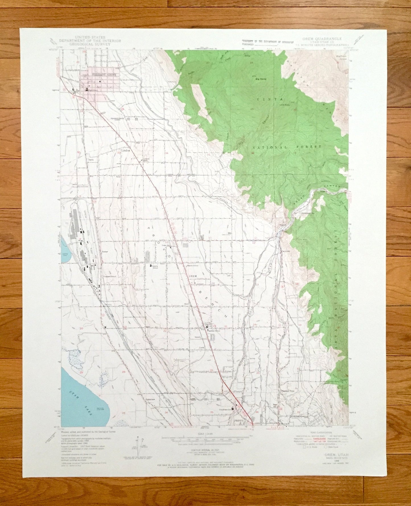
Antique Oren, Utah 1948 US Geological Survey Topographic Map – Pleasant Grove, Provo, Bench, Uinta National Forest, County, Lindon, Hardy UT
Antique Oren, Utah 1948 US Geological Survey Topographic Map – Pleasant Grove, Provo, Bench, Uinta National Forest, County, Lindon, Hardy UT
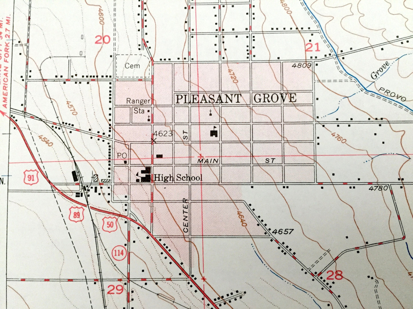
Beautiful, antique map of Orem, Utah and surrounding Utah County area. This is an authentic 1948 edition, 1965 print from the U.S. Geological Survey and NOT a computer reproduction.
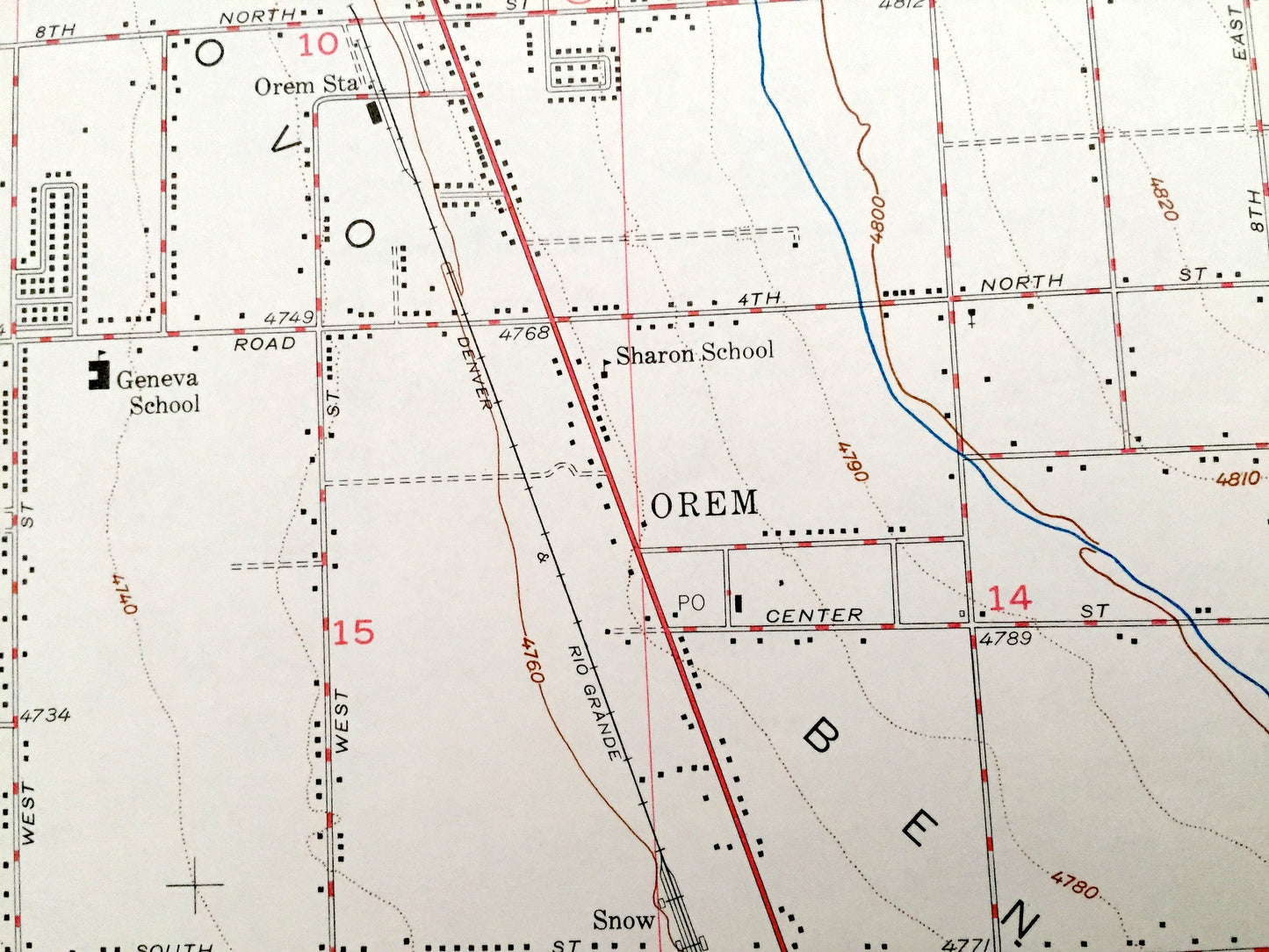
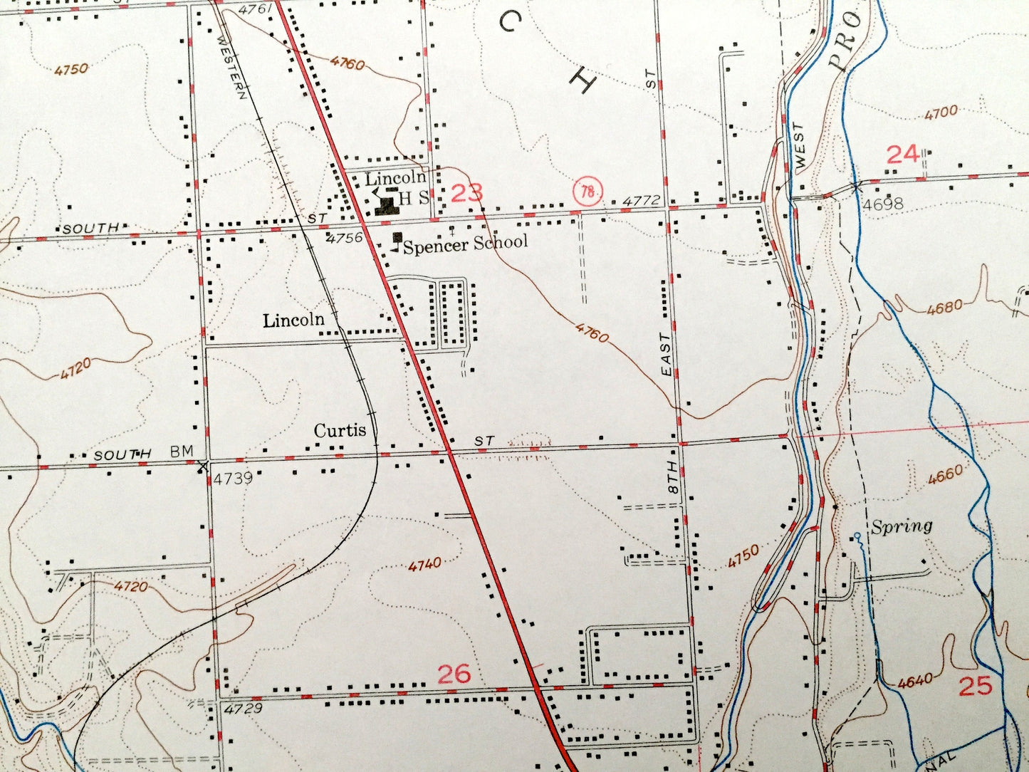
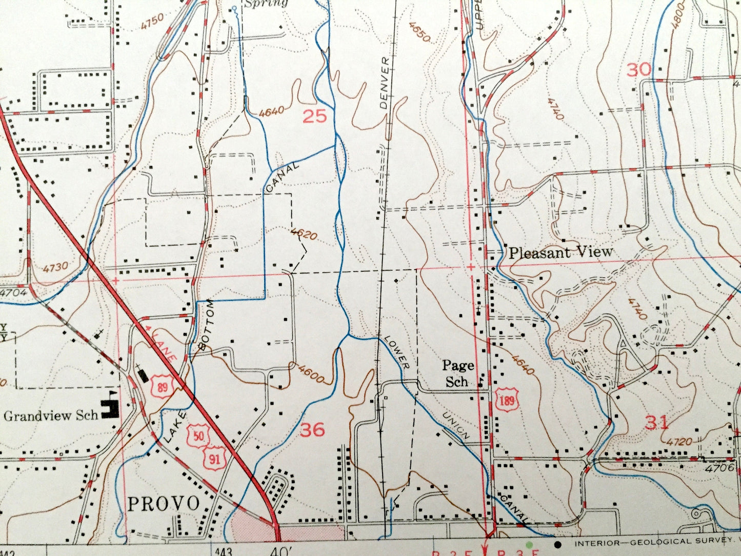
See what Utah looked like over 70 years ago. Lots of intricate details and geological contours. Map even has little squares for every house that existed at the time. The USGS cartographers were very thorough back then!
Perfect for the historian, map-lover, the curious or just as a conversation starter. Wonderful and rare. Vintage maps such as these make great gifts.
Edition of 1948, printed 1965
Dimensions: 22" width x 21" h7ight
----
Features
Cities & Towns: Pleasant Grove, Lindon, Orem, Bunker, Lincoln, Curtis, Provo, Lakeview, Pleasant View, Caryhurst, Olmsted, Christmas City.
Points of Interest: Utah County, Utah Lake, Uinta National Forest, Provo Bench, Wasatch Range, Provo Canyon, Provo River, Big Baldy, Big Provo Cirque and lots more hills, mountains, creeks, towns, roads and train tracks.
Condition: Very Good Vintage condition, commensurate with age. This map is in great shape for being over 55 years old. Has light wear, but this will all add to vintage character when framed.
----
We will happily adjust shipping price for multiple purchases. Maps are rolled up and shipped in sturdy mailing tubes, never folded.
Couldn't load pickup availability
Share