My Store
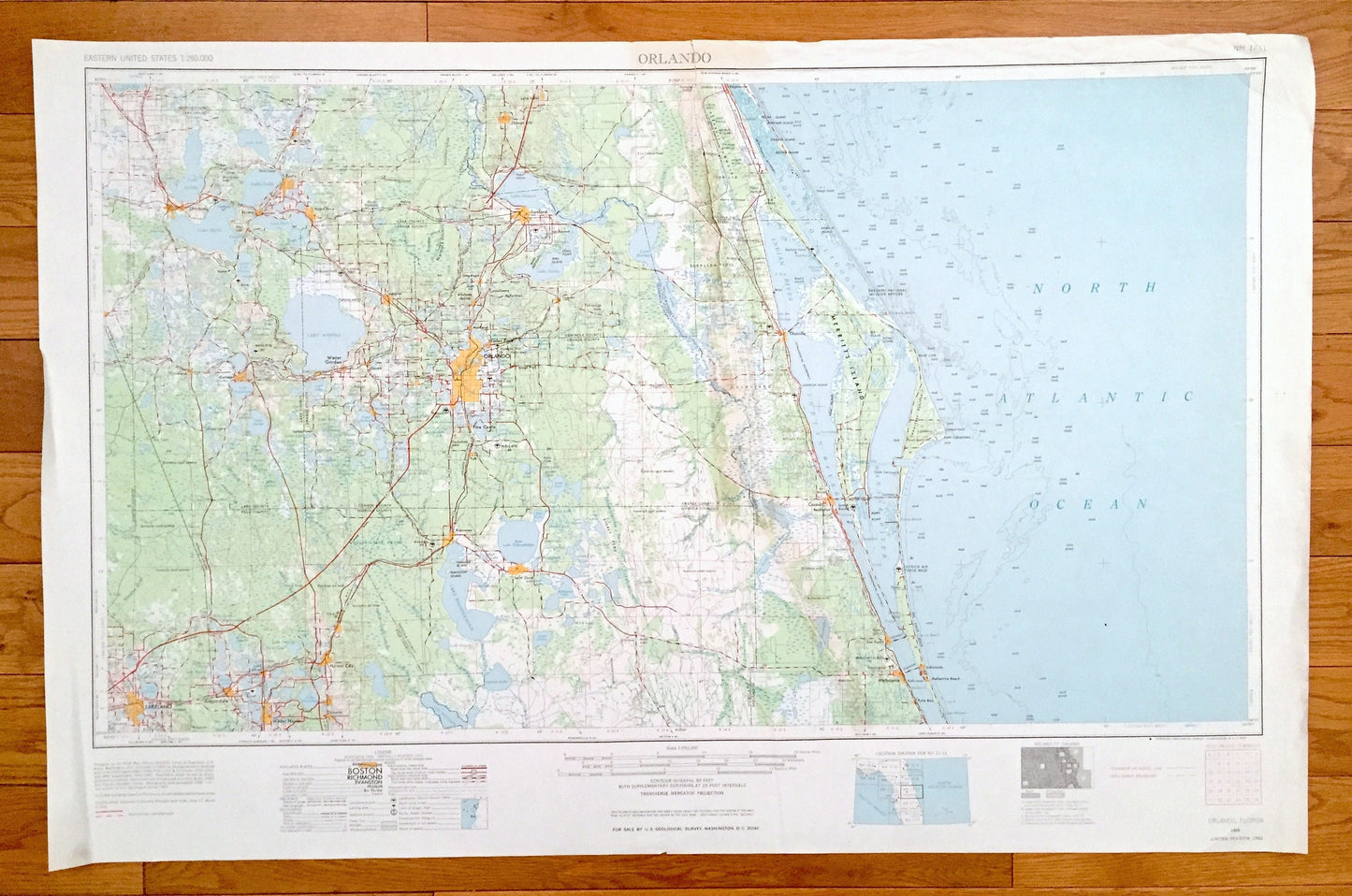
Antique Orlando, Florida 1955 US Geological Survey Topographic Map – Kissimmee, Cape Canaveral, Winter Park, Pine Castle, Lakeland Eustis FL
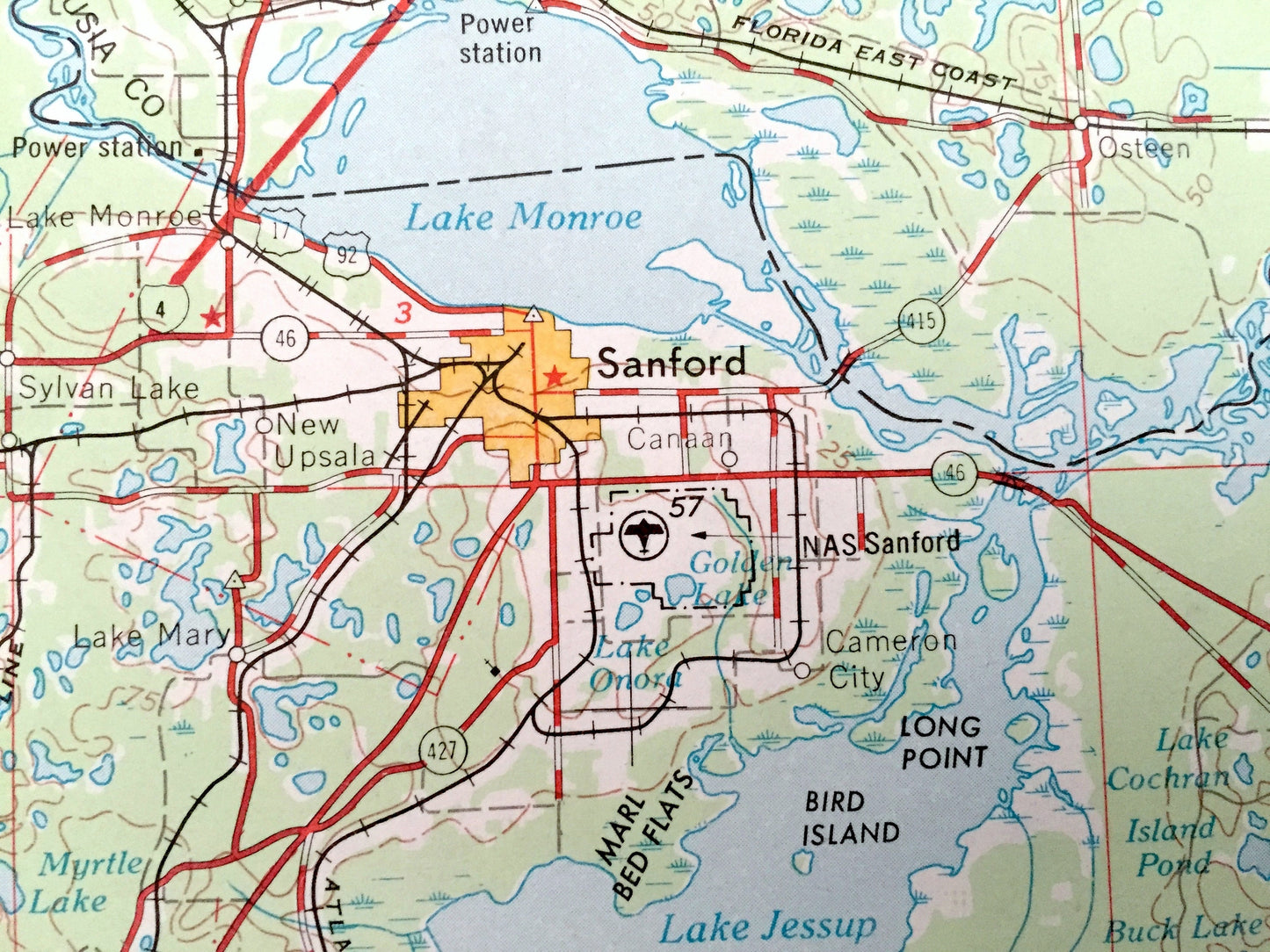
Antique Orlando, Florida 1955 US Geological Survey Topographic Map – Kissimmee, Cape Canaveral, Winter Park, Pine Castle, Lakeland Eustis FL
Beautiful, antique map of Orlando, Florida and surrounding areas. This is an authentic 1955 edition, 1962 print from the U.S. Geological Survey and NOT a computer reproduction.
See what Florida looked like over 65 years ago. Lots of intricate details and geological contours. Map is incredibly large and in the grand 1:250,000 scale. The USGS cartographers were very thorough back then!
Perfect for the historian, map-lover, the curious or just as a conversation starter. Wonderful and rare. Vintage maps such as these make great gifts.
Edition of 1955, printed 1962
Dimensions: 32" width x 22 1/2" height
----
Features
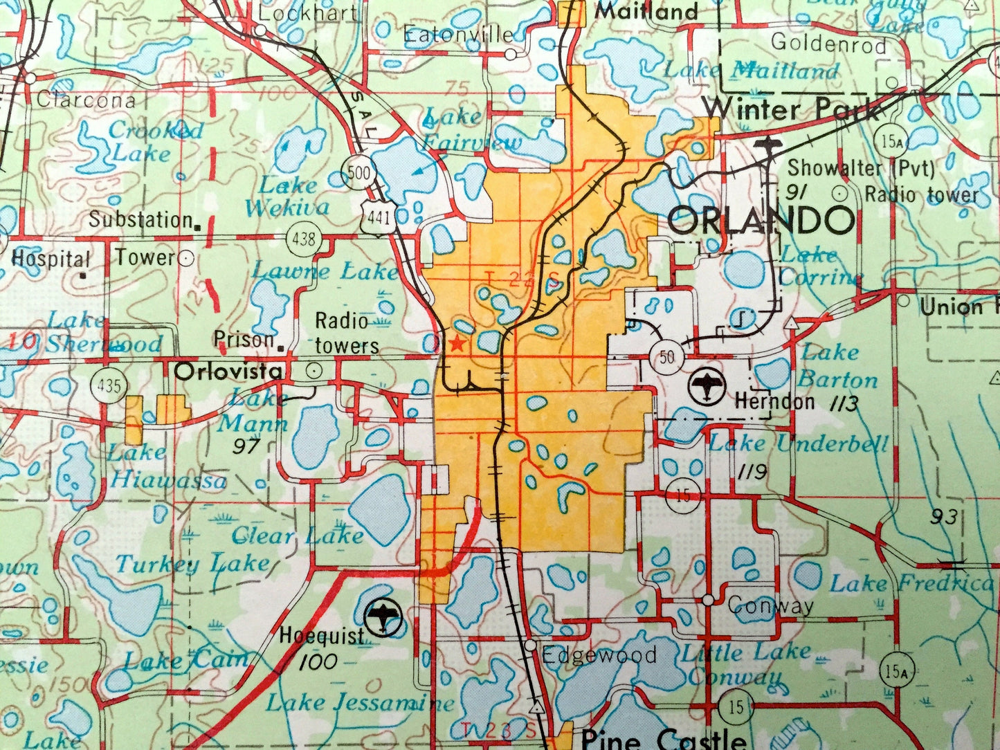
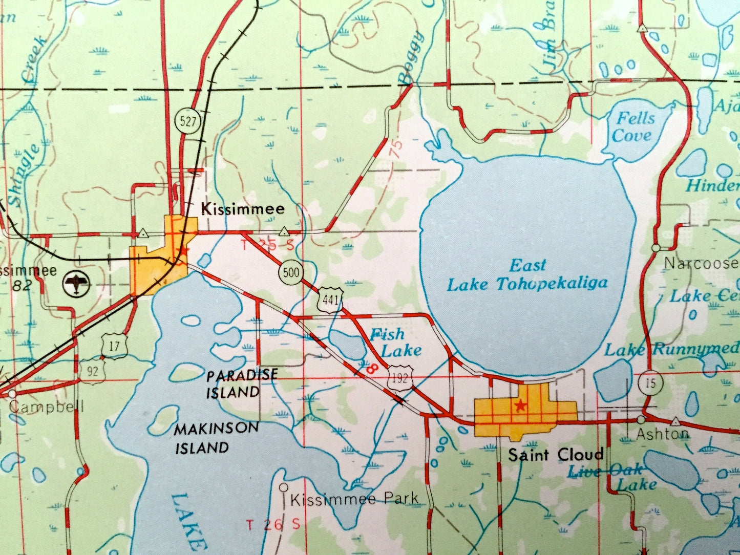
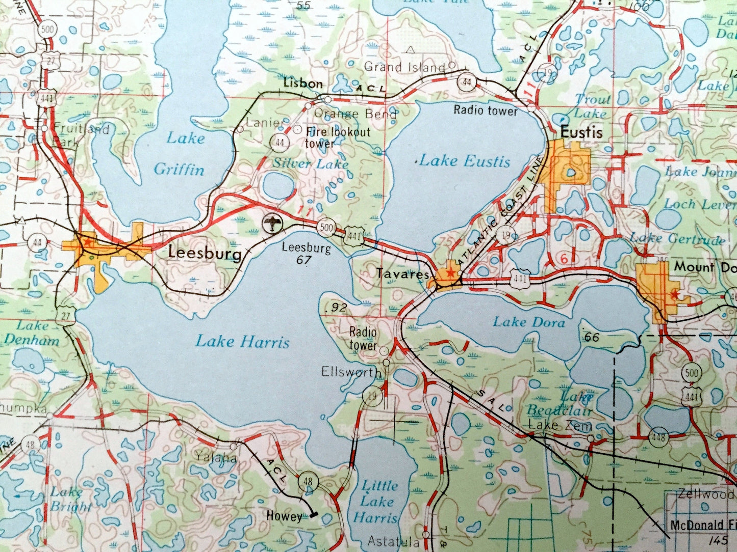
Cities & Towns: Orlando, Winter Garden, Orlovista, Kissimmee, Haines City, Dundee, Winter Haven, Auburndale, Lakeland, Clermont, Groveland, Leesburg, Tavares, Mount Dora, Sanford, Casselberry, Orange City, Lake Helen, Eau Gallie, Melbourne, Palm Bay, Indialantic, Cocoa, Rockledge, Titusville.
Points of Interest: North Atlantic Ocean, Merrits Island, Cape Canaveral, Melbourne Beach, Indian River, Banana River, Lake Jessup, Lake Apopka, Lake Harris, Mosquito Lagoon, Cats Island Swamp, Canaveral Bight, and lots more hills, mountains, lakes, creeks, highways, railroads.
Condition: Good or "Very Vintage" condition, commensurate with age. This map is in great shape for being over 60 years old. Has light edge-wear, toning, and a large tear at the top in the center area, but this will all read as vintage character when framed.
----
We will happily adjust shipping price for multiple purchases. Maps are rolled up and shipped in sturdy mailing tubes, never folded.
Couldn't load pickup availability
Share