My Store
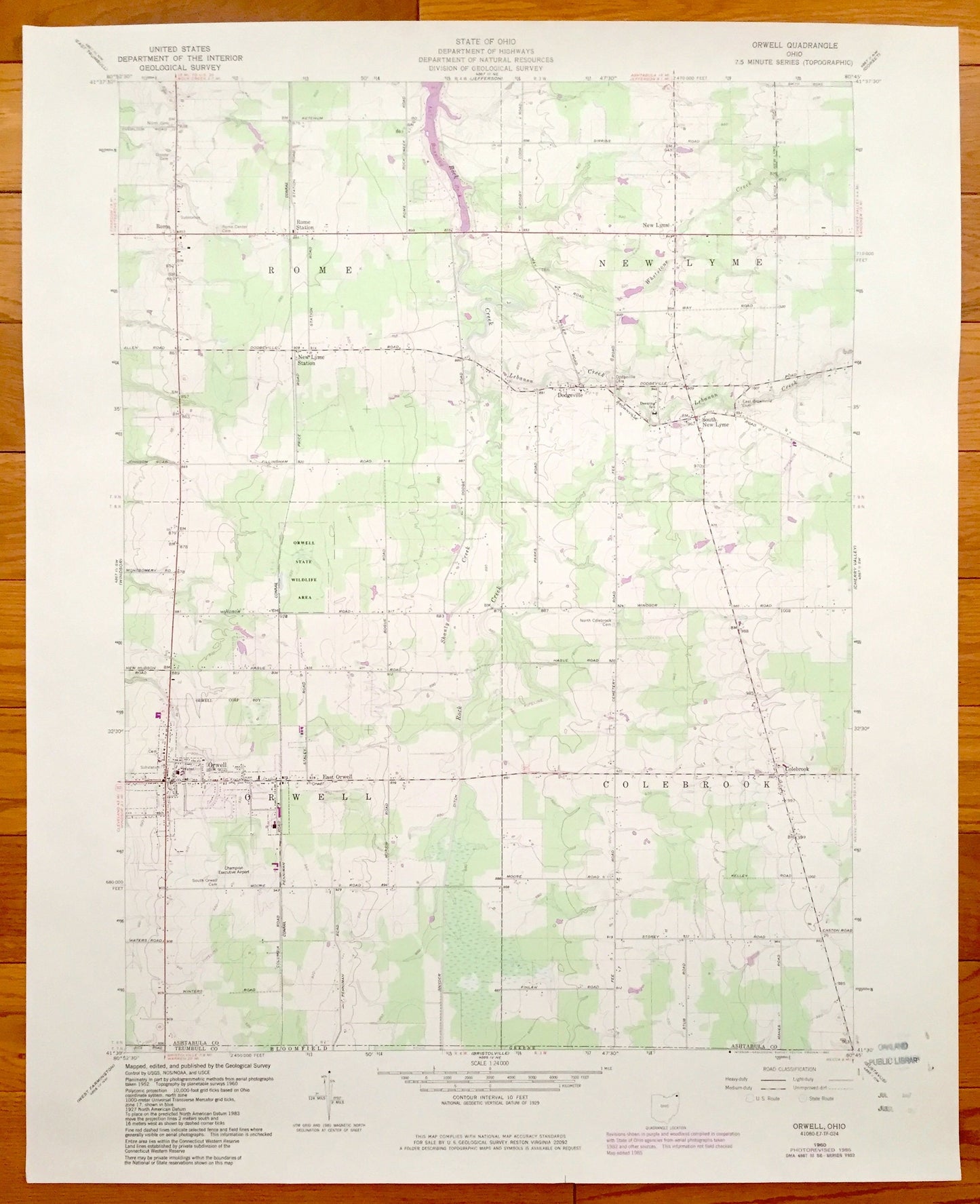
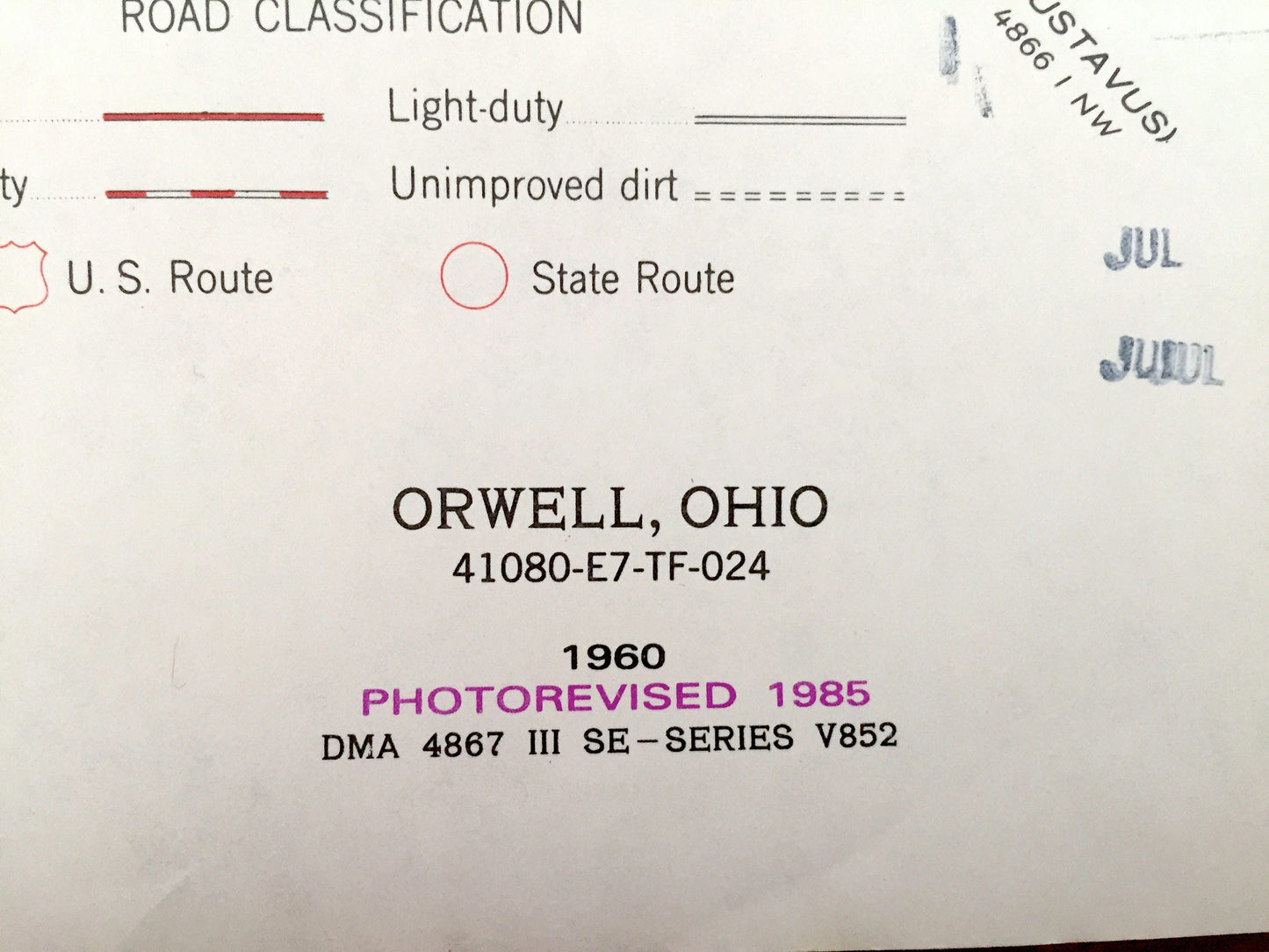
Antique Orwell, Ohio 1960 US Geological Survey Topographic Map – Rome, New Lyme, Colebrook, Dodgeville, South New Lyme, Ashtabula, Trumbull
Antique Orwell, Ohio 1960 US Geological Survey Topographic Map – Rome, New Lyme, Colebrook, Dodgeville, South New Lyme, Ashtabula, Trumbull
Beautiful, antique map of Orwell,Rome, New Lyme, Colebrook, Orwell, Dodgeville, South New Lyme, and East Orwell, Ohio. This is an authentic 1985 print of 1960 survey data from the U.S. Geological Survey and NOT a computer reproduction.
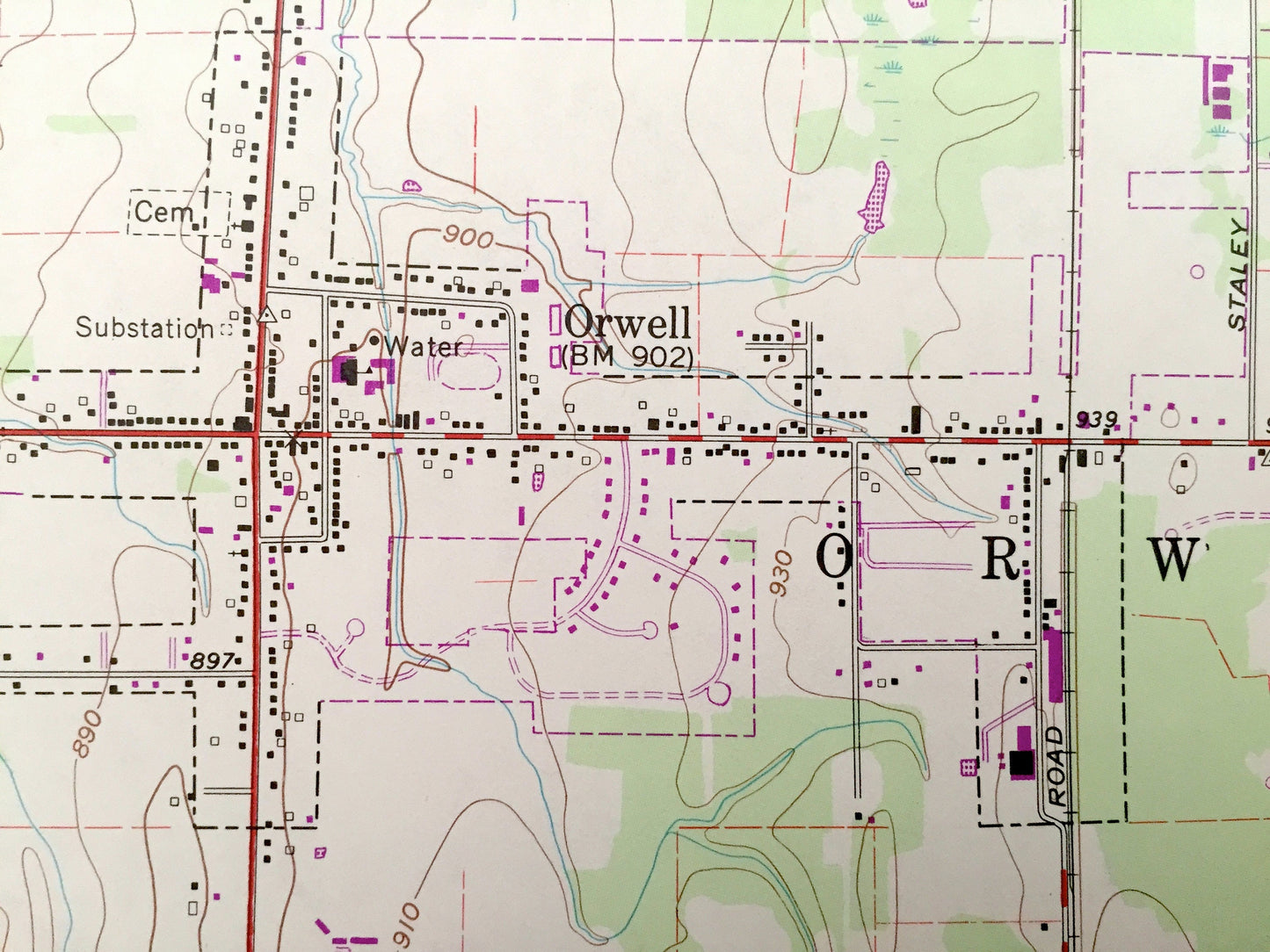
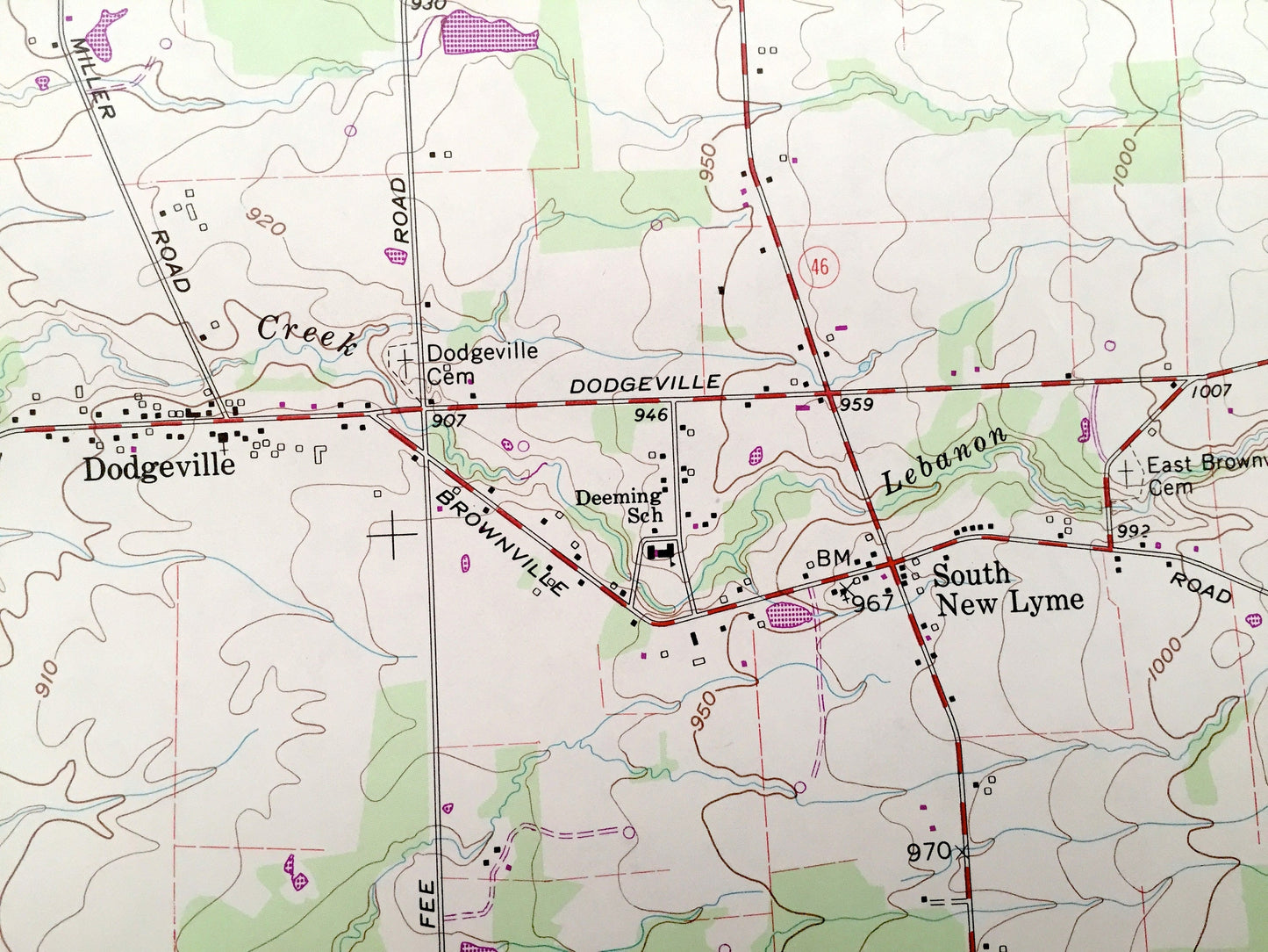
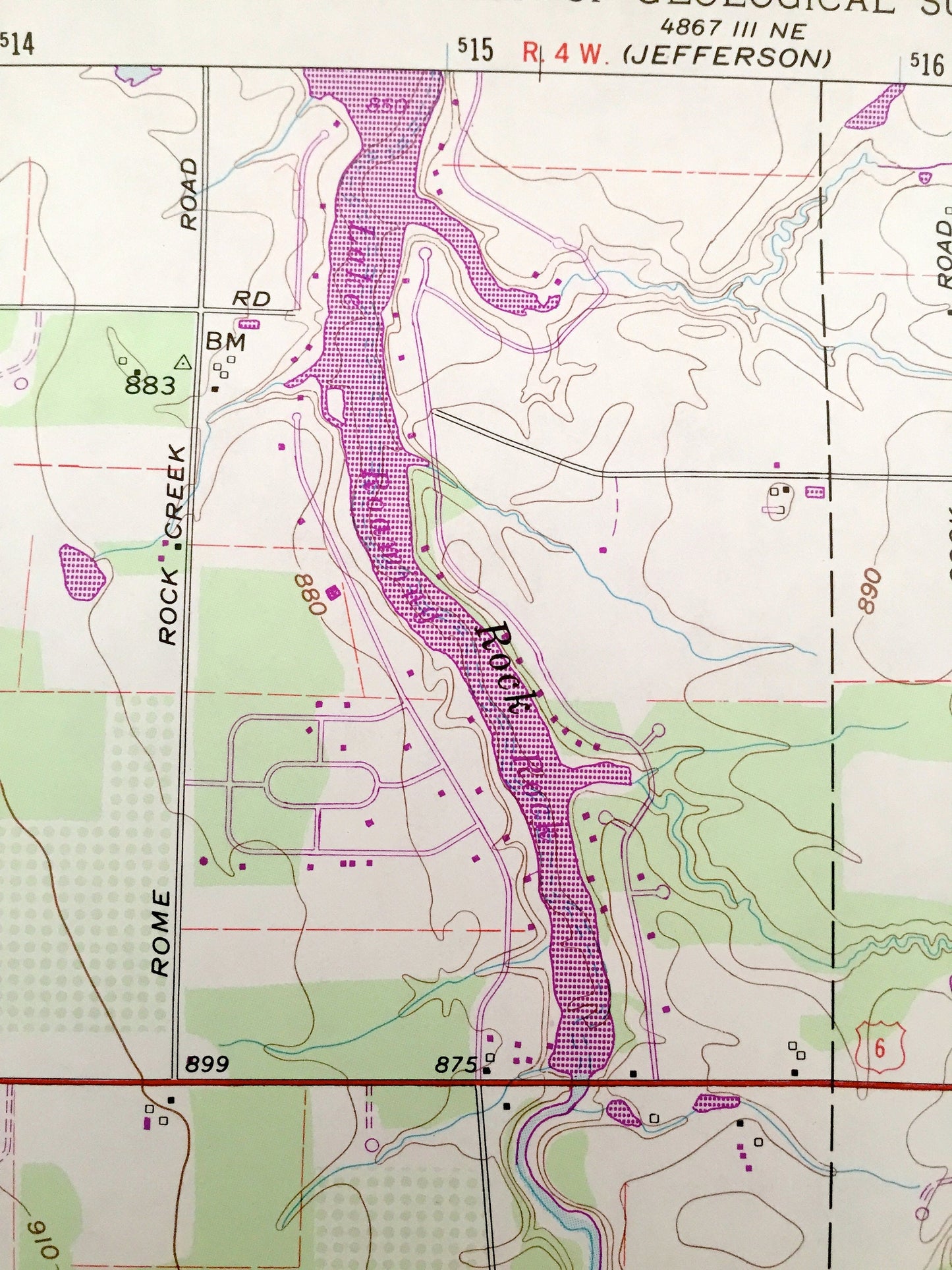
See what Ashtabula and Trumbull Counties of Ohio looked like over 55 years ago. Lots of intricate details and geological contours. Map even has little squares for every house that existed at the time. The USGS cartographers were very thorough back then!
Perfect for the historian, map-lover, the curious or just as a conversation starter. Wonderful and rare. Vintage maps such as this make great gifts.
Edition of 1960, printed 1985
Dimensions: 22" width x 27" height
----
Features
Cities & Towns: Orwell, Rome, New Lyme, Colebrook, Orwell, Dodgeville, South New Lyme, East Orwell.
Points of Interest: Champion Executive Airport, Orwell State Wildlife Area, Rome Station, Conrail, and many more roads, streams, houses, and rivers.
Condition: Very Good condition, commensurate with age. This map is in incredible shape for being almost 30 years old.
----
We will happily adjust shipping price for multiple purchases. Maps are rolled up and shipped in sturdy mailing tubes, never folded.
Couldn't load pickup availability
Share