My Store
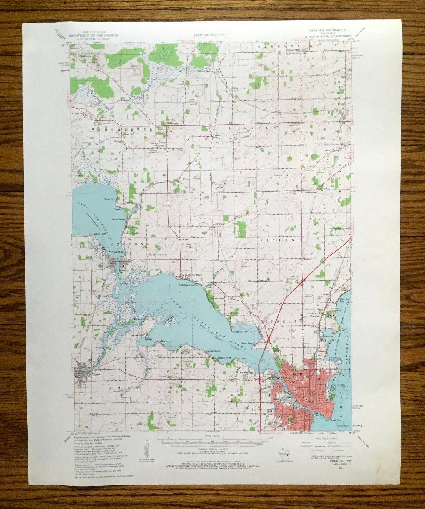
Antique Oshkosh, Wisconsin 1961 US Geological Survey Topographic Map – Winnebago County, Lake Winneconne, Omro, Butte Des Mortes, Larsen, WI
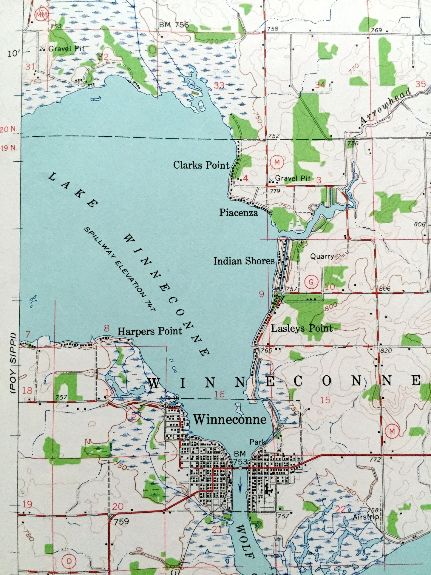
Antique Oshkosh, Wisconsin 1961 US Geological Survey Topographic Map – Winnebago County, Lake Winneconne, Omro, Butte Des Mortes, Larsen, WI
Beautiful, antique map of Oshkosh, Wisconsin and surrounding Winnebago County area. This is an authentic 1961 edition, 1963 print from the U.S. Geological Survey and NOT a computer reproduction.
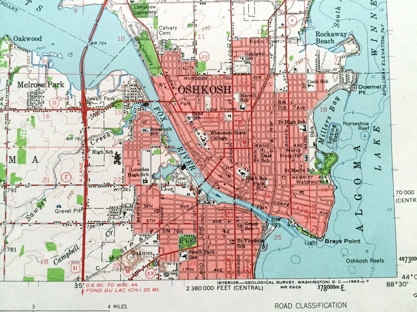
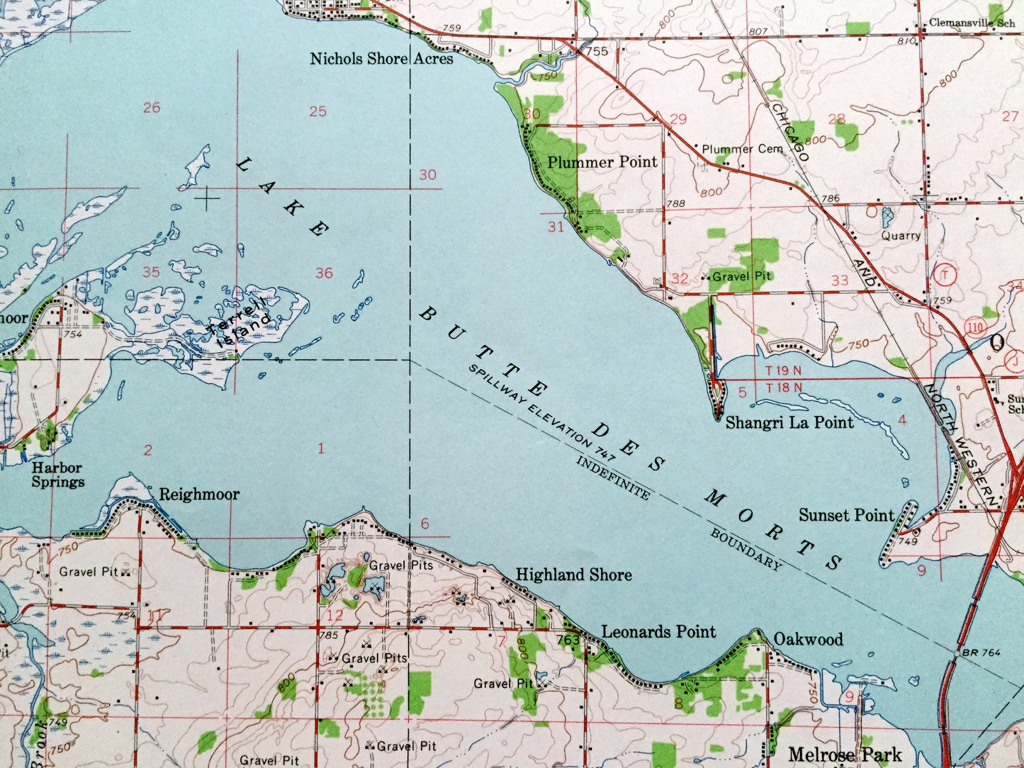
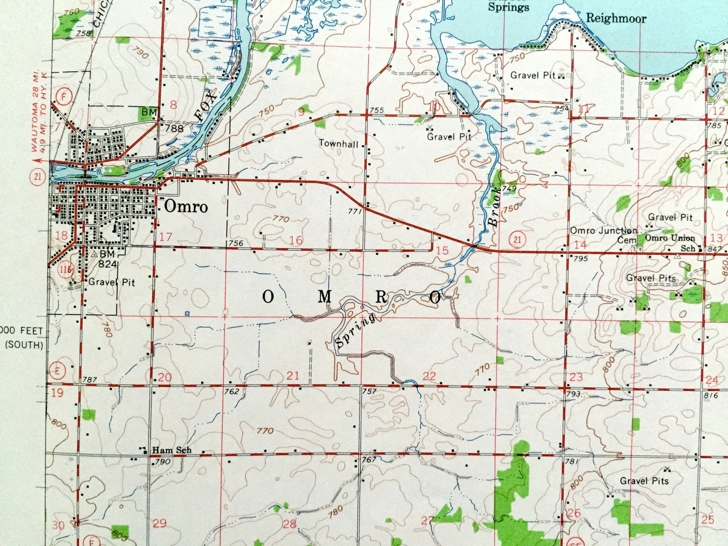
See what Wisconsin looked like more than 60 years ago. Lots of intricate details and geological contours. Map even has little squares for every house that existed at the time. The USGS cartographers were very thorough back then!
Perfect for the historian, map-lover, the curious or just as a conversation starter. Wonderful and rare. Maps such as these make great gifts.
Edition of 1961, printed 1963
Dimensions: 17" width x 21" height
----
Features
Cities & Towns: Oshkosh, Winchester, Greenville, Clayton, Menasha, Neenah, Winneconne, Vinland, Algoma, Larsen, Clarks Point, Harpers Point, Indian Shores, Butte des Morts, Omro, Harbor Springs, Reighmoor, Highland Shore, Melrose Park, Oakwood, Sunset Point, Shangri La Point, Island Beach, Fairview Beach, Allenville, Rockaway Beach, Keenville, Rivermoor.
Points of Interest: Winnebago County, Outagamie County, Lake Winneconne, Lake Butte des Morts, Lake Winnebago, Fox River, Rat River, Valley Airways Airport, and lots more hills, creeks, towns, schools, churches, roads and train tracks.
Condition: Very Good Vintage condition, commensurate with age. This map is in great shape for being 60 years old. Light wear, but this will add to vintage character when framed.
----
We will happily adjust shipping price for multiple purchases. Map will be shipped folded to preserve integrity.
Couldn't load pickup availability
Share