My Store
Antique Ouray, Colorado 1907 Rock Formation Photographs – US Geological Survey – Uncompahgre National Forest, Gunnison, Hinsdale County, CO
Antique Ouray, Colorado 1907 Rock Formation Photographs – US Geological Survey – Uncompahgre National Forest, Gunnison, Hinsdale County, CO
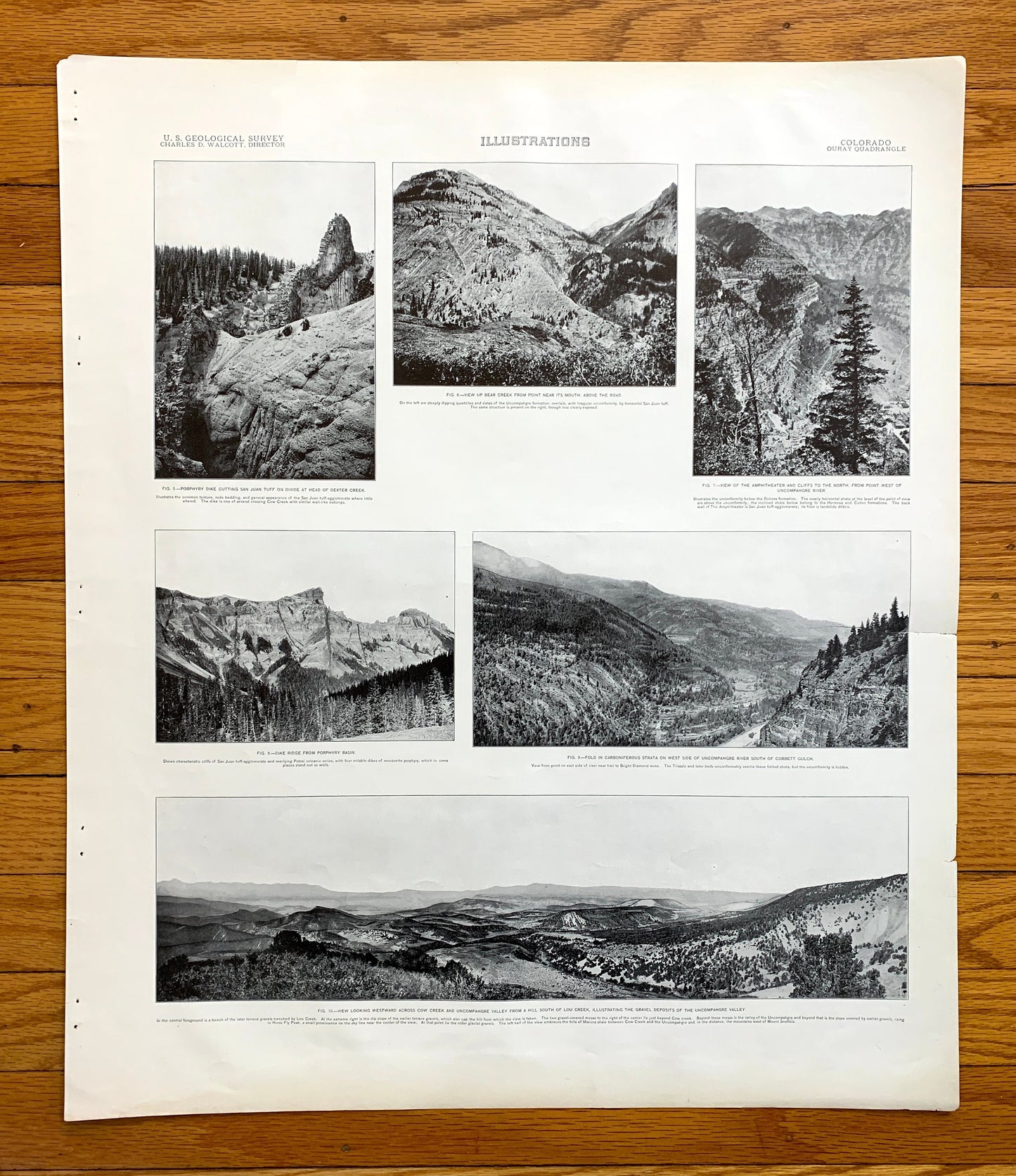
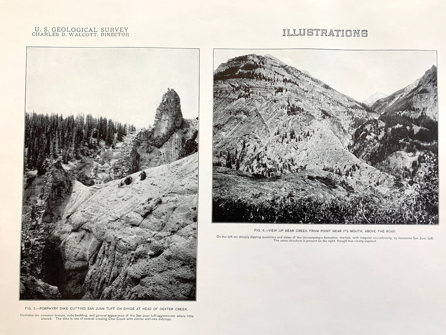
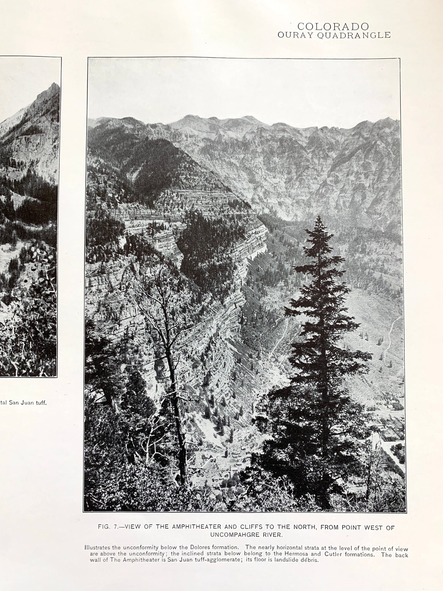
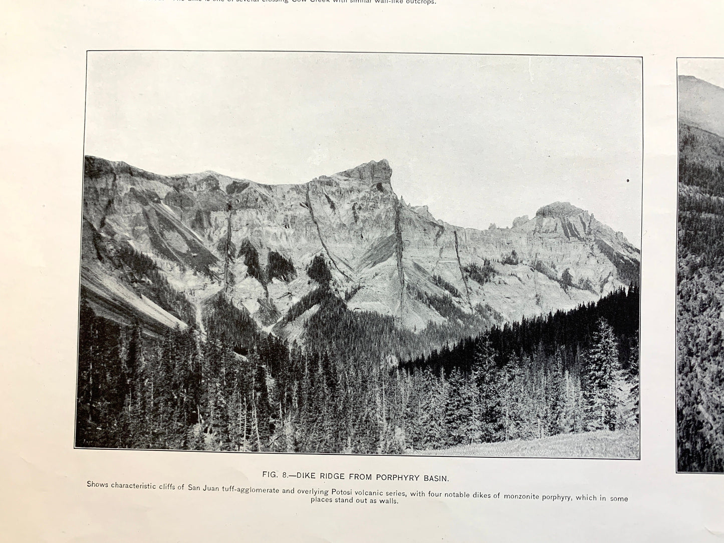
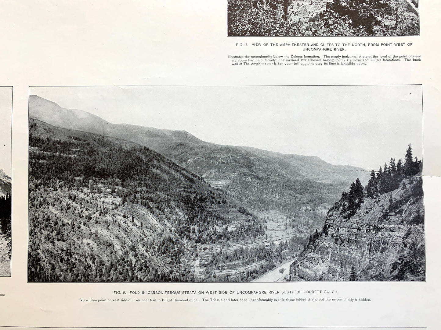
Beautiful, antique plate of photographs of various rock formations of the Ouray, Colorado and surrounding Ouray, Gunnison and Hinsdale County area, including Uncompahgre National Forest. This is an authentic 1907 edition, 1907 print from the U.S. Geological Survey and NOT a computer reprint. It is from a Geologic Atlas folio.
See what Colorado looked like over 120 years ago. Lots of intricate details and geological contours.
Perfect for the historian, map-lover, the curious or just as a conversation starter. Wonderful and rare. Vintage prints such as these make great gifts.
Edition of 1907, printed 1907
Dimensions: 18 1/2" width x 22" height
----
Features
Towns: Ouray, Dallas, Jackson, Portland, Bachelor Switch, Ash.
Points of Interest: Ouray County, Gunnison County, Hinsdale County, Uncompahgre River, Cow Creek, Cimarron Creek, Uncompahgre National Forest, Turret Ridge, Park Mesa, Pinnacle Ridge, Dike Ridge, Blackwall Mountain, Cimarron Ridge, Chimney Peak, Courthouse Mountain, Wetterhorn Peak, Cascade Mountain, Wildhorse Peak, American Flat, Baldy Peak, Horsethief Trail and many more smaller lakes, creeks, houses, schools, roads, churches and train tracks.
Condition: Very Good Vintage condition, commensurate with age. This print is in great shape for being almost 120 years old. Some light wear and staple holes in the margin, and small tear on the right edge as seen in the photos, but this will be hidden when framed.
----
We will happily adjust shipping price for multiple purchases. Prints are rolled up and shipped in sturdy mailing tubes, never folded.
Couldn't load pickup availability
Share