My Store
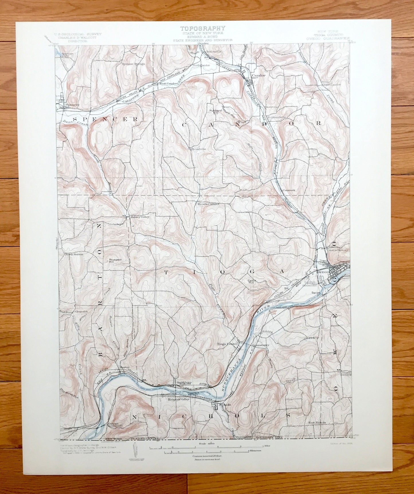
Antique Owego, New York 1903 US Geological Survey Topographic Map – Tioga County, Spencer, Candor, Catatonk, Barton, Nichols, Susquehanna NY
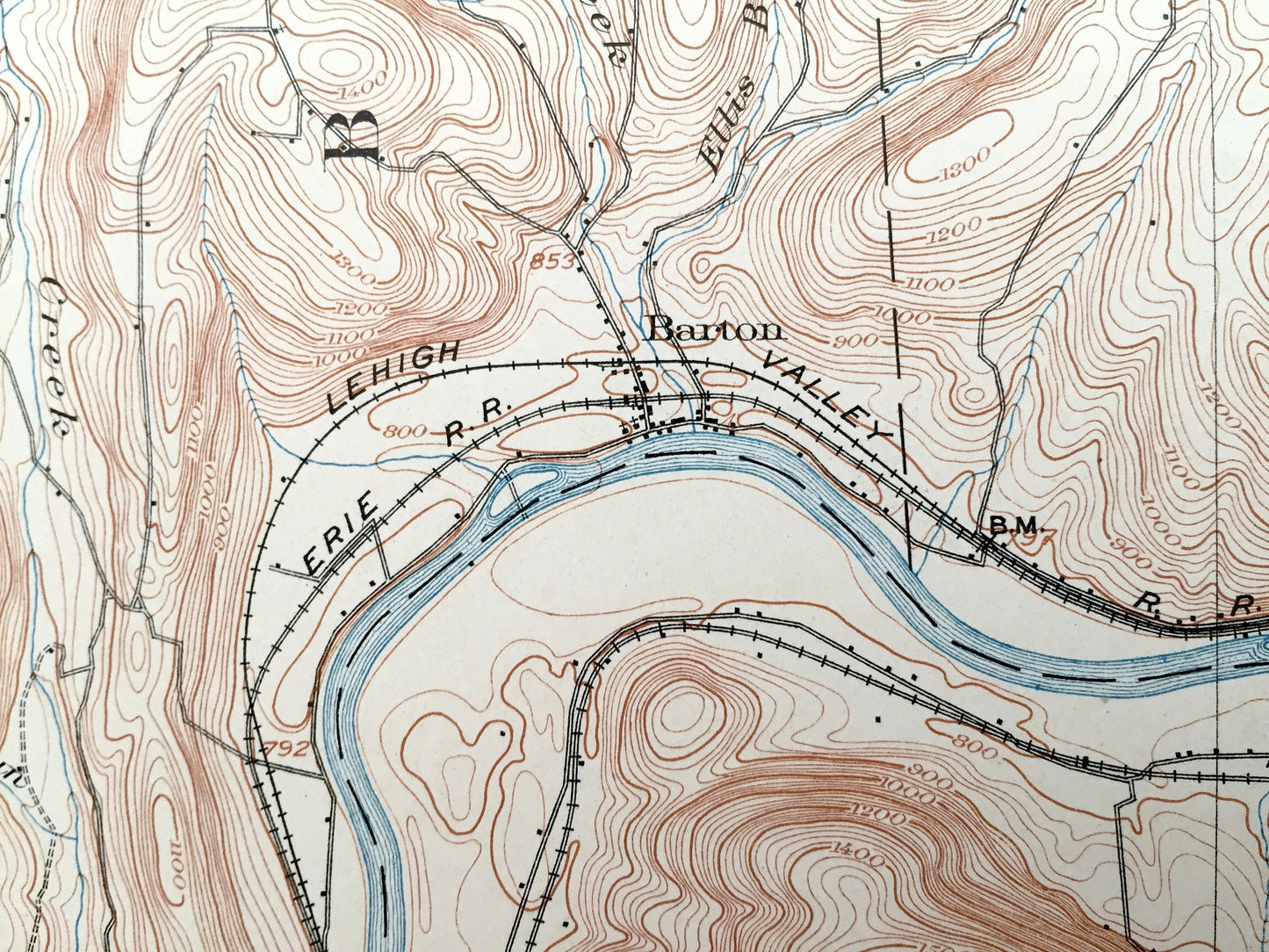
Antique Owego, New York 1903 US Geological Survey Topographic Map – Tioga County, Spencer, Candor, Catatonk, Barton, Nichols, Susquehanna NY
Beautiful, antique map of Owego, New York and surrounding Tioga County area. This is an authentic 1903 print from the U.S. Geological Survey and NOT a computer reproduction.
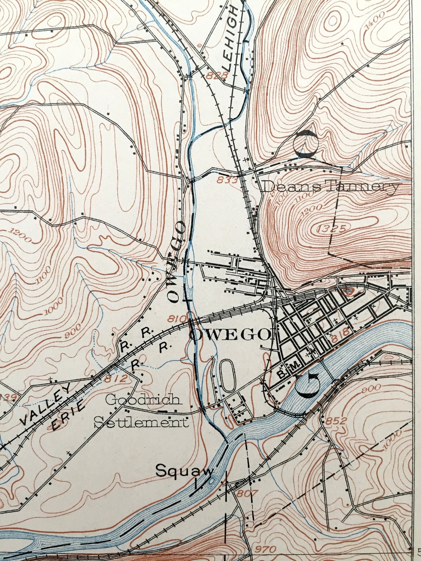
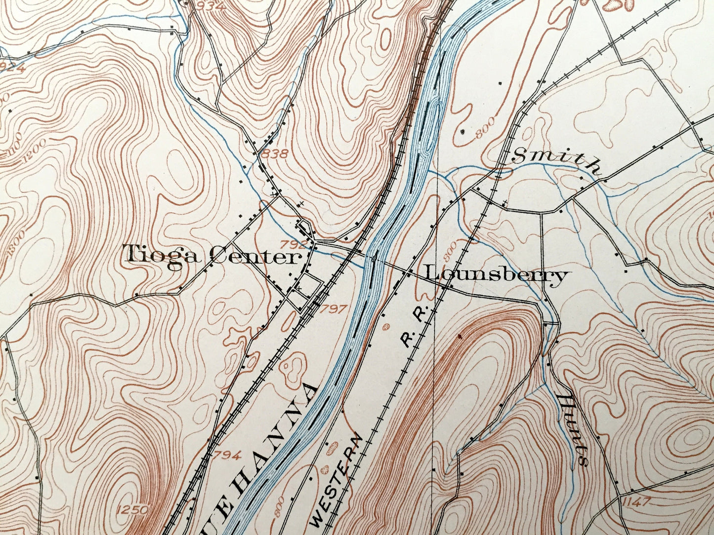
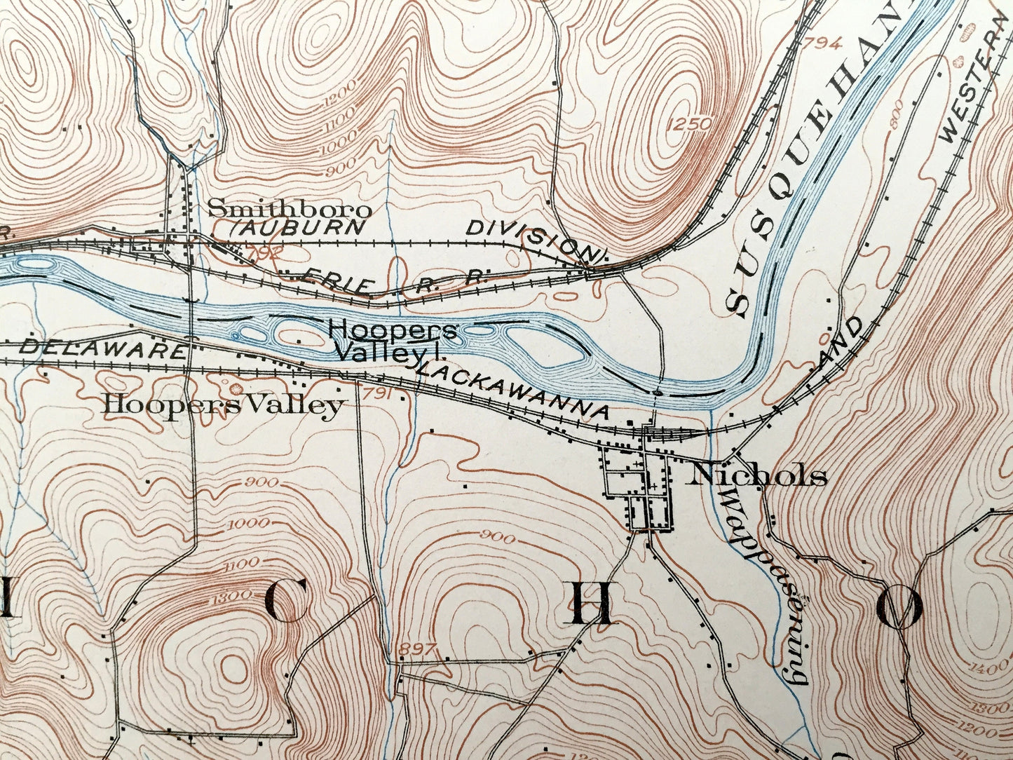
See what New York looked like over 115 years ago. Lots of intricate details and geological contours. Map even has little squares for every house that existed at the time. The USGS cartographers were very thorough back then! On the back is a description of topographic symbols and map guide.
Perfect for the historian, map-lover, the curious or just as a conversation starter. Wonderful and rare. Vintage maps such as these make great gifts.
Edition of 1903, printed 1903
Dimensions: 16 1/2" width x 20" height
----
Features
Cities & Towns: Owego, Spencer, Candor, Barton, Tioga, Nichols, Spencer Springs, Gridleyville, Hubbardsville, Catatonk, Halsey Valley, Deans Tannery, Goodrich Settlement, Glenairn, Osborn, Litchfield, Smithboro, Hoopers Valley, Tioga Center, Lounsberry, Rhoadville.
Points of Interest: Tioga County, Susquehanna River, Catatonk Creek, Owego Creek, Hubbard Hill, Pipe Creek, Dean Creek, and many more towns, ponds, hills, mountains, creeks, hollows, houses, and roads.
Condition: Very Good condition, commensurate with age. This map is in incredible shape for being over 115 years old. An exceedingly well-preserved print.
----
We will happily adjust shipping price for multiple purchases. Maps are rolled up and shipped in sturdy mailing tubes, never folded.
Couldn't load pickup availability
Share