My Store
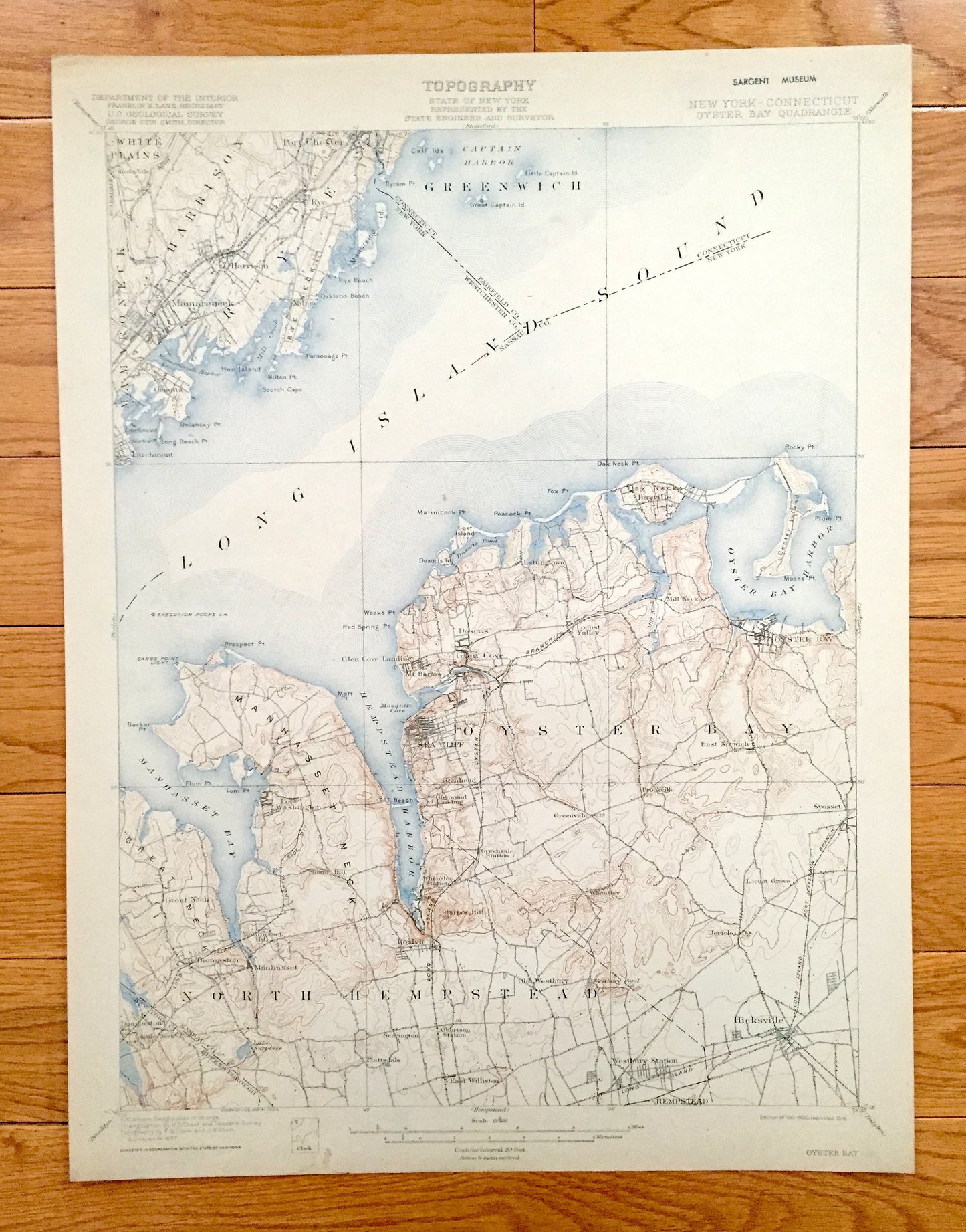
Antique Oyster Bay, New York 1900 US Geological Survey Topographic Map – Hempstead, Sea Cliff, Westchester, Long Island, Bayville, Rye, NY
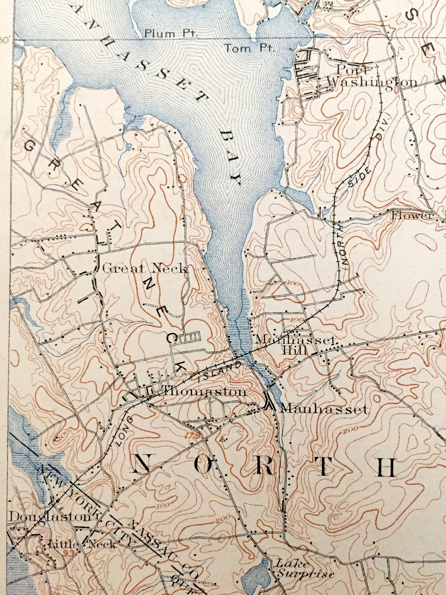
Antique Oyster Bay, New York 1900 US Geological Survey Topographic Map – Hempstead, Sea Cliff, Westchester, Long Island, Bayville, Rye, NY
Beautiful, antique map of Oyster Bay, North Hempstead, Mamaroneck & Harrison, New York. This is an authentic 1900 edition, 1918 print from the U.S. Geological Survey and is NOT a computer reproduction.
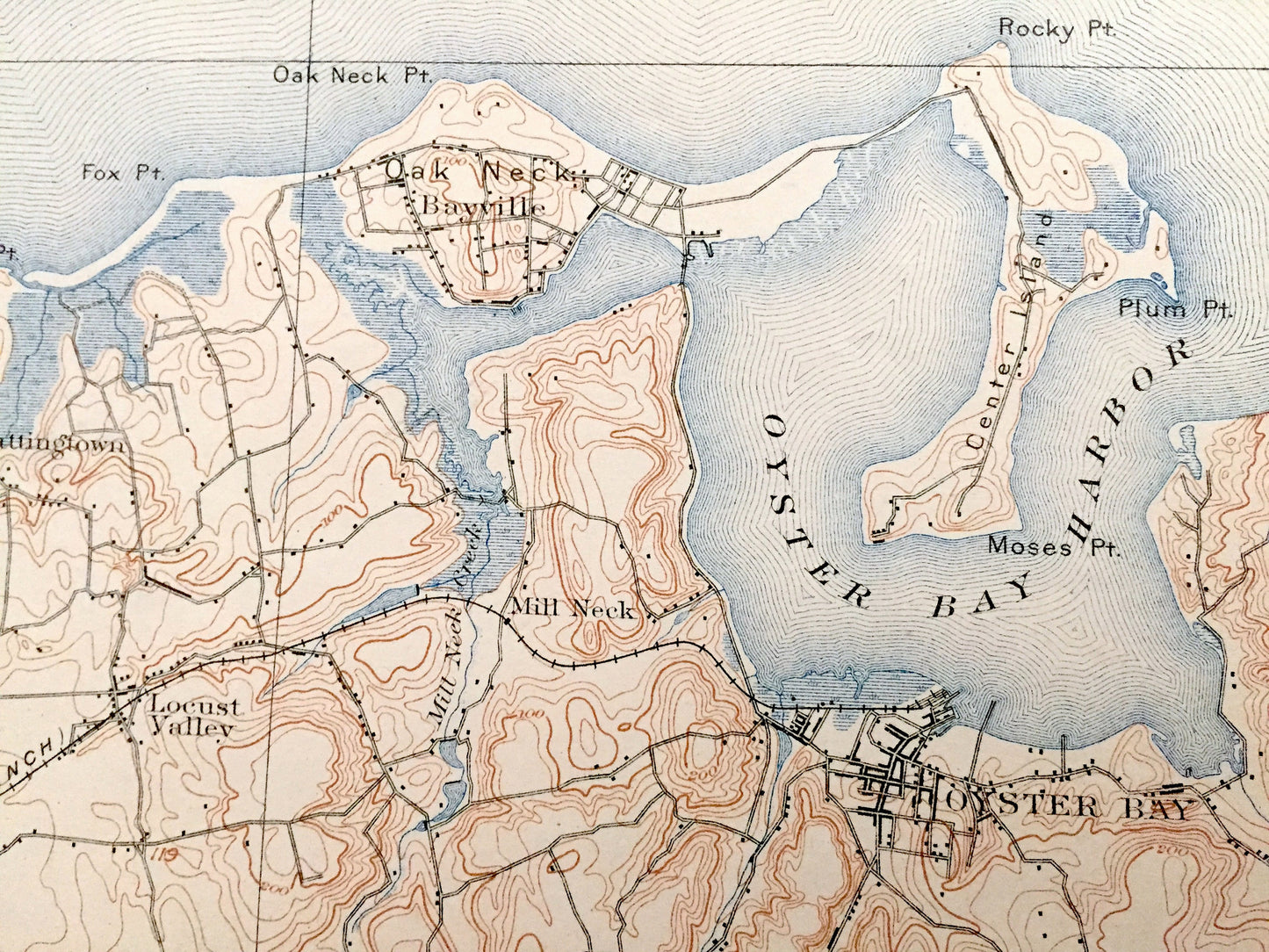
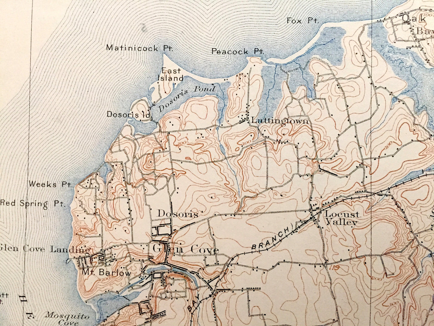
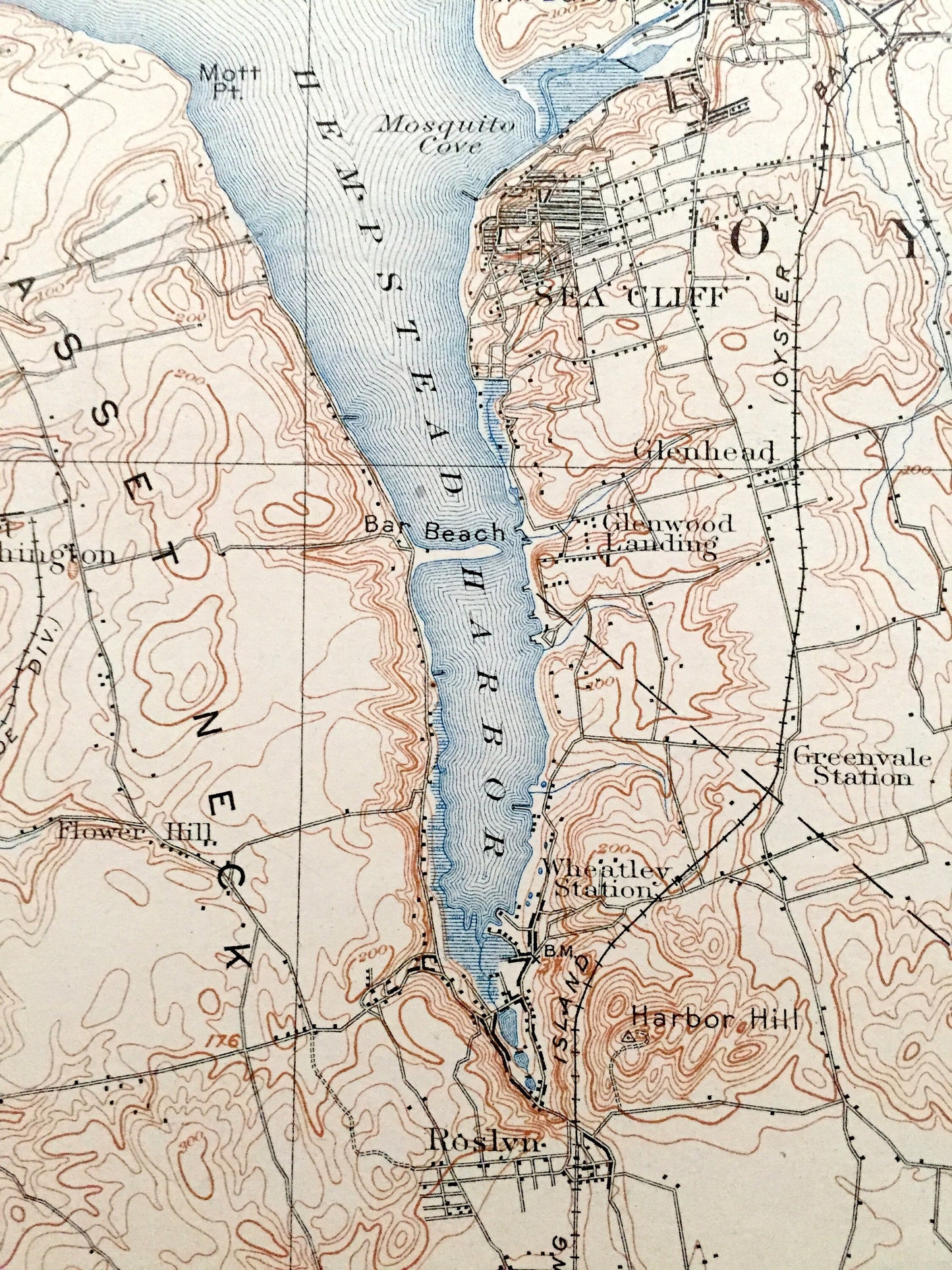
See what Long Island looked like over 120 years ago, before a lot of the land was developed. Lots of intricate details and geological contours. Map even has little squares for every house that existed at the time. The USGS cartographers were very thorough back then! On the back is a description of topographic symbols and map guide.
Perfect for the historian, map-lover, the curious or just as a conversation starter. Wonderful and rare. Vintage maps such as these make great gifts.
Edition of 1900, printed 1918
Dimensions: 15" width x 20" height
----
Features
Cities & Towns: NEW YORK: New York City, Queens, North Hempstead, Oyster Bay, Hempstead, Mamaroneck, White Plains, Harrison, Scarsdale, Rosedale, Larchmont, Orienta, Milton, Port Chester, Rye, Glen Cove Landing, Sea Cliff, Glenhead, Dosoris, Glen Cove, Locust Valley, Lattingtown, Bayville, Mill Neck, East Norwich, Port Washington, Great Neck, Manhasset Hill, Thomaston, Manhasset, Douglaston, Little Neck, Glenwood Landing, Wheatly Station, Roslyn, Plattsdale, Searington, East Williston, Greenvale, Old Westbury, Brookville, Syosset, Jericho, Locust Grove, Westbury Station, Hicksville, Flower Hill.
CONNECTICUT: Greenwich.
Points of Interest: Long Island Sound, Manhasset Bay, Hempstead Harbor, Oyster Bay Harbor, Nassau County, Westchester County, Queens Borough, Great Neck, Manhasset Neck, Scotch Caps, Oakland Beach, Manursing Island, Captain Harbor, Fairfield County, Barker Point, Matinicock Point, Dosoris Island, Centre Island, Rocky Point, Mosquito Cove, Bar Beach, Lake Surprise, Mill Neck Creek, Long Island Railroad, and lots more creeks, train tracks and roads.
Condition: Good Vintage condition, commensurate with age. This map is in great shape for being over 100 years old. Some edge-wear, foxing, toning and museum stamp in margin, but this will add to vintage character when framed.
----
We will happily adjust shipping price for multiple purchases. Maps are rolled up and shipped in sturdy mailing tubes, never folded.
Couldn't load pickup availability
Share