My Store
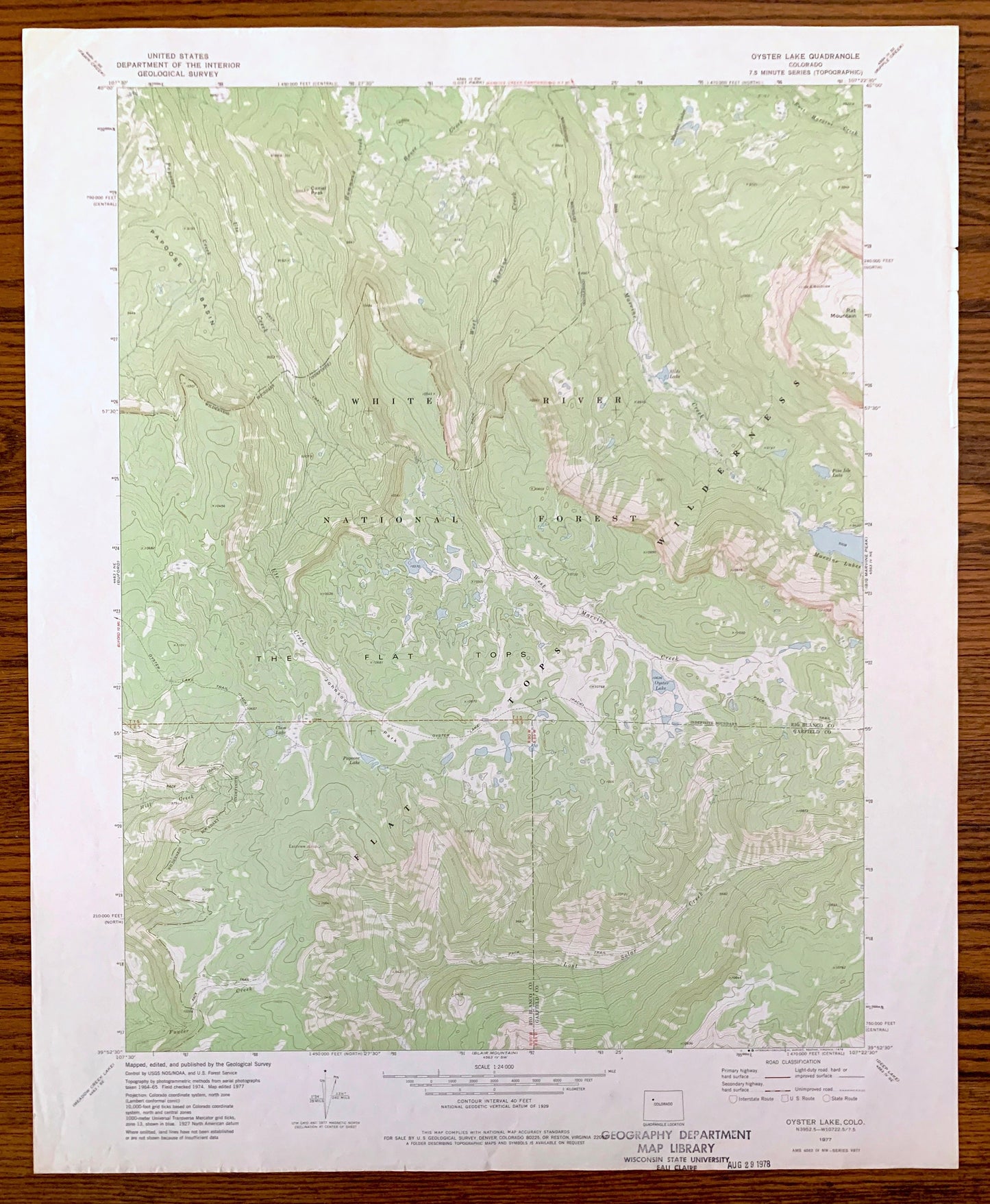
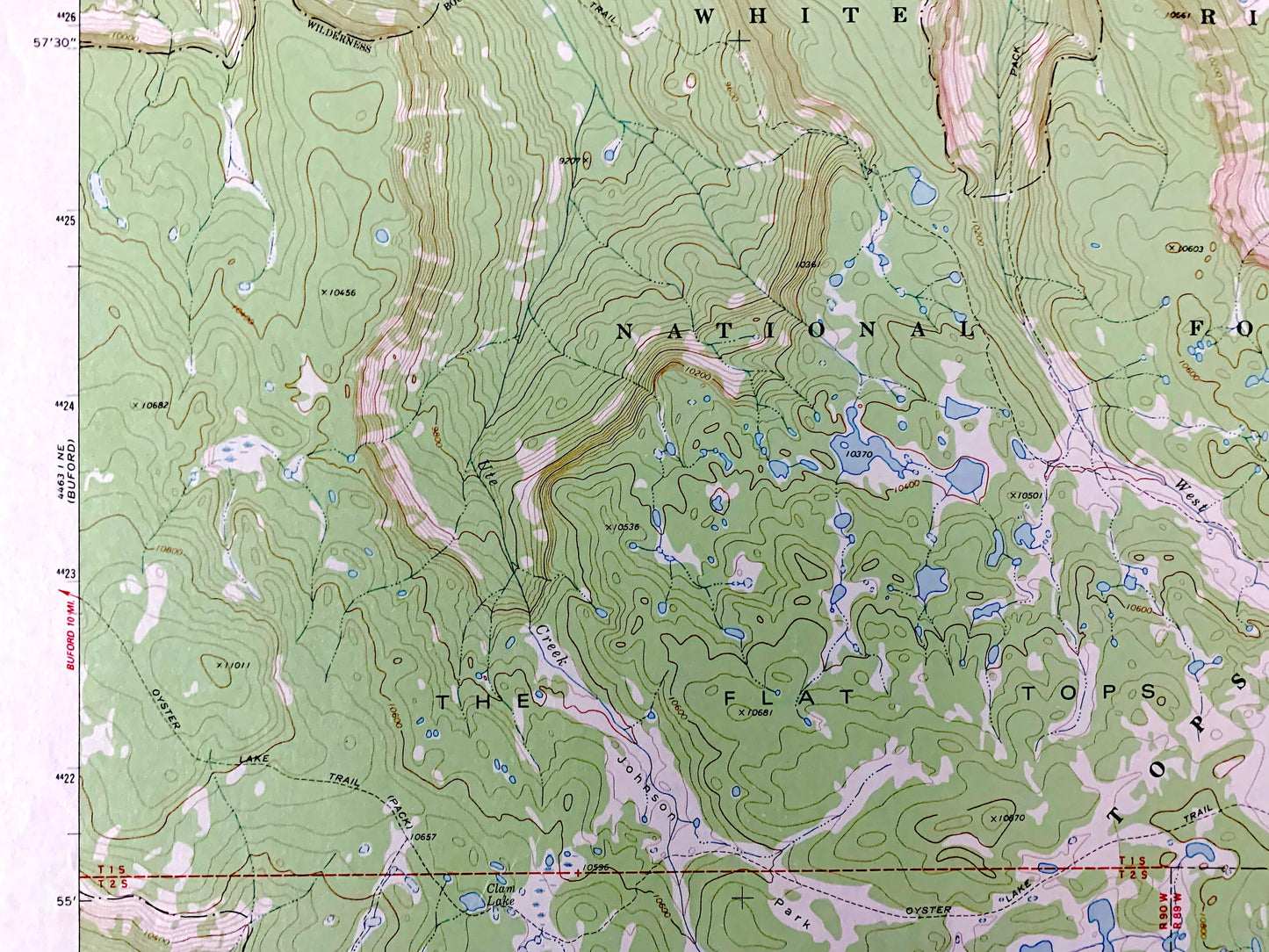
Antique Oyster Lake, Colorado 1977 US Geological Survey Topographic Map – Rio Blanco, Garfield County, White River National Forest, CO
Antique Oyster Lake, Colorado 1977 US Geological Survey Topographic Map – Rio Blanco, Garfield County, White River National Forest, CO
Beautiful, antique map of Oyster Lake, Colorado and surrounding Rio Blanco County and Garfield County areas. This is an authentic 1977 edition, 1978 print from the U.S. Geological Survey and NOT a computer reproduction.
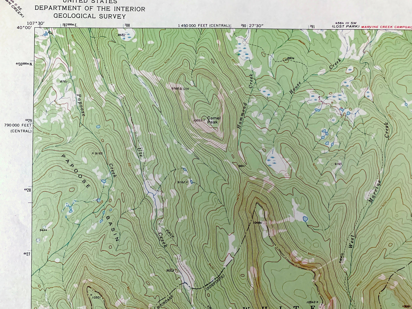
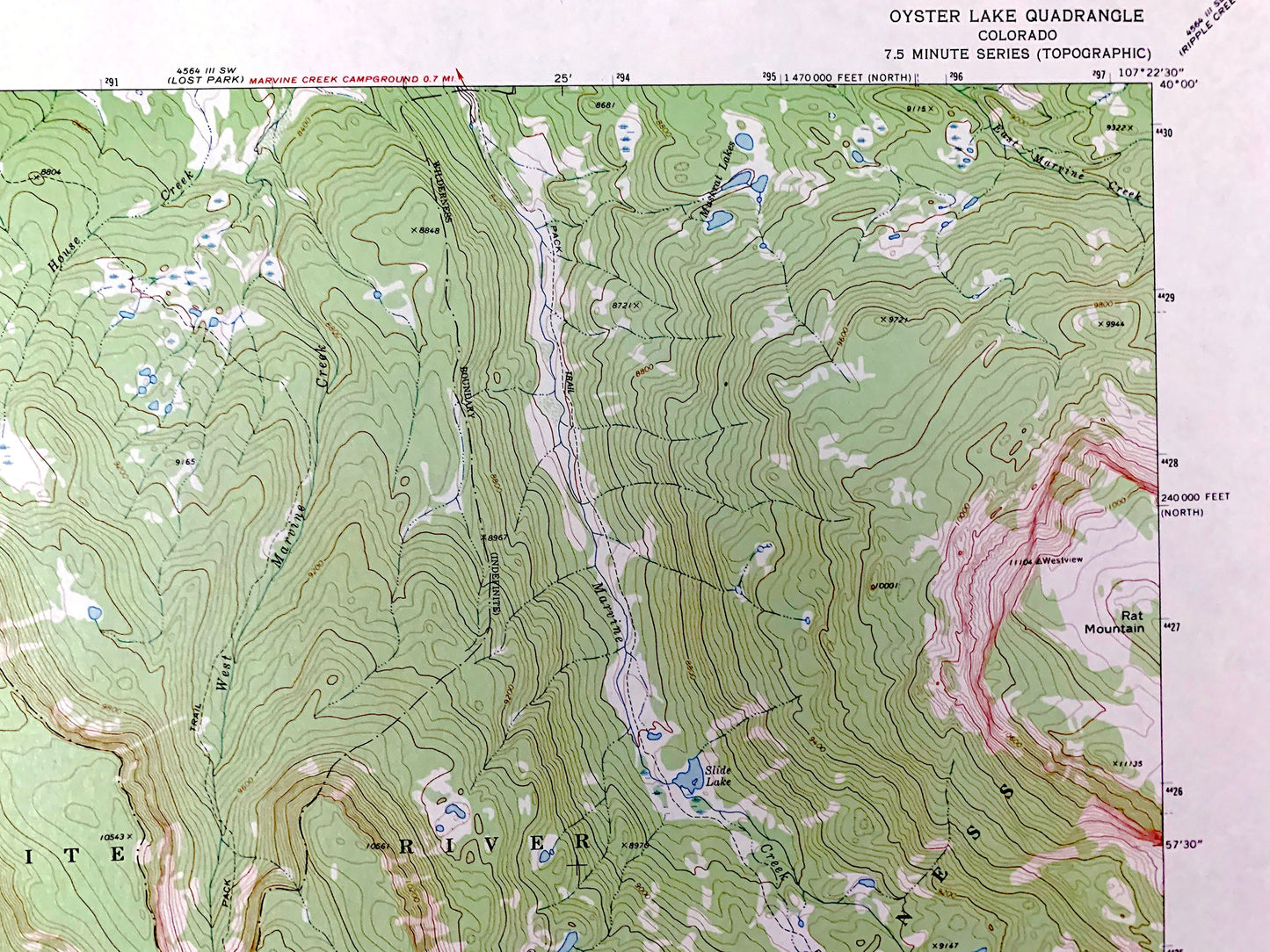
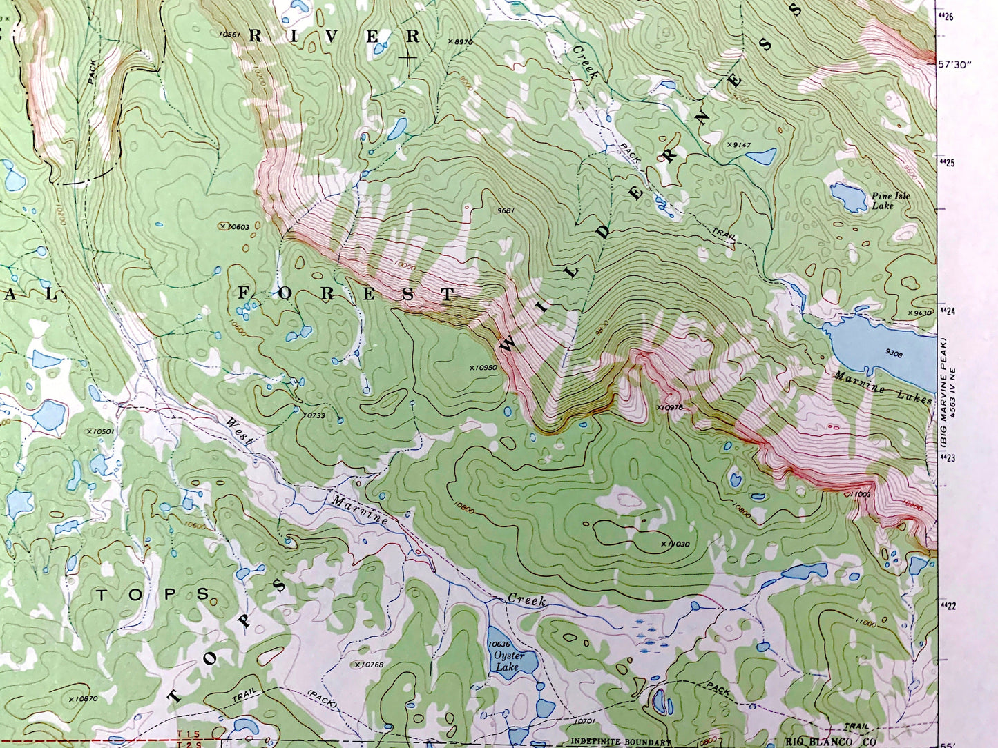
See what Colorado looked like over 45 years ago. Lots of intricate details and geological contours. Map even has little squares for every house that existed at the time. The USGS cartographers were very thorough back then!
Perfect for the historian, map-lover, the curious or just as a conversation starter. Wonderful and rare. Vintage maps such as these make great gifts.
Edition of 1977, printed 1978
Dimensions: 22" width x 27" height
----
Features
Points of Interest: Johnson Park, White River National Forest, Flat Tops Wilderness, The Flat Tops, Papoose Basin, Camel Peak, Rat Mountain, Ute Creek, Hammond Creek, West Marvine Creek, Marvine Lakes, House Creek, East Marvine Creek, Papoose Creek, Oyster Lake, Slide Lake, Hill Creek, Oyster Lake Trail, and many more hills, streams, ponds, houses, schools, railroads, churches and roads.
Condition: Very Good Vintage condition, commensurate with age. This map is in great shape for being over 40 years old. Has light edge-wear and a stamp on lower margin, but will read as character when framed.
----
We will happily adjust shipping price for multiple purchases. Maps are rolled up and shipped in sturdy mailing tubes, never folded.
Couldn't load pickup availability
Share