My Store
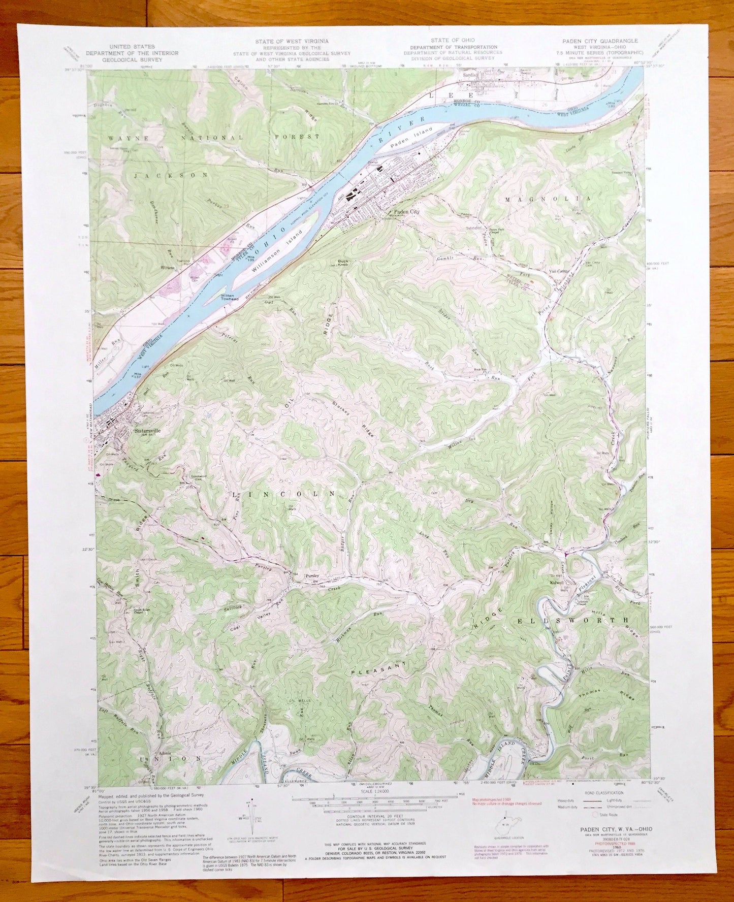
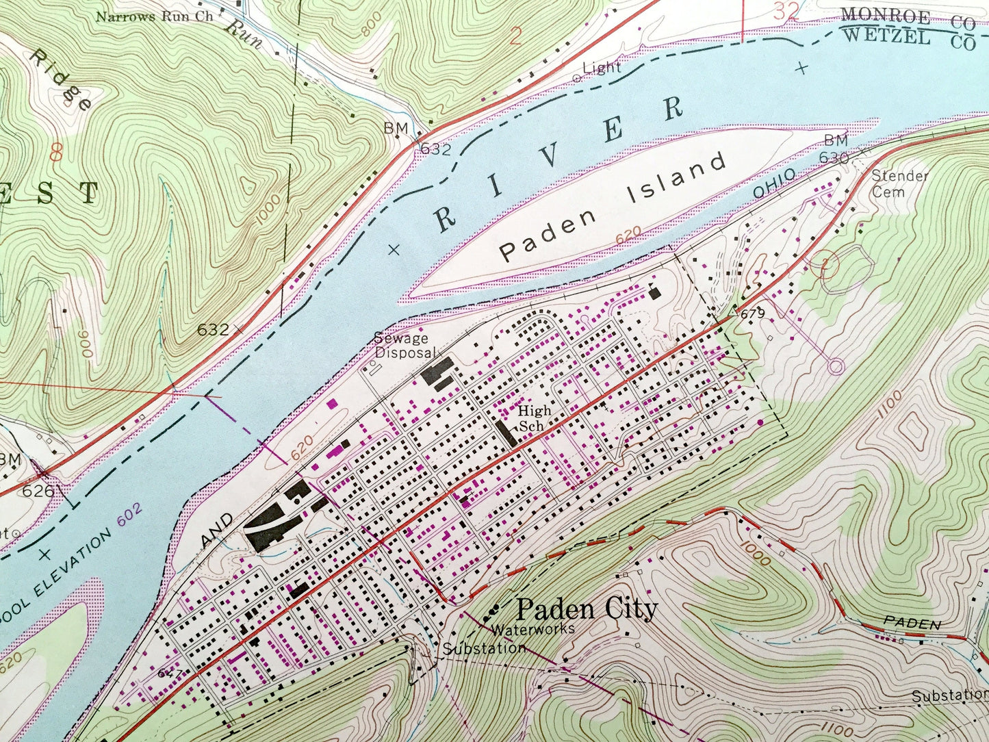
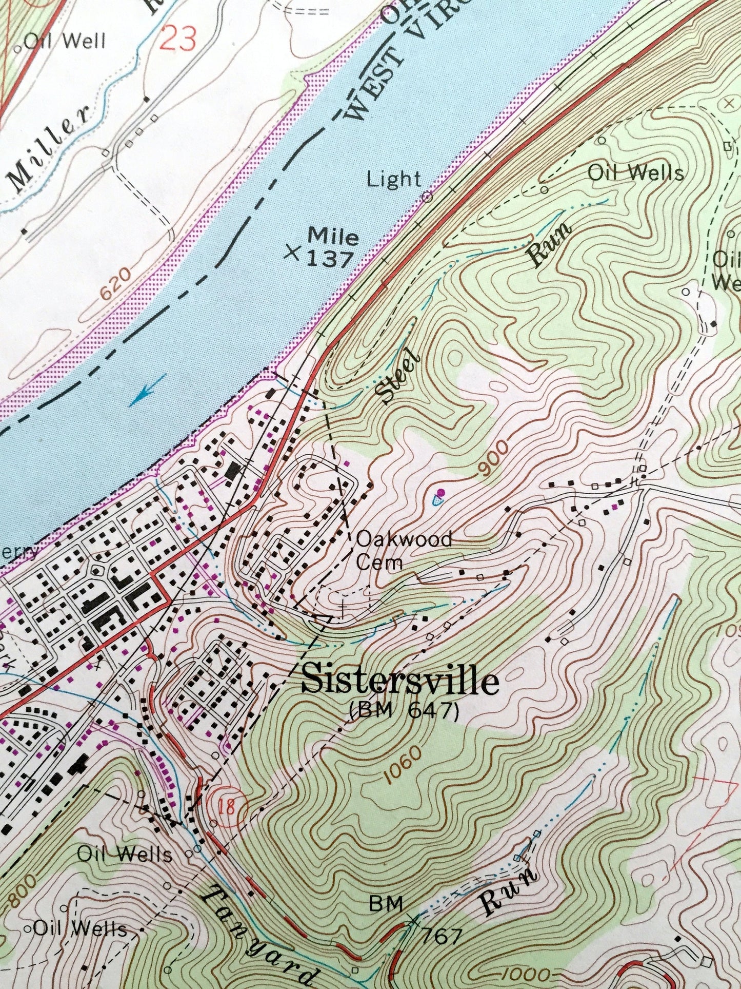
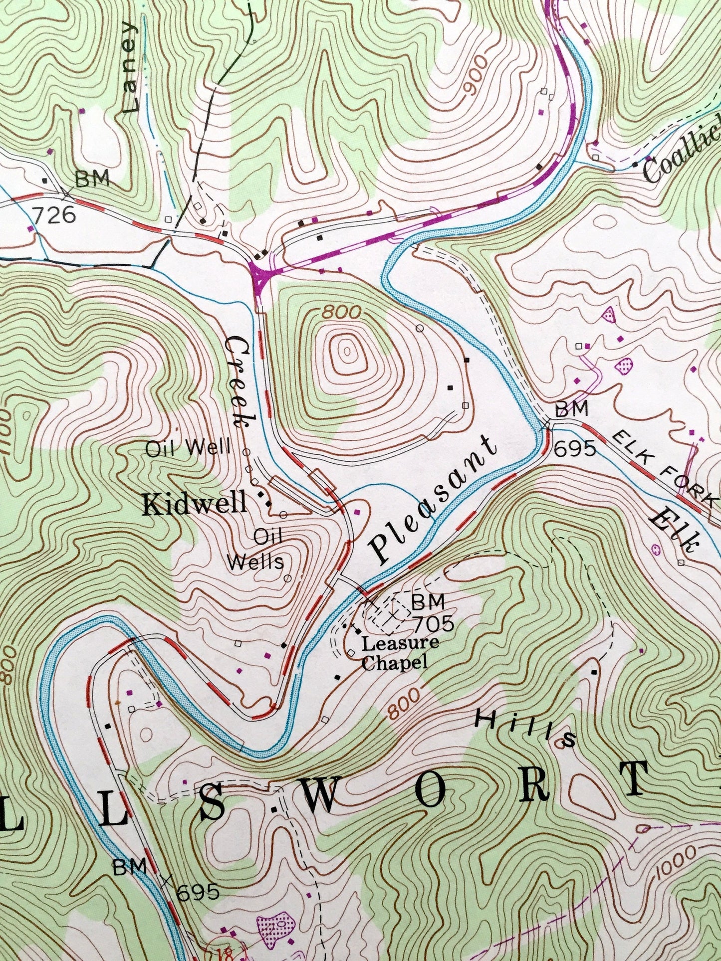
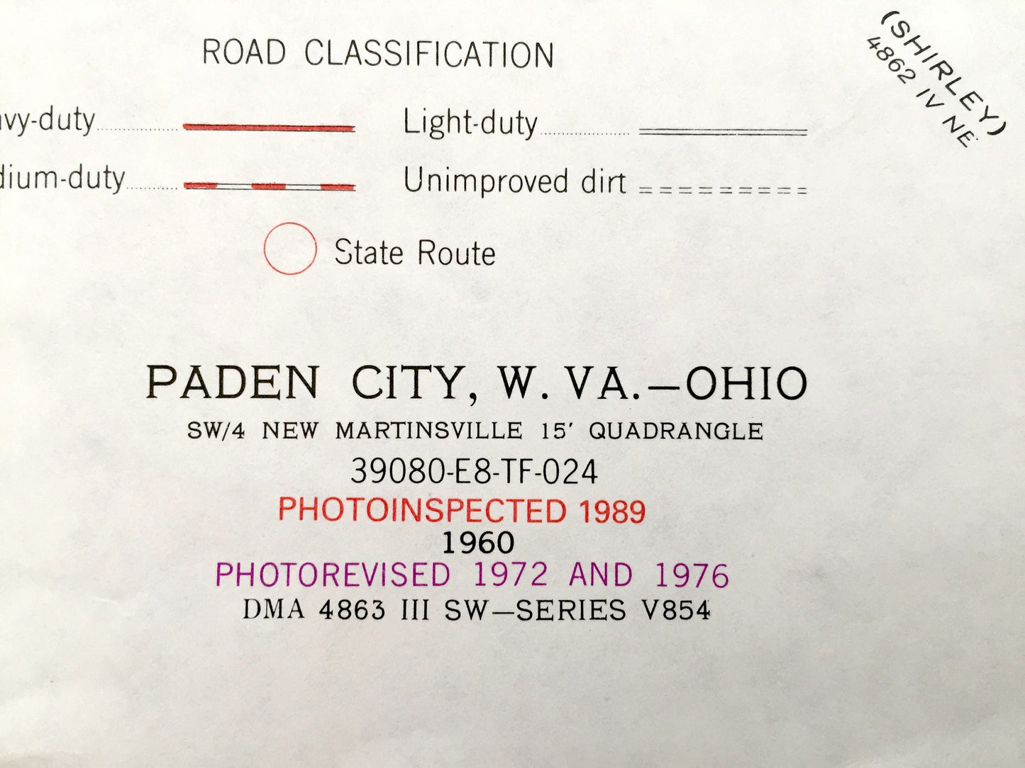
Antique Paden City, West Virginia & Lee, Ohio 1960 US Geological Survey Topographic Map – Sistersville, Ellsworth Union Sardis Wittens WV OH
Antique Paden City, West Virginia & Lee, Ohio 1960 US Geological Survey Topographic Map – Sistersville, Ellsworth Union Sardis Wittens WV OH
Beautiful, antique map of Paden City,Van Camp, Ellsworth, Lincoln and Sistersville, West Virginia including Ohio towns Lee and Sardis across the river. This is an authentic 1989 print of 1960 survey data from the U.S. Geological Survey and NOT a computer reproduction.
See what Tyler County of West Virginia and Monroe County of Ohio looked like almost 60 years ago. Lots of intricate details and geological contours. Map even has little squares for every house that existed at the time. The USGS cartographers were very thorough back then!
Perfect for the historian, map-lover, the curious or just as a conversation starter. Wonderful and rare. Vintage maps such as these make great gifts.
Edition of 1960, printed 1989
Dimensions: 22" width x 27" height
----
Features
Cities & Towns: WEST VIRGINIA: Paden City, Paden Island, Williamson Island, Ellsworth, Kidwell, Van Camp, Magnolia, Sistersville, Union, Adonis, Lincoln.
OHIO: Lee, Sardis, Jackson.
Points of Interest: Wayne National Forest, Regional Oil Wells, Pleasant Ridge, Leasure Chapel, Baltimore and Ohio Railroad, Ohio River, Paden City High School, and lots more hills, streams, ponds, churches, houses, and roads.
Condition: Very Good condition, commensurate with age. This map is in incredible shape for being almost 30 years old.
----
We will happily adjust shipping price for multiple purchases. Maps are rolled up and shipped in sturdy mailing tubes, never folded.
Couldn't load pickup availability
Share