My Store
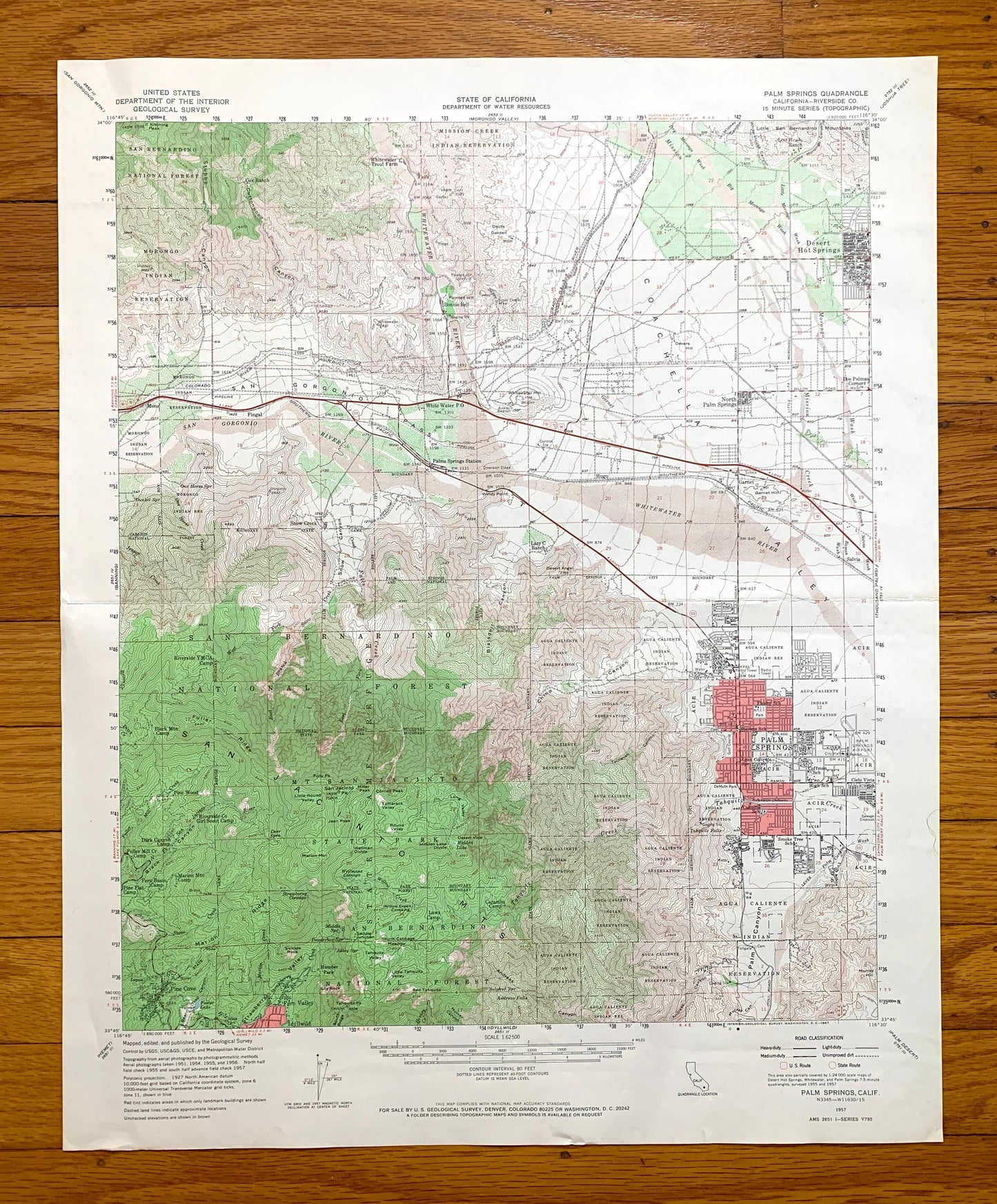
Antique Palm Springs, California 1957 US Geological Survey Topographic Map – Coachella Valley Desert Hot Springs San Bernardino Riverside CA
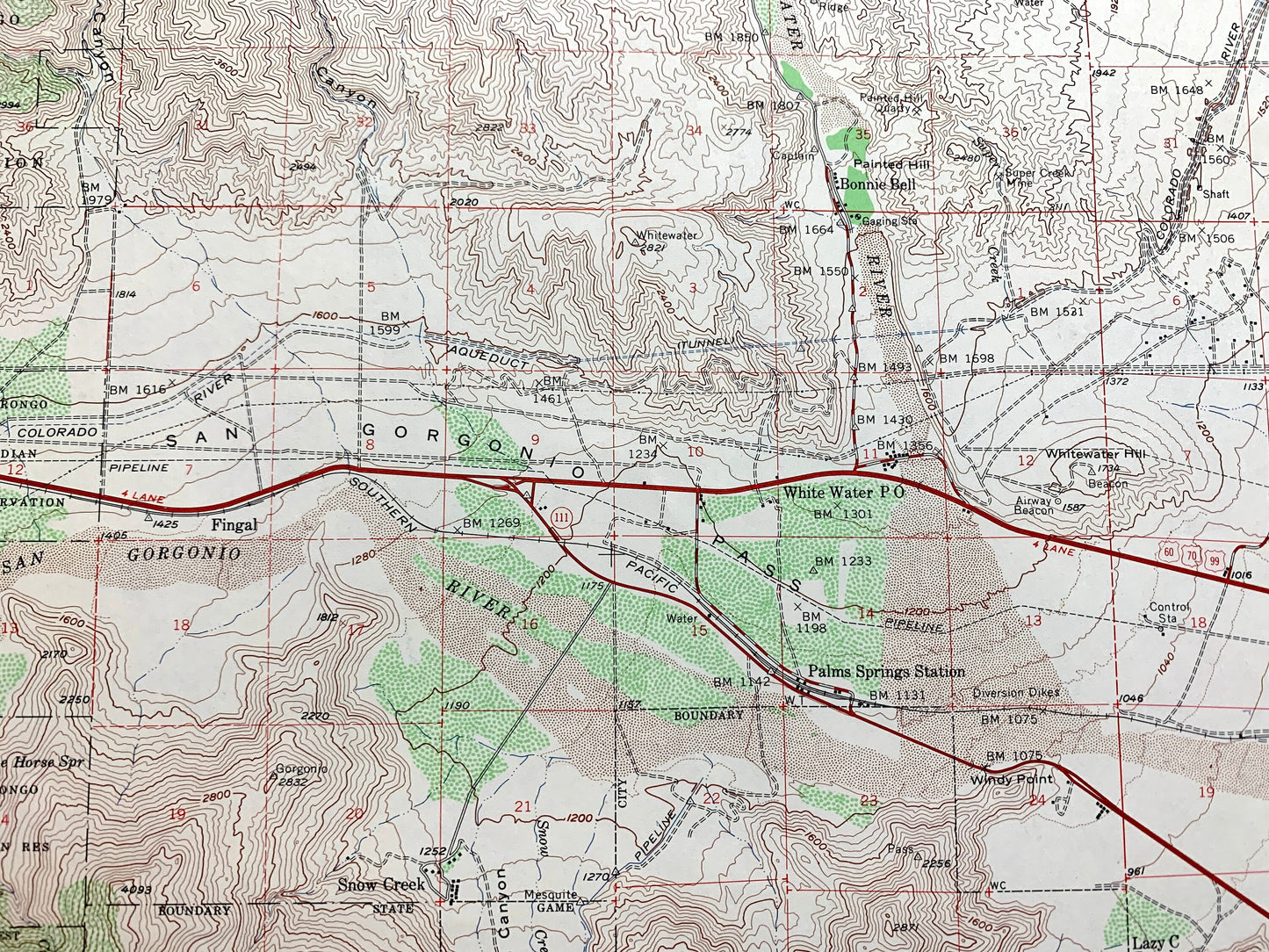
Antique Palm Springs, California 1957 US Geological Survey Topographic Map – Coachella Valley Desert Hot Springs San Bernardino Riverside CA
Beautiful, antique map of Palm Springs, California and surrounding Riverside County area. This is an authentic 1957 edition, 1967 print from the U.S. Geological Survey and NOT a computer reproduction.
See what California looked like over 65 years ago. Lots of intricate details and geological contours. Map even has little squares for every house that existed at the time. The USGS cartographers were very thorough back then!
Perfect for the historian, map-lover, the curious or just as a conversation starter. Wonderful and rare. Vintage maps such as these make great gifts.
Edition of 1957, printed 1967
Dimensions: 17" width x 21" height
----
Features
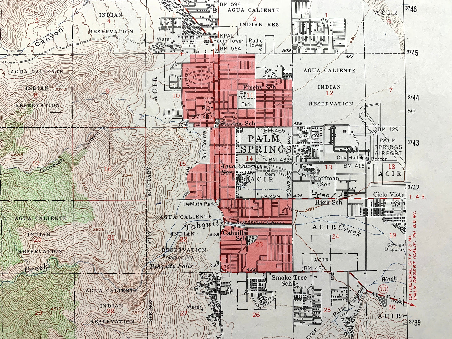
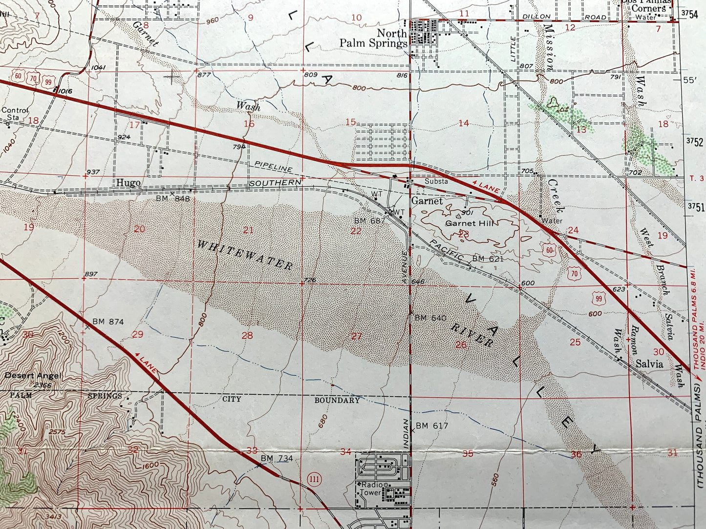
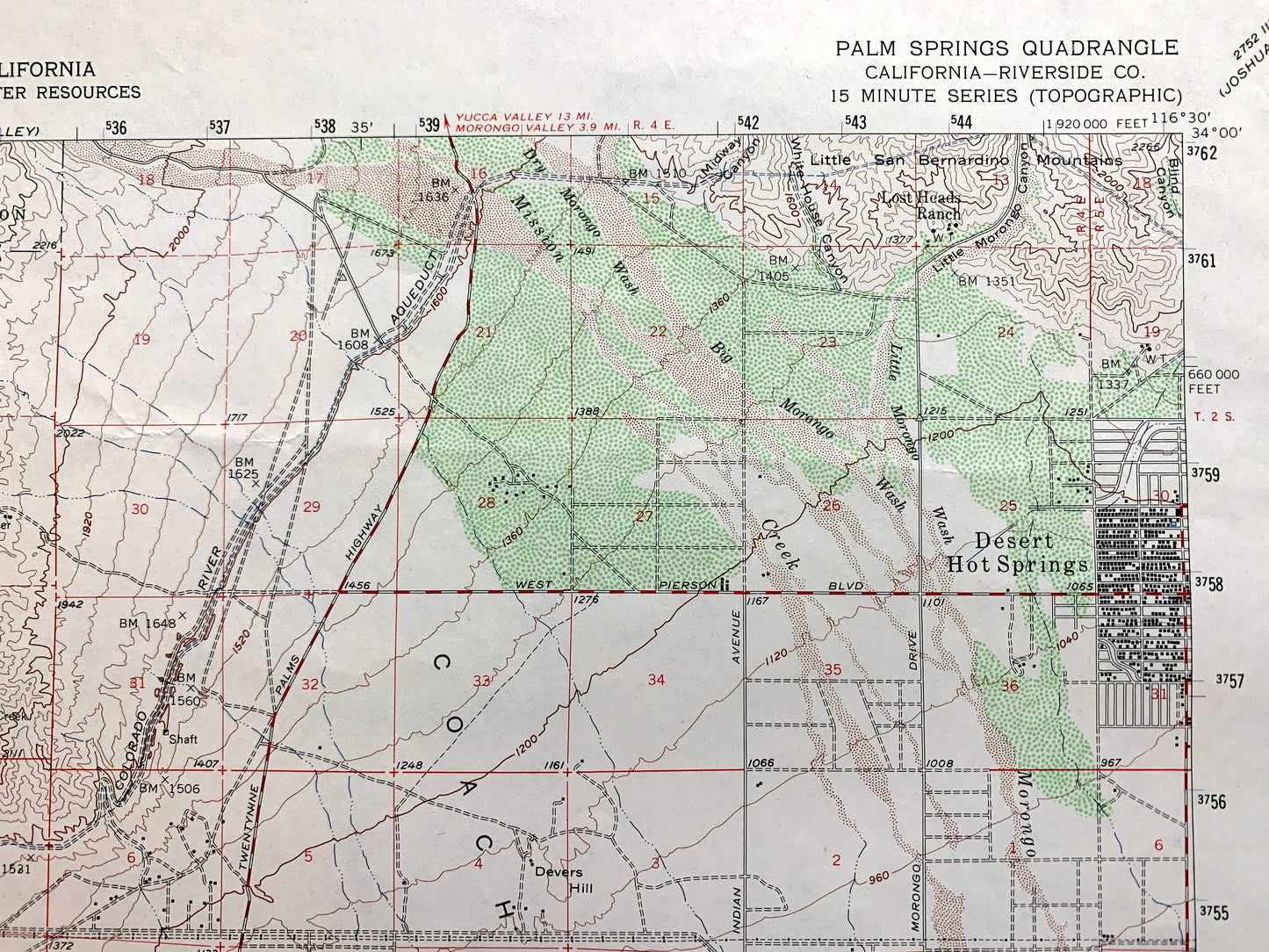
Cities & Towns: Palm Springs, Desert Hot Springs, Cox Ranch, Bonnie Bell, White Water, North Palm Springs, Dos Palmas Corners, Garnet, Salvia, Snow Creek, Pine Cove, Fern Valley, Idyllwild.
Points of Interest: Riverside County, San Bernardino National Forest, Coachella Valley, Whitewater River, San Jacinto Mountains, Aqua Caliente Indian Reservation, San Gorgonio Pass, San Gorgonio River, Snow Canyon, Strawberry Valley, and lots more hills, mountains, canyons, creeks, houses, roads, ranches and camps.
Condition: Good Vintage condition, commensurate with age. This map is in great shape for being over 55 years old. Has very light wear and folds as-issued, but these will flatten easily and all will add to vintage character when framed.
----
We will happily adjust shipping price for multiple purchases. Maps are rolled up and shipped in sturdy mailing tubes, never folded.
Couldn't load pickup availability
Share