My Store
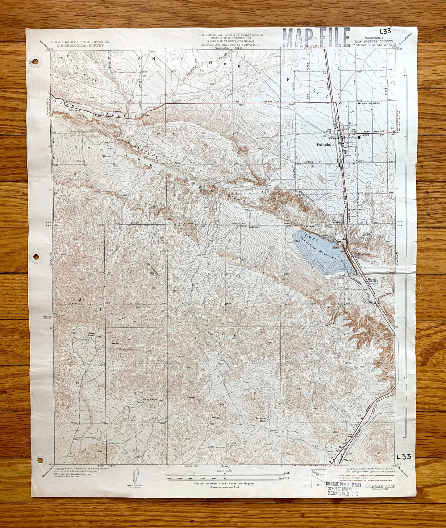
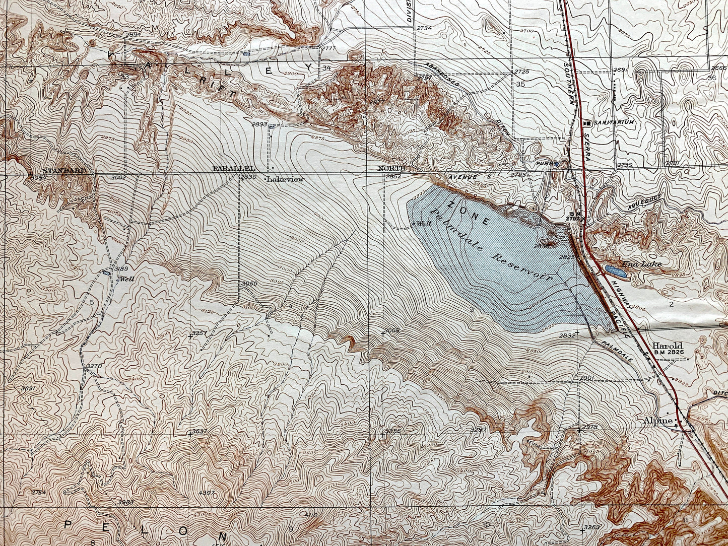
Antique Palmdale, California 1937 US Geological Survey Topographic Map – Los Angeles County, Anaverde Valley, Antelope, Sierra Pelona, CA
Antique Palmdale, California 1937 US Geological Survey Topographic Map – Los Angeles County, Anaverde Valley, Antelope, Sierra Pelona, CA
Beautiful, antique canvas-backed map of Palmdale, California and surrounding Los Angeles County area. This is an authentic 1937 print from the U.S. Geological Survey and NOT a computer reproduction. It is from a Geologic Atlas folio.
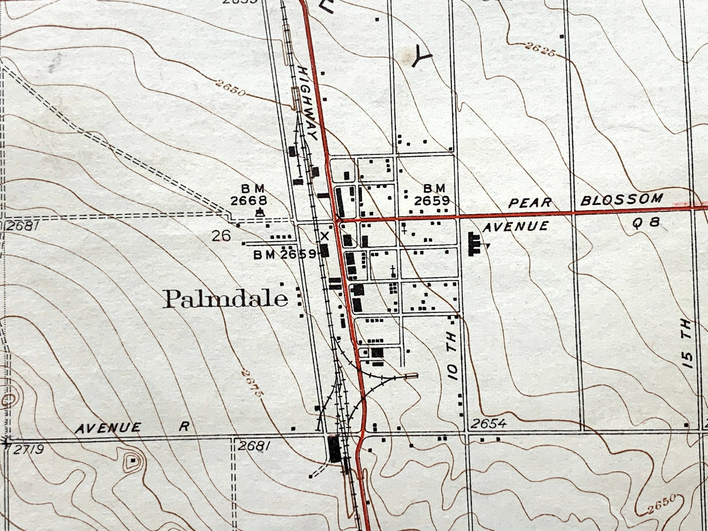
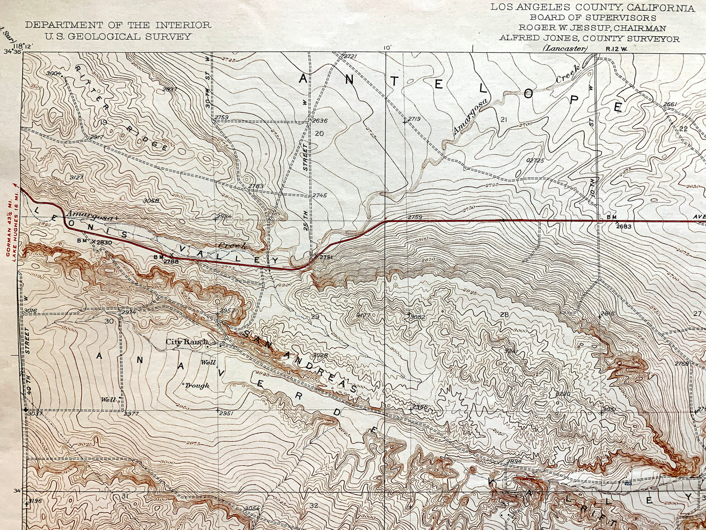
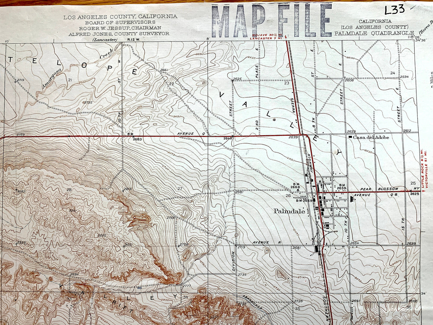
See what California looked like over 85 years ago before modern development. Lots of intricate details and geological contours. Map even has little squares for every house that existed at the time. The USGS cartographers were very thorough back then! On the back is a description of topographic symbols and map guide.
Perfect for the historian, map-lover, the curious or just as a conversation starter. Wonderful and rare. Vintage maps such as these make great gifts.
Edition of 1937, printed 1937
Dimensions: 17" width x 20 1/2" height
----
Features
Cities & Towns: Palmdale, City Ranch, Casa del Adobe, Lakeview, Harold, Alpine, Casa Juvan, Vincent.
Points of Interest: Los Angeles County, Palmdale Reservoir, Antelope Valley, Leonis Valley, San Andreas Rift, Anaverde Valley, Sierra Peolona, Soledad Pass, and many more hills, streams, ponds, houses, schools, churches and roads.
Condition: Good Vintage condition, commensurate with age. This map is in great shape for being over 85 years old. Has some edge-wear, holes in the margin, ex-libris stamps, and pen marks, but these will add to vintage character when framed. It has a canvas back which gives it some paper warble, but a nice heft.
----
We will happily adjust shipping price for multiple purchases. Maps are rolled up and shipped in sturdy mailing tubes, never folded.
Couldn't load pickup availability
Share