My Store
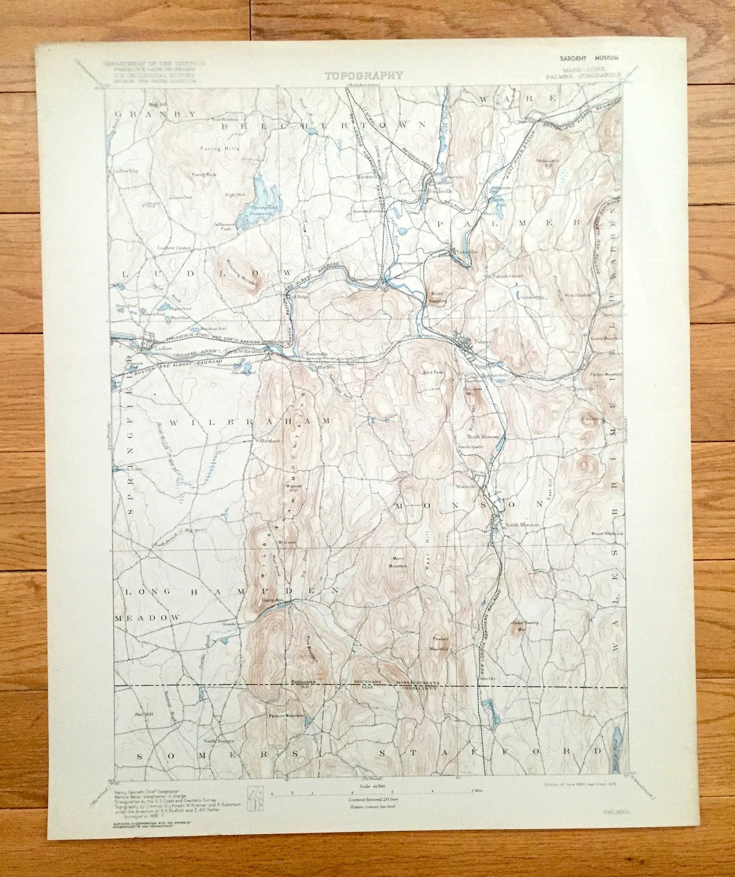
Antique Palmer, Massachusetts 1893 US Geological Survey Topographic Map – Belchertown, Ludlow, Wilbraham, Monson, Stafford Connecticut MA CT
Antique Palmer, Massachusetts 1893 US Geological Survey Topographic Map – Belchertown, Ludlow, Wilbraham, Monson, Stafford Connecticut MA CT
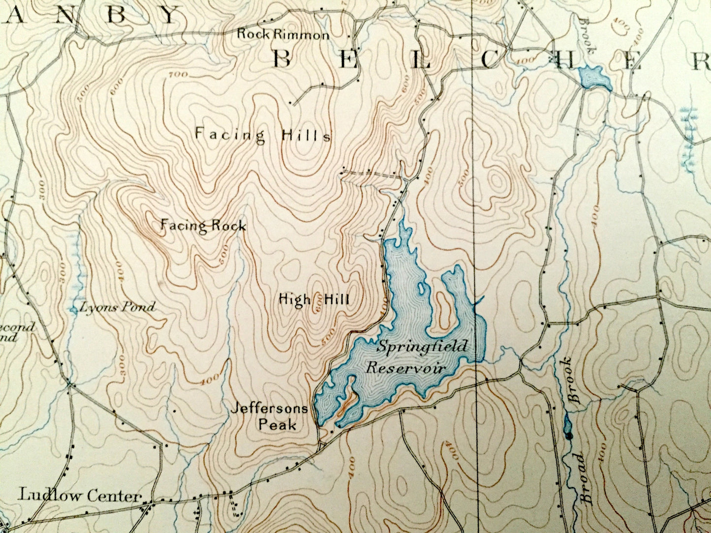
Beautiful, antique map of Palmer, Belchertown, Granby, Wilbraham, Monson, Long Meadown, Hampden and Ludlow, Massachusetts, including surrounding Connecticut towns of Somers and Stafford. This is an authentic 1893 edition, 1918 print from the U.S. Geological Survey and NOT a computer reproduction.
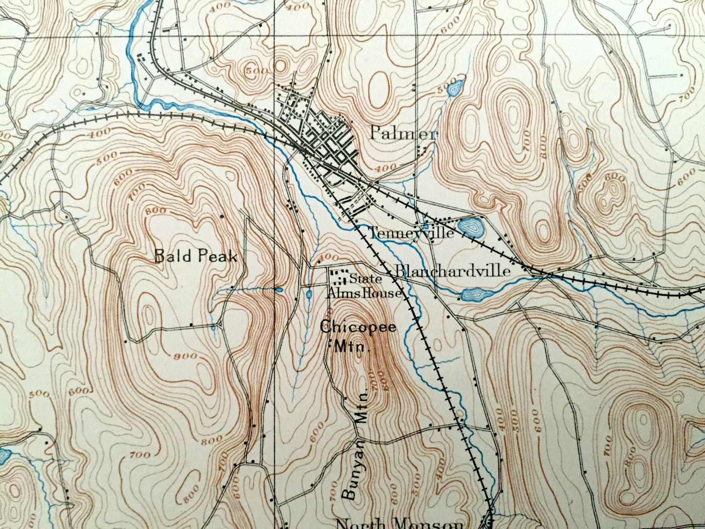
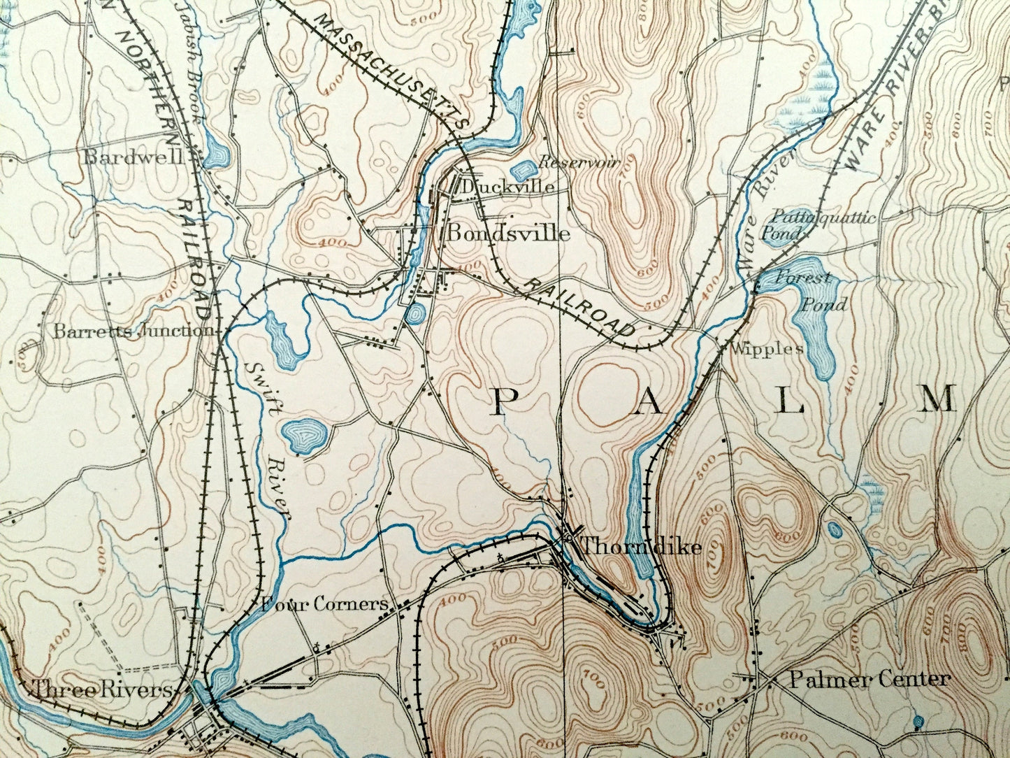
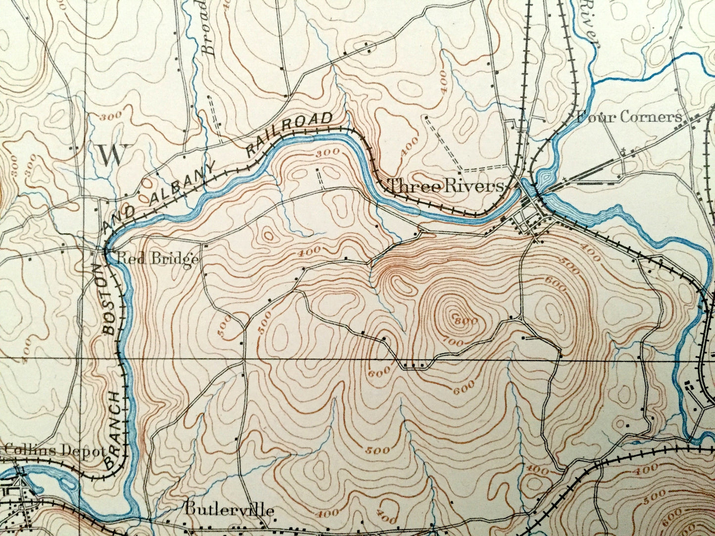
See what Hampden & Tolland Counties looked like over 125 years ago. Lots of intricate details and geological contours. Map even has little squares for every house that existed at the time. The USGS cartographers were very thorough back then! On the back is a description of topographic symbols and map guide.
Perfect for the historian, map-lover, the curious or just as a conversation starter. Wonderful and rare. Vintage maps such as these make great gifts.
Edition of 1893 printed 1918
Dimensions: 16 1/2" width x 20" height
----
Features
Cities & Towns: MASSACHUSETTS: Granby, Belchertown, Ware, Palmer, Palmer Center, Thorndike, Three Rivers, Four Corners, Barretts Junction, Bardwell, Ludlow Center, Ludlow, Butlerville, Blanchardville, Tenneyvill, Palmer, West Brimfield, Parksville, North Monson, Monson, South Monson, Wilbraham, Springfield, Sixteen Acres, Long Meadow, Scantic, Hampden, Wales, Ellis Mills, North Wilbraham, Wipples, Ludlow City, Gibbs Crossing, Duckville, Bonds.
CONNECTICUT: Stafford, North Somers.
Points of Interest: Springfield Reservoir, Facing Hills, Chicopee River, Swift River, Boston & Albany Railroad, Wilbraham Mountains, Granite Quarry North Monson, Cooks Mountain, Forest Pond, State Line Pond, Cendar Swamp Mountain, Pine Mountain, Perkins Mountain, Mount Dumpling, and lots more hills, mountains, streams, ponds, houses, and roads.
Condition: Very Good Vintage condition, commensurate with age. This map is in great shape for being over 100 years old. Light wear and pen in margin, but this will add to vintage character when framed.
----
We will happily adjust shipping price for multiple purchases. Maps are rolled up and shipped in sturdy mailing tubes, never folded.
Couldn't load pickup availability
Share