My Store
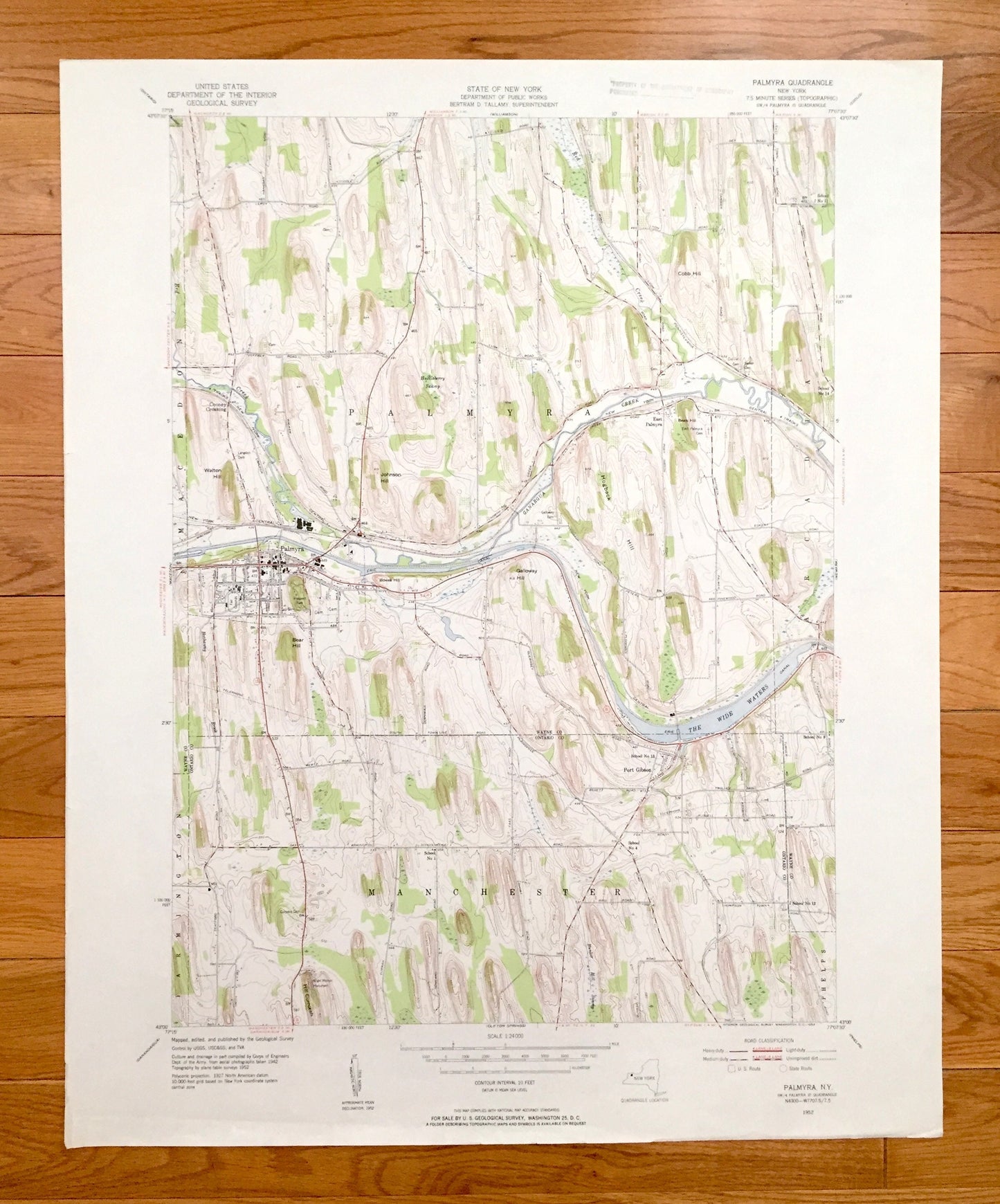
Antique Palmyra, New York 1952 US Geological Survey Topographic Map – Ontario, Wayne County, Macedonia, Farmington, Manchester, Phelps, NY
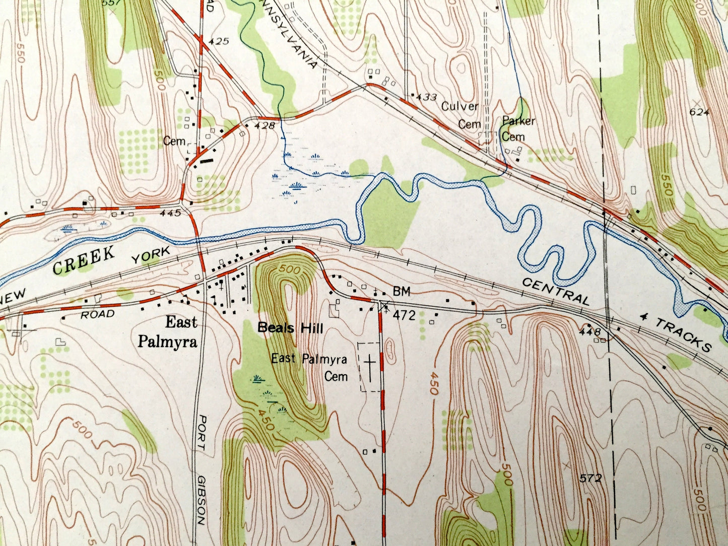
Antique Palmyra, New York 1952 US Geological Survey Topographic Map – Ontario, Wayne County, Macedonia, Farmington, Manchester, Phelps, NY
Beautiful, antique map of Palmyra, New York and surrounding Wayne & Ontario County areas. This is an authentic 1952 edition, 1953 print from the U.S. Geological Survey and NOT a computer reproduction.
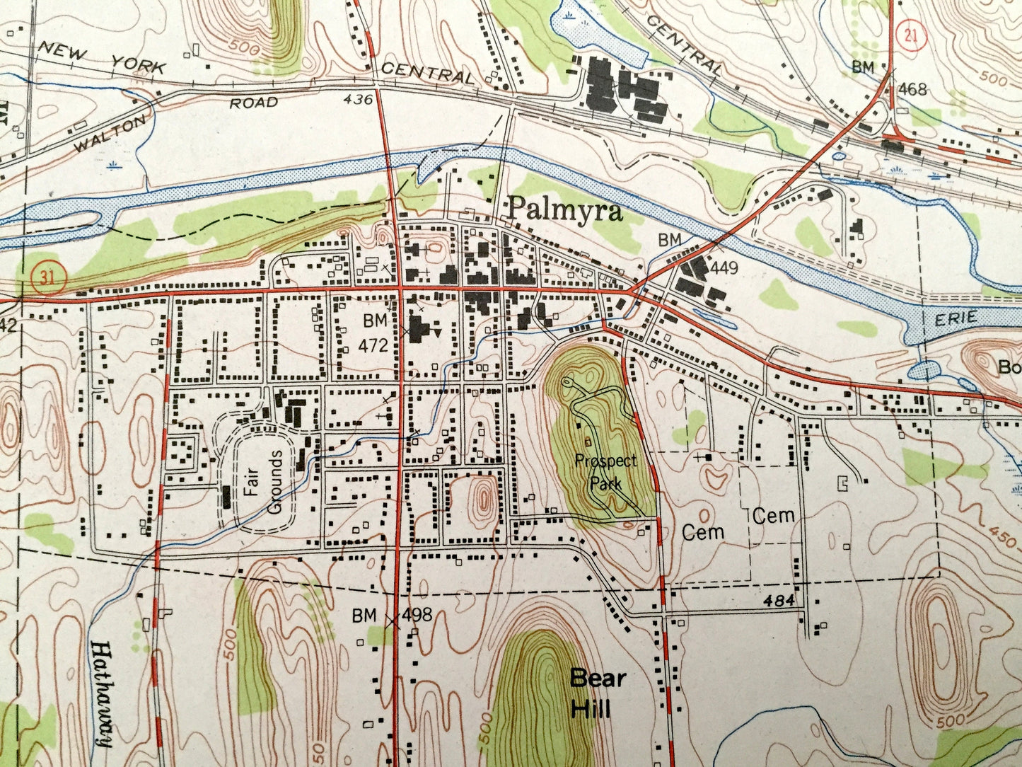
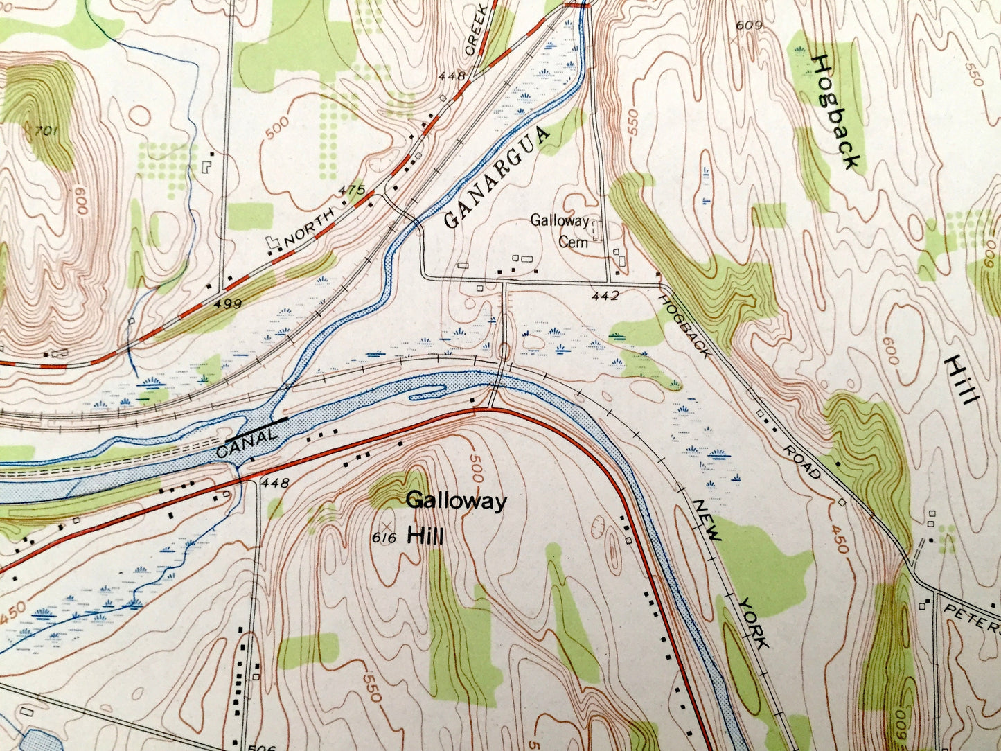
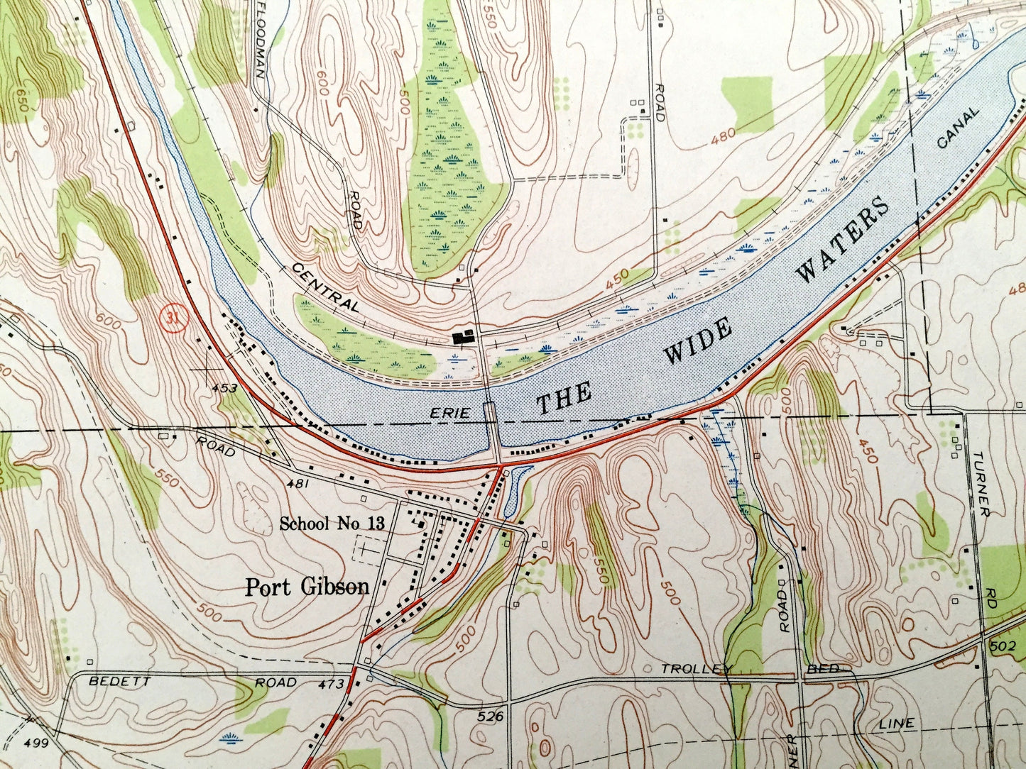
See what upstate New York looked like over 70 years ago. Lots of intricate details and geological contours. Map even has little squares for every house that existed at the time. The USGS cartographers were very thorough back then!
Perfect for the historian, map-lover, the curious or just as a conversation starter. Wonderful and rare. Vintage maps such as these make great gifts.
Edition of 1952, printed 1953
Dimensions: 22" width x 27" height
----
Features
Cities & Towns: Cooney Crossing, East Palmyra, Port Gibson.
Points of Interest: Prospect Park, Ganargua Creek, Erie Canal, The Wide Waters, Hathaway Brook, Red Creek, Huckleberry Swamp, Walton Hill, Johnson Hill, Cobb Hill, Beals Hill, Hogback Hill, Galloway Hill, Bear Hill, Hill Cumorah, Bunker Hill Swamp, and many more hills, streams, ponds, houses, schools, railroads, churches and roads.
Condition: Very Good Vintage condition, commensurate with age. This map is in great shape for being over 70 years old. Light wear and ex-libris stamp in margin but this will add to vintage character when framed.
----
We will happily adjust shipping price for multiple purchases. Maps are rolled up and shipped in sturdy mailing tubes, never folded.
Couldn't load pickup availability
Share