My Store
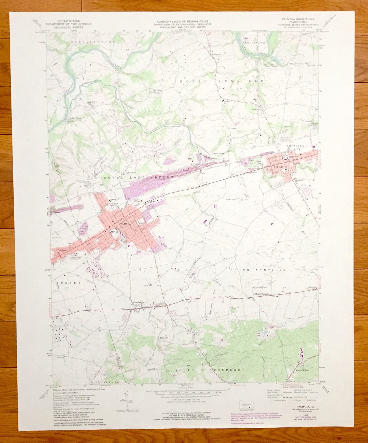
Antique Palmyra, Pennsylvania 1969 US Geological Survey Topographic Map – Lebanon, Dauphin County, Annville, Palmdale, North Annville, PA
Antique Palmyra, Pennsylvania 1969 US Geological Survey Topographic Map – Lebanon, Dauphin County, Annville, Palmdale, North Annville, PA
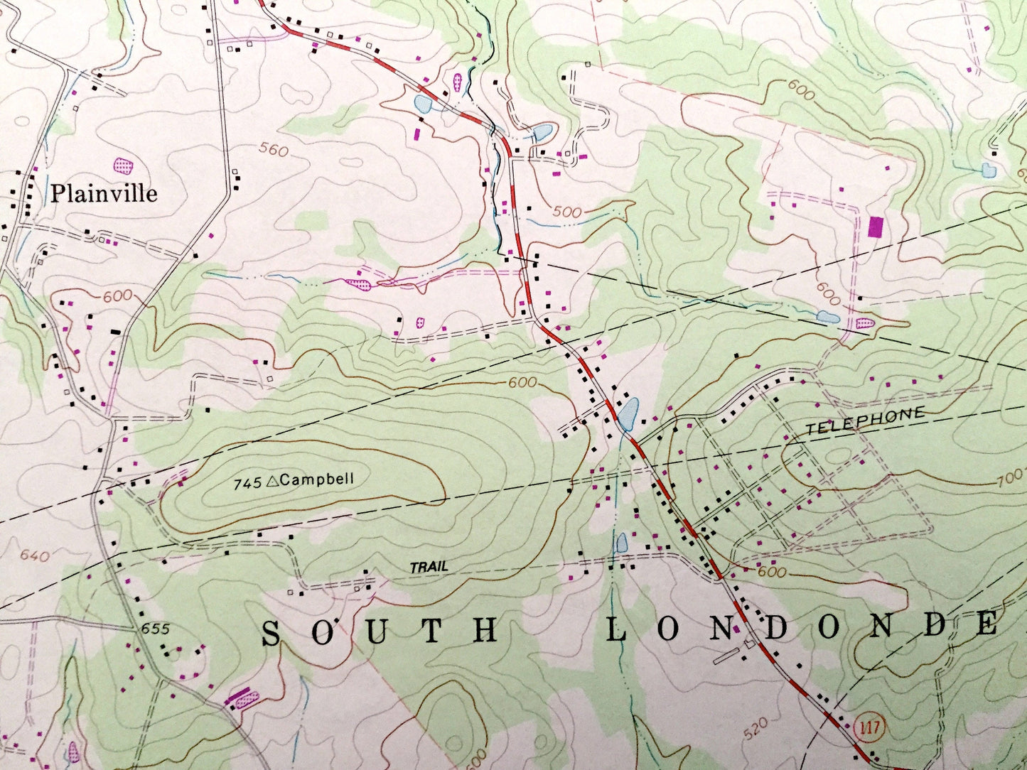
Beautiful, antique map of Palmyra, Pennsylvania and surrounding Lebanon & Dauphin County area. This is an authentic 1969 edition, 1990 print from the U.S. Geological Survey and NOT a computer reproduction.
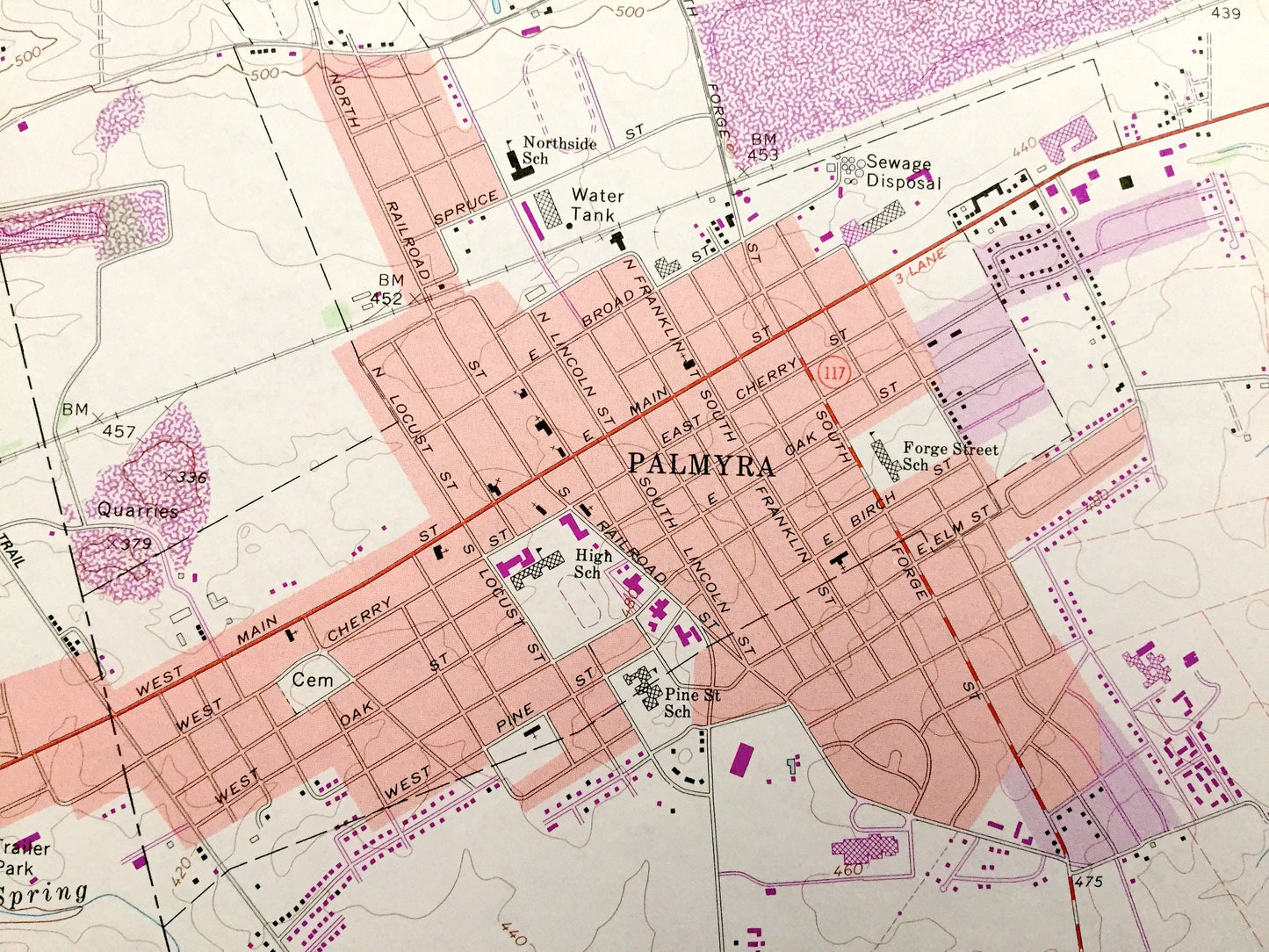
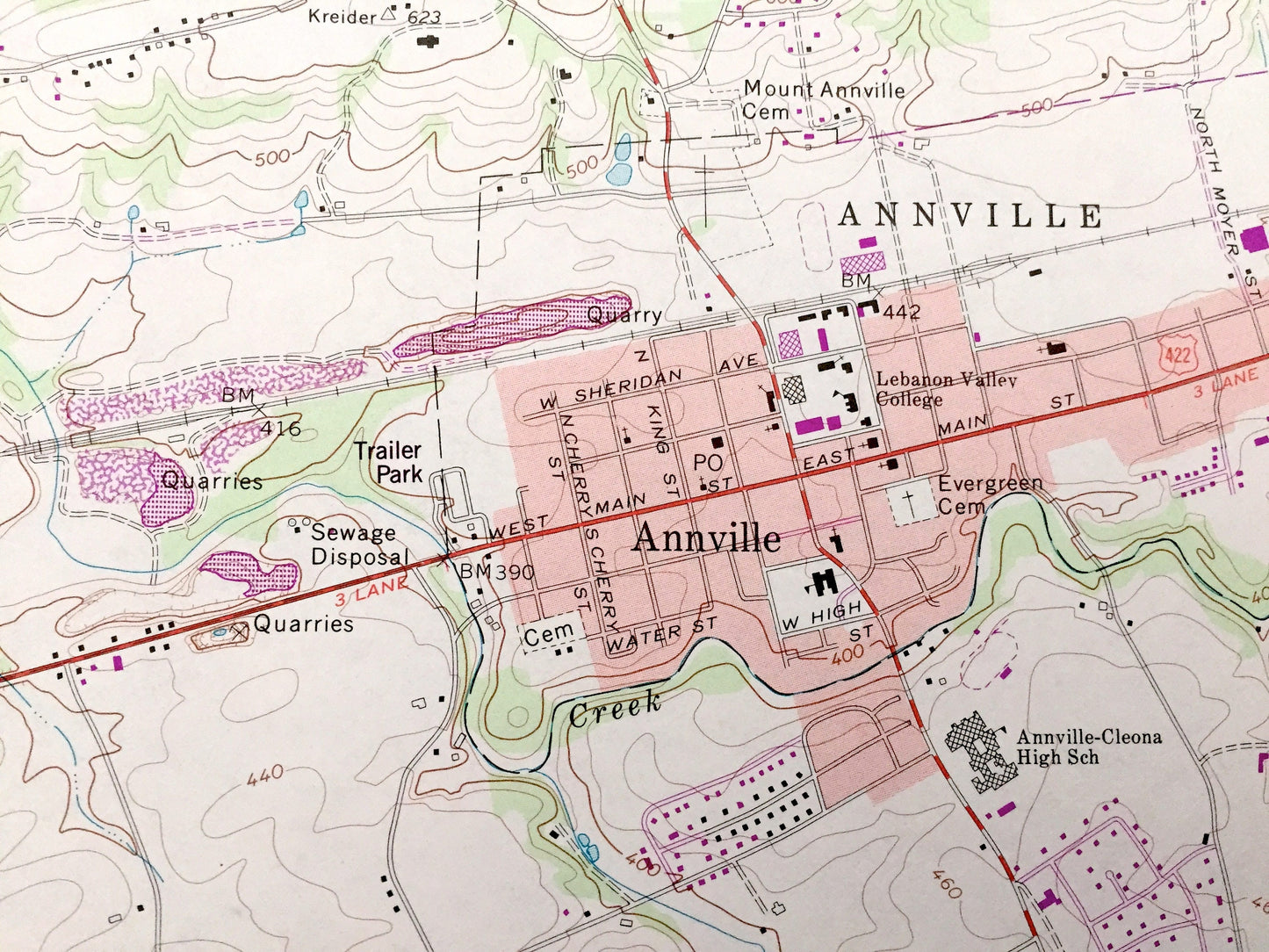
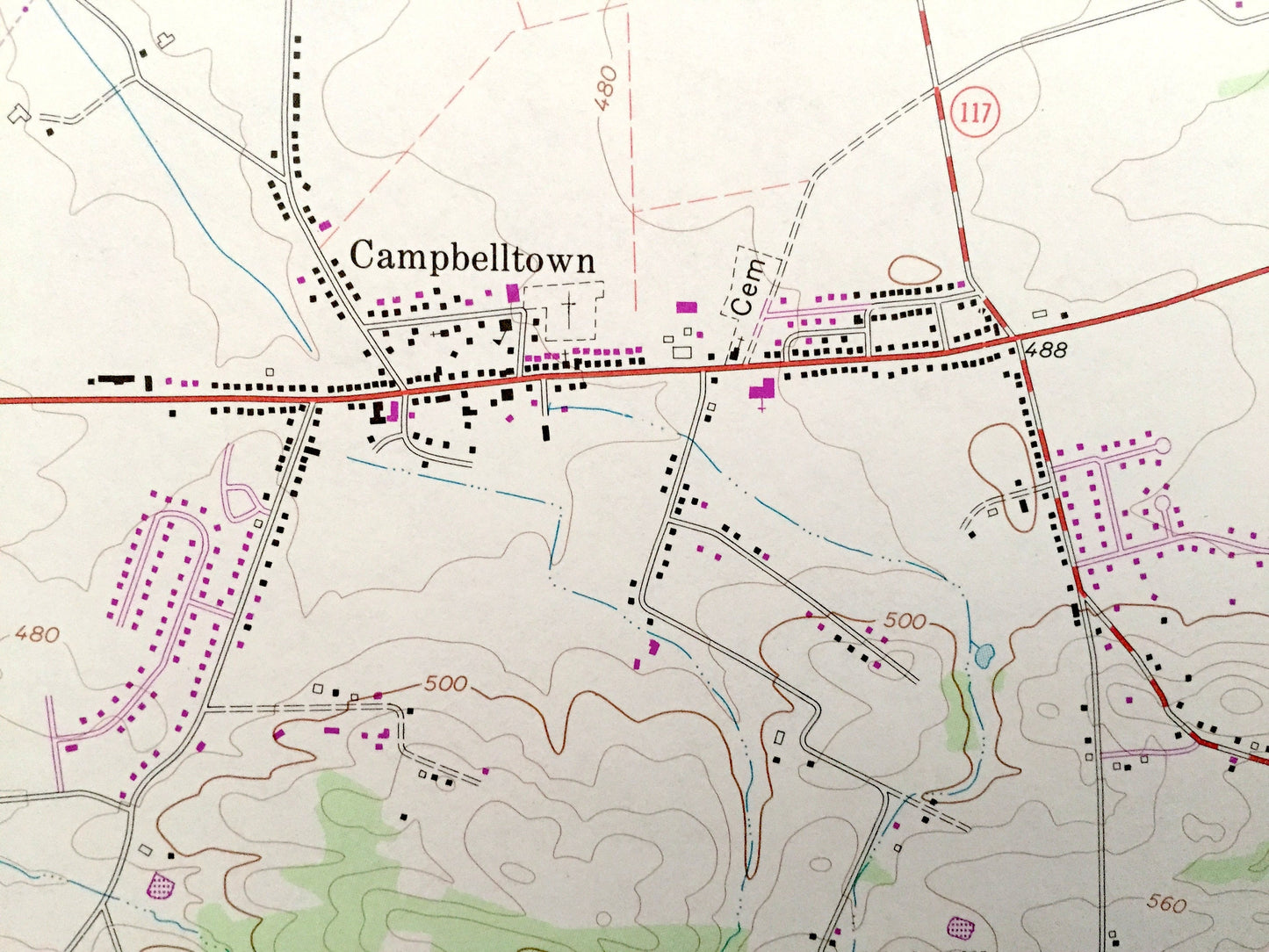
See what Pennsylvania looked like over 50 years ago. Lots of intricate details and geological contours. Map even has little squares for every house that existed at the time. The USGS cartographers were very thorough back then!
Perfect for the historian, map-lover, the curious or just as a conversation starter. Wonderful and rare. Vintage maps such as these make great gifts.
Edition of 1969, printed 1990
Dimensions: 22" width x 27" height
----
Features
Cities & Towns: Palmyra, Campbelltown, Mount Pleasant, Fontana, Annville, Plainville, Mount Wilson, Palmdale, Coffeetown, Clear Spring, Valley Glenn, Syner, Steelstown, Bellegrove, Union Water Works, Derry, Conewago, South Londonderry, South Annville, North Londonderry, East Hanover, North Annville.
Points of Interest: Swatara Creek, Quittapahilla Creek, Reigle Landing Field, Rover Landing Strip, Millard Airport, Bachman Run, Killinger Creek, Grandview Memorial Park, and many more hills, streams, ponds, houses, schools, churches and roads.
Condition: Very Good Vintage condition, commensurate with age. This map is in great shape for being 30 years old.
----
We will happily adjust shipping price for multiple purchases. Maps are rolled up and shipped in sturdy mailing tubes, never folded.
Couldn't load pickup availability
Share