My Store
Antique Palmyra, Virginia 1888 US Geological Survey Topographic Map – Columbia, Fork Union, Scottsville, Fluvanna, Albermarle, Cumberland VA
Antique Palmyra, Virginia 1888 US Geological Survey Topographic Map – Columbia, Fork Union, Scottsville, Fluvanna, Albermarle, Cumberland VA
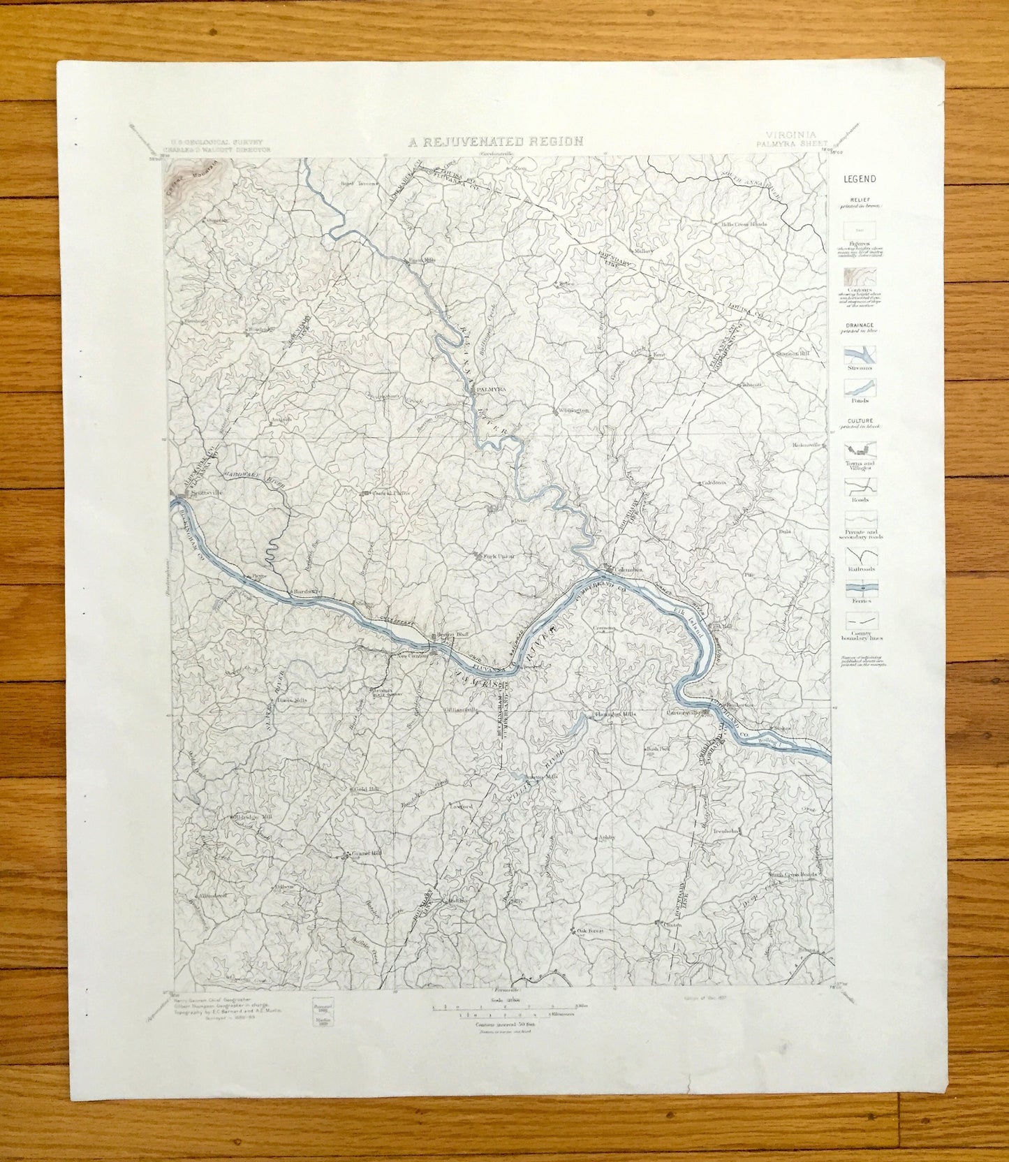
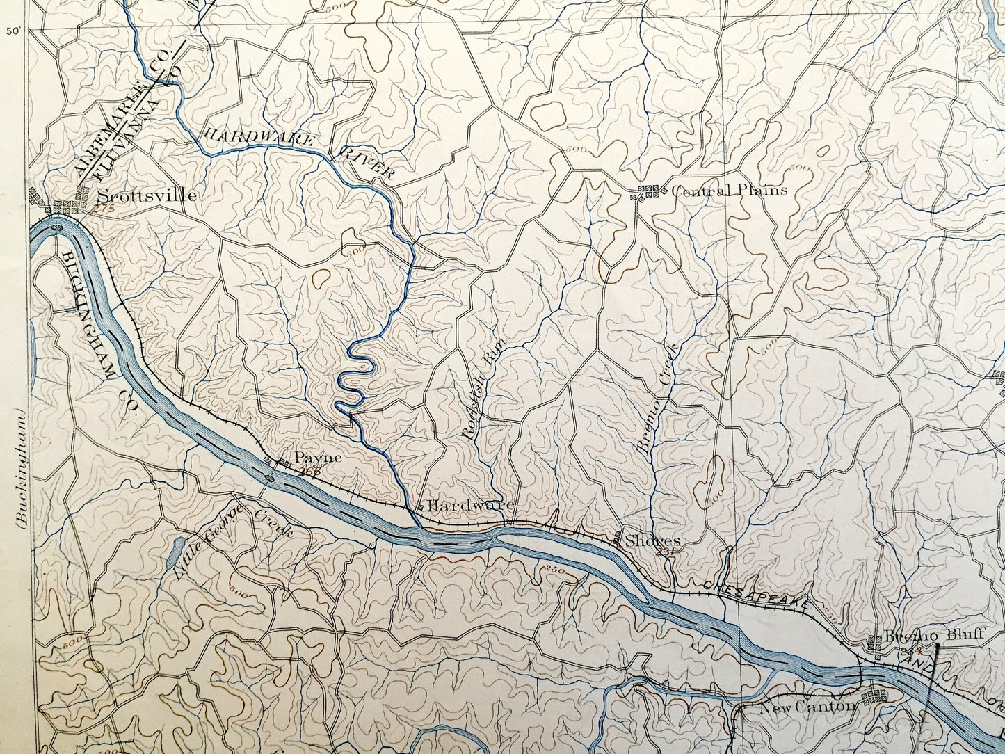
Beautiful, antique map of the Palmyra, Virginia and surrounding Fluvanna, Luisa, Buckingham, Cumberland & Alebermalre County area on the James River. This is an authentic 1888 print from the U.S. Geological Survey and NOT a computer reproduction. It is from a Geologic Atlas folio and features the rare heading "A Rejuvenated Region."
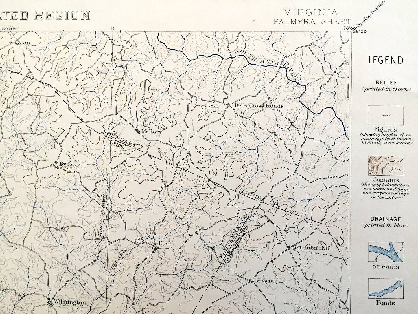
See what Virginia looked like more than 125 years ago—before Lake Monticello was formed. Printed in the very large 30 minute scale, this map covers an immense amount of landscape. Lots of intricate details and geological contours. Map even has little squares for every city block that existed at the time. The USGS cartographers were very thorough back then! Map is canvas-backed. It is also one of the rare maps with accompanying legend on the front.
Perfect for the historian, map-lover, the curious or just as a conversation starter. Wonderful and rare. Vintage maps such as this make great gifts.
Edition of 1888, printed 1888
Dimensions: 18 1/2" width x 22" height
----
Features
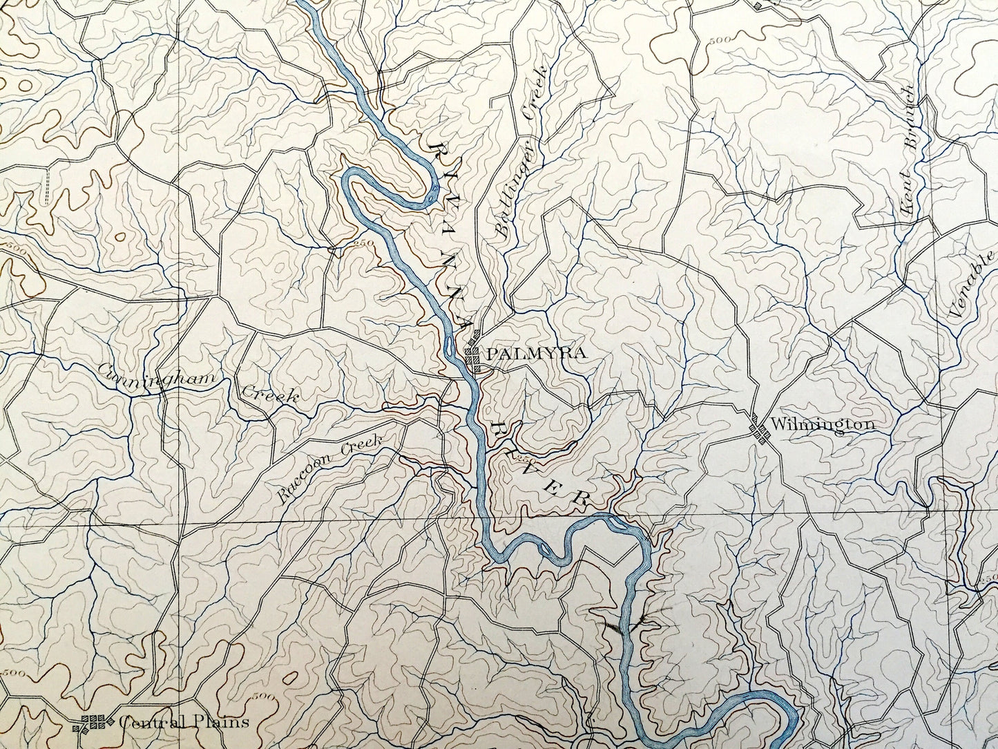
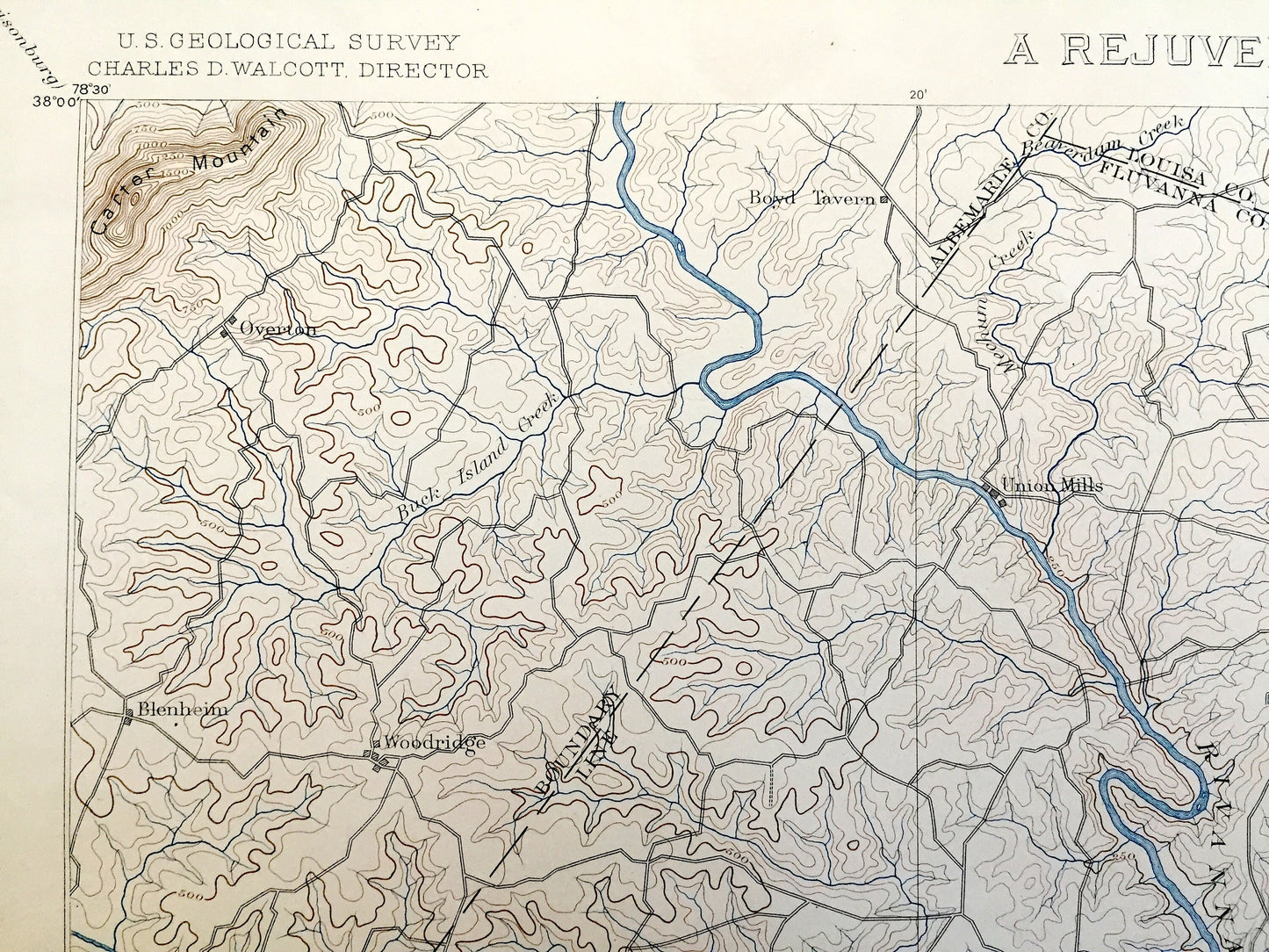
Cities & Towns: Blenheim, Woodridge, Boyd Tavern, Antioch, Overton, Union Mills, Palmyra, Wilmington, Bybee, Zion, Kent, Tabscott, Shannon Hill, Bells Cross Roads, Mallory, Scottsville, Payne, Hardware, Central Plains, Diana Mills, Arvonia, Dixie, Fork Union, Bremo Bluff, New Canton, Boswell, Gilliamsville, Columbia, Caledonia, Hadensvill, Bula, Fife, Elk Hill, Pemerton, Cremona, Gold Hill, Eddridge Mill, Allenslevel, Dillwyn, Gravel Hill, Trenton Mills, Lawford, Tally, Hatcher, Oak Forest, Ashby, Flannagan Mills, Cartersville, Bush Park, Stokes, Clinton, Trenholm, Belona, Smiths Crossroads.
Points of Interest: Fluvanna County, Luisa County, Buckingham County, Cumberland County, Alebermalre County, Powhatan County, James River, Rivanna River, Hardware River, Slate River, Willis River, Byrd Creek, Buck Island Creek, Carter Mountain, and many more small towns, schools, train tracks, roads, hills and creeks.
Condition: Very Good Vintage condition, commensurate with age. This map is in incredible shape for being over 125 years old. Some edge-wear and toning and staple holes in the margin, but this will add to vintage character when framed.
----
We will happily adjust shipping price for multiple purchases. Maps are rolled up and shipped in sturdy mailing tubes, never folded.
Couldn't load pickup availability
Share