My Store
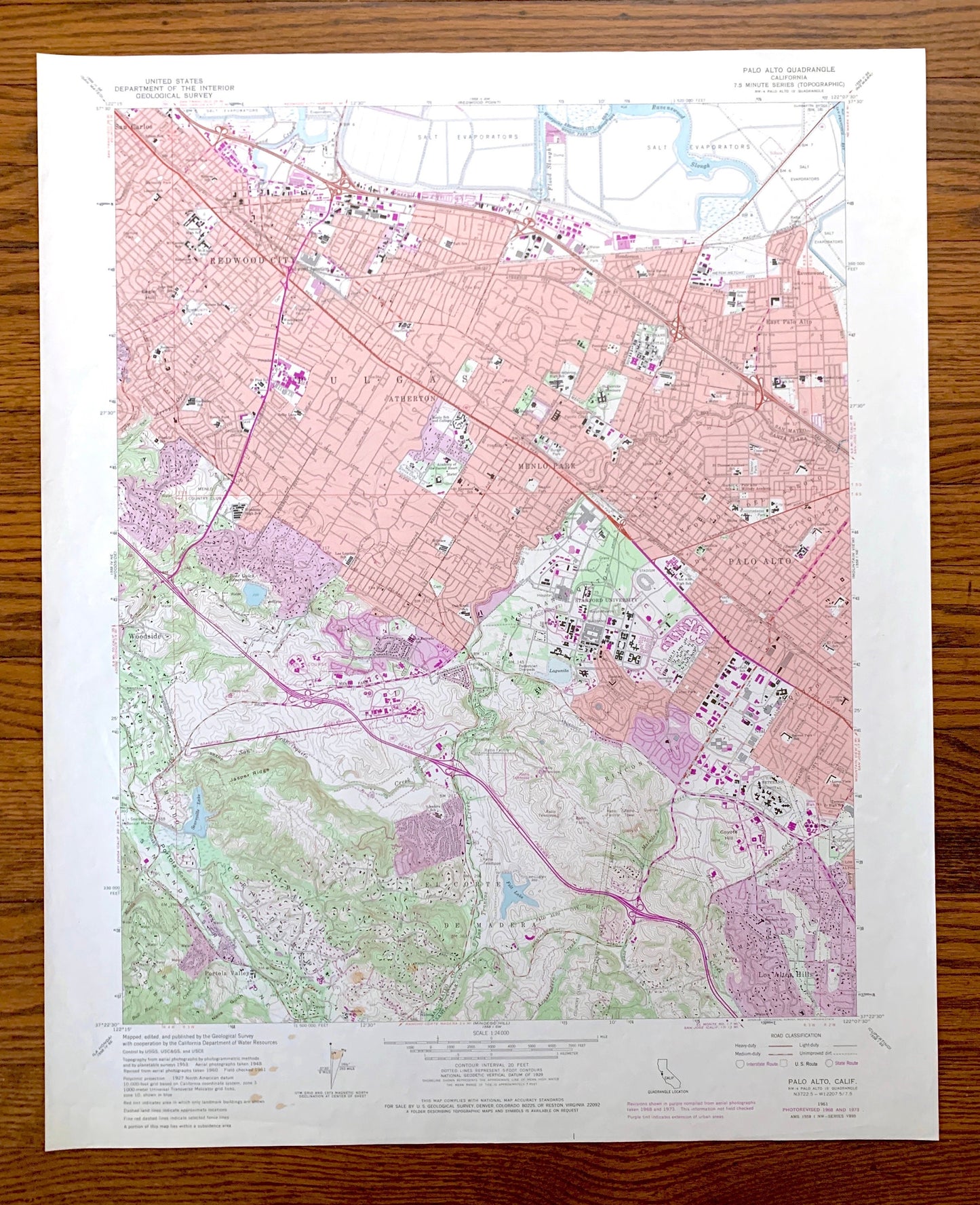
Antique Palo Alto, California 1961 US Geological Survey Topographic Map – Silicon Valley, Stanford University, Menlo Park Pulgas Atherton CA
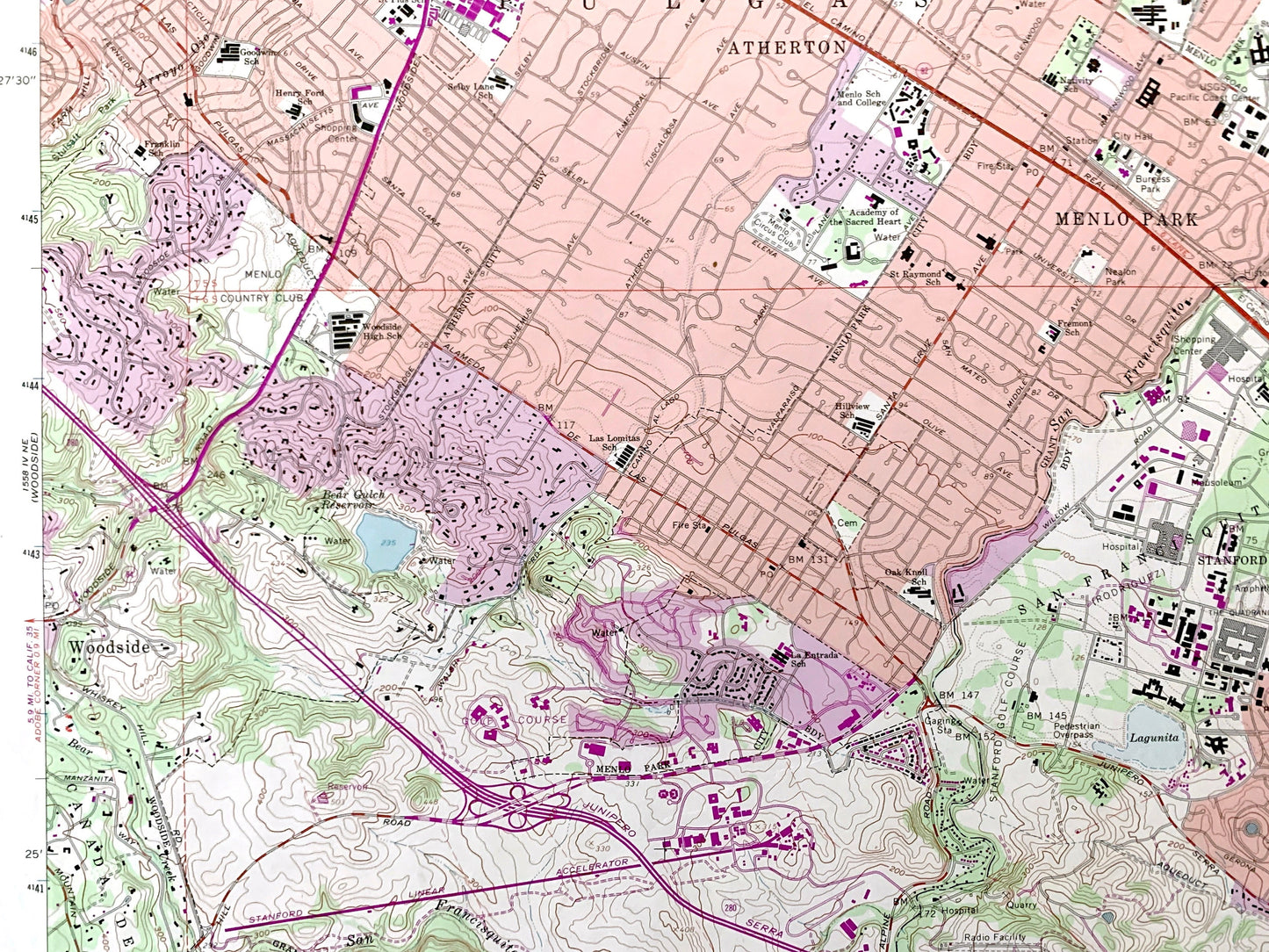
Antique Palo Alto, California 1961 US Geological Survey Topographic Map – Silicon Valley, Stanford University, Menlo Park Pulgas Atherton CA
Beautiful, antique map of Palo Alto and surrounding San Mateo County & Santa Clara County areas. This is an authentic 1961 edition, 1974 print from the U.S. Geological Survey and NOT a computer reproduction.
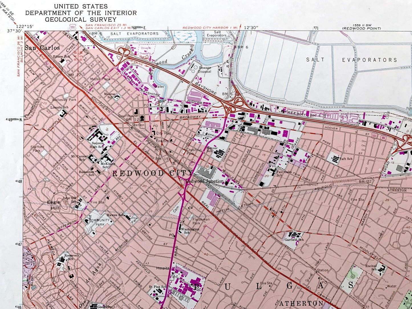
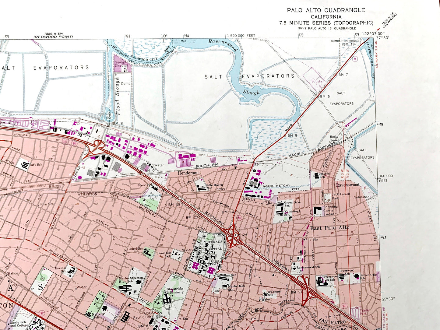
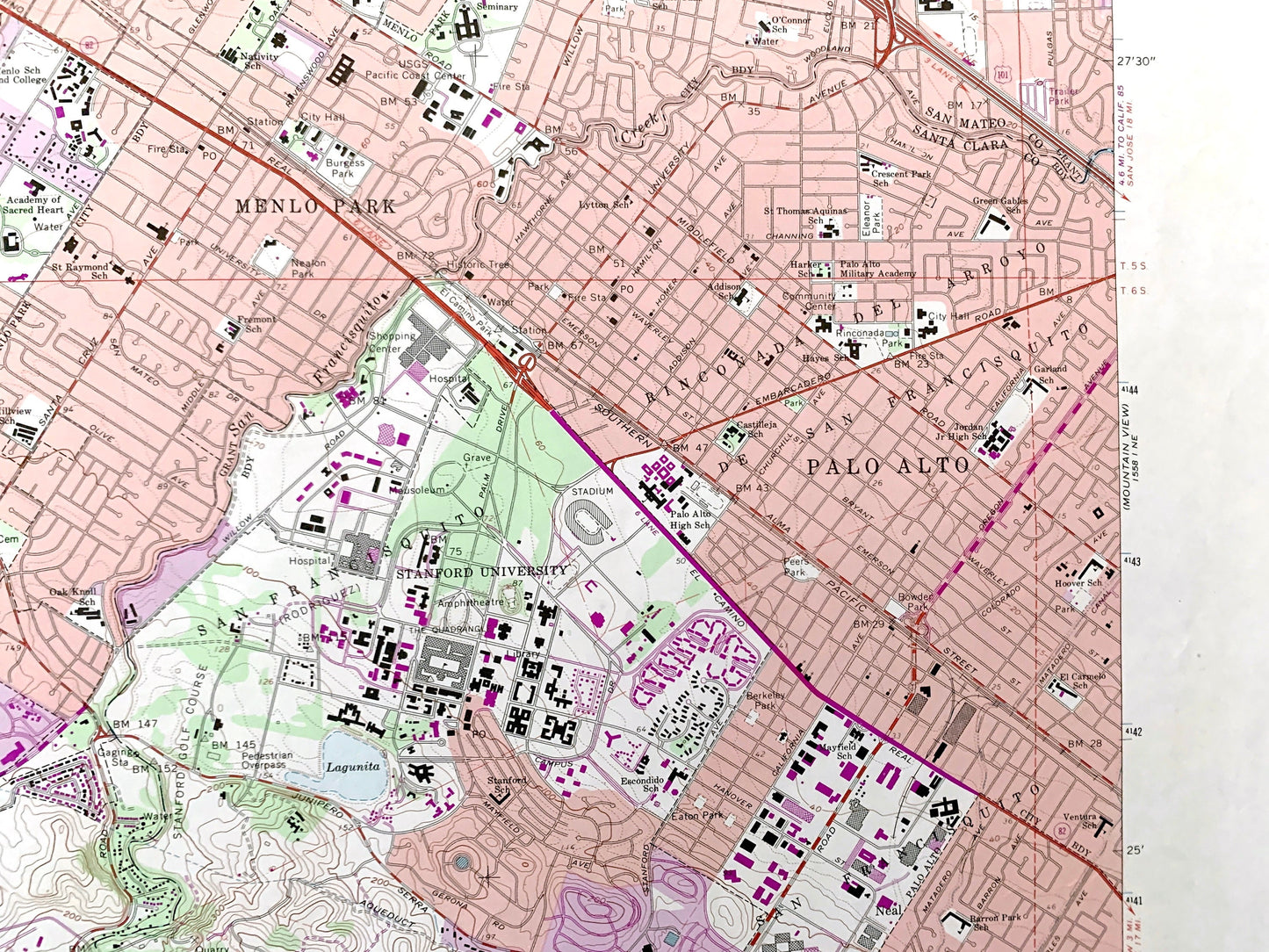
See what Palo Alto, Menlo Park, Mountain View, Sunnyvale, and Los Altos looked like over 60 years ago. Lots of intricate details and geological contours. Map even has little squares for every house that existed at the time. The USGS cartographers were very thorough back then!
Perfect for the historian, map-lover, the curious or just as a conversation starter. Wonderful and rare. Vintage maps such as these make great gifts.
Edition of 1961, printed 1974
Dimensions: 22" width x 27" height
----
Features
Cities & Towns: Palo Alto, Redwood City, Atherton, Pulgas, Menlo Park, East Palo Alto, Woodside, Portola Valley, Los Altos Hills, San Carlos.
Points of Interest: San Francisquito, Jasper Ridge, San Andreas Rift Zone, Canada del Corte de Madera, Ravenswood Slough, Rinconada del Arroyo, San Francisquito Creek, Stanford University, Coyote Hill, Rincon de San Francisquito, Felt Lake, Searsville Lake, Canada de Raymundo, Redwood Creek, Matadero Creek, and lots more hills, mountains, brooks, villages, schools, churches, canyons, roads and train tracks.
Condition: Very Good Vintage condition, commensurate with age. This map is in great shape for being about 50 years old. Map has some light edge-wear but these will read as vintage character when framed.
----
We will happily adjust shipping price for multiple purchases. Maps are rolled up and shipped in sturdy mailing tubes, never folded.
Couldn't load pickup availability
Share