My Store
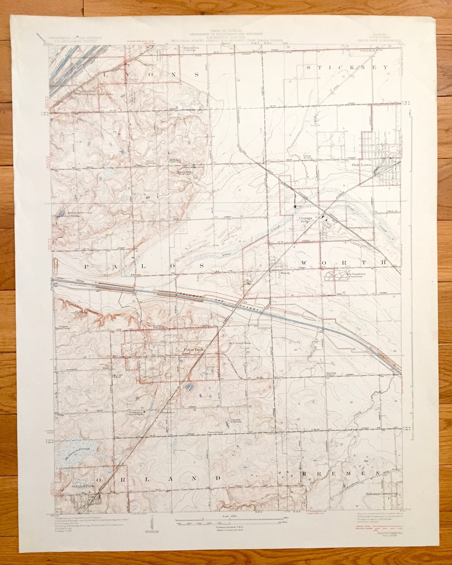
Antique Palos Park, Illinois 1928 US Geological Survey Topographic Map – Orland Park, Bremen, Worth, Oak Lawn, Stickney, Lyons, Chicago, IL
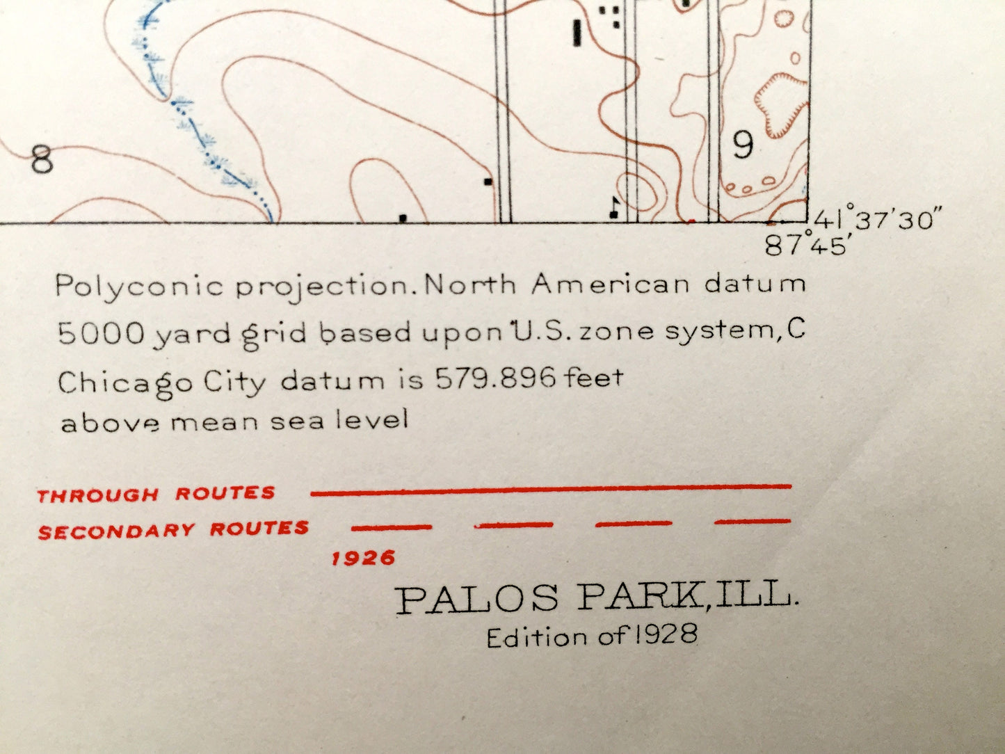
Antique Palos Park, Illinois 1928 US Geological Survey Topographic Map – Orland Park, Bremen, Worth, Oak Lawn, Stickney, Lyons, Chicago, IL
Beautiful, antique map of Park Ridge, Illinois and surrounding Cook County area of Chicago. This is an authentic 1928 print from the U.S. Geological Survey and NOT a computer reproduction.
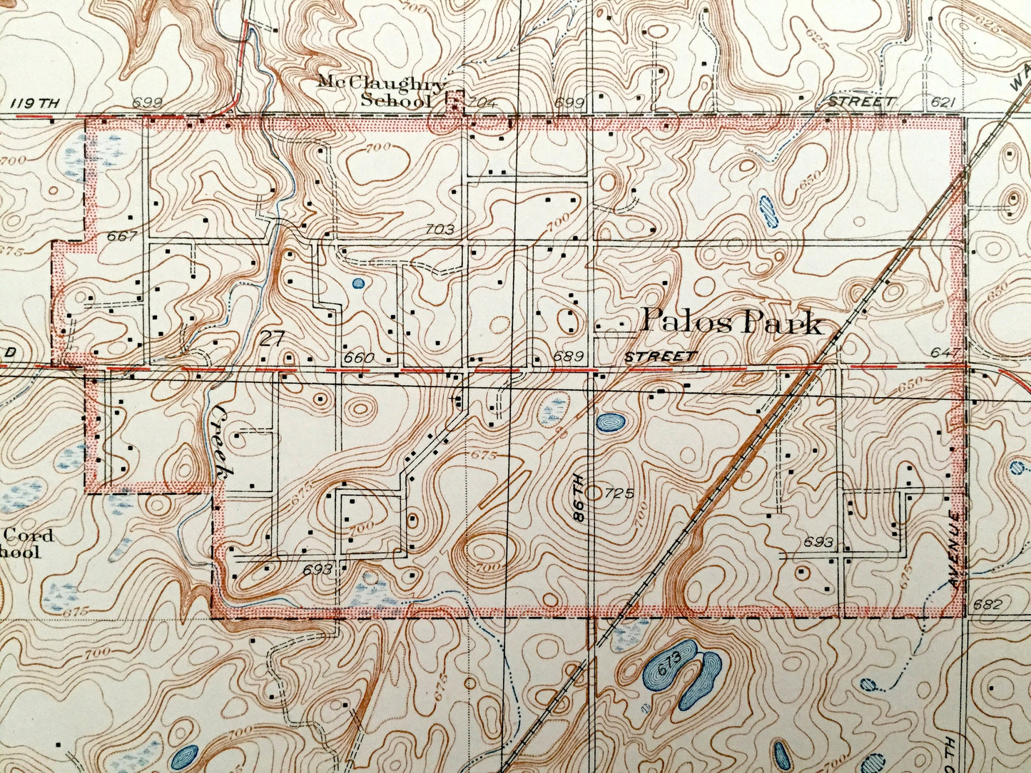
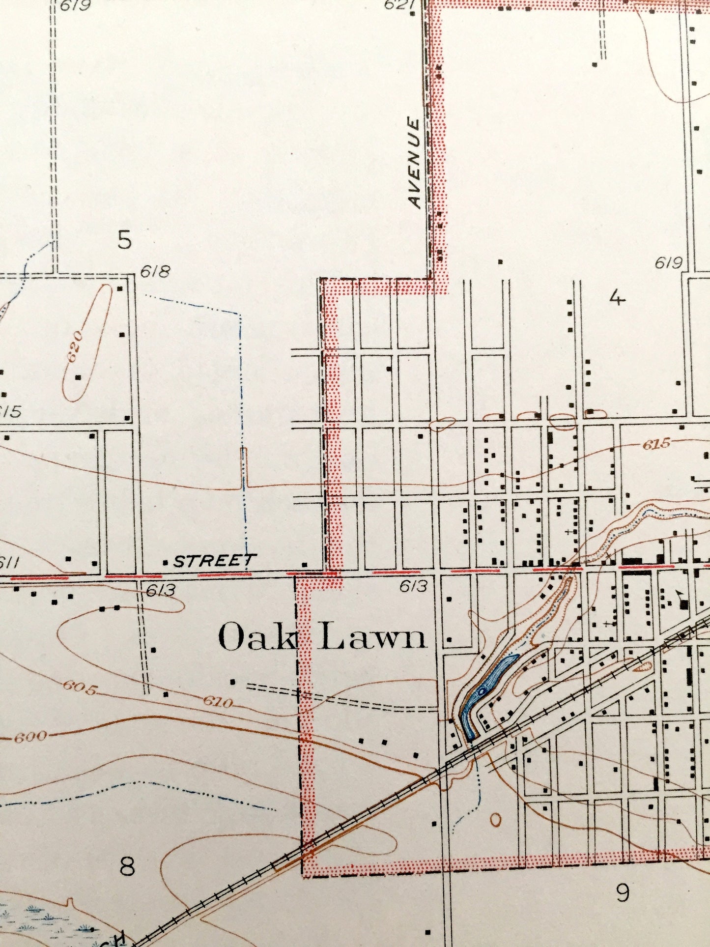
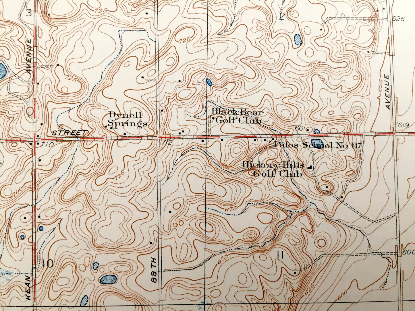
See what Cook County looked like over 90 years ago. Lots of intricate details and geological contours. Map even has little squares for every house that existed at the time. The USGS cartographers were very thorough back then! On the back is a description of topographic symbols and map guide.
Perfect for the historian, map-lover, the curious or just as a conversation starter. Wonderful and rare. Vintage maps such as these make great gifts.
Edition of 1928, printed 1928
Dimensions: 21 1/2" width x 26" height
This is one of the rare oversized maps printed by the USGS, produced in very high-detail 1/24000 scale.
----
Features
Cities & Towns: Orland Park, Palos Park, Bremen, Palos, Worth, Justice, Oak Lawn, Chicago Ridge, Stickney, Lyons, Spring Forest.
Points of Interest: Cook County, McGinnes Slough, Calumet Sag Channel, Stony Creek, Des Plaines River, and lots more hills, creeks, towns, schools, churches, cemeteries, roads and train tracks.
Condition: Very Good Vintage condition, commensurate with age. This map is in great shape for being over 90 years old. Has light wear but this will add to vintage character when framed.
----
We will happily adjust shipping price for multiple purchases. Maps are rolled up and shipped in sturdy mailing tubes, never folded.
Couldn't load pickup availability
Share