My Store
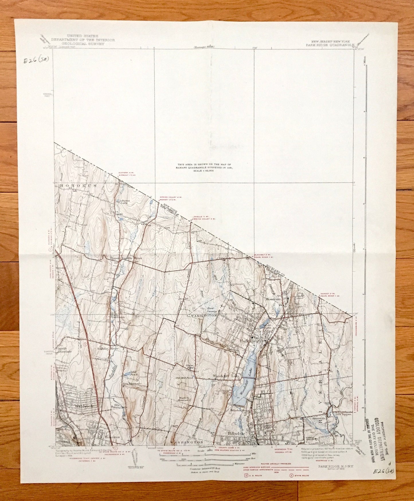
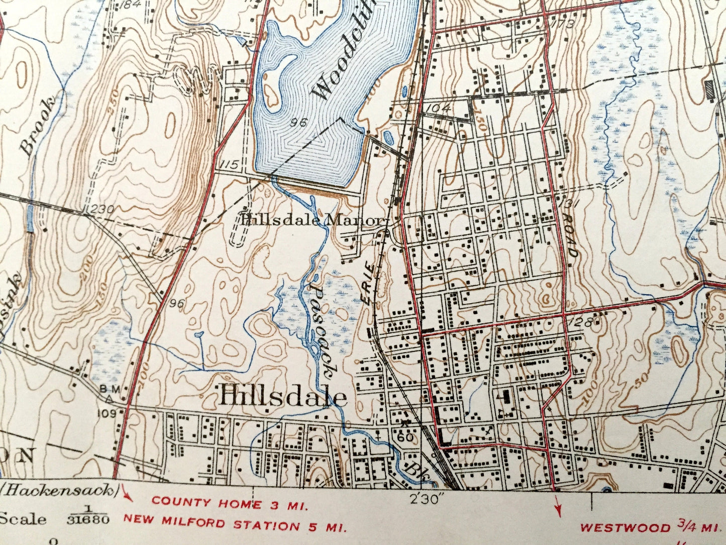
Antique Park Ridge, New Jersey 1939 US Geological Survey Map – Bergen County, Montvale, Hohokus, Woodcliff Lake, Washington, Rivervale, NJ
Antique Park Ridge, New Jersey 1939 US Geological Survey Map – Bergen County, Montvale, Hohokus, Woodcliff Lake, Washington, Rivervale, NJ
Beautiful, antique map of Park Ridge, New Jersey and surrounding Bergen County area. This is an authentic 1939 print from the U.S. Geological Survey and NOT a computer reproduction.
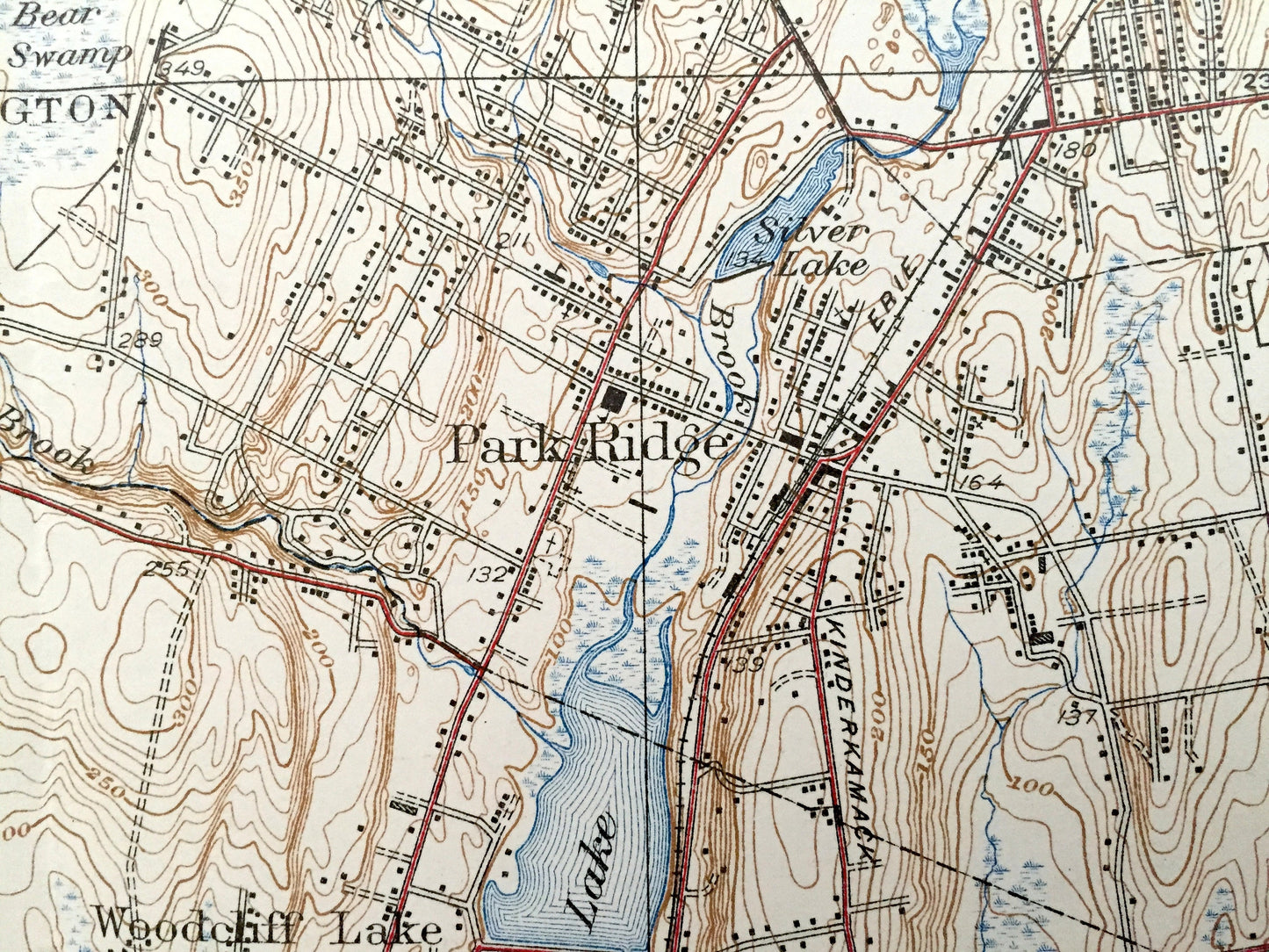
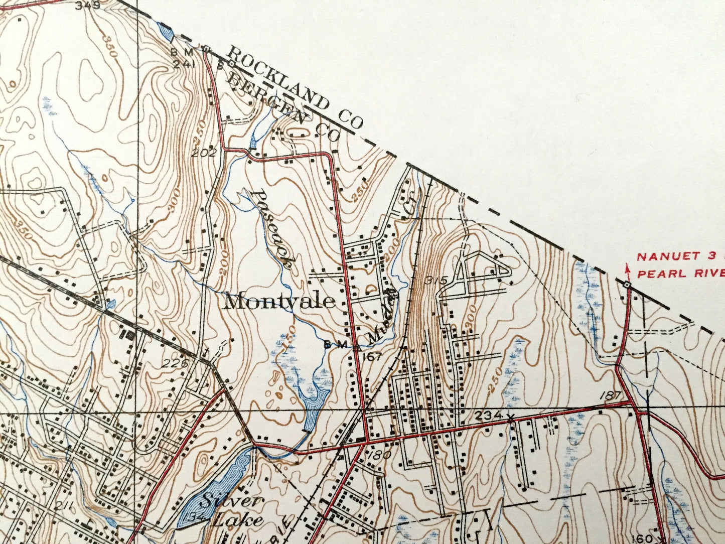
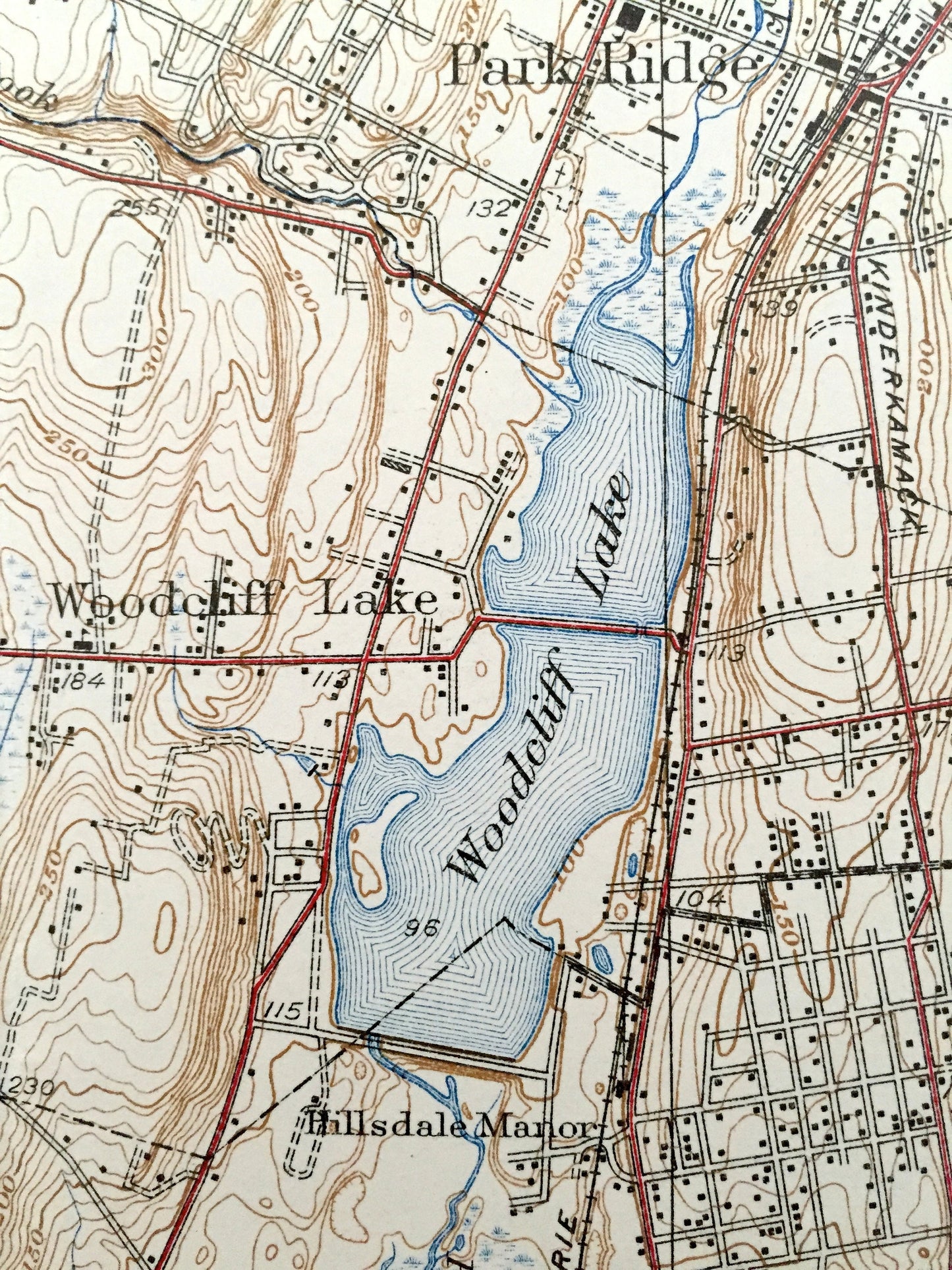
See what New Jersey looked like more than 80 years ago. Lots of intricate details and geological contours. Map even has little squares for every house that existed at the time. The USGS cartographers were very thorough back then! On the back is a description of topographic symbols and map guide.
Perfect for the historian, map-lover, the curious or just as a conversation starter. Wonderful and rare. Vintage maps such as these make great gifts.
Edition of 1939, printed 1939
Dimensions: 16 1/2" width x 20" height
----
Features
Cities & Towns: Park Ridge, Hohokus, Ramsey, Upper Saddle River, Washington, Montvale, Saddle River, Allendale, Waldwick, Ridgewood, Woodcliff Lake, Hillsdale, Rivervale, Old Tappan.
Points of Interest: Bergen County, Woodcliff Lake, Silver Lake, Salle River, Musquapsink Brook, Hackensack River, Bear Swamp, Old Mill Pond, Anona Lake and lots more hills, mountains, creeks, towns, schools, churches, roads and railroads.
Condition: Good Vintage condition, commensurate with age. This map is in incredible shape for being 80 years old. Has some edge-wear, pen marks, stamp, and two fold lines as issued, but this will all read as vintage character when framed, and adds to its uniqueness.
----
We will happily adjust shipping price for multiple purchases. Maps are rolled up and shipped in sturdy mailing tubes, never folded.
Couldn't load pickup availability
Share