My Store
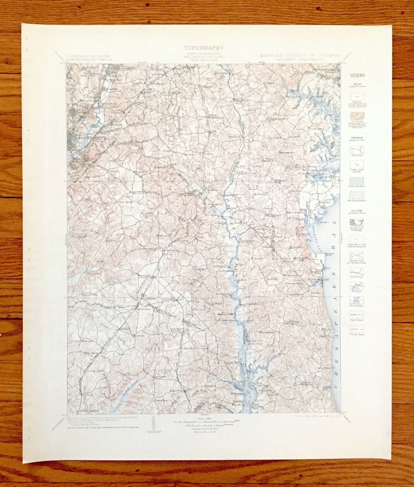
Antique Patuxent, Maryland 1906 US Geological Survey Topographic Map – Prince Georges, Anne Arundel, Annapolis, Chesapeake, Washington DC
Antique Patuxent, Maryland 1906 US Geological Survey Topographic Map – Prince Georges, Anne Arundel, Annapolis, Chesapeake, Washington DC
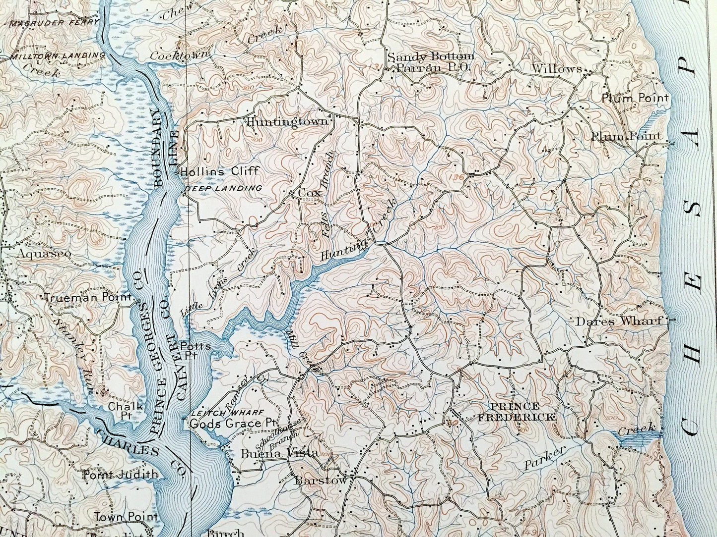
Beautiful, antique map of Maryland, including Washington, DC and West Annapolis, as well as Prince George's County, Anne Arundel County, Charles County, Calvert County, Maryland and the Chesapeake. This is an authentic 1906 edition, 1907 print from the U.S. Geological Survey and is NOT a computer reproduction.
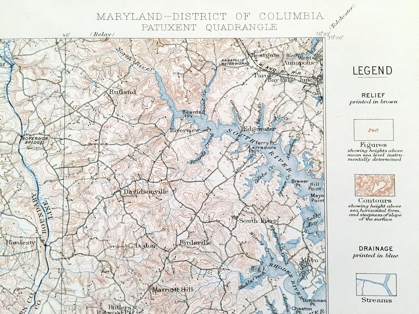
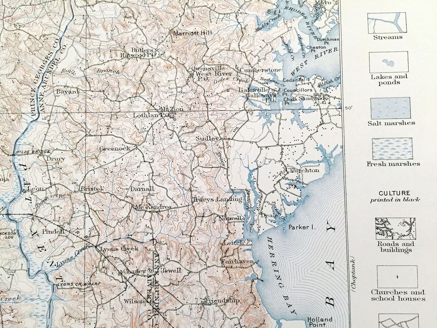
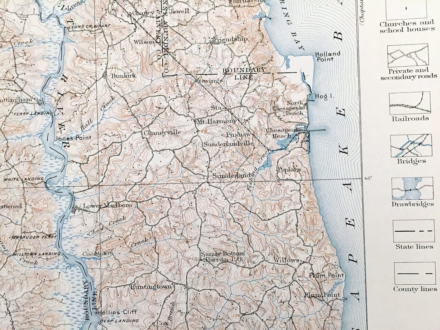
See what Maryland and Washington DC looked like over 115 years ago. Lots of intricate details and geological contours. Map even has little squares for every house that existed at the time. The USGS cartographers were very thorough back then! This is one of the rare maps when its legend on the front.
Perfect for the historian, map-lover, the curious or just as a conversation starter. Wonderful and rare. Vintage maps such as these make great gifts.
Edition of 1906, printed 1907
Dimensions: 18 1/2" width x 21 3/4" height
----
Features
Cities & Towns: WASHINGTON DC: Kendall Green, Brookland, Woodridge, Ivy City, Deanewood, Benning, Lincoln, Twining, East Washington Heights, Anacostia, Good Hope, Garfield, Winthrop Heights, Chesapeake Junction, Wilen Heights, Rives, Congress Heights.
MARYLAND: Hyattsville, Bladensburg, Landover, Tuxedo, Magruder, Oakland, Suitland, Silver Hill, Havermeyer Park, College Park, Riverdale, Good Luck, Buena Vista, Brightseat, Forestville, Hynesboro, Springfield, Woodmoor, Westphalia, Oak Grove, Leeland, Hill, Collington, West Annapolis, Riverview, Rutland, Birdsville, South River, Mayo, Bay Ridge Junction, Parole, Bestgate, Davidsonville, Hall, Leeland, Owensville, West River, Camp Springs, Woodyard, Clinton, Tippett, Thrift, Friendly, Piscataway, Rosaryville, Oxon, McKendree, Brandywine, Cheltanham, Talbert, Marlboro, Upper Marlboro, North Keys, Nottingham, McCalvert, Croom, Drury, Greenock, Mt. Zion, Sudley, Churchton, Deale, Fairhaven, Darnall, Bristol, Jewell, Friendship, Wilson, Dunkirk, Pindell, Charley, Mt. Harmony, Sharperville, Townsend, Cedarville, Baden, Horsehead, Westwood, Beantown, Waldorf, Troy, Middletown, Youngs Switch, Brice, Bryantown, Hughsville, Patuxent, Woodville, Gallant Green, Aquasco, Lower Marlboro, Huntingtown, Buena Vista, Willows, Chesapeake Beach, North Chesapeake Beach, Dares Wharf, Barstow, Benedict, Burnt Store, La Plata, Port Tobacco, White Plains, Edgewater, and more.
Points of Interest: Prince Georges County, Charles County, Calvert County, Anne Arundel County, Anacostia River, South River, Rhodes River, West River, Herring Bay, Chesapeake Bay, Patuxent River, Leitch Wharf, Gods Grace Point, Philadelphia, Baltimore & Washington Railroad, Governor Bridge, and lots more streams, marshes, points, coves, islands, houses, wharfs, roads and national monuments.
Condition: Very Good Vintage condition, commensurate with age. This map is in great shape for being over 115 years old. Has staple-holes in margin from folio, and very light toning and edge-wear, but this will all add to vintage character when framed.
----
We will happily adjust shipping price for multiple purchases. Maps are rolled up and shipped in sturdy mailing tubes, never folded.
Couldn't load pickup availability
Share