My Store
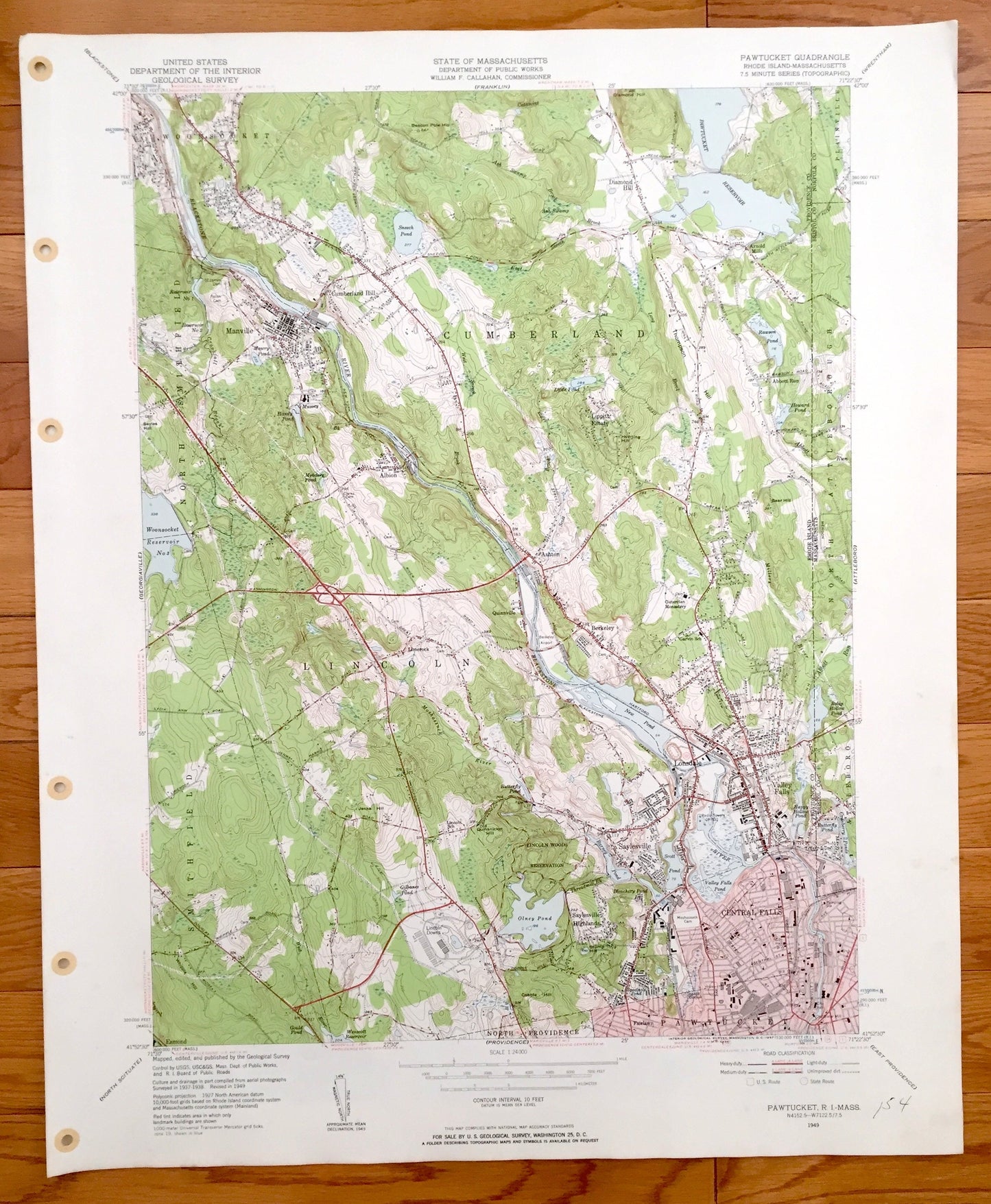
Antique Pawtucket, Rhode Island 1949 US Geological Survey Topographic Map – Cumberland, Central Falls, Lincoln, Woonsocket, Massachusetts RI
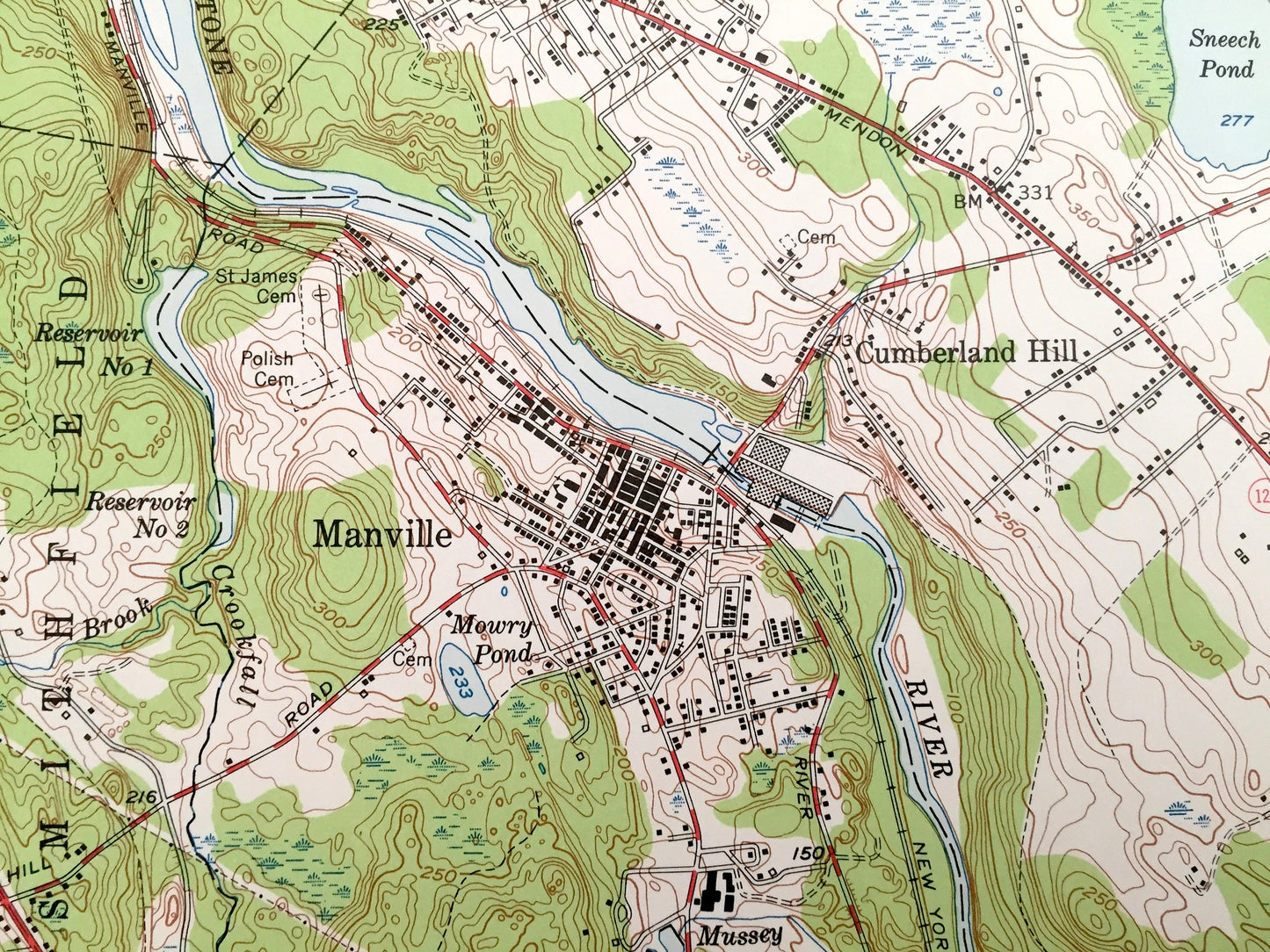
Antique Pawtucket, Rhode Island 1949 US Geological Survey Topographic Map – Cumberland, Central Falls, Lincoln, Woonsocket, Massachusetts RI
Beautiful, antique map of Pawtucket, Rhode Island and surrounding Providence County and Massachusetts areas. This is an authentic 1949 edition, 1957 print from the U.S. Geological Survey and NOT a computer reproduction.
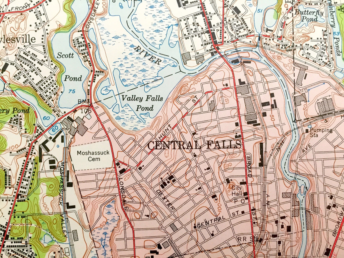
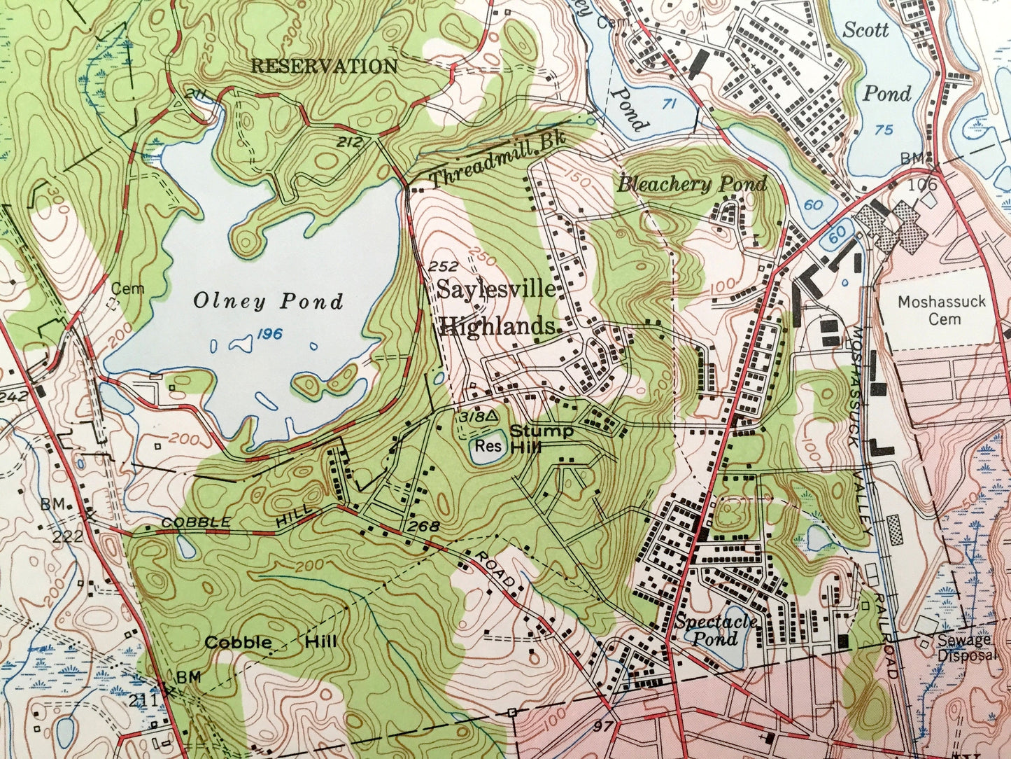
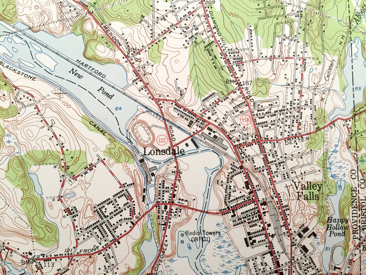
See what Rhode Island looked like over 70 years ago. Lots of intricate details and geological contours. Map even has little squares for every house that existed at the time. The USGS cartographers were very thorough back then!
Perfect for the historian, map-lover, the curious or just as a conversation starter. Wonderful and rare. Vintage maps such as these make great gifts.
Edition of 1949, printed 1957
Dimensions: 22" width x 27" height
----
Features
Cities & Towns: Rhode Island: Cumberland, Pawtucket, North Providence, Central Falls, Lonsdale, Lincoln, Manville, Albion, Diamond Hill, Berkeley, Valley Falls, Lippitt Estate, North Smithfield, Woonsocket, Cumberland Hill, Esmond.
Massachusetts: Attleboro, North Attleboro.
Points of Interest: Blackstone River, Olney Pond, Pawtucket Reservoir, Sneech Pond, New Pond, Lincoln Woods Reservation, and lots more hills, brooks, ponds, marshes, villages, islands, roads, bogs and train tracks.
Condition: Good Vintage condition, commensurate with age. This map is in incredible shape for being 65 years old. Map has punch holes but these are easily concealed with framing or placing a similar-colored paper behind the map, as can be seen in the photos.
----
We will happily adjust shipping price for multiple purchases. Maps are rolled up and shipped in sturdy mailing tubes, never folded.
Couldn't load pickup availability
Share