My Store
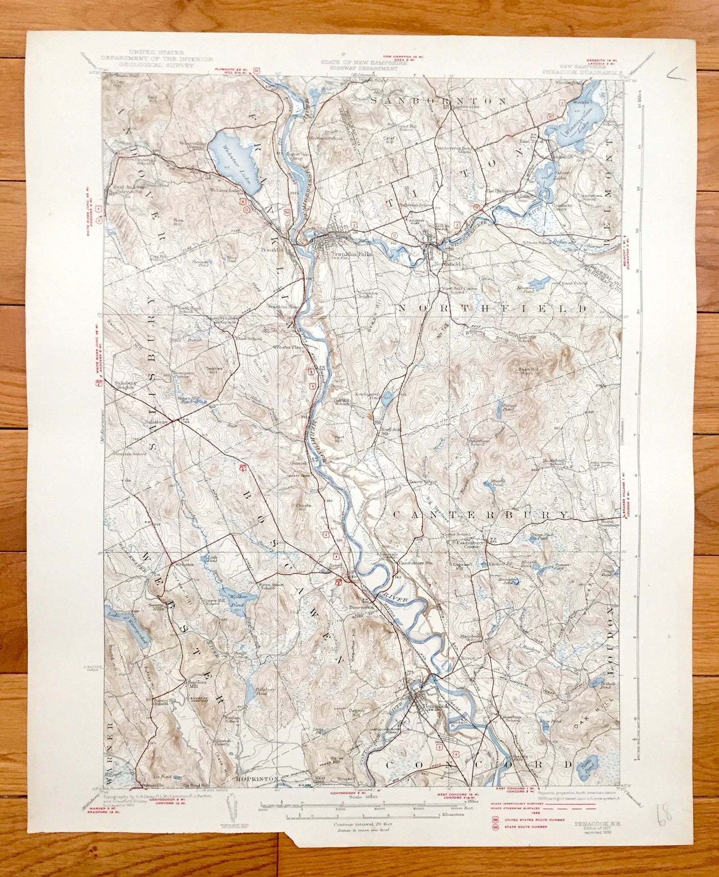
Antique Penacook, New Hampshire 1927 US Geological Survey Topographic Map – Northfield, Tilton, Salisbury, Boscawen, Concord, Canterbury NH
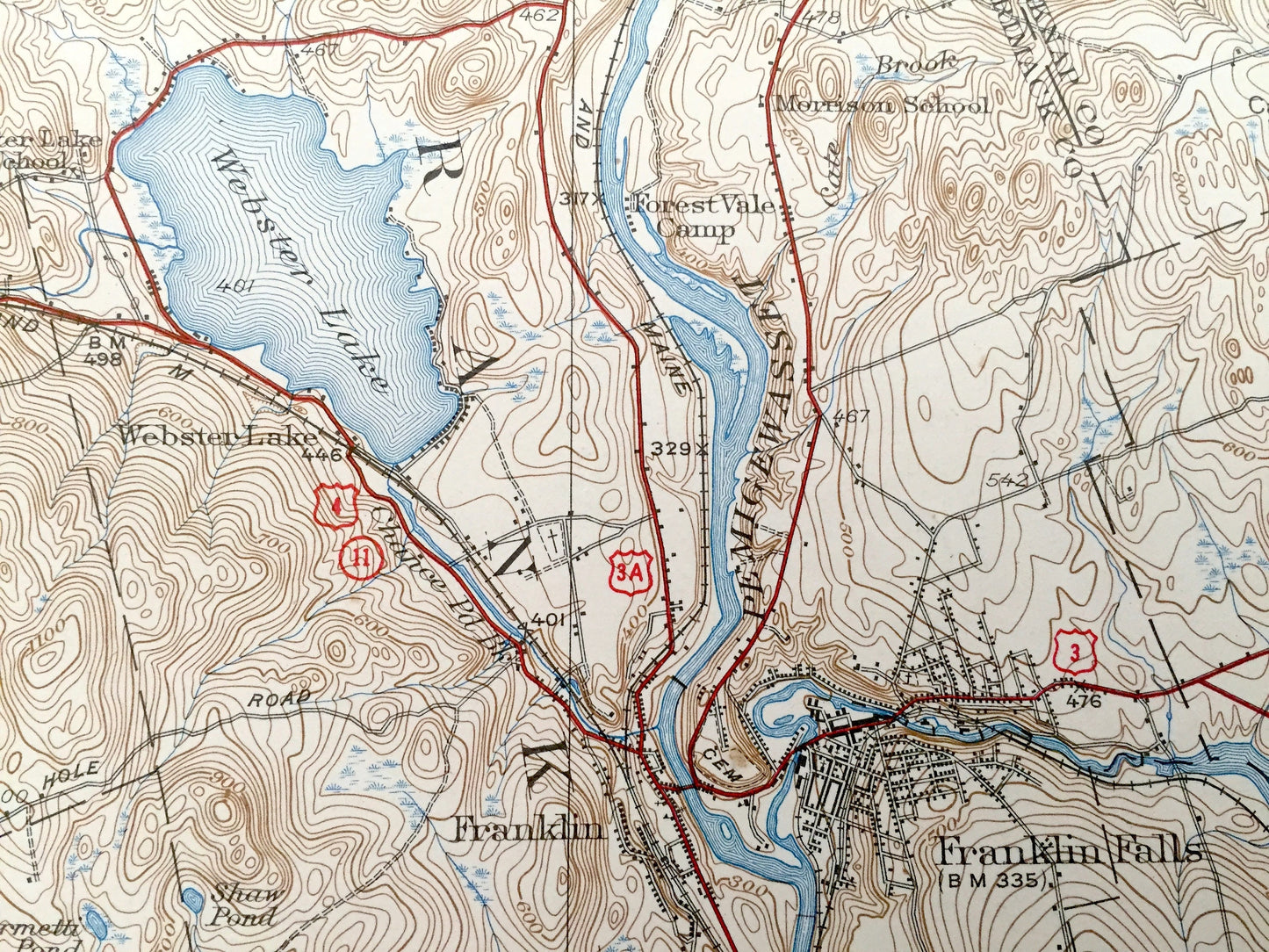
Antique Penacook, New Hampshire 1927 US Geological Survey Topographic Map – Northfield, Tilton, Salisbury, Boscawen, Concord, Canterbury NH
Beautiful, antique map of Penacook, Canterbury, Webster, Boscawen, Salisbury, Andover, Franklin, Sanbornton, Tilton and Northfield, New Hampshire. This is an authentic 1927 edition, 1939 print from the U.S. Geological Survey and NOT a computer reproduction.
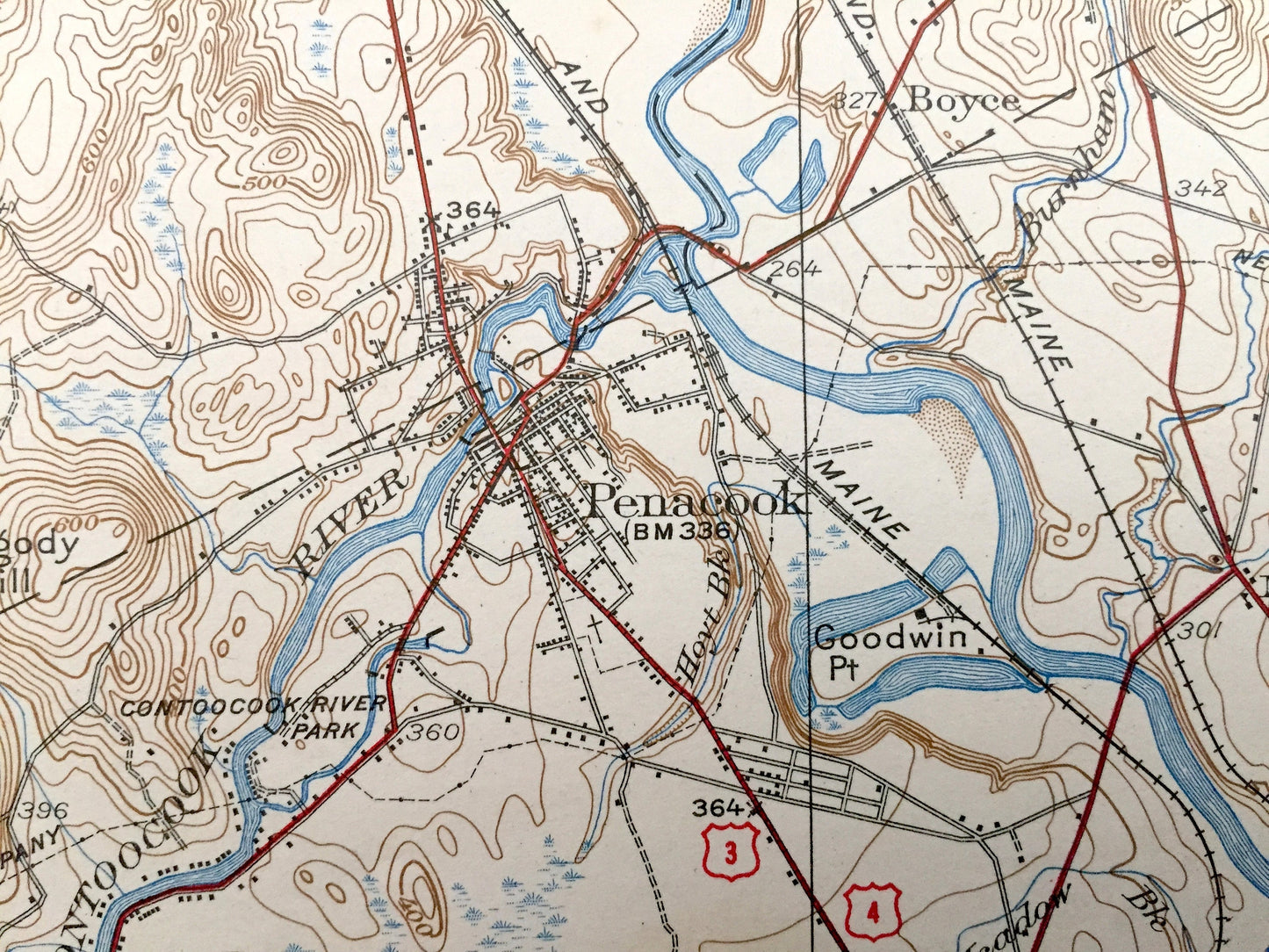
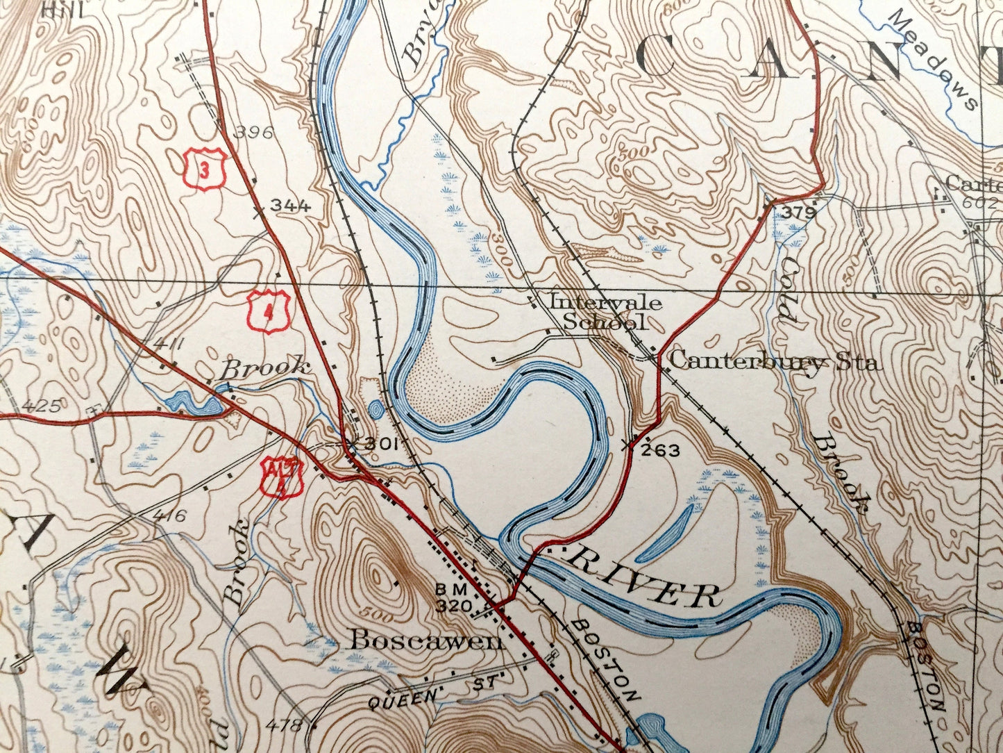
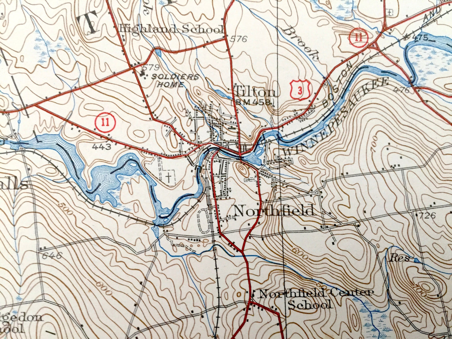
See what Merrimack & Belknap Counties looked like over 90 years ago. Lots of intricate details and geological contours. Map even has little squares for every house that existed at the time. The USGS cartographers were very thorough back then! On the back is a description of topographic symbols and map guide.
Perfect for the historian, map-lover, the curious or just as a conversation starter. Wonderful and rare. Vintage maps such as these make great gifts.
Edition of 1927, printed 1939
Dimensions: 16 1/2" width x 20" height
----
Features
Cities & Towns: Andover, Sanbornton, Tilton, East Tilton, Belmont June, Gardners Grove, Northfield, Northfield Center, Franklin Falls, Webster Lake, Salisbury Heights, Webster, Snyders Mill, Garish Corner, Boscawen, Penacook, Concord, London, Canterbury, Canterbury Center, Swetts Mills, Hopkinson, Davisville, Warner, Dingit Corner.
Points of Interest: Webster Lake, Pemigewasset River, Merrimack River, Morrison School, Calef Hill School, Sanbornton Road School, Winnisquam Lake, Silver Lake, Jamestown School, Tebbets School, Northfield Center School, Sondogardy Pond, Northfield Station, Oak Hill School, Bean Hill, Mt. Tug, Blanchard School, Carter Schoo, Walker Pond, Lake Winnepocket, Contoocook River, Kezer Seminary, Boston & Maine Railroad, and lots more hills, mountains, streams, ponds, houses, schools and roads.
Condition: Very Good Vintage condition, commensurate with age. This map is in great shape for being over 80 years old. Has some edge-wear, and missing lower margin area, but this will read as vintage character when framed.
----
We will happily adjust shipping price for multiple purchases. Maps are rolled up and shipped in sturdy mailing tubes, never folded.
Couldn't load pickup availability
Share