My Store
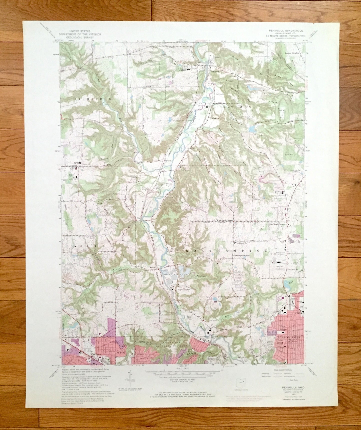
Antique Peninsula, Ohio 1963 US Geological Survey Topographic Map – Summit County, Boston, Bath Northampton Fairlawn Akron Cuyahoga Falls OH
Antique Peninsula, Ohio 1963 US Geological Survey Topographic Map – Summit County, Boston, Bath Northampton Fairlawn Akron Cuyahoga Falls OH
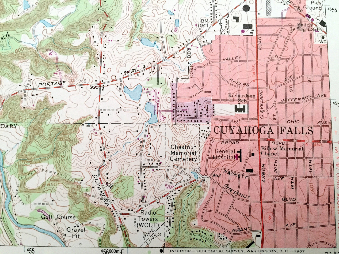
Beautiful, antique map of Peninsula, Ohio and surrounding Summit County areas. This is an authentic 1963 edition, 1967 print from the U.S. Geological Survey and NOT a computer reprint.
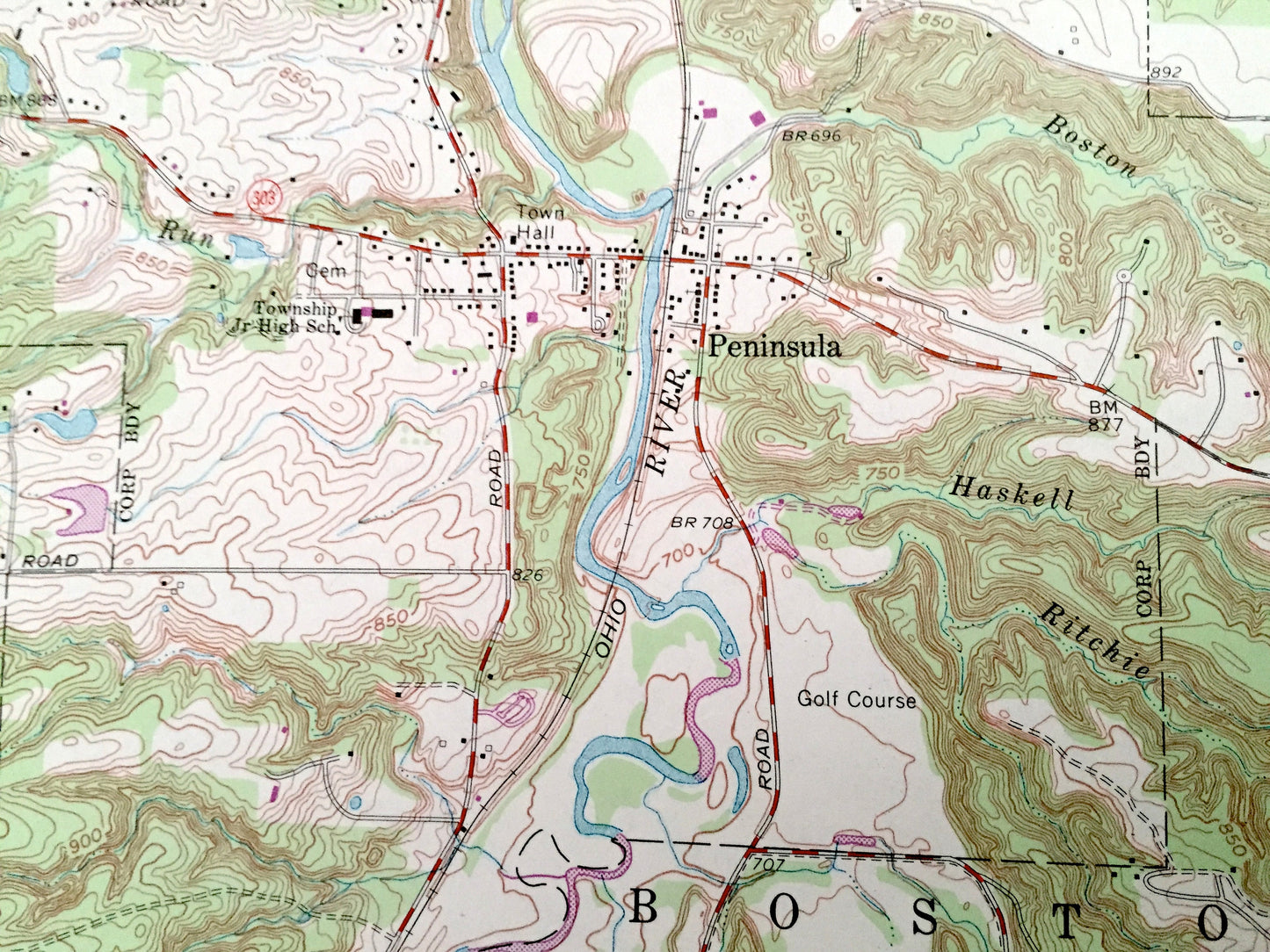
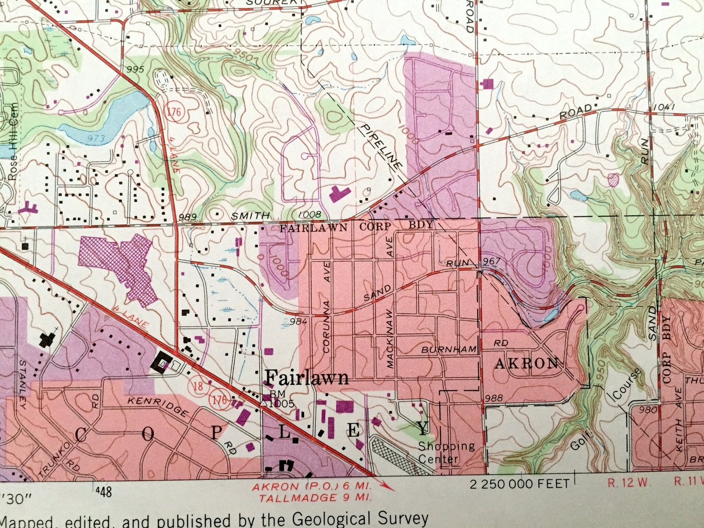
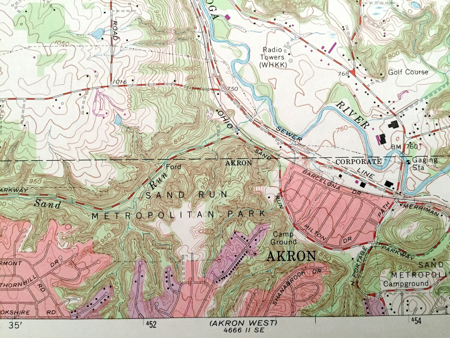
See what Ohio looked like over 55 years ago. Lots of intricate details and geological contours. Map even has little squares for every house that existed. The USGS cartographers were very thorough back then!
Perfect for the historian, map-lover, the curious or just as a conversation starter. Wonderful and rare. Vintage maps such as these make great gifts.
Edition of 1963, printed 1967
Dimensions: 22" width x 27" height
----
Features
Cities & Towns: Everett, Ira, Botzum, Copley, Cuyahoga Falls, Northampton Center, West Steels Corners, East Steel Corners, Boston Heights, Peninsula.
Points of Interest: Cuyahoga River, Akron Sewage Disposal, Police Rifle Range and Dog Training Area, Sand Run Metropolitan Park, Ascot Park, Boston Ledges, Ritchie Ledges, Virginia Kendall Park, Tamsin Park, Wyoga Lake Park, Furnace Run, Yellow Creek, Sand Run, Mud Brook, Salt Run, Boston Run, Slipper Run, campgrounds, and many more hills, ditches, streams, creeks, ponds, houses, schools, railroads, churches and roads.
Condition: Very Good Vintage condition, commensurate with age. This map is in great shape for being over 50 years old. Has light edge-wear but this will add character when framed.
----
We will happily adjust shipping price for multiple purchases. Maps are rolled up and shipped in sturdy mailing tubes, never folded.
Couldn't load pickup availability
Share