My Store
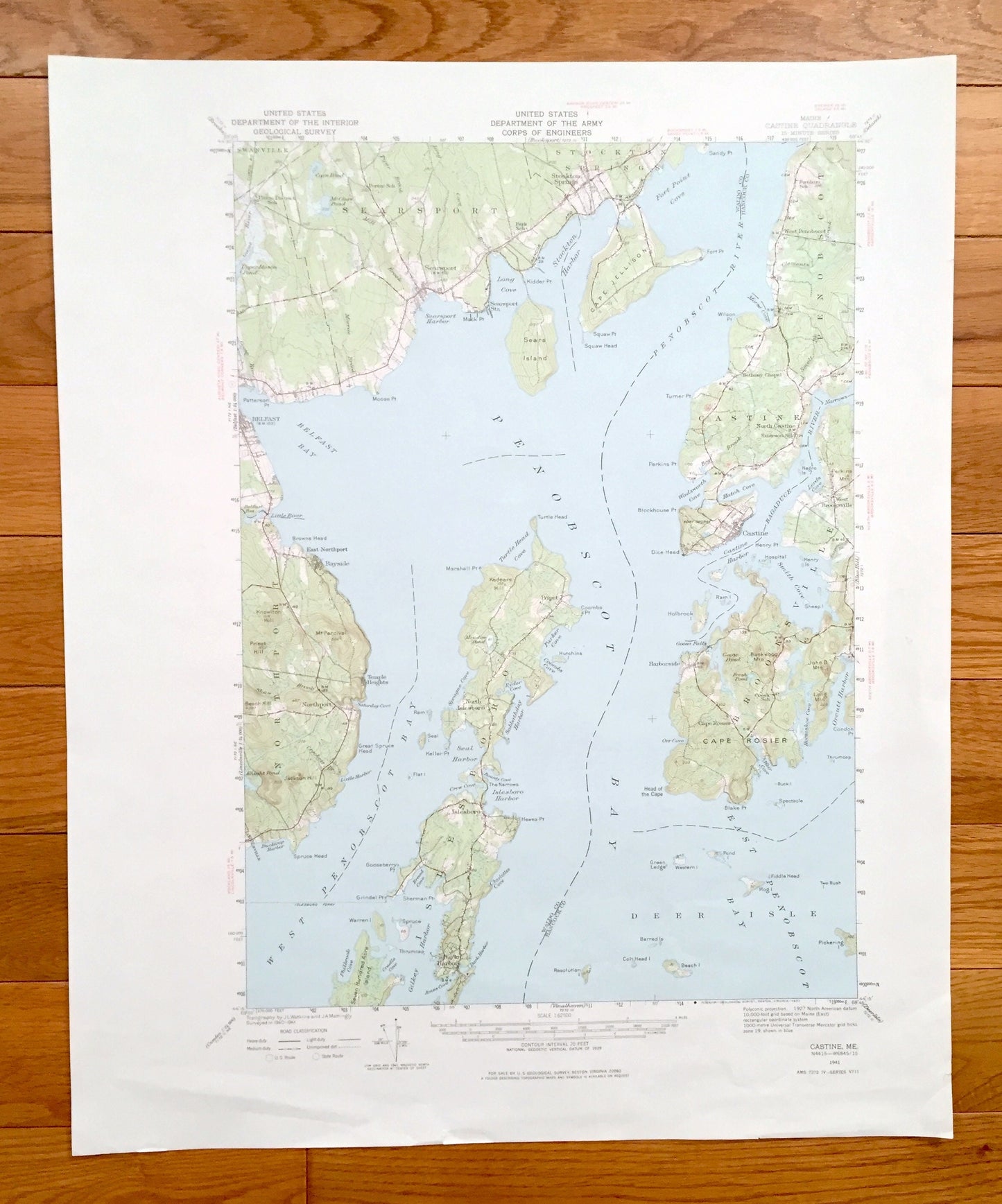
Antique Penobscot Bay, Maine 1941 US Geological Survey Topographic Map – Northport, Searsport, Castine, Brooksville, Deer Isle, Islesboro ME
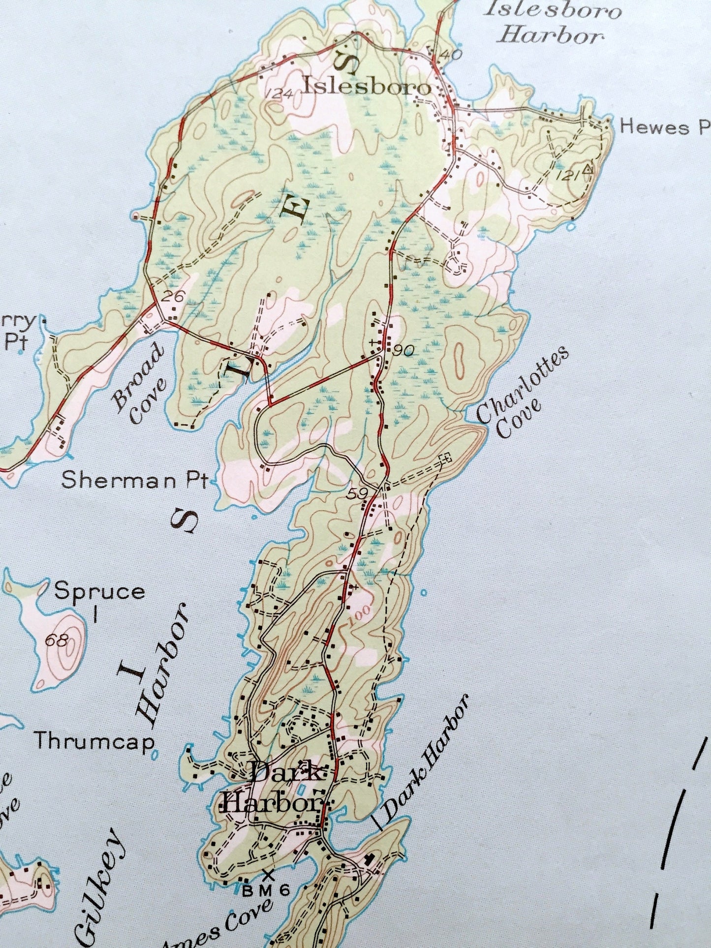
Antique Penobscot Bay, Maine 1941 US Geological Survey Topographic Map – Northport, Searsport, Castine, Brooksville, Deer Isle, Islesboro ME
Beautiful, antique map of Penobscot Bay, Maine and surrounding Waldo & Hancock Counties. This is an authentic 1941 edition, 1977 print from the U.S. Geological Survey and NOT a computer reproduction.
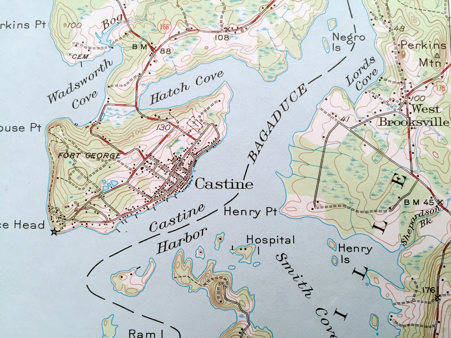
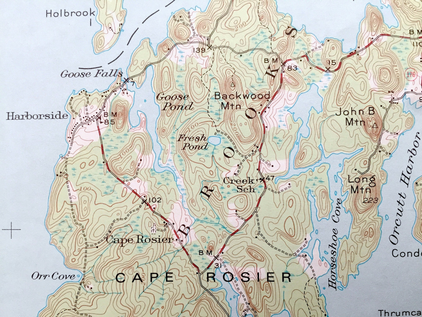
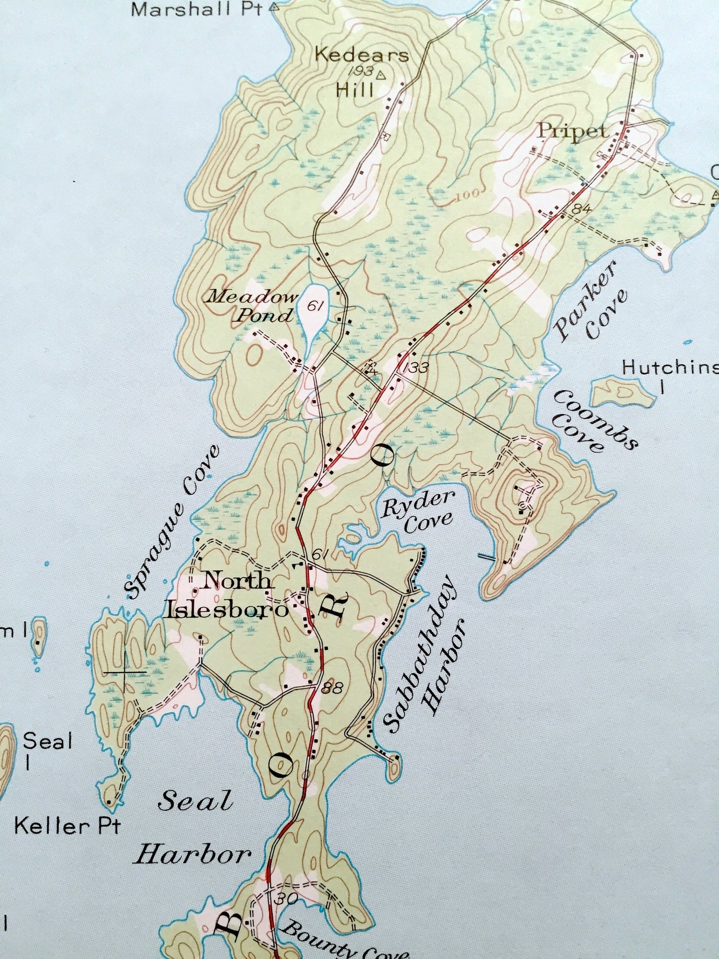
See what Northport, Islesboro, Searsport, Stockton Springs, Penobscot, Castine, Brooksvile and Deer Isle looked like 80 years ago. Lots of intricate details and geological contours. Map even has little squares for every house that existed at the time. The USGS cartographers were very thorough back then!
Perfect for the historian, map-lover, the curious or just as a conversation starter. Wonderful and rare. Vintage maps such as these make great gifts.
Edition of 1941, printed 1977
Dimensions: 18" width x 22" height
----
Features
Cities & Towns: Northport, Swanville, Searsport, Stockton Springs, Islesboro, Penobscot, Castine, Brooksville, Deer Isle, Belfast, Bayside, Temple Heights, Lincolnville, Pripet, North Islesboro, Dark Harbor, West Penobscot, North Castine, West Brooksville, Harborside, Cape Rosier.
Points of Interest: Atlantic Ocean, Maine Coast, Penobscot Bay, West Penobscot Bay, East Penobscot Bay, Belfast Bay, Searsport Harbor, Stockton Harbor, Fort Point Cove, Seal Harbor, Bagaduce River, Smith Cove, Long Cove, Penobscot River, Sears Island, Cape Jellison, Moose Point, Patterson Point, Little River, Mt. Percival, Beech Hill, Spruce Head, Ducktrap Harbor, Sprague Cove, Thrumcap Monument, Seven Hundred Island, Islesboro Harbor, Dice Head, Castine Harbor, Morse Cove, Bog Brook, Wadsworth Cove, Hatch Cove, Blockhouse Point, Goose Falls, Orcutt Harbor, Horseshoe Harbor, and lots more hills, streams, ponds, marshes, houses, islands—a lot of islands—coves and roads.
Condition: Very Good Vintage condition, commensurate with age. This map is in great shape for being over 40 years old. Has light wear but this will add to vintage character when framed.
----
We will happily adjust shipping price for multiple purchases. Maps are rolled up and shipped in sturdy mailing tubes, never folded.
Couldn't load pickup availability
Share